Category:February 2010 in Norfolk, England
Jump to navigation
Jump to search
Deutsch: Bilder, die im Februar 2010 in Norfolk, England aufgenommen worden sind. Bitte beachten Sie, dass dies weder das Datum des Uploads noch das Datum des Scannens eines Fotos ist.
English: Images/pictures taken in Norfolk, England during February 2010. Note this is not the date of the upload, nor the date a photo was scanned.
Español: Fotografías o imágenes tomadas en Norfolk, England durante febrero 2010. No es la fecha de subida ni escaneo, sino la fecha en que las fotografías o imágenes se crearon.
Esperanto: Bildoj faritaj en Norfolk, England en februaro 2010. Tio ne estas la dato, kiam la bildoj estis alŝutitaj aŭ skanitaj.
Français : Photographies ou images prises en Norfolk, England durant février 2010. Ce n'est pas la date du téléchargement ou du scan.
Galego: Fotografías ou imaxes tomadas en Norfolk, England durante febreiro 2010. Non é a data de subida nin escaneamento, senón a data na que se crearon as fotografías ou imaxes.
Italiano: Fotografie o immagini scattate a Norfolk, England nel febbraio 2010. Nota bene: la data non si riferisce né a quella di upload né a quella in cui la foto è stata digitalizzata.
Norsk bokmål: Bilder tatt i Norfolk, England i løpet av februar 2010. Merk at dette ikke er datoen for opplasting, eller når et bilde har blitt skannet.
Norsk nynorsk: Bilete teke i Norfolk, England i løpet av februar 2010. Merk at dette ikkje er datoen for opplasting, eller når eit bilete har vorte skanna.
Русский: Изображения, сделанные в Norfolk, England в течение февраль 2010 (не дата загрузки изображения).
Українська: Зображення, зроблені в Norfolk, England протягом лютий 2010. Зауважте, що це не дата завантаження чи дата сканування фотографії.
| February 2009 | ← | February 2010 | → | February 2011 | |||||||
| Jan | Feb | Mar | Apr | May | Jun | Jul | Aug | Sep | Oct | Nov | Dec |
| 63 | 102 | 250 | 124 | 139 | 158 | 204 | 122 | 63 | 136 | 4 | 44 |
|---|---|---|---|---|---|---|---|---|---|---|---|
Subcategories
This category has only the following subcategory.
Media in category "February 2010 in Norfolk, England"
The following 101 files are in this category, out of 101 total.
-
 (Former) Brackish Marsh - geograph.org.uk - 1714784.jpg 1,600 × 1,200; 673 KB
-
 -2010-01-30 Hopper Head, 2 Church cottage, West Runton.JPG 605 × 865; 128 KB
-
 2 Church Cottage West Runton 30 01 2010 (1).JPG 4,000 × 3,000; 2.59 MB
-
 2 Church Cottage West Runton 30 01 2010 (10).JPG 3,000 × 4,000; 2.15 MB
-
 2 Church Cottage West Runton 30 01 2010 (11).JPG 4,000 × 3,000; 2.46 MB
-
 2 Church Cottage West Runton 30 01 2010 (13).JPG 4,000 × 3,000; 2.38 MB
-
 2 Church Cottage West Runton 30 01 2010 (14).JPG 4,000 × 3,000; 2.35 MB
-
 2 Church Cottage West Runton 30 01 2010 (2).JPG 3,000 × 4,000; 2.13 MB
-
 2 Church Cottage West Runton 30 01 2010 (22).JPG 4,000 × 3,000; 2.33 MB
-
 2 Church Cottage West Runton 30 01 2010 (23).JPG 4,000 × 3,000; 2.32 MB
-
 2 Church Cottage West Runton 30 01 2010 (27).JPG 3,000 × 4,000; 2.15 MB
-
 2 Church Cottage West Runton 30 01 2010 (28).JPG 4,000 × 3,000; 2.56 MB
-
 2 Church Cottage West Runton 30 01 2010 (3).JPG 3,000 × 4,000; 2.17 MB
-
 2 Church Cottage West Runton 30 01 2010 (4).JPG 3,000 × 4,000; 2.17 MB
-
 2 Church Cottage West Runton 30 01 2010 (5).JPG 4,000 × 3,000; 2.38 MB
-
 2 Church Cottage West Runton 30 01 2010 (6).JPG 4,000 × 3,000; 2.3 MB
-
 2 Church Cottage West Runton 30 01 2010 (7).JPG 4,000 × 3,000; 2.28 MB
-
 2 Church Cottage West Runton 30 01 2010 (8).JPG 4,000 × 3,000; 2.3 MB
-
 2 Church Cottage West Runton 30 01 2010 (9).JPG 3,000 × 4,000; 2.18 MB
-
 2 Church Cottage West Runton 30 01 2010.JPG 4,000 × 3,000; 2.34 MB
-
 Access road to Dower House Touring Park - geograph.org.uk - 1709676.jpg 640 × 480; 161 KB
-
 All Saints, West Acre - geograph.org.uk - 1718341.jpg 3,264 × 2,448; 1.98 MB
-
 Beach at Snettisham - geograph.org.uk - 1714646.jpg 1,600 × 1,200; 671 KB
-
 Beeston Road railway bridge. - geograph.org.uk - 1716397.jpg 2,048 × 1,536; 1.42 MB
-
 Broome Heath - geograph.org.uk - 1714022.jpg 800 × 531; 113 KB
-
 Broome Heath - geograph.org.uk - 1714267.jpg 800 × 531; 120 KB
-
 Broome Heath - geograph.org.uk - 1714281.jpg 800 × 531; 109 KB
-
 Broome Heath - geograph.org.uk - 1714465.jpg 800 × 531; 179 KB
-
 Burnt out goods van - geograph.org.uk - 1732009.jpg 800 × 531; 158 KB
-
 Chicken Roundabout - geograph.org.uk - 1715515.jpg 800 × 531; 141 KB
-
 Cottage by West Harling Common - geograph.org.uk - 1710450.jpg 640 × 480; 165 KB
-
 Cromer Firestation 04 02 2010.JPG 4,000 × 3,000; 2.29 MB
-

-
 Deep puddles on the road to West Harling - geograph.org.uk - 1709188.jpg 640 × 480; 147 KB
-
 Driveway to Lodge Farm in Stubbs Green - geograph.org.uk - 1728119.jpg 640 × 493; 170 KB
-
 Elm Farm (farmhouse) in Stubbs Green - geograph.org.uk - 1728140.jpg 640 × 500; 148 KB
-
 Entering Fersfield - geograph.org.uk - 1700924.jpg 1,600 × 1,200; 441 KB
-

-
 Flooded Gravel Extraction workings - geograph.org.uk - 1714406.jpg 800 × 531; 93 KB
-
 Flooded path beside the River Thet - geograph.org.uk - 1703364.jpg 640 × 480; 188 KB
-
 Gone fishing - geograph.org.uk - 1717980.jpg 640 × 528; 83 KB
-
 Hasiboro sands chart 13 02 2010.JPG 4,000 × 3,000; 2.34 MB
-
 Henry Bloggs Cainine defense medal and Italian Medal 13th February 2010.jpg 1,797 × 2,095; 776 KB
-
 House behind tall trees, West Harling - geograph.org.uk - 1709202.jpg 640 × 480; 193 KB
-
 Lane through Stubbs Green - geograph.org.uk - 1728111.jpg 640 × 480; 163 KB
-
 Lodge Farm in Stubbs Green - geograph.org.uk - 1728122.jpg 640 × 506; 171 KB
-
 Moat - geograph.org.uk - 1728429.jpg 1,600 × 1,200; 810 KB
-
 Muntjac in Thorpe Woodlands - geograph.org.uk - 1710126.jpg 640 × 480; 196 KB
-
 Old barn at Elm Farm in Stubbs Green - geograph.org.uk - 1728146.jpg 640 × 480; 149 KB
-
 Path through Thorpe Woodlands - geograph.org.uk - 1710115.jpg 640 × 480; 174 KB
-
 Roundabout Lane - geograph.org.uk - 1727791.jpg 480 × 640; 150 KB
-
 Rural level crossing in Roudham - geograph.org.uk - 1710417.jpg 640 × 480; 114 KB
-
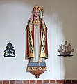 Sacred Heart Church, North Walsham - Statue - geograph.org.uk - 1713255.jpg 922 × 1,000; 122 KB
-
 Sacred Heart Church, North Walsham - Window - geograph.org.uk - 1713271.jpg 384 × 1,000; 97 KB
-
 Sacred Heart Church, North Walsham - Window - geograph.org.uk - 1713281.jpg 537 × 1,000; 96 KB
-
 Sacred Heart Church, North Walsham - Window - geograph.org.uk - 1713283.jpg 548 × 1,000; 137 KB
-
 Seagulls on the Lake - geograph.org.uk - 1714436.jpg 800 × 531; 52 KB
-
 Sheringham fire station - geograph.org.uk - 1395041.jpg 640 × 427; 214 KB
-
 Sheringham Firestation 04 02 2010 (1).JPG 4,000 × 3,000; 2.55 MB
-
 Snowdrops east of the Dower House - geograph.org.uk - 1709293.jpg 640 × 480; 192 KB
-

-

-
 St Michael, Ryston, Norfolk - Chancel - geograph.org.uk - 1714503.jpg 1,000 × 662; 137 KB
-
 St Michael, Ryston, Norfolk - Chancel - geograph.org.uk - 1714504.jpg 1,000 × 707; 135 KB
-
 St Michael, Ryston, Norfolk - Chancel - geograph.org.uk - 1714510.jpg 1,000 × 675; 111 KB
-
 St Michael, Ryston, Norfolk - Chancel - geograph.org.uk - 1714512.jpg 1,000 × 769; 121 KB
-
 St Michael, Ryston, Norfolk - East end - geograph.org.uk - 1714499.jpg 1,000 × 665; 129 KB
-
 St Michael, Ryston, Norfolk - Font - geograph.org.uk - 1714517.jpg 792 × 1,000; 123 KB
-
 St Michael, Ryston, Norfolk - Interior - geograph.org.uk - 1714554.jpg 598 × 1,000; 96 KB
-
 St Michael, Ryston, Norfolk - Ledger slab - geograph.org.uk - 1714550.jpg 861 × 1,000; 205 KB
-
 St Michael, Ryston, Norfolk - Ledger slab - geograph.org.uk - 1714552.jpg 1,000 × 712; 185 KB
-
 St Michael, Ryston, Norfolk - Organ - geograph.org.uk - 1714513.jpg 1,000 × 996; 149 KB
-
 St Michael, Ryston, Norfolk - Organ - geograph.org.uk - 1714516.jpg 670 × 1,000; 108 KB
-
 St Michael, Ryston, Norfolk - Piscina - geograph.org.uk - 1714542.jpg 613 × 1,000; 112 KB
-
 St Michael, Ryston, Norfolk - Pulpit - geograph.org.uk - 1714553.jpg 639 × 1,000; 109 KB
-
 St Michael, Ryston, Norfolk - Sanctuary - geograph.org.uk - 1714507.jpg 1,000 × 896; 146 KB
-
 St Michael, Ryston, Norfolk - Sanctuary - geograph.org.uk - 1714509.jpg 1,000 × 848; 130 KB
-
 St Michael, Ryston, Norfolk - Tomb chest - geograph.org.uk - 1714543.jpg 1,000 × 820; 148 KB
-
 St Michael, Ryston, Norfolk - Wall monument - geograph.org.uk - 1714521.jpg 674 × 1,000; 146 KB
-
 St Michael, Ryston, Norfolk - Wall monument - geograph.org.uk - 1714522.jpg 605 × 1,000; 104 KB
-
 St Michael, Ryston, Norfolk - Wall monument - geograph.org.uk - 1714541.jpg 609 × 1,000; 130 KB
-
 St Michael, Ryston, Norfolk - Wall monument - geograph.org.uk - 1714545.jpg 1,000 × 884; 146 KB
-
 St Michael, Ryston, Norfolk - West end - geograph.org.uk - 1714506.jpg 1,000 × 718; 144 KB
-
 St Peter Stowbridge - geograph.org.uk - 1714645.jpg 1,600 × 1,200; 806 KB
-
 Standing his ground - geograph.org.uk - 1709200.jpg 640 × 480; 172 KB
-
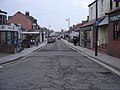 Station Road Sheringham - geograph.org.uk - 1716388.jpg 2,048 × 1,536; 1.3 MB
-
 Stubbs Green House - geograph.org.uk - 1728130.jpg 640 × 480; 173 KB
-

-
 The Dower House Touring Park - reception - geograph.org.uk - 1709681.jpg 640 × 480; 183 KB
-
 The old bridge at Bridgham - geograph.org.uk - 1703344.jpg 640 × 480; 161 KB
-
 The Old Railway Station at Heacham,Norfolk. - geograph.org.uk - 1709710.jpg 2,048 × 1,536; 1.32 MB
-
 The smallest of the three lakes - geograph.org.uk - 1714416.jpg 800 × 531; 83 KB
-
 To Stubbs Green on Roundabout Lane - geograph.org.uk - 1727803.jpg 640 × 480; 147 KB
-
 Track in Big Wood, West Harling - geograph.org.uk - 1709671.jpg 640 × 480; 160 KB
-
 Track in Thorpe Woodlands - geograph.org.uk - 1710136.jpg 640 × 480; 141 KB
-

-
 Two Houses - geograph.org.uk - 1702266.jpg 1,200 × 1,600; 796 KB
-
 Unnamed lane to North Lopham - geograph.org.uk - 1709659.jpg 640 × 480; 91 KB
-
 View across Stubbs Green Common - geograph.org.uk - 1728135.jpg 640 × 480; 140 KB
-

-

_Brackish_Marsh_-_geograph.org.uk_-_1714784.jpg)

.JPG)
.JPG)
.JPG)
.JPG)
.JPG)
.JPG)
.JPG)
.JPG)
.JPG)
.JPG)
.JPG)
.JPG)
.JPG)
.JPG)
.JPG)
.JPG)
.JPG)


_in_Stubbs_Green_-_geograph.org.uk_-_1728140.jpg)


.JPG)


.jpg)


_-_geograph.org.uk_-_1703051.jpg)


