Category:Feuerwehrgerätehaus (Seitendorf, Heilsbronn)
Jump to navigation
Jump to search
| Object location | | View all coordinates using: OpenStreetMap |
|---|
| NO WIKIDATA ID FOUND! Search for Feuerwehrgerätehaus (Seitendorf, Heilsbronn) on Wikidata | |
| Upload media |
Media in category "Feuerwehrgerätehaus (Seitendorf, Heilsbronn)"
The following 4 files are in this category, out of 4 total.
-
 Feuerwehrgerätehaus Seitendorf (Heilsbronn) 1.jpg 3,264 × 2,176; 1.49 MB
-
 Seitendorf (Heilsbronn), Feuerwehrgerätehaus 1679.jpg 1,940 × 1,676; 869 KB
-
 Seitendorf (Heilsbronn), Feuerwehrgerätehaus 1680.jpg 1,872 × 2,924; 1.09 MB
-
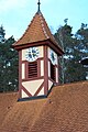 Turm des Feuerwehrgerätehauses Seitendorf (Heilsbronn).jpg 2,176 × 3,264; 1.63 MB
_1.jpg)
,_Feuerwehrger%C3%A4tehaus_1679.jpg)
,_Feuerwehrger%C3%A4tehaus_1680.jpg)
.jpg)