Category:Forres (civil parish)
Jump to navigation
Jump to search
Scottish parish in Moray, Scotland, UK | |||||
| Upload media | |||||
| Instance of | |||||
|---|---|---|---|---|---|
| Named after | |||||
| Location |
| ||||
| Population |
| ||||
| Area |
| ||||
 | |||||
Subcategories
This category has the following 3 subcategories, out of 3 total.
B
- Broom of Moy Bridge (16 F)
F
- Findhorn Viaduct, Forres (4 F)
Media in category "Forres (civil parish)"
The following 200 files are in this category, out of 386 total.
(previous page) (next page)-
 79 High Street Forres - geograph.org.uk - 5790398.jpg 800 × 800; 184 KB
-

-
 A Park by the Mosset Burn - geograph.org.uk - 1950212.jpg 640 × 480; 89 KB
-
 A940 - geograph.org.uk - 4115322.jpg 640 × 480; 306 KB
-
 A940 - geograph.org.uk - 4115338.jpg 640 × 480; 367 KB
-
 A940 Entering Forres - geograph.org.uk - 5385195.jpg 640 × 427; 398 KB
-
 A940 near Forres - geograph.org.uk - 5385186.jpg 640 × 427; 415 KB
-
 A940 near Loch of Blairs - geograph.org.uk - 2283124.jpg 800 × 572; 104 KB
-
 A940 near Mundole - geograph.org.uk - 2283110.jpg 800 × 575; 111 KB
-
 A940, Cothall Wood - geograph.org.uk - 5385180.jpg 640 × 427; 431 KB
-
 A940, Loch Wood - geograph.org.uk - 5385183.jpg 640 × 427; 423 KB
-
 A96 passing to the north of Forres - geograph.org.uk - 2283022.jpg 640 × 473; 47 KB
-
 A96, Forres - geograph.org.uk - 4379660.jpg 800 × 600; 427 KB
-
 A96, Forres - geograph.org.uk - 5385232.jpg 640 × 427; 311 KB
-
 Aircraft sculpture - geograph.org.uk - 2635841.jpg 2,048 × 1,536; 1.4 MB
-
 AJ Engineering's New Lifting Equipment - geograph.org.uk - 6114193.jpg 1,024 × 576; 149 KB
-
 Alexander Edward Memorial - geograph.org.uk - 6396885.jpg 5,184 × 3,888; 7.88 MB
-
 Anglers in the River Findhorn - geograph.org.uk - 2284098.jpg 640 × 427; 396 KB
-
 Approaching Netherton Cottages - geograph.org.uk - 2304426.jpg 640 × 413; 308 KB
-
 Approaching roundabout on the A96 - geograph.org.uk - 4260216.jpg 1,600 × 1,027; 213 KB
-
 At Chapelton Dam - geograph.org.uk - 5898099.jpg 640 × 483; 134 KB
-
 At the bus stop, Nairn Road, Forres - geograph.org.uk - 5664297.jpg 640 × 480; 174 KB
-
 Auchernack House - geograph.org.uk - 3538032.jpg 640 × 408; 296 KB
-
 Avenue in Grant Park - geograph.org.uk - 5188706.jpg 495 × 640; 415 KB
-
 Avenue in Grant Park - geograph.org.uk - 5188709.jpg 511 × 640; 423 KB
-
 Bales by Forres Enterprise Park - geograph.org.uk - 4859734.jpg 1,024 × 576; 105 KB
-
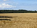 Barley near Forres - geograph.org.uk - 4115305.jpg 640 × 480; 284 KB
-
 Benromach Distillery - geograph.org.uk - 5876698.jpg 800 × 500; 125 KB
-
 Bervie Chipper - geograph.org.uk - 5474386.jpg 1,024 × 731; 130 KB
-
 Bogs of Blervie - geograph.org.uk - 3299484.jpg 640 × 456; 400 KB
-
 Building site, Forres - geograph.org.uk - 4115295.jpg 640 × 480; 292 KB
-
 Building, Cumming Street, Forres - geograph.org.uk - 6093046.jpg 2,173 × 2,322; 2.98 MB
-
 Burn of Mosset - geograph.org.uk - 3122965.jpg 2,272 × 1,704; 2.34 MB
-
 Burn of Mosset - geograph.org.uk - 4114970.jpg 640 × 480; 337 KB
-
 Burn of Mosset - geograph.org.uk - 5898100.jpg 640 × 473; 113 KB
-
 Bus stop in High Street, Forres - geograph.org.uk - 5664310.jpg 640 × 480; 200 KB
-
 Califer Hill Viewpoint - geograph.org.uk - 3647222.jpg 1,200 × 900; 588 KB
-
 Califer memorial garden and viewpoint - geograph.org.uk - 3130105.jpg 2,272 × 1,704; 2.85 MB
-
 Califer Viewpoint - geograph.org.uk - 3830298.jpg 640 × 427; 64 KB
-
 Car park at Muiry Wood, near Forres - geograph.org.uk - 4862280.jpg 1,024 × 576; 199 KB
-
 Cast-ups at Broom of May - geograph.org.uk - 6278663.jpg 1,280 × 941; 1.21 MB
-
 Chapelton Muir - geograph.org.uk - 2818382.jpg 640 × 365; 311 KB
-
 Cluny Hill Woods - geograph.org.uk - 5188747.jpg 640 × 427; 490 KB
-
 Coastal farmland near Mill of Grange - geograph.org.uk - 4084048.jpg 640 × 480; 77 KB
-
 Colourful Conifers - geograph.org.uk - 5188721.jpg 640 × 640; 496 KB
-
 Conifer with a Curve - geograph.org.uk - 5188729.jpg 640 × 427; 455 KB
-
 Cothall Wood - geograph.org.uk - 2864767.jpg 640 × 480; 144 KB
-
 Cothall wood - geograph.org.uk - 4022144.jpg 4,608 × 3,456; 6.37 MB
-
 Cottage at Cothall - geograph.org.uk - 5385170.jpg 640 × 427; 522 KB
-
 Cottages at Easter Newforres - geograph.org.uk - 5898113.jpg 640 × 384; 86 KB
-
 Cottages at Netherton - geograph.org.uk - 6285303.jpg 1,280 × 912; 307 KB
-
 Cows at Wester Newforres - geograph.org.uk - 3130761.jpg 1,704 × 2,272; 1.84 MB
-

-
 Crop field, Lingieston - geograph.org.uk - 4084058.jpg 640 × 480; 54 KB
-
 Crossroads near Blervie Castle - geograph.org.uk - 1902393.jpg 800 × 531; 164 KB
-
 Cumming Street, Forres - geograph.org.uk - 6403614.jpg 1,024 × 768; 575 KB
-
 Dark Tower - geograph.org.uk - 5188735.jpg 344 × 640; 144 KB
-
 Dava Way - geograph.org.uk - 5108328.jpg 640 × 427; 457 KB
-
 Decorated House - geograph.org.uk - 3538076.jpg 640 × 413; 348 KB
-
 Derelict buildings - geograph.org.uk - 3123605.jpg 2,272 × 1,704; 1.92 MB
-
 Digger at work - geograph.org.uk - 3298457.jpg 640 × 384; 372 KB
-
 Disused Airstrip - geograph.org.uk - 2553159.jpg 640 × 480; 130 KB
-
 Drainage Channel at Findhorn Bay - geograph.org.uk - 2532151.jpg 480 × 640; 58 KB
-
 Duck Pond near Mundole - geograph.org.uk - 2864558.jpg 640 × 480; 119 KB
-
 EarthShare site - geograph.org.uk - 1902373.jpg 800 × 531; 191 KB
-
 Easter Califer - geograph.org.uk - 3299503.jpg 640 × 400; 330 KB
-
 Easter Newforres - geograph.org.uk - 3130764.jpg 2,272 × 1,704; 1.88 MB
-
 Easter Newforres - geograph.org.uk - 3299453.jpg 640 × 416; 444 KB
-
 End of the line - geograph.org.uk - 3123180.jpg 2,272 × 1,704; 2.82 MB
-
 Ep Clear - geograph.org.uk - 5188762.jpg 640 × 272; 248 KB
-
 Eyes in the Night - geograph.org.uk - 5188734.jpg 371 × 640; 106 KB
-
 Fairyhills Wood - geograph.org.uk - 4115301.jpg 800 × 600; 542 KB
-
 Fairyhills Wood - geograph.org.uk - 4115315.jpg 640 × 480; 380 KB
-
 Farm buildings at Netherton - geograph.org.uk - 1903410.jpg 800 × 531; 145 KB
-
 Farm road to Wester Lawrenceton - geograph.org.uk - 1902391.jpg 800 × 531; 263 KB
-
 Farmland on the outskirts of Forres - geograph.org.uk - 3100452.jpg 1,024 × 680; 204 KB
-
 Farmland towards Forres - geograph.org.uk - 4084063.jpg 640 × 480; 73 KB
-
 Feeding cattle at Lingiefield, Forres - geograph.org.uk - 5620813.jpg 1,024 × 683; 142 KB
-
 Field and Woods near Red Craig - geograph.org.uk - 2864544.jpg 640 × 480; 104 KB
-

-
 Field Entrance at Califer - geograph.org.uk - 6361987.jpg 640 × 427; 359 KB
-
 Field Near Cothall Wood - geograph.org.uk - 2864763.jpg 640 × 480; 131 KB
-
 Field Near Invererne - geograph.org.uk - 2532137.jpg 640 × 480; 52 KB
-
 Field of Barley Near Netherton - geograph.org.uk - 2532524.jpg 640 × 480; 81 KB
-
 Fields Near Forres - geograph.org.uk - 5897026.jpg 640 × 407; 70 KB
-
 Fields near Netherton Farm - geograph.org.uk - 1903415.jpg 800 × 531; 125 KB
-
 Findhorn Bay - geograph.org.uk - 1827054.jpg 640 × 480; 93 KB
-
 Findhorn Bay - geograph.org.uk - 2304431.jpg 640 × 403; 368 KB
-
 Findhorn Bay - geograph.org.uk - 2532154.jpg 640 × 480; 70 KB
-
 Findhorn Bay - geograph.org.uk - 4610499.jpg 640 × 360; 54 KB
-
 Findhorn Floodplain - geograph.org.uk - 2686536.jpg 640 × 427; 387 KB
-
 Findhorn Floodplain - geograph.org.uk - 2686544.jpg 640 × 414; 384 KB
-
 Findhorn Floodplain - geograph.org.uk - 2686562.jpg 640 × 417; 397 KB
-
 Findhorn Viaduct - geograph.org.uk - 6276209.jpg 640 × 427; 257 KB
-
 Findhorn Viaduct - geograph.org.uk - 6276216.jpg 640 × 427; 296 KB
-
 Findhorn Viaduct, Forres - geograph.org.uk - 6278675.jpg 1,280 × 960; 221 KB
-
 Findhorn Viaduct, Forres - geograph.org.uk - 6285299.jpg 1,280 × 960; 359 KB
-
 Fire Display - geograph.org.uk - 5600475.jpg 427 × 640; 280 KB
-
 First Glimpse of the Tower - geograph.org.uk - 5188731.jpg 392 × 640; 63 KB
-
 Fishermans car park - geograph.org.uk - 3131700.jpg 2,272 × 1,704; 1.84 MB
-
 Flood defences, Forres - geograph.org.uk - 5886929.jpg 1,024 × 683; 323 KB
-
 Flood Embankment - geograph.org.uk - 2304408.jpg 427 × 640; 545 KB
-
 Flowers for Bees - geograph.org.uk - 3079002.jpg 640 × 496; 167 KB
-
 Forget- me- not - geograph.org.uk - 1950424.jpg 1,600 × 1,200; 1,013 KB
-
 Former Woollen Mill on Burngreen Lane - geograph.org.uk - 6047115.jpg 1,024 × 768; 365 KB
-
 Forres - geograph.org.uk - 3350806.jpg 720 × 482; 57 KB
-
 Forres Dental Care - geograph.org.uk - 5898082.jpg 640 × 377; 51 KB
-
 Forres Episcopal Church - geograph.org.uk - 5665211.jpg 480 × 640; 136 KB
-
 Forres High Street - geograph.org.uk - 6275525.jpg 1,600 × 1,200; 365 KB
-
 Forres Jobcentre - geograph.org.uk - 3538084.jpg 640 × 427; 317 KB
-
 Forres river gauging station - geograph.org.uk - 5777382.jpg 3,000 × 2,194; 2.95 MB
-
 Forres Sale Room, Tyler Street - geograph.org.uk - 5664290.jpg 640 × 480; 139 KB
-
 Forres Sale Room, Tytler Street - geograph.org.uk - 3572549.jpg 640 × 480; 87 KB
-
 Forres Sale Rooms - geograph.org.uk - 3536907.jpg 640 × 408; 318 KB
-
 Forres Tesco - geograph.org.uk - 5874951.jpg 640 × 381; 64 KB
-
 Forres, Grantown Road - geograph.org.uk - 5385210.jpg 640 × 427; 361 KB
-
 Forres, Nairn Road - geograph.org.uk - 5385222.jpg 640 × 427; 347 KB
-

-
 From Califer Viewpoint - geograph.org.uk - 4739848.jpg 640 × 379; 63 KB
-
 Gate and gate lodge at Cathay House Nursing Home - geograph.org.uk - 4862274.jpg 1,024 × 615; 189 KB
-

-
 Gatehouse near Dallas Dhu Distillery - geograph.org.uk - 5477100.jpg 1,024 × 768; 147 KB
-
 Giant Hogweeds - geograph.org.uk - 3570548.jpg 640 × 399; 500 KB
-
 Glittering Spheres - geograph.org.uk - 5188756.jpg 427 × 640; 438 KB
-
 Going, going... - geograph.org.uk - 5664288.jpg 640 × 480; 130 KB
-
 Gordon Pool on the River Findhorn - geograph.org.uk - 2237443.jpg 640 × 480; 56 KB
-
 Gordon Street Forres - geograph.org.uk - 6051584.jpg 640 × 640; 111 KB
-
 Grant Park, Forres - geograph.org.uk - 5887010.jpg 1,024 × 683; 323 KB
-
 Grant Park, Forres - geograph.org.uk - 6288880.jpg 1,280 × 947; 276 KB
-
 Grantown 23 miles - geograph.org.uk - 4283291.jpg 800 × 600; 482 KB
-
 Grantown Road - geograph.org.uk - 5385215.jpg 640 × 427; 408 KB
-

-

-
 Greshop Industrial Estate, Forres - geograph.org.uk - 5886941.jpg 1,024 × 683; 341 KB
-
 Greshop Industrial Estate, Forres - geograph.org.uk - 5886944.jpg 1,024 × 683; 304 KB
-
 Harrisons Dry Cleaning and Laundry Company - geograph.org.uk - 1941197.jpg 1,600 × 1,061; 726 KB
-
 Heading in to Forres - geograph.org.uk - 3635869.jpg 640 × 480; 61 KB
-

-
 High Street Forres - geograph.org.uk - 6051589.jpg 640 × 640; 121 KB
-
 High Street Forres - geograph.org.uk - 6051593.jpg 512 × 640; 93 KB
-
 High Street, Forres - geograph.org.uk - 6403613.jpg 1,024 × 768; 488 KB
-
 High Wall near Mundole - geograph.org.uk - 2864569.jpg 640 × 480; 141 KB
-
 Hogweed infested woodland - geograph.org.uk - 4283328.jpg 800 × 600; 587 KB
-
 House on Saint Leonards Road, Forres - geograph.org.uk - 6090631.jpg 2,448 × 3,264; 2.83 MB
-
 Illuminated Path on Cluny Hill - geograph.org.uk - 5188711.jpg 640 × 480; 544 KB
-
 In Cothall Wood - geograph.org.uk - 5896930.jpg 640 × 459; 141 KB
-
 In Muiry Wood - geograph.org.uk - 5898111.jpg 640 × 462; 138 KB
-
 Incredible edible - geograph.org.uk - 5124551.jpg 640 × 480; 123 KB
-
 Inside the Oculus - geograph.org.uk - 5922742.jpg 400 × 640; 195 KB
-
 Invererne - geograph.org.uk - 2304158.jpg 640 × 406; 317 KB
-
 Invererne House - geograph.org.uk - 5922740.jpg 640 × 382; 301 KB
-
 Invererne House - geograph.org.uk - 5924626.jpg 640 × 640; 132 KB
-
 Invererne House - geograph.org.uk - 5924630.jpg 640 × 480; 98 KB
-
 Invererne House Detail - geograph.org.uk - 5924688.jpg 640 × 480; 70 KB
-
 Invererne House Detail - geograph.org.uk - 5925548.jpg 1,024 × 885; 204 KB
-
 Invererne Road, Forres - geograph.org.uk - 5620814.jpg 1,024 × 683; 238 KB
-
 Invererne Road, Forres - geograph.org.uk - 5620817.jpg 1,024 × 683; 120 KB
-
 Inverness and Perth Junction Railway - geograph.org.uk - 4283198.jpg 800 × 600; 466 KB
-
 Inverness and Perth Junction Railway - geograph.org.uk - 4283228.jpg 800 × 600; 503 KB
-
 Inverness and Perth Junction Railway - geograph.org.uk - 4283238.jpg 800 × 600; 426 KB
-
 Japanese Knotweed - geograph.org.uk - 2304313.jpg 640 × 427; 590 KB
-
 Knockomie Hotel - geograph.org.uk - 1940180.jpg 1,600 × 1,152; 726 KB
-
 Lane near Forres Enterprise Park - geograph.org.uk - 3130770.jpg 2,272 × 1,704; 1.95 MB
-
 Leanchoil Hospital - geograph.org.uk - 2818351.jpg 640 × 447; 486 KB
-
 Leanchoil Hospital - geograph.org.uk - 5898091.jpg 640 × 383; 96 KB
-
 Leanchoil Hospital, Forres - geograph.org.uk - 3123399.jpg 640 × 480; 73 KB
-
-
 Leys Road, Forres - geograph.org.uk - 6288878.jpg 960 × 1,280; 269 KB
-
 Line of straw bales - geograph.org.uk - 3130754.jpg 2,272 × 1,704; 1.97 MB
-
 Lingieston - geograph.org.uk - 2304456.jpg 640 × 427; 423 KB
-
 Lingieston - geograph.org.uk - 4084057.jpg 640 × 480; 70 KB
-
 Loch of Blairs - geograph.org.uk - 2321894.jpg 640 × 480; 102 KB
-
 Loch of Blairs - geograph.org.uk - 2865118.jpg 640 × 480; 126 KB
-
 Loch of Blairs - geograph.org.uk - 4116234.jpg 800 × 600; 509 KB
-
 Loch of Blairs - geograph.org.uk - 6240703.jpg 1,024 × 731; 212 KB
-
 Loch of Blairs - geograph.org.uk - 6240708.jpg 640 × 480; 95 KB
-
 Loch of Blairs Boathouse - geograph.org.uk - 6240731.jpg 1,024 × 640; 219 KB
-
 Loch of Blairs Boathouse - geograph.org.uk - 6240771.jpg 1,024 × 768; 358 KB
-
 Loch View - geograph.org.uk - 4283301.jpg 800 × 600; 534 KB
-
 Loch Wood - geograph.org.uk - 4115332.jpg 640 × 853; 632 KB
-
 Loch Wood - geograph.org.uk - 4379688.jpg 800 × 600; 589 KB
-
 Loch Wood - geograph.org.uk - 6240414.jpg 640 × 480; 109 KB
-
 Looking towards Easter Newforres - geograph.org.uk - 4862775.jpg 1,024 × 576; 152 KB
-
 Mackenzie ^ Cruickshank garden centre - geograph.org.uk - 5777121.jpg 3,000 × 2,132; 2.47 MB
-
 Macrae Court - geograph.org.uk - 5898081.jpg 640 × 370; 53 KB
-
 Manachy Burn - geograph.org.uk - 794351.jpg 427 × 640; 305 KB
-
 Mannachie Avenue, Forres - geograph.org.uk - 3166755.jpg 640 × 480; 66 KB
-
 Mannachie Farm - geograph.org.uk - 3123584.jpg 2,272 × 1,704; 2.31 MB
-
 Mannachie Farm - geograph.org.uk - 794411.jpg 640 × 360; 192 KB
-
 Mannachie Gardens - geograph.org.uk - 5108343.jpg 640 × 298; 250 KB
-
 Mannachie Road - geograph.org.uk - 5898085.jpg 640 × 345; 66 KB
-
 Middlefield - geograph.org.uk - 2304450.jpg 640 × 422; 380 KB
-
 Middlefield Farm - geograph.org.uk - 3122960.jpg 2,272 × 1,704; 1.83 MB
-
 Mill of Grange - geograph.org.uk - 2304467.jpg 640 × 415; 352 KB
-

-
 Minor road near Mundole - geograph.org.uk - 3100449.jpg 1,024 × 680; 318 KB
-
 Minor road near Mundole - geograph.org.uk - 3100450.jpg 1,024 × 680; 266 KB
-
 Minor road through Limekilns Wood - geograph.org.uk - 5477131.jpg 1,024 × 768; 184 KB
-
 Minor road to Dallas Dhu distillery - geograph.org.uk - 4022166.jpg 4,608 × 3,456; 5.68 MB
-
 Monkeyflower - geograph.org.uk - 1950445.jpg 1,265 × 1,600; 1.32 MB


_-_geograph.org.uk_-_4830769.jpg)
_-_geograph.org.uk_-_4830771.jpg)


&filefrom=Monument+To+James+Thomson+-+geograph.org.uk+-+6047119.jpg#mw-category-media)