Category:Foulness Island
Jump to navigation
Jump to search

island in Rochford, Essex, England | |||||
| Upload media | |||||
| Instance of | |||||
|---|---|---|---|---|---|
| Location | Foulness, Rochford, Essex, East of England, England | ||||
 | |||||
Subcategories
This category has the following 2 subcategories, out of 2 total.
C
F
- Foulness SSSI (3 F)
Media in category "Foulness Island"
The following 39 files are in this category, out of 39 total.
-
 Across Crow Corner - geograph.org.uk - 393276.jpg 640 × 480; 35 KB
-
 Admiralty Chart No 1607 Thames Estuary Southern Part, Published 1967.jpg 14,926 × 8,420; 41.66 MB
-
 Admiralty Chart No 1975 Kentish Knock and the Naze to The Nore, Published 1934.jpg 16,391 × 11,234; 44.43 MB
-
 Admiralty Chart No 3750 River Crouch, Published 1969 (Composite ).jpg 14,781 × 8,243; 11.78 MB
-
 Admiralty Chart No 3750 River Crouch, Published 1969.jpg 11,023 × 8,276; 29.78 MB
-
 Deserted roads of Foulness Island - geograph.org.uk - 901311.jpg 480 × 640; 81 KB
-
 Drainage Channel by Priestwood - geograph.org.uk - 1490912.jpg 640 × 425; 62 KB
-
 Farms and fields of Foulness Island - geograph.org.uk - 901333.jpg 640 × 480; 111 KB
-
 Feral Branta canadensis on Foulness Island, Essex.jpg 4,168 × 2,856; 1.95 MB
-
 Foulness and Potton.jpg 3,861 × 1,286; 507 KB
-
 Foulness Island banner.jpg 3,220 × 461; 157 KB
-
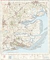
 Foulness Island map.jpg 701 × 467; 102 KB
-
 Foulness Island map.png 701 × 467; 48 KB
-
 Foulness Sands - geograph.org.uk - 1277021.jpg 640 × 430; 50 KB
-
 Foulness Sands - geograph.org.uk - 1277024.jpg 640 × 430; 57 KB
-
 Great Wakering, Maplin Sands - geograph.org.uk - 916817.jpg 640 × 480; 79 KB
-
 Lodge Farm, Foulness Island - geograph.org.uk - 1494393.jpg 640 × 425; 65 KB
-
 Not-so-deserted roads of Foulness - geograph.org.uk - 1490887.jpg 640 × 425; 77 KB
-
 Official Secrets Act warning sign.jpg 427 × 640; 83 KB
-
 Ordnance Survey One-Inch Sheet 162 Southend-on-Sea, Published 1957.jpg 8,323 × 9,954; 10.3 MB
-
 Ordnance Survey One-Inch Sheet 162 Southend-on-Sea, Published 1969.jpg 8,285 × 9,899; 34.34 MB
-
 River Roach - geograph.org.uk - 234781.jpg 640 × 480; 33 KB
-

-
 Thames Estuary airports proposed locations SS Richard Montgomery.png 1,075 × 692; 318 KB
-
 Thames Estuary airports proposed locations.gif 1,075 × 692; 322 KB
-
 Track to Crouch Corner - geograph.org.uk - 1492244.jpg 640 × 425; 64 KB
-
 Track to Great Burwood Farm - geograph.org.uk - 1490853.jpg 640 × 425; 58 KB
-
 Track to Nase Wick - geograph.org.uk - 1492399.jpg 640 × 425; 59 KB
-
 View towards Monkton Barn, Foulness - geograph.org.uk - 1494412.jpg 640 × 425; 37 KB
-
 Coconut Shy at Churchend - geograph.org.uk - 310199.jpg 600 × 451; 46 KB
-
 Foulness countryside - geograph.org.uk - 310206.jpg 600 × 450; 33 KB
-
 Foulness fields - geograph.org.uk - 310187.jpg 600 × 450; 34 KB
-
 Foulness Island in summer - geograph.org.uk - 300005.jpg 640 × 480; 97 KB
-
 Foulness Island seawall - geograph.org.uk - 1412986.jpg 640 × 358; 30 KB
-

-
 Foulness Lookout Tower - geograph.org.uk - 1413099.jpg 333 × 500; 109 KB
-
 High Corner Foulness Island - geograph.org.uk - 180940.jpg 640 × 432; 84 KB
-

-
 Yokesfleet Creek - geograph.org.uk - 234770.jpg 640 × 480; 59 KB


.jpg)


