Category:Freshford, County Kilkenny
Jump to navigation
Jump to search
Gaeilge: Baile beag Éireannach é Achadh Úr (Béarla: Freshford, nó uaireanta Aghoura), atá suite i gContae Chill Chainnigh, 14 ciliméadar thuaidh ón gcathair Cill Chainnigh agus 101 theas ón gcathair Bhaile Átha Cliath. Tá an baile suite ar an mbóthar idir Cill Chainnigh agus Baile Sheáin.
village in Leinster, Ireland  | |||||
| Upload media | |||||
| Instance of | |||||
|---|---|---|---|---|---|
| Location | County Kilkenny, Leinster, Ireland | ||||
| Elevation above sea level |
| ||||
 | |||||
Subcategories
This category has the following 16 subcategories, out of 16 total.
C
- Clashacrow (townland) (8 F)
F
- Freshford Fever Hospital (2 F)
H
- Hospital Bridge, Freshford (3 F)
O
- Old Bridge, Freshford (6 F)
P
S
- Old School House, Freshford (3 F)
T
- Toberlachtain (5 F)
- Tobernapeastia (6 F)
W
- Wayside Cross, Freshford (2 F)
Media in category "Freshford, County Kilkenny"
The following 92 files are in this category, out of 92 total.
-
 Barn and Bales - geograph.org.uk - 6473877.jpg 800 × 600; 779 KB
-
 Barn and Barley - geograph.org.uk - 6510500.jpg 800 × 600; 652 KB
-
 Brewery ruin Freshford.png 3,000 × 1,987; 29.2 MB
-
 Bridge and Stream - geograph.org.uk - 6424524.jpg 800 × 600; 291 KB
-
 Canon's Field Mass Path possible exit (1).jpg 3,008 × 2,000; 2.89 MB
-
 Canon's Field Mass Path possible exit 2.jpg 3,008 × 2,000; 2.96 MB
-
 Church and Stream - geograph.org.uk - 6424487.jpg 600 × 800; 220 KB
-
 Clapper bridge Freshford.jpg 4,032 × 2,016; 4.15 MB
-
 Commemorative plaque for village pump in Freshford.jpg 4,160 × 3,120; 6 MB
-
 Confined Trail - geograph.org.uk - 6424906.jpg 800 × 600; 207 KB
-
 Country Lane - geograph.org.uk - 6512011.jpg 800 × 600; 849 KB
-
 Demesne Entrance - geograph.org.uk - 6424540.jpg 800 × 600; 245 KB
-
 Disused Postbox - geograph.org.uk - 6491153.jpg 600 × 800; 1.01 MB
-
 Drain cover by Richard DeLoughry Kilkenny.jpg 4,160 × 3,120; 3.62 MB
-
 Dwelling and Junction - geograph.org.uk - 6491144.jpg 800 × 600; 681 KB
-
 Entrance and Avenue - geograph.org.uk - 6491254.jpg 800 × 600; 919 KB
-
 Entrance and Drive - geograph.org.uk - 6473872.jpg 800 × 600; 648 KB
-
 Farm Avenue - geograph.org.uk - 6491156.jpg 800 × 600; 1.03 MB
-
 Farm Avenue - geograph.org.uk - 6511998.jpg 800 × 600; 864 KB
-
 Farm Entrance - geograph.org.uk - 6491242.jpg 800 × 600; 1.09 MB
-
 Farm Operations - geograph.org.uk - 6491138.jpg 800 × 600; 881 KB
-
 Field Gate - geograph.org.uk - 6491250.jpg 800 × 600; 803 KB
-
 Fire Station - geograph.org.uk - 6424902.jpg 800 × 600; 125 KB
-
 Former entry into mass path.jpg 4,032 × 2,016; 2.19 MB
-
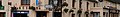 Freshford (County Kilkenny) banner.jpg 3,888 × 556; 652 KB
-
 Freshford Church of Ireland NM plaque.png 3,008 × 2,000; 8.11 MB
-
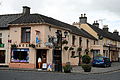
 Freshford Farrell's Bar.png 3,008 × 2,000; 7.16 MB
-
 Freshford Horse Park.png 3,008 × 2,000; 7.26 MB
-
 Freshford Hospital Bridge.png 3,008 × 2,000; 9.19 MB
-
 Freshford New Bridge road view.png 3,000 × 1,995; 7.21 MB
-
 Freshford New Bridge.png 3,000 × 1,995; 8.51 MB
-
 Freshford Old Bridge view from East.png 3,000 × 1,995; 8.09 MB
-
 Freshford Old Bridge.png 3,008 × 2,000; 7.47 MB
-
 Freshford Street name sign Chapel Street.png 1,824 × 1,128; 1.47 MB
-
 Freshford Street name sign The Fowl Market.png 2,595 × 1,608; 4.47 MB
-
 Freshford weighing bridge.png 2,016 × 4,032; 10.77 MB
-
 Garden Wall - geograph.org.uk - 6424858.jpg 800 × 600; 211 KB
-
 Gate and Avenue - geograph.org.uk - 6512002.jpg 800 × 600; 779 KB
-
 Gate and Stile - geograph.org.uk - 6424878.jpg 800 × 600; 236 KB
-
 Gate and Track - geograph.org.uk - 6512009.jpg 800 × 600; 904 KB
-
 Gated Laneway - geograph.org.uk - 6512020.jpg 800 × 600; 699 KB
-
 Glenfield & Kennedy Limited maker's mark.jpg 3,104 × 3,104; 4.92 MB
-
 IMG FreshfordShop1817.jpg 3,888 × 2,592; 2.69 MB
-
 Inscription at Boherglass wayside shrine.jpg 4,032 × 2,016; 2.72 MB
-
 Leafless Forest - geograph.org.uk - 6424863.jpg 800 × 600; 336 KB
-
 Maker's mark on village pump.jpg 4,160 × 3,120; 3.64 MB
-
 Manhole cover by Duggan Bros Templemore.jpg 3,104 × 3,104; 3.32 MB
-
 Mown Meadow - geograph.org.uk - 6491131.jpg 800 × 600; 857 KB
-
 Neglected Digger - geograph.org.uk - 6424871.jpg 800 × 600; 296 KB
-
 Nuenna Hospital Bridge.png 3,008 × 2,000; 11.34 MB
-
 Old Cinema - geograph.org.uk - 6424900.jpg 800 × 600; 158 KB
-
 Overgrown Parapet - geograph.org.uk - 6491267.jpg 800 × 600; 888 KB
-
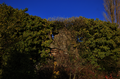
 Pasture and Woodland - geograph.org.uk - 6473886.jpg 800 × 600; 824 KB
-
 Petrol Pump - geograph.org.uk - 6424911.jpg 600 × 800; 143 KB
-
 Petrol Station - geograph.org.uk - 6424907.jpg 600 × 800; 141 KB
-
 Picnic Benches - geograph.org.uk - 6424551.jpg 800 × 600; 323 KB
-
 Pronunciation Test - geograph.org.uk - 6510493.jpg 800 × 600; 630 KB
-
 Pump Detail - geograph.org.uk - 6424909.jpg 600 × 800; 156 KB
-
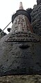
 Rev John Shee memorial 1838.png 2,016 × 3,284; 9.23 MB
-
 Road and Signpost - geograph.org.uk - 6424896.jpg 800 × 600; 185 KB
-
 Road Junction - geograph.org.uk - 6491141.jpg 800 × 600; 670 KB
-
 Road Junction - geograph.org.uk - 6510510.jpg 800 × 600; 654 KB
-
 Road Scene - geograph.org.uk - 6424885.jpg 800 × 600; 283 KB
-
 Sewer pipe in Freshford.jpg 2,016 × 4,032; 1.94 MB
-
 Sewer pipe next to St. Lachtain's Church in Freshford.jpg 1,584 × 3,168; 636 KB
-
 Sewer pipe on Old Bridge in Freshford.jpg 4,032 × 2,016; 4.41 MB
-
 Sewer vent in Freshford along Bohergloss 2.jpg 2,016 × 4,032; 3.15 MB
-
 Sewer vent in Freshford along Bohergloss.jpg 4,032 × 2,016; 2.25 MB
-
 Sign of Spring - geograph.org.uk - 6424542.jpg 600 × 800; 152 KB
-
 Small waterfall in Freshford 2.jpg 4,032 × 2,016; 3.57 MB
-
 Small waterfall in Freshford 3.jpg 4,032 × 2,016; 3.8 MB
-
 Small waterfall in Freshford.jpg 4,032 × 2,016; 3.8 MB
-
 St Lachtain's Cemetery.jpg 2,544 × 1,232; 601 KB
-
 Stone Plaque - geograph.org.uk - 6011948.jpg 800 × 600; 447 KB
-
 Stream and Bridge - geograph.org.uk - 6011951.jpg 800 × 600; 562 KB
-
 Stream and Field - geograph.org.uk - 6491259.jpg 800 × 600; 1.05 MB
-
 Street name sign Brewery Lane Freshford.png 2,316 × 1,593; 4.15 MB
-
 Structure at Tobernapeastia.jpg 4,032 × 2,016; 1.7 MB
-
 Stubble Field - geograph.org.uk - 6424893.jpg 800 × 600; 338 KB
-
 Thatched Cottage - geograph.org.uk - 6424510.jpg 800 × 600; 200 KB
-
 Thatched Cottage Freshford.png 3,000 × 1,820; 6.43 MB
-
 Tonge & Taggart manhole cover in Freshford.jpg 3,104 × 3,104; 3.41 MB
-
 Trail Signs - geograph.org.uk - 6424557.jpg 800 × 600; 291 KB
-
 Tree and Wall - geograph.org.uk - 6511990.jpg 800 × 600; 982 KB
-
 Village Green - geograph.org.uk - 6011727.jpg 800 × 600; 421 KB
-
 Village Green - geograph.org.uk - 6625157.jpg 800 × 600; 975 KB
-
 Water Pump - geograph.org.uk - 6011735.jpg 600 × 800; 385 KB
-
 Watering Point - geograph.org.uk - 6424891.jpg 800 × 600; 221 KB
-
 Wayside shrine on Boherglass in Freshford.jpg 4,032 × 2,016; 3.25 MB
-
 Woodland Path - geograph.org.uk - 6424518.jpg 600 × 800; 387 KB
-
 Woodland Path - geograph.org.uk - 6424861.jpg 800 × 600; 334 KB
-
 Young Forest - geograph.org.uk - 6424875.jpg 800 × 600; 336 KB


.jpg)


_banner.jpg)