Category:Garland County, Arkansas
Vai alla navigazione
Vai alla ricerca
Counties of Arkansas: Arkansas · Ashley · Baxter · Benton · Boone · Bradley · Calhoun · Carroll · Chicot · Clark · Clay · Cleburne · Cleveland · Columbia · Conway · Craighead · Crawford · Crittenden · Cross · Dallas · Desha · Drew · Faulkner · Franklin · Fulton · Garland · Grant · Greene · Hempstead · Hot Spring · Howard · Independence · Izard · Jackson · Jefferson · Johnson · Lafayette · Lawrence · Lee · Lincoln · Little River · Logan · Lonoke · Madison · Marion · Miller · Mississippi · Monroe · Montgomery · Nevada · Newton · Ouachita · Perry · Phillips · Pike · Poinsett · Polk · Pope · Prairie · Pulaski · Randolph · Saline · Scott · Searcy · Sebastian · Sevier · Sharp · St. Francis · Stone · Union · Van Buren · Washington · White · Woodruff · Yell
contea statunitense   | |||||
| Carica un file multimediale | |||||
| Istanza di | |||||
|---|---|---|---|---|---|
| Luogo | Arkansas, Stati Uniti d'America | ||||
| Capitale | |||||
| Data di fondazione o creazione |
| ||||
| Popolazione |
| ||||
| Superficie |
| ||||
| Distinto da | |||||
| sito web ufficiale | |||||
 | |||||
Sottocategorie
Questa categoria contiene le 29 sottocategorie indicate di seguito, su un totale di 29.
*
A
- Arkansas Highway 88 (8 F)
- Arkansas Highway 290 (4 F)
- Avant Mine (1 F)
C
E
- East Coleman Mine (71 F)
H
L
M
- Miller Mountain Mine (2 F)
- Minerals of Avant (5 F)
- Minerals of Hot Springs (40 F)
- Minerals of Jessieville (2 F)
- Minerals of North shore (1 F)
- Monte Cristo Mines (1 F)
N
O
R
- Rockwell, Arkansas (1 F)
S
- Stuart Schmitt Deposit (2 F)
File nella categoria "Garland County, Arkansas"
Questa categoria contiene 25 file, indicati di seguito, su un totale di 25.
-
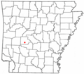
 ARMap-doton-Fountain Lake.png 300 × 262; 13 KB
-
 ARMap-doton-Hot Springs Village.png 300 × 262; 13 KB
-
 ARMap-doton-Lake Hamilton.png 300 × 262; 13 KB
-
 ARMap-doton-Lonsdale.png 300 × 262; 13 KB
-
 ARMap-doton-Mountain Pine.png 300 × 262; 13 KB
-
 ARMap-doton-Piney.png 300 × 262; 13 KB
-
 ARMap-doton-Rockwell.png 300 × 262; 13 KB
-
 Garland County Arkansas 2010 Township Map large.jpg 2 000 × 1 540; 832 KB
-

-

-

-
-

-
 Garland County Poor House (NYPL b11707252-G89F310 006F).tiff 3 072 × 1 743; 15,32 MB
-
 Grand Avenue-US 70B, Hot Springs.jpg 1 280 × 960; 177 KB
-
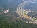
 Highway 270 west in Royal, AR 001.jpg 2 157 × 1 213; 852 KB
-
 Hot springs area map.jpg 576 × 480; 72 KB
-
 Lake Hamilton Power Band in Indiana for BOA Nationals- 2014-01-03 13-19.jpg 1 024 × 577; 221 KB
-
 Lake in Garland County, Arkansas.jpg 4 824 × 3 533; 9,89 MB
-
 Lake Ouachita north of Mount Ida, Arkansas.jpg 4 032 × 3 024; 2,09 MB
-
 Lake Ouachita State Park.jpg 4 032 × 3 024; 9,26 MB
-
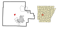
 Map of Arkansas highlighting Garland County.svg 1 278 × 1 113; 90 KB
-
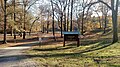 Stephens Park, Garland County, AR.jpg 5 248 × 2 952; 8,03 MB
-
 USA Garland County, Arkansas age pyramid.svg 520 × 600; 8 KB
-
 Vernonia texana.jpg 2 448 × 2 958; 2,38 MB


