Category:Monroe County, Arkansas
Jump to navigation
Jump to search
Counties of Arkansas: Arkansas · Ashley · Baxter · Benton · Boone · Bradley · Calhoun · Carroll · Chicot · Clark · Clay · Cleburne · Cleveland · Columbia · Conway · Craighead · Crawford · Crittenden · Cross · Dallas · Desha · Drew · Faulkner · Franklin · Fulton · Garland · Grant · Greene · Hempstead · Hot Spring · Howard · Independence · Izard · Jackson · Jefferson · Johnson · Lafayette · Lawrence · Lee · Lincoln · Little River · Logan · Lonoke · Madison · Marion · Miller · Mississippi · Monroe · Montgomery · Nevada · Newton · Ouachita · Perry · Phillips · Pike · Poinsett · Polk · Pope · Prairie · Pulaski · Randolph · Saline · Scott · Searcy · Sebastian · Sevier · Sharp · St. Francis · Stone · Union · Van Buren · Washington · White · Woodruff · Yell
county in Arkansas, United States   | |||||
| Upload media | |||||
| Instance of | |||||
|---|---|---|---|---|---|
| Named after | |||||
| Location | Arkansas | ||||
| Capital | |||||
| Inception |
| ||||
| Population |
| ||||
| Area |
| ||||
| Different from | |||||
 | |||||
Subcategories
This category has the following 15 subcategories, out of 15 total.
A
- Arkansas Highway 39 (7 F)
- Arkansas Highway 86 (5 F)
- Arkansas Highway 17 (8 F)
- Arkansas Highway 362 (1 P, 4 F)
B
- Baytown Site (2 F)
C
- Cache River (Arkansas) (4 F)
M
P
Media in category "Monroe County, Arkansas"
The following 29 files are in this category, out of 29 total.
-
 Arkansas Highway 238 turns near Brinkley.jpg 4,128 × 2,322; 2.54 MB
-
 Arkansas Highway 238.jpg 4,123 × 2,010; 2.08 MB
-
 Arkansas Highway 238S terminus at US 49.jpg 3,045 × 2,290; 2.73 MB
-
 Arkansas Highway 238S terminus.jpg 2,265 × 1,410; 711 KB
-
 Arkansas Highway 302 begins.jpg 2,556 × 1,604; 1.3 MB
-
 Arkansas Highway 366 terminus at US 49.jpg 2,600 × 1,950; 2.42 MB
-
 Arkansas Highway 39S terminus at US 49.jpg 3,303 × 2,475; 3.59 MB
-
 B&A Motel, Brinkley, Arkansas LCCN2017709993.tif 5,325 × 3,655; 111.42 MB
-
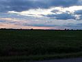 Delta field at sunset 002.jpg 2,342 × 1,755; 1.03 MB
-
 Delta field at sunset.jpg 4,128 × 2,322; 2.02 MB
-
 Great egret (45161387844).jpg 5,760 × 3,840; 1.82 MB
-
 Highway 17 junction with US 70 near Brinkley, AR 001.jpg 2,062 × 1,557; 1.33 MB
-
 Highway 17 junction with US 70 near Brinkley, AR 002.jpg 2,390 × 1,796; 1.75 MB
-
 Highway 17 near Clarendon, AR.jpg 2,452 × 1,843; 966 KB
-
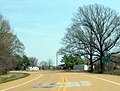
 Highway 362 western terminus, Louisiana Purchase State Park.jpg 2,110 × 1,581; 1.6 MB
-
 Highway 39 junction with US 49.jpg 2,062 × 1,545; 1.4 MB
-

-

-
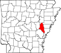 Map of Arkansas highlighting Monroe County.svg 4,474 × 3,895; 102 KB
-
 Monroe County AR sign.jpg 1,024 × 768; 604 KB
-
 US 49 north of Louisiana Purchase State Park, AR.jpg 1,741 × 1,306; 1.01 MB
-
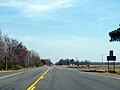
 US 49 south of Brinkley, AR.jpg 2,307 × 1,730; 1.78 MB
-
 US 49 south of Louisiana Purchase State Park.jpg 2,408 × 1,807; 1.85 MB
-
 US 49 south of US 79 junction.jpg 2,331 × 1,748; 1.72 MB
-
 US 70 near Dagmar WMA, Arkansas.jpg 2,372 × 1,777; 1.81 MB
-
 US 70 west of Brinkley, AR.jpg 2,784 × 2,087; 2.63 MB
-
 US 79 and Highway 17 near Clarendon, AR.jpg 1,619 × 1,213; 502 KB
-
 US 79 north of US 49 junction.jpg 2,456 × 1,843; 2.16 MB
-
 USA Monroe County, Arkansas age pyramid.svg 520 × 600; 7 KB


.jpg)


