Category:Sebastian County, Arkansas
Jump to navigation
Jump to search
Counties of Arkansas: Arkansas · Ashley · Baxter · Benton · Boone · Bradley · Calhoun · Carroll · Chicot · Clark · Clay · Cleburne · Cleveland · Columbia · Conway · Craighead · Crawford · Crittenden · Cross · Dallas · Desha · Drew · Faulkner · Franklin · Fulton · Garland · Grant · Greene · Hempstead · Hot Spring · Howard · Independence · Izard · Jackson · Jefferson · Johnson · Lafayette · Lawrence · Lee · Lincoln · Little River · Logan · Lonoke · Madison · Marion · Miller · Mississippi · Monroe · Montgomery · Nevada · Newton · Ouachita · Perry · Phillips · Pike · Poinsett · Polk · Pope · Prairie · Pulaski · Randolph · Saline · Scott · Searcy · Sebastian · Sevier · Sharp · St. Francis · Stone · Union · Van Buren · Washington · White · Woodruff · Yell
county in Arkansas, United States   | |||||
| Upload media | |||||
| Instance of | |||||
|---|---|---|---|---|---|
| Location | Arkansas | ||||
| Capital | |||||
| Inception |
| ||||
| Population |
| ||||
| Area |
| ||||
| official website | |||||
 | |||||
Subcategories
This category has the following 14 subcategories, out of 14 total.
Media in category "Sebastian County, Arkansas"
The following 8 files are in this category, out of 8 total.
-
 Cardinal Motel, highway 71 and 271 South, Fort Smith, Ark (85507).jpg 3,337 × 2,098; 2.86 MB
-

-
 Million dollar free bridge, Fort Smith, Arkansas (64528).jpg 3,353 × 2,120; 2.93 MB
-
 Mitchell's Modern Court, Ft. Smith, Ark (83805).jpg 3,329 × 2,095; 2.65 MB
-
 Ritz Motel and Café, U.S. highway 71 and 271, city limits, Ft. Smith, Ark (84332).jpg 3,353 × 2,145; 2.9 MB
-
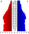 USA Sebastian County, Arkansas age pyramid.svg 520 × 600; 8 KB
-
 Vervack Bros, Texaco (85540).jpg 3,358 × 2,135; 2.79 MB
-
 Wide Awake Restaurant (80523).jpg 3,326 × 2,122; 3.22 MB
.jpg)

.jpg)
.jpg)
.jpg)

.jpg)
.jpg)