Category:Geography of Bashkortostan
Jump to navigation
Jump to search
Federal subjects of the Russian Federation:
Republics: Adygea · Altai · Bashkortostan · Buryatia · Chechnya · Chuvashia · (Crimea) · Dagestan · Ingushetia · Kabardino-Balkaria · Kalmykia · Karachay–Cherkessia · Karelia · Khakassia · Komi · Mari El · Mordovia · North Ossetia — Alania · Sakha (Yakutia) · Tatarstan · Tyva · UdmurtiaKrais: Altai · Kamchatka · Khabarovsk · Krasnodar · Krasnoyarsk · Perm · Primorsky · Stavropol · Zabaykalsky
Oblasts: Amur · Arkhangelsk · Astrakhan · Belgorod · Bryansk · Chelyabinsk · Irkutsk · Ivanovo · Kaliningrad · Kaluga · Kemerovo · Kirov · Kostroma · Kurgan · Kursk · Leningrad · Lipetsk · Magadan · Moscow · Murmansk · Nizhny Novgorod · Novgorod · Novosibirsk · Omsk · Orenburg · Oryol · Penza · Pskov · Rostov · Ryazan · Sakhalin · Samara · Saratov · Smolensk · Sverdlovsk · Tambov · Tomsk · Tula · Tver · Tyumen · Ulyanovsk · Vladimir · Volgograd · Vologda · Voronezh · Yaroslavl
Federal cities: Moscow · Saint Petersburg · (Sevastopol)
Autonomous oblast: Jewish
Autonomous okrugs: Chukotka · Khantia-Mansia · Nenetsia · Yamalo-Nenets
| Parent categories were assigned using the {{Category Russia}} template. In general, new categories should not be added by hand. The tree of categories is maintained automatically, any human edits may be overridden by bot. |
| Upload media | |||||
| Instance of |
| ||||
|---|---|---|---|---|---|
| Subclass of | |||||
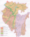
| Location | Bashkortostan, Russia | ||||
| |||||
Subcategories
This category has the following 15 subcategories, out of 15 total.
A
B
- Bugulma-Belebey Upland (10 F)
C
- Countryside in Bashkortostan (4 F)
F
G
M
P
- Propaschaya yama (3 F)
R
S
Media in category "Geography of Bashkortostan"
The following 13 files are in this category, out of 13 total.
-
 Aygir on Inzer river4.jpg 1,024 × 768; 279 KB
-
 Bashkir village.jpg 1,024 × 768; 264 KB
-
 Reservoir flooded road.jpg 1,600 × 1,200; 749 KB
-
 Reservoir Serek-Kul.jpg 1,600 × 1,200; 806 KB
-
 Russian Landscape in September - 07.10.2007.jpg 1,200 × 1,600; 272 KB
-
 Башҡортостан тупраҡтары.png 1,373 × 1,685; 6.04 MB
-
 Башҡортостандың махсус һаҡланыусы объекттары.png 1,297 × 1,713; 5.29 MB
-
 Вид на Теляшево и озеро Карабалыкты.jpg 2,005 × 891; 471 KB
-
 Вид на Теляшево, гору Крепсакан и озеро Карабалыкты.jpg 2,816 × 2,112; 1.91 MB
-
 Западная точка РБ.jpg 4,912 × 3,264; 3.79 MB
-
 Капова пещера.jpg 473 × 685; 437 KB
-
 На южной точке.jpg 4,912 × 3,264; 6.05 MB
-
 Южная точка РБ.jpg 4,912 × 3,264; 4.38 MB


