Category:Geography of Meløy
Jump to navigation
Jump to search
| NO WIKIDATA ID FOUND! Search for Geography of Meløy on Wikidata | |
| Upload media |
Subcategories
This category has the following 9 subcategories, out of 9 total.
E
- Engabreen (34 F)
- Engabrevatnet (4 F)
F
G
M
- Mountains of Meløy (3 F)
S
- Svartisvatnet, Meløy (1 F)
Ø
Media in category "Geography of Meløy"
The following 7 files are in this category, out of 7 total.
-
 Engabreen glacier arm of Svartisen seen from County Road 17.jpg 4,481 × 2,987; 2.43 MB
-
 Ferry connection Forøy–Ågskaret.jpg 4,896 × 3,264; 2.57 MB
-
 Kunna and Kunnsundet seen from County Road 17 in the east.jpg 4,896 × 3,264; 2.96 MB
-
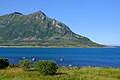
 The island of Kunna off Reipå.jpg 4,896 × 3,264; 2.7 MB
-
 The Støtt archipelago off Reipå.jpg 3,586 × 2,006; 841 KB
-
 View from Skjeggen peak over Reipå.jpg 4,267 × 2,906; 2.23 MB
-
 Åmøya seen from the ferry on the way to Forøy.jpg 4,896 × 3,264; 1.9 MB


