Category:Geography of the Region of Murcia
Jump to navigation
Jump to search
Autonomous communities of Spain: Andalusia · Aragon · Asturias · Balearic Islands · Basque Autonomous Community · Canary Islands · Cantabria · Castile and León · Castile-La Mancha · Catalonia · Extremadura · Galicia · Community of Madrid · Region of Murcia · Navarre · La Rioja · Valencian Community · Autonomous cities: Ceuta · Melilla
Provinces of Spain: Álava · Albacete · Alicante · Almería · Asturias‡ · Ávila · Badajoz · Balearic Islands‡ · Barcelona · Biscay · Burgos · Cáceres · Cádiz · Cantabria‡ · Castellón · Ciudad Real · Córdoba · A Coruña · Cuenca · Gipuzkoa · Girona · Granada · Guadalajara · Huelva · Huesca · Jaén · León · Lleida · Lugo · Madrid‡ · Málaga · Murcia‡ · Navarre‡ · Ourense · Palencia · Las Palmas · Pontevedra · La Rioja‡ · Salamanca · Santa Cruz de Tenerife · Segovia · Seville · Soria · Tarragona · Teruel · Toledo · Valencia · Valladolid · Zamora · Zaragoza · Autonomous cities: Ceuta · Melilla
‡: uniprovincial autonomous communities.
‡: uniprovincial autonomous communities.

Wikimedia category | |||||
| Upload media | |||||
| Instance of | |||||
|---|---|---|---|---|---|
| Category combines topics | |||||
| geography | |||||
science that studies the terrestrial surface, the societies that inhabit it and the territories, landscapes, places or regions that form it when interacting with each other     | |||||
| Pronunciation audio | |||||
| Instance of |
| ||||
| Different from | |||||
| Partially coincident with | |||||
| Region of Murcia | |||||
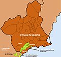
autonomous community of Spain _IberianPeninsulaNASA_(cropped).jpg)    Ubicación de la Región de Murciaa | |||||
| Instance of | |||||
| Location | Spain | ||||
| Located in or next to body of water | |||||
| Capital |
| ||||
| Legislative body | |||||
| Executive body |
| ||||
| Head of government |
| ||||
| Occupant | |||||
| Inception |
| ||||
| Highest point | |||||
| Population |
| ||||
| Area |
| ||||
| Elevation above sea level |
| ||||
| Follows |
| ||||
| Different from | |||||
| Partially coincident with |
| ||||
| official website | |||||
 | |||||
Subcategories
This category has the following 26 subcategories, out of 26 total.
Media in category "Geography of the Region of Murcia"
The following 18 files are in this category, out of 18 total.
-
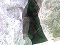
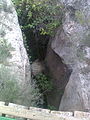 ABERTURA CERRADA DE AGUALEJA.jpg 1,536 × 2,048; 1.05 MB
-
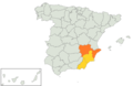 AlmeriaMurciaSureste.png 1,024 × 663; 152 KB
-
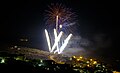 Castillo de fuegos artificiales en honor de Santa Barbara.jpg 4,320 × 2,629; 3.26 MB
-
 Cañada de Canara.jpg 300 × 224; 19 KB
-
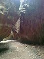 CERRADA DE AGUALEJA PARTE DEL RECORRIDO.jpg 1,536 × 2,048; 481 KB
-
 CERRADA DE AGUALEJA VISTO POR ARRIBA.jpg 2,048 × 1,536; 1.03 MB
-
 Cerro Negro de Calasparra.JPG 4,000 × 2,248; 5.3 MB
-
 Fiestas Cañada de Canara.JPG 150 × 200; 4 KB
-
 Fuente arriba en Benizar.jpg 4,320 × 3,240; 11.91 MB
-
 Iglesiamacisvenda.jpg 2,592 × 1,944; 424 KB
-
 LIC Sierra Almenara Cabo Cope Moreras.jpg 1,230 × 1,146; 142 KB
-
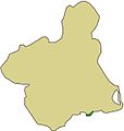 Mapa localizacion sierra fausilla.jpg 571 × 600; 38 KB
-
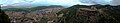 Panoramica desde el calar.jpg 8,000 × 1,538; 6.69 MB
-
 Panorámica desde el Barranco Cantón.jpg 3,072 × 1,728; 3.08 MB
-
 PARTE DE LA CERRADA DE LA AGUALEJA.jpg 1,536 × 2,048; 919 KB
-
 PUENTE QUE HAY QUE PASAR PARA LLEGERRADA DE AGUALEJAAR A C.jpg 2,048 × 1,536; 920 KB
-
 Santomera pantano.jpg 300 × 164; 6 KB
-
 VISTA DE LA CERRADA DE AGUALEJA.jpg 1,536 × 2,048; 615 KB


