Category:Global maps centered 10E
Jump to navigation
Jump to search
| NO WIKIDATA ID FOUND! Search for Global maps centered 10E on Wikidata | |
| Upload media |
Subcategories
This category has only the following subcategory.
S
Media in category "Global maps centered 10E"
The following 29 files are in this category, out of 29 total.
-
 Anthropogene-Landschaften.png 4,779 × 2,594; 1.37 MB
-
 Beers Ulster County Atlas Page006-007.jpg 6,997 × 4,681; 6.92 MB
-
 Blank map world gmt.pdf 4,989 × 3,689; 5.25 MB
-
 CIA Political World Map 2002.jpg 3,206 × 1,698; 874 KB
-
 Continenti wikivoyage.png 1,150 × 415; 150 KB
-
 Eckert4.jpg 5,400 × 2,700; 1.56 MB
-
 ErdebeiNacht2Hölzel.png 1,878 × 940; 1.1 MB
-
 Fasciola hepatica prevalence.jpg 1,425 × 625; 504 KB
-
 Geoid height red blue.png 1,686 × 1,166; 940 KB
-
 Geoida.png 1,686 × 1,166; 1.43 MB
-
 GOPAC Members.png 691 × 442; 89 KB
-
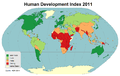 Hdi2011.png 2,804 × 1,766; 135 KB
-
 Hdi2011colorsave.png 2,804 × 1,766; 134 KB
-
 Hdi2011eng.png 2,804 × 1,766; 136 KB
-
 Hoelzel10ost.jpg 10,800 × 6,123; 5.84 MB
-
 Hoelzelbluemarble.png 2,058 × 1,034; 1.56 MB
-
 Hoelzelnaturalearth.png 3,038 × 1,944; 6.66 MB
-
 Jährliche Niederschlagssummen & Mitteltemperaturen.png 4,779 × 2,594; 2.42 MB
-
 Map of Refugia = Example 18000 BC to the present.png 4,779 × 2,594; 2.34 MB
-
 Mollweide10ost.jpg 10,800 × 5,401; 4.52 MB
-
 Population balls (wide).png 5,004 × 2,540; 1.29 MB
-
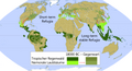
 Troll-Paffen Climate Classification Map.png 4,779 × 2,594; 4.14 MB
-
 Vegetationszonen 18.000 BC.png 4,779 × 3,657; 2.05 MB
-
 Vegetationszonen.png 4,779 × 2,594; 4.11 MB
-
 Weltkarte-Agglomeration.png 2,000 × 1,086; 1.34 MB
-
 Weltkarte.jpg 2,804 × 1,521; 715 KB
-
 Wildnisweltkarte.png 4,779 × 2,594; 4.2 MB
-
 Winkeltripel10ost.jpg 10,800 × 6,600; 5.41 MB
-
 World map 2004 CIA large.jpg 4,595 × 2,335; 2.24 MB


.png)


