Category:Grand County, Utah
Bước tới điều hướng
Bước tới tìm kiếm
Counties of Utah: Beaver · Box Elder · Cache · Carbon · Daggett · Davis · Duchesne · Emery · Garfield · Grand · Iron · Juab · Kane · Millard · Morgan · Piute · Rich · Salt Lake · San Juan · Sanpete · Sevier · Summit · Tooele · Uintah · Utah · Wasatch · Washington · Wayne · Weber
county in eastern Utah, United States   | |||||
| Tải lên phương tiện | |||||
| Là một | |||||
|---|---|---|---|---|---|
| Được đặt tên theo | |||||
| Vị trí | Utah, Hoa Kỳ | ||||
| Trung tâm hành chính | |||||
| Ngày thành lập hoặc tạo ra |
| ||||
| Dân số |
| ||||
| Diện tích |
| ||||
| trang chủ chính thức | |||||
 | |||||
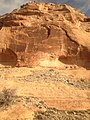
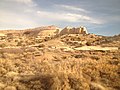
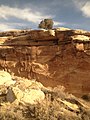
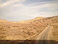
English: Media related to Grand County, Utah, a county on the eastern edge of Utah, United States.
Thể loại con
Thể loại này có 13 thể loại con sau, trên tổng số 13 thể loại con.
B
E
G
H
M
N
P
S
T
Tập tin trong thể loại “Grand County, Utah”
165 tập tin sau nằm trong thể loại này, trong tổng số 165 tập tin.
-
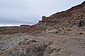
 - panoramio (2946).jpg 3.264×1.840; 1,5 MB
-
 1993 in der naehe von moab utah.jpg 747×494; 139 kB
-
1993-06-08-Jeep-Safari-bei-Moab-(Utah).ogv 7 min 2 s, 640×352; 55,06 MB
-
 2016.10.22 Canyonlands NP, UT (85).jpg 3.008×1.692; 2,11 MB
-
 A Light in the Night (6625771707).jpg 3.456×5.184; 11,49 MB
-
 A259, Moab, Utah, USA, Gold Bar Rim, looking north, 2008.JPG 1.024×683; 560 kB
-
 Across the United States by train banner.jpg 4.192×598; 890 kB
-

-
 Amasaback.jpg 800×600; 707 kB
-
 Amtrak California Zephyr banner.jpg 2.100×300; 238 kB
-
 Amtrak California Zephyr Green River - Floy, Utah.jpg 4.192×2.587; 2,14 MB
-
 Amtrak SF - Chicago, Feb-2018 (39515297765).jpg 2.000×1.333; 588 kB
-
 Balancing Rock in Utah.jpg 5.184×3.456; 12,29 MB
-
 Bar M - panoramio (1).jpg 3.264×2.448; 3,86 MB
-
 Bar M - panoramio.jpg 3.264×2.448; 3,89 MB
-
 Bar M area - panoramio.jpg 3.264×2.448; 3,03 MB
-
 Bar M parking - panoramio.jpg 3.264×2.448; 2,91 MB
-
-
 BIker Portrait (10812262166).jpg 2.304×1.536; 1,94 MB
-

-
 Bouquet (5170503366).jpg 5.184×3.456; 19,74 MB
-
 Californiazephyr banner.jpg 2.100×300; 522 kB
-
 Campsite along the Colorado River - panoramio.jpg 2.048×495; 595 kB
-
 Canyon Panorama-sRGB.jpg 8.923×1.900; 14,86 MB
-
 Canyon Panorama.tif 8.923 × 1.900, 2 trang; 48,54 MB
-
 Canyon reflections (8729909522).jpg 4.752×3.168; 1,55 MB
-
 Canyon-landscape-Thompson-Utah.jpeg 3.156×2.368; 1,92 MB
-
 Cascading potholes (19452324296).jpg 3.168×4.752; 1,29 MB
-
 Castle Valley and surroundings.jpg 5.464×3.640; 3,03 MB
-

-
 Cattle herded along US-191, Oct 09.jpg 3.296×2.472; 1,12 MB
-
 Colorado River, Southern Utah - panoramio.jpg 2.592×1.944; 1,83 MB
-
 Colorado River01.jpg 2.520×1.680; 3,7 MB
-
 Colorado River02.jpg 2.331×1.516; 3,03 MB
-
 Colorado River05.jpg 2.482×1.648; 2,37 MB
-
 Colorado River06.jpg 2.520×1.680; 2,26 MB
-
 Colorado River071.jpg 2.520×1.680; 3,59 MB
-
 ColoradoRiverByMoab.jpg 6.000×4.500; 4,37 MB
-
 Cool Valley - panoramio.jpg 3.264×2.448; 2,26 MB
-
-

-

-
 DESERT COTTONTAIL - NARA - 545557.jpg 3.000×2.019; 536 kB
-
 Desert Driftwood (8729911186).jpg 3.168×4.752; 1,97 MB
-
 Desert Stream (8728792657).jpg 2.742×2.765; 723 kB
-
-
 Dinosaur tracks Copper Ridge 1.jpg 5.616×3.744; 10,14 MB
-
 Dinosaur tracks Copper Ridge 6.jpg 5.616×3.744; 8,11 MB
-
 Exploring Arches NP (Unsplash).jpg 6.000×4.000; 6,1 MB
-
 Extreme Desert Climbs (Unsplash).jpg 4.622×3.081; 1,45 MB
-
 Federal 26-43H.jpg 1.600×1.067; 251 kB
-
 Federal 28-11.jpg 1.600×1.067; 184 kB
-
 Felony Tower and Woodrruff Bottom (7257582874).jpg 1.600×1.067; 741 kB
-
 Gemini Bridges - panoramio.jpg 2.160×1.440; 761 kB
-
 Good Morning Moab (5156887780).jpg 3.435×5.172; 16,1 MB
-
 Grand County 1997 01.jpg 1.071×707; 634 kB
-
 Grand County 1997 02.jpg 1.054×707; 690 kB
-
 Grand County 1997 03.jpg 1.033×680; 1,03 MB
-
 Grand County 1997 05.jpg 1.051×686; 1,01 MB
-
 Grand County, UT, USA - panoramio (17).jpg 3.264×2.448; 3,13 MB
-
 Grand County, UT, USA - panoramio (18).jpg 3.264×2.448; 2,76 MB
-
 Grand County, UT, USA - panoramio (19).jpg 3.264×2.448; 3 MB
-
 Grand County, UT, USA - panoramio (2).jpg 3.264×2.448; 3,44 MB
-
 Grand County, UT, USA - panoramio (21).jpg 3.264×2.448; 3,58 MB
-
 Grand County, UT, USA - panoramio (22).jpg 3.264×2.448; 3,46 MB
-
 Grand County, UT, USA - panoramio (23).jpg 3.264×2.448; 3,73 MB
-
 Grand County, UT, USA - panoramio (24).jpg 3.264×2.448; 3,49 MB
-
 Grand County, UT, USA - panoramio (25).jpg 3.264×2.448; 3,86 MB
-
 Grand County, UT, USA - panoramio (28).jpg 3.264×2.448; 2,48 MB
-
 Grand County, UT, USA - panoramio (29).jpg 3.264×2.448; 2,35 MB
-
 Grand County, UT, USA - panoramio (3).jpg 3.264×2.448; 3,61 MB
-
 Grand County, UT, USA - panoramio (30).jpg 3.264×2.448; 2,54 MB
-
 Grand County, UT, USA - panoramio (31).jpg 3.264×2.448; 2,59 MB
-
 Grand County, UT, USA - panoramio (32).jpg 3.264×2.448; 2,47 MB
-
 Grand County, UT, USA - panoramio (33).jpg 4.000×2.248; 2,78 MB
-
 Grand County, UT, USA - panoramio.jpg 3.264×2.448; 2,47 MB
-
 Great Salt Valley Overlook (18855901504).jpg 4.752×3.168; 1,44 MB
-
 Great Salt Valley Overlook (19290838778).jpg 4.752×3.168; 1,87 MB
-
 Great Salt Valley overlook (19478386015).jpg 4.752×3.168; 1,39 MB
-
 Greentown Cross Section.jpg 10.742×8.625; 20,73 MB
-
 Highline in Moab.jpg 4.032×3.024; 2,97 MB
-
 Horsethief Switchbacks (7257584216).jpg 1.600×1.067; 459 kB
-
 I-70 - panoramio.jpg 3.264×1.840; 1,38 MB
-
 I-70 near Exit 204 - Cisco - panoramio.jpg 3.264×2.448; 2,71 MB
-
 ISS-52 Solar Evaporation Ponds near Moab, Utah.jpg 4.928×3.280; 10,05 MB
-
 Landscape in Grand County, UT viewed the from the California Zephyr (1).jpg 3.264×2.448; 2,53 MB
-
 Landscape in Grand County, UT viewed the from the California Zephyr (10).jpg 2.448×3.264; 3,25 MB
-
 Landscape in Grand County, UT viewed the from the California Zephyr (11).jpg 2.448×3.264; 3,19 MB
-
 Landscape in Grand County, UT viewed the from the California Zephyr (2).jpg 3.264×2.448; 2,61 MB
-
 Landscape in Grand County, UT viewed the from the California Zephyr (3).jpg 3.264×2.448; 2,66 MB
-
 Landscape in Grand County, UT viewed the from the California Zephyr (4).jpg 3.264×2.448; 3,47 MB
-
 Landscape in Grand County, UT viewed the from the California Zephyr (5).jpg 3.264×2.448; 2,61 MB
-
 Landscape in Grand County, UT viewed the from the California Zephyr (6).jpg 3.264×2.448; 2,62 MB
-
 Landscape in Grand County, UT viewed the from the California Zephyr (7).jpg 3.264×2.448; 2,84 MB
-
 Landscape in Grand County, UT viewed the from the California Zephyr (8).jpg 3.264×2.448; 2,99 MB
-
 Landscape in Grand County, UT viewed the from the California Zephyr (9).jpg 2.448×3.264; 2,58 MB
-
 Landscape in Grand County, UT viewed the from the California Zephyr.jpg 3.264×2.448; 2,37 MB
-

-
 Landscape near Cisco viewed the from the California Zephyr in Grand County, UT.jpg 3.264×2.448; 2,38 MB
-
 LIZARD - NARA - 545553.jpg 3.000×2.025; 1,27 MB
-
 Moab (239445302).jpg 792×527; 148 kB
-
 Moab 001.jpg 800×600; 162 kB
-
 Moab Country Morning (5074104186).jpg 1.286×854; 304 kB
-
 Moab Landscape (6607825369).jpg 5.162×3.435; 19,29 MB
-
 Moab Man - panoramio.jpg 1.032×1.440; 551 kB
-
 Moab Mill Tailings Removal Project.jpg 3.264×2.448; 2,11 MB
-
 Moab Panorama (Unsplash).jpg 4.896×3.264; 8,11 MB
-
 Moab Plateau Country (5168375038).jpg 1.286×854; 342 kB
-
 Moab Utah roadtrip.jpg 800×600; 114 kB
-
 Moab, United States (Unsplash aMgRySE38Yw).jpg 4.240×2.542; 5,74 MB
-
 Moab, United States (Unsplash Lwx3byZvxYM).jpg 6.000×4.000; 9,99 MB
-
 Moab, United States.jpg 4.896×3.264; 4,08 MB
-
 Moab, USA (Unsplash).jpg 5.472×3.648; 14,29 MB
-
 Moab, UT (23471068623).jpg 3.976×2.652; 2,93 MB
-
 Moab, UT (23471069523).jpg 3.976×2.652; 1,47 MB
-
 Moab, UT (24015259021).jpg 3.976×2.652; 5,43 MB
-
 Moab, UT (24071772296).jpg 3.976×2.652; 4,67 MB
-
 Moab, UT (24097854975).jpg 3.976×2.652; 2,67 MB
-
 Moab, UT (24097855985).jpg 3.976×2.652; 3,06 MB
-
 Moab, UT 84532, USA - panoramio (1).jpg 3.264×2.448; 3,56 MB
-
 Moab, UT 84532, USA - panoramio.jpg 3.264×2.448; 4,36 MB
-
 Moab, Utah from 30000 ft. (5572911812).jpg 1.024×555; 227 kB
-
 MoabAlcove.JPG 2.048×1.536; 1,37 MB
-
 Mohab Canyon near Arches NP, Utah 8-25-12 (7993174591).jpg 1.538×1.201; 596 kB
-
 Morning Reflections.JPG 4.272×2.848; 4,63 MB
-
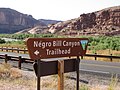 N-word Bill Canyon sign.JPG 1.024×768; 329 kB
-
 North 40 - panoramio.jpg 3.264×2.448; 3,76 MB
-
 Overlook from Gemini Bridges Road - panoramio.jpg 2.160×1.440; 513 kB
-
 Overlook to the Colorado River, Moab.jpg 5.184×3.456; 8,47 MB
-

-
 Potash road big bear - panoramio.jpg 3.470×2.347; 2,46 MB
-
 PRICKLY PEAR CACTUS BLOSSOMS - NARA - 545727.jpg 2.023×3.000; 914 kB
-
 PRINCE'S PLUME - NARA - 545716.jpg 3.000×2.026; 1,33 MB
-
 Railway near Moab, Utah.jpg 3.816×2.437; 5,66 MB
-
 Railway tracks near a level crossing with SR-313, Utah 20110815 2.jpg 4.775×3.163; 6,1 MB
-
 Red Canyon River 2004 - panoramio.jpg 2.448×2.488; 2,39 MB
-
 Reel-rock-photo-moab.jpg 5.184×3.456; 4,81 MB
-
 River Road (3696834316).jpg 700×1.050; 134 kB
-
 Rock face (15699816263).jpg 3.264×2.448; 3 MB
-
 Rock Wave (8728789769).jpg 3.168×4.752; 1,71 MB
-
 Sagebrush Rebellion July 4th, 1980 Grand County Utah.JPG 4.000×2.664; 2,15 MB
-
 Sand Sky and Slickrock (5185361113).jpg 3.447×5.176; 15,11 MB
-
 Sand-flats.jpg 4.688×2.769; 11,63 MB
-
 Shaffer Trail 2005-07-26 (3710789977).jpg 3.504×2.336; 3,1 MB
-
 Shaffer Trail 2005-07-26 (3711600884).jpg 3.504×2.336; 3,35 MB
-
 Shinarump Mine Entrance.jpg 2.992×2.000; 2,22 MB
-
 Shinarump Mine Waste Rock 2.jpg 2.992×2.000; 1,96 MB
-
 Shinarump Mine Waste Rock.jpg 2.992×2.000; 2,26 MB
-
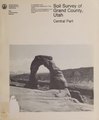 Soil survey of Grand County, Utah, central part (IA soilsurveyofgran00hans).pdf 1.783 × 2.164, 515 trang; 67,28 MB
-
 Spring in the La Sals (Unsplash).jpg 7.200×4.800; 22,14 MB
-
 Survival in the desert (8729910422).jpg 3.168×4.752; 1,53 MB
-
 Tranquility (Unsplash).jpg 5.608×3.727; 8,28 MB
-
 Turn west to continue on UT-128 East - panoramio.jpg 1.600×1.200; 442 kB
-
 Upper Big Bend Campground, Moab, United States (Unsplash).jpg 3.000×2.000; 2,96 MB
-
 USA - Far West (14792664730).jpg 5.184×3.456; 7,29 MB
-
 USA Grand County, Utah age pyramid.svg 520×600; 7 kB
-
 Usa-ut-moab-lionsback.jpg 2.560×1.920; 2,18 MB
-
 Utah State Route 128 (6352000838).jpg 4.320×3.240; 9,89 MB
-
 UTAH-NEAR MOAB - NARA - 545723.jpg 3.000×2.026; 917 kB
-
 View from California Zephyr near Westwater, Utah - June 2022 - Sarah Stierch.jpg 4.032×3.024; 5,73 MB
-
 West of Grand Junction CA (12136986296).jpg 2.272×1.704; 3,64 MB
-
 Williams Bottom Camping Area dyeclan.com - panoramio.jpg 2.674×5.562; 8,93 MB
-
 Ylmob 1b (14656240616).jpg 2.302×1.222; 855 kB
-
 Ylmob 2b (14699123063).jpg 2.624×864; 570 kB
-
 YUCCA - NARA - 545717.jpg 3.000×2.015; 1,23 MB
.jpg)

.jpg)
.jpg)


.jpg)

.jpg)


_(Grand_County,_Utah,_USA)_(32776754510).jpg)
.jpg)

.jpg)
.jpg)

.jpg)


_(Grand_County,_Utah,_USA)_(33032003281).jpg)


.jpg)
.jpg)


.jpg)
.jpg)


.jpg)

.jpg)


.jpg)
.jpg)
.jpg)
.jpg)
.jpg)
.jpg)
.jpg)
.jpg)
.jpg)
.jpg)
.jpg)
.jpg)
.jpg)
.jpg)
.jpg)
.jpg)

.jpg)
.jpg)
.jpg)


.jpg)


.jpg)
.jpg)
.jpg)
.jpg)
.jpg)
.jpg)
.jpg)
.jpg)
.jpg)
.jpg)
.jpg)


.jpg)

.jpg)
.jpg)


.jpg)
.jpg)

.jpg)
.jpg)

.jpg)
.jpg)
.jpg)
.jpg)
.jpg)
.jpg)
.jpg)
.jpg)

.jpg)

.jpg)


.jpg)
.jpg)
.jpg)

.jpg)

.jpg)
.jpg)


.jpg)
.jpg)
.jpg)

.jpg)
.jpg)


.jpg)


.jpg)

.jpg)

.jpg)