Category:Guiseley
Jump to navigation
Jump to search
town in the City of Leeds metropolitan borough in West Yorkshire, England  | |||||
| Upload media | |||||
| Instance of | |||||
|---|---|---|---|---|---|
| Location | Leeds, West Yorkshire, Yorkshire and the Humber, England | ||||
| Official language | |||||
| Population |
| ||||
 | |||||
Subcategories
This category has the following 15 subcategories, out of 15 total.
B
- Bradford Golf Club (7 F)
- Bus stops in Guiseley (2 F)
G
- Guiseley Beck (3 F)
H
N
- New Scarborough (1 F)
- Nunroyd Park (9 F)
S
- Signs in Guiseley (2 F)
T
W
- Whale Jaws Hill (8 F)
Media in category "Guiseley"
The following 63 files are in this category, out of 63 total.
-
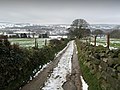
 Allotments, Moor Lane - geograph.org.uk - 2061417.jpg 2,592 × 1,944; 2.2 MB
-
 Bracken End Farm - geograph.org.uk - 2798211.jpg 4,320 × 3,240; 3.44 MB
-
 Bridleway - Coach Road - geograph.org.uk - 3030133.jpg 480 × 640; 130 KB
-

-
 Bridleway - Moorland Avenue - geograph.org.uk - 3222834.jpg 480 × 640; 108 KB
-

-
 Bridleway descending towards Menston - geograph.org.uk - 2798218.jpg 4,320 × 3,240; 3.05 MB
-

-
 Clapper Brow, Parkinson's Park, Kelcliffe, Guiseley - geograph.org.uk - 3754865.jpg 1,600 × 1,200; 619 KB
-
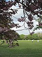 Cricket and cherry blossom - geograph.org.uk - 1282400.jpg 466 × 640; 150 KB
-

-
 Flooded Woodland - Thorpe Lane - geograph.org.uk - 996482.jpg 640 × 480; 117 KB
-
 Footpath - Thorpe Lane - geograph.org.uk - 996491.jpg 640 × 477; 118 KB
-

-
 Gas Installation - Back Lane - geograph.org.uk - 3041107.jpg 640 × 480; 101 KB
-
 Guiseley - A view from Carlton Lane - geograph.org.uk - 1627350.jpg 640 × 457; 80 KB
-
 Guiseley Brickworks (5734431463) (2).jpg 3,648 × 2,056; 3.18 MB
-
 Guiseley Cemetery - geograph.org.uk - 749842.jpg 640 × 426; 86 KB
-
 Guiseley Cross and Stocks 2010.jpg 2,448 × 3,264; 1.54 MB
-
 Guiseley Moor in the Snow - geograph.org.uk - 1715415.jpg 2,272 × 1,704; 1.19 MB
-

-

-
 Manning Stainton - The Green - geograph.org.uk - 1941502.jpg 480 × 640; 73 KB
-

-
 Ordnance Survey Flush Bracket S8679 - geograph.org.uk - 3028988.jpg 3,264 × 2,448; 2.97 MB
-

-

-
 Patrick Bronte and Maria Branwell (29866116716).jpg 3,000 × 4,000; 9.93 MB
-
 Posh sheep in Jackdaw Field. - geograph.org.uk - 870408.jpg 480 × 640; 122 KB
-
 Receipt with Seal (16809361894).jpg 5,072 × 4,768; 19.55 MB
-
 Reva Reservoir - geograph.org.uk - 410447.jpg 640 × 480; 37 KB
-
 Scoreboard, Guiseley Cricket Club - geograph.org.uk - 1282438.jpg 640 × 469; 126 KB
-
 Springfield Road - geograph.org.uk - 688972.jpg 640 × 480; 67 KB
-
 Stone Faces, Guiseley (29699282810).jpg 2,524 × 1,936; 4.25 MB
-

-
 Un-named lane off Moor Lane - geograph.org.uk - 2061481.jpg 2,592 × 1,944; 2.33 MB
-
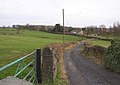
 Westfield Farm near Guiseley - geograph.org.uk - 1627391.jpg 640 × 457; 87 KB
-
 At the top of Lands Lane, Guiseley - geograph.org.uk - 340122.jpg 640 × 423; 83 KB
-
 Building, Wells Road, Guiseley - geograph.org.uk - 340150.jpg 640 × 480; 75 KB
-
 Butts Lane, Guiseley - geograph.org.uk - 340133.jpg 640 × 480; 101 KB
-
 Calfhole Beck, near West Carlton - geograph.org.uk - 45971.jpg 640 × 480; 222 KB
-
 Cambridge Street - geograph.org.uk - 689043.jpg 640 × 480; 65 KB
-
 Footpath - off Leeds Road - geograph.org.uk - 688957.jpg 640 × 440; 97 KB
-

-
 Giant hedge, Lands Lane, Guiseley - geograph.org.uk - 340165.jpg 640 × 406; 51 KB
-

-
 Guiseley Moor - geograph.org.uk - 41289.jpg 640 × 480; 132 KB
-
 Guiseley Moor - geograph.org.uk - 442511.jpg 640 × 480; 128 KB
-
 KFC - Leeds Road - geograph.org.uk - 688961.jpg 640 × 370; 45 KB
-
 Moat, The Rectory, Guiseley - geograph.org.uk - 340187.jpg 640 × 469; 155 KB
-
 Moor Lane, Guiseley - geograph.org.uk - 340865.jpg 640 × 411; 60 KB
-

-
 Nunroyd Avenue - Leeds Road - geograph.org.uk - 688950.jpg 640 × 403; 50 KB
-
 Privies, Wells Road, Guiseley - geograph.org.uk - 340130.jpg 640 × 480; 117 KB
-
 Queensway, Guiseley - geograph.org.uk - 340843.jpg 640 × 470; 54 KB
-

-
 The Rectory, Guiseley - geograph.org.uk - 340191.jpg 640 × 480; 171 KB
-
 The valley above Queensway, Guiseley - geograph.org.uk - 340868.jpg 640 × 480; 114 KB
-
 Tofts and crofts, Guiseley. - geograph.org.uk - 340835.jpg 640 × 480; 96 KB
-

-
 Wells Road, off Well Lane, Guiseley - geograph.org.uk - 340105.jpg 640 × 480; 86 KB
-
 West Parade, off Lands Lane, Guiseley - geograph.org.uk - 340183.jpg 640 × 475; 77 KB
-
 Wills Gill, Guiseley - geograph.org.uk - 340872.jpg 640 × 455; 75 KB


_(2).jpg)


.jpg)

.jpg)


.jpg)


