Category:Airedale
Jump to navigation
Jump to search
English: Airedale is a geographic area in Yorkshire, England, corresponding to the river valley of the River Aire.
valley in Yorkshire, UK  | |||||
| Upload media | |||||
| Instance of | |||||
|---|---|---|---|---|---|
| Location |
| ||||
 | |||||
Subcategories
This category has the following 26 subcategories, out of 26 total.
A
C
E
F
G
H
I
R
S
Y
Media in category "Airedale"
The following 9 files are in this category, out of 9 total.
-
 Aire Valley - geograph.org.uk - 106701.jpg 640 × 480; 116 KB
-
 Airedale 1922 OS Map.png 1,200 × 900; 2.53 MB
-
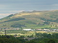 Carleton and Skipton.jpg 2,560 × 1,920; 2.14 MB
-
 Overflowing Aire - geograph.org.uk - 291786.jpg 640 × 480; 110 KB
-
 View of Airedale - geograph.org.uk - 495841.jpg 640 × 372; 77 KB
-

-
 Holden Lane Downhill - geograph.org.uk - 715409.jpg 640 × 480; 73 KB
-

-
 The Aire valley from Druids Altar - geograph.org.uk - 638385.jpg 640 × 90; 20 KB


