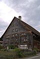
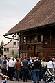
Category:Hablützelhaus
Jump to navigation
Jump to search
| Object location | | View all coordinates using: OpenStreetMap |
|---|
 | |||||
| Upload media | |||||
| Instance of | |||||
|---|---|---|---|---|---|
| Part of | |||||
| Location |
| ||||
| Street address |
| ||||
| Heritage designation | |||||
 | |||||
Media in category "Hablützelhaus"
The following 17 files are in this category, out of 17 total.
-
 1-Hablützelhaus-d-DSC01885.jpg 3,880 × 2,608; 1.15 MB
-
 1-Hablützelhaus-o-DSC01890.jpg 2,608 × 3,880; 1.24 MB
-
 1-Hablützelhaus-o-DSC01891.jpg 2,608 × 3,880; 1.07 MB
-
 1-Hablützelhaus-o-DSC01892.jpg 2,608 × 3,880; 1.27 MB
-
 1-Hablützelhaus-s-DSC01877.jpg 2,592 × 3,872; 1.51 MB
-

-

-

-

-

-

-

-

-

-

-

-


