Category:Hadleigh, Essex
Jump to navigation
Jump to search
town in southeast Essex, England  | |||||
| Upload media | |||||
| Instance of | |||||
|---|---|---|---|---|---|
| Part of | |||||
| Location | Castle Point, Essex, East of England, England | ||||
 | |||||
English: Hadleigh is a town in southeast Essex, England, on the A13 between Benfleet and Leigh-on-Sea with a population of about 18,300.
Nederlands: Hadleigh is een plaats in het bestuurlijke gebied Castle Point, in het Engelse graafschap Essex. De plaats telt 18.300 inwoners.
Subcategories
This category has the following 3 subcategories, out of 3 total.
H
- Hadleigh War Memorial, Essex (1 F)
J
- St James the Less, Hadleigh (21 F)
Media in category "Hadleigh, Essex"
The following 88 files are in this category, out of 88 total.
-
 'Woolies' final week ^ - geograph.org.uk - 1111259.jpg 640 × 483; 112 KB
-
 1600 London Road, Leigh-on-Sea - geograph.org.uk - 915335.jpg 640 × 480; 100 KB
-

-
-

-

-

-

-
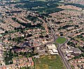
 Aerial view of Hadleigh town centre - geograph.org.uk - 1656993.jpg 640 × 511; 206 KB
-

-

-
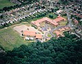
 Aerial view of west Hadleigh - geograph.org.uk - 1594271.jpg 640 × 508; 174 KB
-
-

-
 Alderman John H. Burrows.png 156 × 232; 58 KB
-
 Belfairs Woods, Southend-on-Sea, United Kingdom (Unsplash dha6S S23Bw).jpg 6,000 × 4,000; 23.51 MB
-
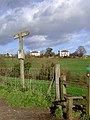
 Boundary marker - geograph.org.uk - 1142490.jpg 640 × 480; 112 KB
-
 Broseley, hermitage 2, hadleigh, london region.jpg 310 × 232; 20 KB
-
 Castle Farm - geograph.org.uk - 316539.jpg 600 × 450; 57 KB
-
 Castle Lane - geograph.org.uk - 316164.jpg 450 × 600; 33 KB
-
 Dodds Grove - Prittle Brook - geograph.org.uk - 166098.jpg 480 × 640; 159 KB
-
 Felled Oaks - geograph.org.uk - 166096.jpg 480 × 640; 102 KB
-
 Fire Station , Hadleigh - geograph.org.uk - 333652.jpg 640 × 499; 83 KB
-
 Fire Station, Hadleigh - geograph.org.uk - 905161.jpg 425 × 640; 64 KB
-
 Hadleigh Allotments - geograph.org.uk - 113154.jpg 640 × 392; 49 KB
-
 Hadleigh Castle Southend-on-Sea England.jpg 1,057 × 824; 165 KB
-
 Hadleigh Colony Memorial Fountain - geograph.org.uk - 316381.jpg 450 × 600; 46 KB
-
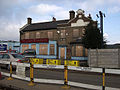
 Hadleigh Fire Station, now closed - geograph.org.uk - 1569268.jpg 640 × 416; 124 KB
-
 Hadleigh Library - geograph.org.uk - 1569271.jpg 640 × 365; 112 KB
-
 Hadleigh Slipway - geograph.org.uk - 307969.jpg 450 × 600; 28 KB
-
 Hadleigh, Essex - 'The Hadleigh Sculpture'.jpg 1,110 × 1,500; 647 KB
-
 Hadleigh, Essex - geograph.org.uk - 1718123.jpg 640 × 368; 92 KB
-
Hadleigh.ogg 1.1 s; 12 KB
-
 Hedingham Omnibuses bus L370 Alexander Dennis Enviro200 EU58 JCJ (3).jpg 3,872 × 2,592; 1.81 MB
-
 Hedingham Omnibuses bus L374 Volvo Olympian Northern Counties R643 MNU (1).jpg 3,872 × 2,592; 2.01 MB
-
 Hedingham Omnibuses bus L374 Volvo Olympian Northern Counties R643 MNU.jpg 3,872 × 2,592; 1.63 MB
-
 Leisure Centre - geograph.org.uk - 504214.jpg 640 × 341; 57 KB
-
 Lewis Electruk RVW 732.jpg 940 × 940; 86 KB
-
 Morrison's Supermarket, Hadleigh - geograph.org.uk - 1718108.jpg 640 × 375; 74 KB
-
 Mount Zion - geograph.org.uk - 316372.jpg 600 × 450; 33 KB
-
 Pair of shoes in Belfairs Woods (Unsplash).jpg 6,000 × 4,000; 8.69 MB
-
 Pylon Corridor, Pound Wood - geograph.org.uk - 619080.jpg 508 × 640; 50 KB
-
 Rainbow over the Thames Estuary - geograph.org.uk - 1099195.jpg 427 × 640; 46 KB
-
 Rectory Road, Hadleigh - geograph.org.uk - 1505242.jpg 640 × 476; 156 KB
-
 Reservoir valve house - geograph.org.uk - 1636118.jpg 640 × 426; 117 KB
-
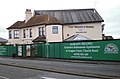
 Salvation Army Citadel, Hadleigh - geograph.org.uk - 211172.jpg 640 × 480; 47 KB
-
 Salvation Army Citadel, Hadleigh - geograph.org.uk - 905165.jpg 640 × 425; 58 KB
-
 Sea wall construction, Hadleigh Marshes - geograph.org.uk - 1519299.jpg 640 × 420; 144 KB
-
 Shops at Hadleigh - geograph.org.uk - 1718114.jpg 640 × 440; 106 KB
-
 Shops at Hadleigh - geograph.org.uk - 1718119.jpg 640 × 371; 87 KB
-
 Slipway Into Hadleigh Ray - geograph.org.uk - 41410.jpg 640 × 482; 80 KB
-
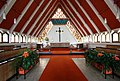 St Barnabas, Hadleigh, Essex - Chancel - geograph.org.uk - 1898944.jpg 1,000 × 678; 171 KB
-
 St Barnabas, Hadleigh, Essex - East end - geograph.org.uk - 1898950.jpg 1,000 × 747; 193 KB
-
 St Barnabas, Hadleigh, Essex - Font - geograph.org.uk - 1898948.jpg 608 × 1,000; 107 KB
-
 St Barnabas, Hadleigh, Essex - Font ^ flags - geograph.org.uk - 1898952.jpg 729 × 1,000; 135 KB
-
 St Barnabas, Hadleigh, Essex - geograph.org.uk - 1898933.jpg 1,000 × 725; 132 KB
-
 St Barnabas, Hadleigh, Essex - geograph.org.uk - 1898938.jpg 1,000 × 729; 161 KB
-
 St Barnabas, Hadleigh, Essex - West end - geograph.org.uk - 1898945.jpg 1,000 × 690; 160 KB
-
 St Barnabas, Hadleigh, Essex - Window - geograph.org.uk - 1898947.jpg 1,000 × 484; 193 KB
-
 St. Michael's Church - geograph.org.uk - 316284.jpg 600 × 450; 41 KB
-
 St. Michael's Church - geograph.org.uk - 316293.jpg 600 × 450; 60 KB
-
 The Crown @ Hadleigh - geograph.org.uk - 232100.jpg 640 × 479; 70 KB
-
-
 The Waggon and Horses, Hadleigh - geograph.org.uk - 232087.jpg 640 × 423; 51 KB
-
 Tylerset Farm, Daws Heath - geograph.org.uk - 1153042.jpg 640 × 425; 87 KB
-
 Victoria House Corner Clock Tower - geograph.org.uk - 511793.jpg 480 × 640; 49 KB
-
 Canvey Island from Hadleigh Castle - geograph.org.uk - 30237.jpg 640 × 427; 82 KB
-
 Concrete footpath signs - geograph.org.uk - 525330.jpg 405 × 640; 115 KB
-
 Evening sunshine over Marine Parade - geograph.org.uk - 554597.jpg 552 × 640; 66 KB
-
 Gasometers - Eastwood - geograph.org.uk - 297490.jpg 640 × 459; 65 KB
-
 Hadleigh Gt. Wood - The Bomb Crater - geograph.org.uk - 150352.jpg 480 × 640; 165 KB
-
 Hadleigh Hills - geograph.org.uk - 316548.jpg 450 × 600; 30 KB
-
 Hadleigh Marsh - geograph.org.uk - 307049.jpg 600 × 450; 39 KB
-
 Hadleigh Marsh - geograph.org.uk - 764477.jpg 640 × 500; 81 KB
-
 Hadleigh Methodist Church - geograph.org.uk - 211174.jpg 640 × 480; 60 KB
-
 Hadleigh Ray - geograph.org.uk - 307046.jpg 600 × 450; 45 KB
-
 Leigh cliffs and Hadleigh marshes - geograph.org.uk - 55693.jpg 640 × 480; 56 KB
-
 Plumtree Hill - geograph.org.uk - 30429.jpg 640 × 427; 74 KB
-
 Plumtree Hill - geograph.org.uk - 316171.jpg 450 × 600; 77 KB
-
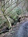
 Prittle Brook - geograph.org.uk - 166103.jpg 480 × 640; 162 KB
-
 Rayleigh Weir Industrial Estate - geograph.org.uk - 600429.jpg 640 × 405; 82 KB
-
 Round Hill - Eastern slope - geograph.org.uk - 294598.jpg 482 × 640; 104 KB
-
 Sandpit Hill - geograph.org.uk - 316265.jpg 450 × 600; 33 KB
-
 Stile and Farm gate - geograph.org.uk - 504200.jpg 640 × 480; 125 KB
-
 Swamp - Hadleigh Castle Country Park - geograph.org.uk - 294567.jpg 525 × 640; 135 KB
-
 West Wood - Boundary bank and ditch - geograph.org.uk - 211148.jpg 480 × 640; 169 KB
-
 West Wood - Prittle Brook - geograph.org.uk - 211156.jpg 480 × 640; 168 KB
-
 West Wood path, Hadleigh - geograph.org.uk - 113127.jpg 640 × 480; 161 KB


.jpg)


.jpg)
.jpg)


.jpg)


