Category:Hartford, Cheshire
Jump to navigation
Jump to search
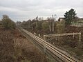
English: Hartford is a village and civil parish in the unitary authority of Cheshire West and Chester and the ceremonial county of Cheshire, England. It lies at the intersection of the A559 road and the West Coast Mainline (between Liverpool and Crewe) and is less than 2 miles (3.5 km) south west of the town of Northwich. It forms part of the Weaver Vale parliamentary constituency.
village and civil parish in Cheshire, England  | |||||
| Upload media | |||||
| Instance of | |||||
|---|---|---|---|---|---|
| Location | Cheshire West and Chester, Cheshire, North West England, England | ||||
| Located in or next to body of water | |||||
| Said to be the same as | Hartford | ||||
 | |||||
Subcategories
This category has the following 8 subcategories, out of 8 total.
C
- Coachman Hotel, Hartford (6 F)
G
- Greenbank railway station (23 F)
H
- Hartford Hall, Cheshire (2 F)
- Hartford Bridge (7 F)
- Hartford railway station (39 F)
J
M
V
- Vale Royal viaduct (5 F)
Media in category "Hartford, Cheshire"
The following 135 files are in this category, out of 135 total.
-
 A556 - geograph.org.uk - 2004642.jpg 800 × 600; 226 KB
-
 A556, Chester Road - geograph.org.uk - 2057188.jpg 640 × 480; 137 KB
-
 A556, Hartford - geograph.org.uk - 2004645.jpg 640 × 480; 161 KB
-
 A559 Chester Road, Hartford - geograph.org.uk - 5436209.jpg 640 × 481; 83 KB
-
 Ancient Sweet Chestnut Tree - geograph.org.uk - 1771962.jpg 3,072 × 2,304; 1.17 MB
-
 Beach Road, Hartfordbeach - geograph.org.uk - 5223436.jpg 1,024 × 683; 394 KB
-
 Beechwood Avenue, Hartford Beach - geograph.org.uk - 5935356.jpg 1,024 × 683; 246 KB
-
 Boggy Stream in Marshall's Arm Nature Reserve - geograph.org.uk - 1771981.jpg 3,072 × 2,304; 1.39 MB
-
 Brown Heath Farm - geograph.org.uk - 1773366.jpg 3,072 × 2,304; 757 KB
-
 Burrows Hill - geograph.org.uk - 5223438.jpg 1,024 × 683; 383 KB
-
 Cheshire Age UK, Hartford Business Centre (1).JPG 4,320 × 3,240; 2.5 MB
-
 Cheshire Age UK, Hartford Business Centre (2).JPG 4,320 × 3,240; 2.7 MB
-
 Chester Road junction with Bradburns Lane - geograph.org.uk - 5935379.jpg 1,024 × 683; 227 KB
-
 Chester Road, Hartford.JPG 4,320 × 3,240; 3.28 MB
-
 Cutting on Disused Railway Line - geograph.org.uk - 1773308.jpg 3,072 × 2,304; 1.87 MB
-

-
 Disused Railway Line - geograph.org.uk - 1773286.jpg 3,072 × 2,304; 1.02 MB
-
 Down WCML express at Hartford Junction, 1964 - geograph.org.uk - 4258016.jpg 2,356 × 1,398; 1.68 MB
-
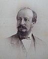 Edward Milner of Hartford Manor.jpg 800 × 989; 162 KB
-
 Elizabeth II Postbox, Chester Road, Hartford - geograph.org.uk - 5935413.jpg 683 × 1,024; 246 KB
-
 Elizabeth II Postbox, Hartford Post Office - geograph.org.uk - 5935385.jpg 683 × 1,024; 210 KB
-
 Embankment - geograph.org.uk - 17919.jpg 640 × 480; 86 KB
-

-
 Entrance to Nalco Chemicals Plant - geograph.org.uk - 1773245.jpg 3,072 × 2,304; 1.32 MB
-
 Farmland, Hodge Lane Farm - geograph.org.uk - 4955162.jpg 640 × 426; 42 KB
-
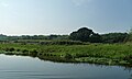 Floating pennywort, west bank, Weaver Navigation - geograph.org.uk - 5160461.jpg 1,024 × 615; 100 KB
-
 Footpath from Chester Rd to Hodge Lane - geograph.org.uk - 3550023.jpg 4,288 × 2,848; 2.99 MB
-
 Footpath from Chester Rd to Hodge Lane - geograph.org.uk - 3550030.jpg 4,288 × 2,848; 2.99 MB
-
 Footpath junction, east bank, Weaver Navigation - geograph.org.uk - 5160456.jpg 1,024 × 768; 296 KB
-
 Former Manor House, (I'm Guessing) - geograph.org.uk - 1772015.jpg 3,072 × 2,304; 1.02 MB
-
 Former Railway Workers Cottages - geograph.org.uk - 1773391.jpg 3,072 × 2,304; 1.35 MB
-

-
 Golf Course - geograph.org.uk - 1773320.jpg 3,072 × 2,304; 1.05 MB
-
 Grazing Meadow - geograph.org.uk - 1773700.jpg 3,072 × 2,304; 568 KB
-
 Greenbank (2747920432).jpg 1,600 × 1,200; 750 KB
-
 Hartford Bridge - geograph.org.uk - 4440969.jpg 640 × 325; 45 KB
-
 Hartford from the air - geograph.org.uk - 3946632.jpg 640 × 480; 189 KB
-
 Hartford Golf Club - geograph.org.uk - 5866038.jpg 1,024 × 768; 181 KB
-
 Hartford Golf Club House - geograph.org.uk - 1773272.jpg 3,072 × 2,304; 638 KB
-
 Hartford Junction (crop) geograph-2383907-by-Ben-Brooksbank.jpg 1,131 × 842; 533 KB
-
 Hartford Junction - geograph.org.uk - 1773377.jpg 3,072 × 2,304; 1,000 KB
-
 Hartford Junction Carlisle - Birmingham express geograph-2710400-by-Ben-Brooksbank.jpg 2,390 × 1,409; 671 KB
-
 Hartford Junction geograph-2383907-by-Ben-Brooksbank.jpg 2,394 × 1,397; 762 KB
-
 Hartford Junction Up cement empties geograph-2770170-by-Ben-Brooksbank.jpg 2,393 × 1,370; 1.7 MB
-
 Hartford Junction with up petrol train geograph-2751413-by-Ben-Brooksbank.jpg 2,394 × 1,346; 1.64 MB
-
 Hartford Junction, 1965 with Up fast freight - geograph.org.uk - 4252461.jpg 2,372 × 1,496; 4.38 MB
-
 Hartford Junction, with double-headed Up express, 1961 - geograph.org.uk - 4243177.jpg 2,443 × 1,424; 1.91 MB
-
 Hartford Manor circa 1870.jpg 788 × 605; 118 KB
-
 Hartford Methodist Church - geograph.org.uk - 6247548.jpg 4,000 × 4,693; 2.05 MB
-
 Hartford MOT & Service Centre.JPG 4,320 × 3,240; 2.62 MB
-
 Hartford Picnic Area - geograph.org.uk - 2004650.jpg 640 × 480; 244 KB
-
 Hartford Picnic Area - geograph.org.uk - 2004654.jpg 640 × 480; 251 KB
-
 Hartford Picnic Area - geograph.org.uk - 2004656.jpg 640 × 480; 188 KB
-
 Hartford Picnic Area - geograph.org.uk - 2004659.jpg 640 × 480; 228 KB
-
 Hartford Post Office - geograph.org.uk - 5935388.jpg 1,024 × 683; 204 KB
-
 Hartford sidings 2 geograph-2152697.jpg 1,024 × 606; 170 KB
-
 Hartford Sidings 2143547 392ca96b.jpg 1,024 × 623; 153 KB
-
 Hartford Tennis and Bowls Clubhouse - geograph.org.uk - 1771905.jpg 3,072 × 2,304; 898 KB
-
 Hartford twinning sign, Cheshire.JPG 4,320 × 3,240; 4.03 MB
-
 Hartford Video Centre, Cheshire.JPG 4,320 × 3,240; 2.64 MB
-
 Hartford Village Hall, Cheshire.JPG 4,608 × 3,456; 3.54 MB
-
 Hartford, Cheshire (1).JPG 3,456 × 4,608; 3.39 MB
-
 Hartford, Cheshire (2).JPG 4,608 × 3,456; 3.36 MB
-
 Hartford, Cheshire (3).JPG 4,608 × 3,456; 3.49 MB
-
 Hartford, Cheshire (4).JPG 3,456 × 4,608; 3.62 MB
-
 Hartford, Cheshire (5).JPG 3,456 × 4,608; 3.66 MB
-
 Hartford, Cheshire (6).JPG 3,456 × 4,608; 3.42 MB
-
 Hartford, Cheshire, geograph-3960410-by-Ben-Brooksbank.jpg 2,323 × 1,318; 2.03 MB
-
 Hartford, picnic site - geograph.org.uk - 5489956.jpg 1,024 × 768; 212 KB
-
 Hercules working on the Weaver Navigation - geograph.org.uk - 5160504.jpg 1,024 × 768; 83 KB
-
 Hodge Lane - geograph.org.uk - 5223434.jpg 1,024 × 683; 310 KB
-

-
 House in Littledales Park, Hartford.JPG 4,320 × 3,240; 2.77 MB
-
 Impossible Impassable Path - geograph.org.uk - 1773340.jpg 3,072 × 2,304; 1.98 MB
-
 Junction for Hartford Hall hotel - geograph.org.uk - 4440967.jpg 640 × 367; 35 KB
-

-
 Marshy Pond between Marshall's Arm and the River Weaver - geograph.org.uk - 1771990.jpg 3,072 × 2,304; 1.45 MB
-
 Milepost on Chester Road, Hartford.JPG 4,320 × 3,240; 3.62 MB
-
 Milner family of Hartford Manor.jpg 1,200 × 846; 518 KB
-
 Northwich Road roundabout - geograph.org.uk - 2808380.jpg 640 × 480; 52 KB
-

-
 Ornamental Gates - geograph.org.uk - 5769006.jpg 800 × 600; 222 KB
-
 Ornamental Pond on Golf Course - geograph.org.uk - 1773297.jpg 3,072 × 2,304; 1.13 MB
-
 Overbridge near Heyesmere - geograph.org.uk - 4440844.jpg 640 × 332; 58 KB
-
 Playground off Bradburns Lane - geograph.org.uk - 5935364.jpg 1,024 × 683; 149 KB
-
 Playing Fields, Chester Road, Hartford - geograph.org.uk - 1771922.jpg 3,072 × 2,304; 1.11 MB
-
 Pond - geograph.org.uk - 1773395.jpg 3,072 × 2,304; 1.76 MB
-
 Post Office, The Green, Hartford - geograph.org.uk - 1771888.jpg 3,072 × 2,304; 972 KB
-
 Railbridge over footpath - geograph.org.uk - 1773398.jpg 3,072 × 2,304; 1.45 MB
-
 Railway Cottages - geograph.org.uk - 6246648.jpg 5,355 × 3,713; 1.73 MB
-
 Railway Line - geograph.org.uk - 1773371.jpg 3,072 × 2,304; 859 KB
-
 Railway Line NW of Hartford Railway Station - geograph.org.uk - 1771873.jpg 2,304 × 3,072; 1.86 MB
-
 Railway Overbridge - geograph.org.uk - 3550033.jpg 4,288 × 2,848; 2.94 MB
-
 Red Lion, Hartford.JPG 4,320 × 3,240; 3.38 MB
-
 River Weaver rail bridge - geograph.org.uk - 4149509.jpg 3,330 × 2,460; 1.74 MB
-
 Roadbridge over the A556 Chester Road - geograph.org.uk - 1773690.jpg 3,072 × 2,304; 982 KB
-
 Rough grazing land - geograph.org.uk - 1773335.jpg 3,072 × 2,304; 1,013 KB
-
 School Playing Fields - geograph.org.uk - 1771937.jpg 3,072 × 2,304; 644 KB
-
 Service Station, Chester Road, Hartford - geograph.org.uk - 1771909.jpg 3,072 × 2,304; 696 KB
-

-
 Slowboat, Hartford - geograph.org.uk - 6065613.jpg 1,024 × 768; 229 KB
-
 Small Pond - geograph.org.uk - 1773385.jpg 3,072 × 2,304; 1.67 MB
-
 Southern end of Littledales Lane - geograph.org.uk - 1773684.jpg 3,072 × 2,304; 1.26 MB
-
 Start of footpath with stile - geograph.org.uk - 1773679.jpg 2,304 × 3,072; 1.62 MB
-
 Strange encounter on the Weaver Navigation - geograph.org.uk - 5160496.jpg 1,024 × 615; 51 KB
-
 Stream flowing along disused railway track - geograph.org.uk - 1773332.jpg 2,304 × 3,072; 3.71 MB
-
 Teeing Off at Hartford Golf Club - geograph.org.uk - 1773278.jpg 3,072 × 2,304; 553 KB
-
 Tennis Courts Hartford - geograph.org.uk - 1771898.jpg 3,072 × 2,304; 925 KB
-
 The Grange approaching Chester Road - geograph.org.uk - 5935360.jpg 1,024 × 683; 326 KB
-
 The Grange Senior School, Hartford - geograph.org.uk - 5935369.jpg 1,024 × 683; 185 KB
-
 The Hartford Diner - geograph.org.uk - 996153.jpg 640 × 480; 91 KB
-
 The Hollies, Hartford.jpg 4,000 × 3,000; 4.88 MB
-
 The Red Lion Public House, Chester Road, Hartford - geograph.org.uk - 1771883.jpg 3,072 × 2,304; 889 KB
-
 The Riddings from the air - geograph.org.uk - 3946640.jpg 640 × 480; 129 KB
-
 The Weaver Navigation - geograph.org.uk - 4955164.jpg 581 × 640; 48 KB
-
 The Willows Veterinary Hospital - geograph.org.uk - 1771894.jpg 3,072 × 2,304; 789 KB
-
 Up WCML express at Hartford Junction, 1965 - geograph.org.uk - 4265922.jpg 2,371 × 1,319; 1.46 MB
-
 View east towards Hartford - geograph.org.uk - 3550032.jpg 4,288 × 2,848; 2.95 MB
-
 View west from White Hart Gardens - geograph.org.uk - 3550018.jpg 4,288 × 2,848; 3 MB
-
 Vr hartford.png 591 × 443; 63 KB
-
 Wall and steps to Whitehall, Hartford, Cheshire 01.jpg 4,000 × 3,000; 2.49 MB
-
 Wall and steps to Whitehall, Hartford, Cheshire 02.jpg 4,000 × 3,000; 2.71 MB
-
 Wall and steps to Whitehall, Hartford, Cheshire 03.jpg 4,000 × 3,000; 5.08 MB
-

-
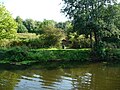
 Weaver Navigation at Poor's Wood - geograph.org.uk - 5160472.jpg 1,024 × 768; 158 KB
-
 West bank, Weaver Navigation - geograph.org.uk - 5160488.jpg 1,024 × 768; 141 KB
-
 West Coast Main Line, Hartford - geograph.org.uk - 6065532.jpg 1,024 × 768; 320 KB
-
 White Hart Gardens, Hartford - geograph.org.uk - 6065610.jpg 1,024 × 768; 256 KB
-
 Whitegate Road crossing the A556 - geograph.org.uk - 5436217.jpg 640 × 481; 83 KB
-
 Whitehall, Hartford, Cheshire.jpg 4,000 × 3,000; 2.17 MB
-
 Woodland with small stream - geograph.org.uk - 1771969.jpg 2,304 × 3,072; 3.4 MB
-
 Woodland with small stream - geograph.org.uk - 1773324.jpg 3,072 × 2,304; 1.56 MB
-
 Wrong side of the track - geograph.org.uk - 1773386.jpg 3,072 × 2,304; 748 KB
-
 Farmland to the southwest of Northwich - geograph.org.uk - 192603.jpg 640 × 480; 179 KB
-
 May Blossom, Hartford - geograph.org.uk - 174881.jpg 640 × 512; 133 KB


.JPG)
.JPG)


_-_geograph.org.uk_-_1772015.jpg)


.jpg)


_geograph-2383907-by-Ben-Brooksbank.jpg)


.JPG)
.JPG)
.JPG)
.JPG)
.JPG)
.JPG)


