Category:Hiking trails in Utah
Jump to navigation
Jump to search
States of the United States: Alaska · Arizona · California · Colorado · Connecticut · Delaware · Florida · Georgia · Hawaii · Idaho · Illinois · Indiana · Iowa · Kansas · Kentucky · Maine · Maryland · Massachusetts · Michigan · Minnesota · Mississippi · Missouri · Montana · Nebraska · Nevada · New Hampshire · New Jersey · New Mexico · New York · North Carolina · North Dakota · Ohio · Oregon · Pennsylvania · Rhode Island · South Carolina · Tennessee · Texas · Utah · Vermont · Virginia · Washington · West Virginia · Wisconsin · Wyoming
English: Hiking trails in the U.S. state of Utah.
Wikimedia category | |||||
| Upload media | |||||
| Instance of | |||||
|---|---|---|---|---|---|
| Category combines topics | |||||
| Utah | |||||
state of the United States of America      | |||||
| Pronunciation audio | |||||
| Instance of | |||||
| Part of | |||||
| Named after | |||||
| Location |
| ||||
| Located in or next to body of water | |||||
| Capital | |||||
| Legislative body |
| ||||
| Executive body | |||||
| Highest judicial authority | |||||
| Official language | |||||
| Anthem |
| ||||
| Head of government |
| ||||
| Inception |
| ||||
| Highest point |
| ||||
| Population |
| ||||
| Area |
| ||||
| Elevation above sea level |
| ||||
| Replaces |
| ||||
| Different from | |||||
| Maximum temperature record |
| ||||
| Minimum temperature record |
| ||||
| official website | |||||
 | |||||
Subcategories
This category has the following 31 subcategories, out of 31 total.
*
- Boardwalks in Utah (8 F)
A
B
C
- Cascade Springs Trail (Utah) (2 F)
- Cecret Lake Trail (12 F)
- Chinle Trail (2 F)
G
- Great Western Trail (5 F)
- Grotto Falls Trail (2 F)
- Grove Creek Trail (Utah) (27 F)
J
- Joint Trail (29 F)
K
- Kayenta Trail (2 F)
L
- Lower Calf Creek Falls Trail (11 F)
M
P
- Pink Ledges Trail (13 F)
- Pothole Point Trail (21 F)
R
- Rattlesnake Creek Trail (Utah) (13 F)
S
T
- Timber Creek Overlook Trail (15 F)
- Timpanogos Cave Trail (1 F)
- Timpanogos Summit Trail (17 F)
Media in category "Hiking trails in Utah"
The following 41 files are in this category, out of 41 total.
-
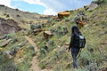
 2015.08.15 15.36.30a - Flickr - andrey zharkikh.jpg 7,658 × 2,228; 4.35 MB
-
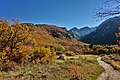
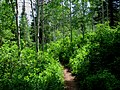
 Autumn mountain trail.jpg 3,008 × 2,000; 5.53 MB
-
 Bench along Left Fork Maple Canyon Trail, Utah, Jul 16.jpg 2,592 × 1,944; 2.23 MB
-
 Brian Head Peak summit sign.jpg 3,872 × 2,592; 5.41 MB
-
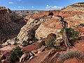
 Canyon Path (135796237).jpeg 2,048 × 1,365; 1.5 MB
-
-
 Casto Canyon Trailhead, Red Canyon, DyeClan.com - panoramio.jpg 5,184 × 3,456; 10.01 MB
-
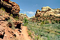
 Corner Canyon, Draper, Utah.jpg 1,280 × 960; 320 KB
-
 END OF TRAIL in Bryce Canyon.jpg 5,184 × 3,456; 16.56 MB
-
 End of Tube 3 at Mammoth Cave - panoramio (2).jpg 3,000 × 4,000; 4.29 MB
-
 Ensign Peak, The Trail plaque.JPG 960 × 1,280; 843 KB
-
 Grotto Trail in September - panoramio.jpg 2,800 × 2,128; 1.61 MB
-
 Jacobs Ladder Trail to Lone Peak.jpg 3,036 × 4,048; 5.62 MB
-
 Kessler Peak.jpg 3,024 × 4,032; 9.11 MB
-
 Kodachrome Basin02.jpg 2,520 × 1,680; 2.85 MB
-
 Kodachrome Basin05.jpg 2,520 × 1,680; 3.12 MB
-
 Kodachrome Basin06.jpg 2,520 × 1,680; 3.01 MB
-
 Kodachrome Basin07.jpg 2,520 × 1,680; 4.06 MB
-
 Little Death Hollow Trailhead (3685115826).jpg 1,600 × 1,067; 665 KB
-
 Logan Canyon Scenic Byway - Blind Hollow Trail Junction - NARA - 7720138.jpg 3,300 × 2,148; 1,007 KB
-
 Logan Canyon Scenic Byway - Crimson Trail in Shadows on Logan Canyon - NARA - 7720158.jpg 2,000 × 3,008; 1.56 MB
-
 Logan Canyon Scenic Byway - Dog Leading the Way on the Crimson Trail - NARA - 7720194.jpg 3,008 × 2,000; 1.59 MB
-
 Logan Canyon Scenic Byway - Four Hikers Returning - NARA - 7720182.jpg 3,008 × 2,000; 2.49 MB
-
 Logan Canyon Scenic Byway - Heading up the Blind Hollow Trail - NARA - 7720142.jpg 3,300 × 2,143; 853 KB
-

-
 Logan Canyon Scenic Byway - Hikers Signing Juniper Logbook - NARA - 7720180.jpg 2,000 × 3,008; 1.79 MB
-
 Logan Canyon Scenic Byway - Hiking on Blind Hollow Trail - NARA - 7720137.jpg 2,267 × 3,294; 1.1 MB
-
 Logan Canyon Scenic Byway - Trail Sign in Valley - NARA - 7720176.jpg 3,008 × 2,000; 2.84 MB
-
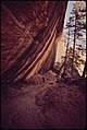
 Logan Canyon Scenic Byway - Wind Caves Trailhead - NARA - 7720183.jpg 2,256 × 1,496; 947 KB
-
 My Public Lands Roadtrip- Nine Mile Canyon in Utah (19978048790).jpg 4,496 × 3,000; 8.22 MB
-
 OOG "Old Ones" trailhead marker dyeclan.com - panoramio.jpg 3,264 × 2,448; 4.34 MB
-
 Red Canyon Trail, UT 9-09 (15641803981).jpg 2,450 × 1,535; 1.57 MB
-
 Right Fork Maple Canyon Trail, Jul 16.jpg 2,592 × 1,944; 2.35 MB
-
 Rim Trail in Hurricane, Utah - panoramio.jpg 4,608 × 3,456; 3.26 MB
-
 River in Kolob Canyons, Walk to the Kolob Arch (Zion National Park) (3440691612).jpg 2,784 × 1,856; 1.79 MB
-
 Rochester Panel Trailhead DyeClan.com - panoramio.jpg 1,952 × 3,264; 1.82 MB
-
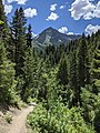
 UintaTrail.jpg 3,456 × 2,592; 6.69 MB
-
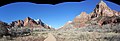
 West Rim Trail Dead Horse Point SP Utah 2023.jpg 3,000 × 2,000; 5.26 MB
-
-
 Zion Canyon from Pa'Rus Trail - panoramio.jpg 1,600 × 549; 176 KB
-
 Zion National Park 1989 46.jpg 635 × 972; 898 KB


.jpeg)
.jpeg)


.jpg)


.jpg)


.jpg)

.jpg)


_(3440691612).jpg)


.jpg)
