Category:Historical maps of Ankara
Jump to navigation
Jump to search
| NO WIKIDATA ID FOUND! Search for Historical maps of Ankara on Wikidata | |
| Upload media |
Media in category "Historical maps of Ankara"
The following 5 files are in this category, out of 5 total.
-
 1680 Angouri map Turcicum Imperium by Frederik de Wit BPL 15917 detail.png 1,067 × 749; 1.71 MB
-
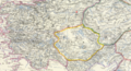 1861 Angora detail map Turkey in Asia, Asia Minor, and Transcaucasia by Johnston.png 1,262 × 686; 2.06 MB
-
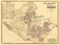
 1924 Ankara şehir haritası.png 1,720 × 1,308; 4.82 MB
-
 Ankara city map 1924.pdf 5,304 × 4,047; 31.27 MB
-
 Jansen Planı.jpg 640 × 701; 103 KB


