Category:Hoogeveenseweg 19, Bruntinge
Jump to navigation
Jump to search
| Object location | | View all coordinates using: OpenStreetMap |
|---|
farmhouse in Midden-Drenthe, Netherlands  | |||||
| Upload media | |||||
| Instance of | |||||
|---|---|---|---|---|---|
| Location | Bruntinge, Midden-Drenthe, Drenthe, Netherlands | ||||
| Street address |
| ||||
| Located on street |
| ||||
| Heritage designation |
| ||||
 | |||||
|
This is a category about rijksmonument number 38747
|
| Address |
|
Media in category "Hoogeveenseweg 19, Bruntinge"
The following 60 files are in this category, out of 60 total.
-
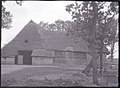
 Achteraanzicht - Bruntinge - 20044590 - RCE.jpg 1,200 × 805; 308 KB
-
 Achtergevel - Bruntinge - 20044591 - RCE.jpg 1,200 × 795; 262 KB
-
 Balken plafond nr. F 480-15 - Bruntinge - 20450357 - RCE.jpg 1,200 × 900; 78 KB
-
 Balken plafond nr. F 480-16 - Bruntinge - 20450356 - RCE.jpg 1,200 × 900; 77 KB
-
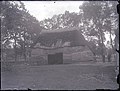
 Boerderij van B. Mulder UILK 242 ZIE ST 3860 - Bruntinge - 20450327 - RCE.jpg 1,200 × 911; 419 KB
-
 De oprit naar de boerderij toe - Bruntinge - 20389289 - RCE.jpg 1,200 × 1,200; 445 KB
-
 Deel voorgevel nr. F 110-33 - Bruntinge - 20450355 - RCE.jpg 1,200 × 900; 147 KB
-
 Detail - Bruntinge - 20044592 - RCE.jpg 804 × 1,200; 120 KB
-
 Gebint- en kapconstr. nr. F 463-13 - Bruntinge - 20450335 - RCE.jpg 1,200 × 900; 161 KB
-
 Gebint- en kapconstr. nr. F 463-15 - Bruntinge - 20450337 - RCE.jpg 1,200 × 900; 151 KB
-
 Gebintconstr. nr. F 463-07 - Bruntinge - 20450350 - RCE.jpg 1,200 × 900; 93 KB
-
 Gebintconstr. nr. F 463-09 - Bruntinge - 20450349 - RCE.jpg 1,200 × 900; 83 KB
-
 Gebintconstr. nr. F 463-10 - Bruntinge - 20450339 - RCE.jpg 1,200 × 900; 90 KB
-
 Gebintconstr. nr. F 463-12 - Bruntinge - 20450347 - RCE.jpg 1,200 × 900; 96 KB
-
 Kapconstr. nr. F 463-14 - Bruntinge - 20450336 - RCE.jpg 1,200 × 900; 153 KB
-
 Overzicht achtergevel van de boerderij - Bruntinge - 20450329 - RCE.jpg 915 × 1,200; 245 KB
-
-

-
 Overzicht boerderij - Bruntinge - 20450332 - RCE.jpg 1,200 × 919; 305 KB
-

-
-
 Overzicht boerderij met omgeving - Bruntinge - 20450333 - RCE.jpg 1,200 × 922; 281 KB
-

-
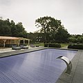 Overzicht met zwembad op de voorgrond - Bruntinge - 20389295 - RCE.jpg 1,200 × 1,200; 252 KB
-

-
 Overzicht richting voorgevel met vijver op de voorgrond - Bruntinge - 20389301 - RCE.jpg 1,200 × 1,200; 367 KB
-
 Overzicht schaapskooi bij de boerderij - Bruntinge - 20450352 - RCE.jpg 1,200 × 906; 382 KB
-
 Overzicht schaapskooi bij de boerderij - Bruntinge - 20450354 - RCE.jpg 1,200 × 909; 378 KB
-
-

-

-
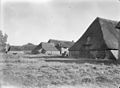
 Overzicht van de kapschuur - Bruntinge - 20389312 - RCE.jpg 1,200 × 1,200; 467 KB
-
 Overzicht van de kapschuur - Bruntinge - 20389313 - RCE.jpg 1,200 × 960; 355 KB
-
 Overzicht van de kapschuur - Bruntinge - 20389315 - RCE.jpg 1,200 × 1,200; 449 KB
-
 Overzicht van de linker zijgevel met rieten schilddak - Bruntinge - 20389309 - RCE.jpg 1,200 × 1,200; 462 KB
-

-

-
 Overzicht van de voorgevel met rieten schilddak - Bruntinge - 20389310 - RCE.jpg 1,200 × 1,200; 351 KB
-
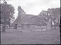
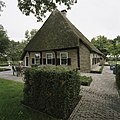
 Overzicht voorzijde - Bruntinge - 20044588 - RCE.jpg 1,200 × 801; 301 KB
-
-
-
 Plafond nr. F 480-14 - Bruntinge - 20450358 - RCE.jpg 1,200 × 900; 125 KB
-
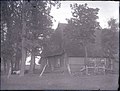
 Situering - Bruntinge - 20389288 - RCE.jpg 1,200 × 1,200; 408 KB
-
 Situering - Bruntinge - 20389292 - RCE.jpg 1,200 × 1,200; 414 KB
-
 Situering - Bruntinge - 20389293 - RCE.jpg 1,200 × 1,200; 300 KB
-
 Situering - Bruntinge - 20389294 - RCE.jpg 1,200 × 1,200; 471 KB
-
 Situering van de boerderij en de kapschuur - Bruntinge - 20389305 - RCE.jpg 1,200 × 960; 314 KB
-
 Versierde schoor nr. F 110-32 - Bruntinge - 20450345 - RCE.jpg 1,200 × 900; 113 KB
-
 Voor- en zijgevel nr. F 464-23 - Bruntinge - 20450359 - RCE.jpg 1,200 × 900; 203 KB
-
 Voorgevel - Bruntinge - 20044589 - RCE.jpg 796 × 1,200; 303 KB
-
 Voorgevel nr. F 108-25 - Bruntinge - 20450344 - RCE.jpg 1,200 × 900; 94 KB
-
 Voorgevel nr. F 464-24 - Bruntinge - 20450341 - RCE.jpg 1,200 × 900; 144 KB
-
 Zicht op de kapschuur met omgeving - Bruntinge - 20389314 - RCE.jpg 1,200 × 960; 366 KB
-
 Zij- en achtergevel nr. F 110-35 - Bruntinge - 20450340 - RCE.jpg 1,200 × 900; 129 KB
-
 Zij- en achtergevel nr. F 464-21 - Bruntinge - 20450342 - RCE.jpg 1,200 × 900; 133 KB
-
 Zij- en voorgevel nr. F 464-25 - Bruntinge - 20450360 - RCE.jpg 1,200 × 900; 154 KB
-
 Zijgevel nr. F 464-26 - Bruntinge - 20450363 - RCE.jpg 1,200 × 900; 141 KB
-
 Zijgevel nr. F 464-27 - Bruntinge - 20450361 - RCE.jpg 1,200 × 900; 141 KB
-
 Zijgevel woonged. nr. F 110-34 - Bruntinge - 20450343 - RCE.jpg 1,200 × 900; 227 KB
-
 Zijgevel woonged. nr. F 464-22 - Bruntinge - 20450362 - RCE.jpg 1,200 × 900; 209 KB


