Category:Horsell
Jump to navigation
Jump to search
English: Horsell in Surrey is an ancient (pre-Domesday Book) village nearby to the more modern 19th. century Woking, probably best known because of its association with the story The War of the Worlds, written by H.G. Wells. It was part of the former Woking Urban District.
village in Surrey, England, UK | |||||
| Upload media | |||||
| Instance of | |||||
|---|---|---|---|---|---|
| Location | Woking, Surrey, South East England, England | ||||
 | |||||
Subcategories
This category has the following 7 subcategories, out of 7 total.
B
- Bus stops in Horsell (5 F)
- Buses in Horsell (12 F)
C
- The Crown, Horsell (4 F)
H
- Horsell War Memorial (2 F)
M
R
- Red Lion pub, Horsell (3 F)
Media in category "Horsell"
The following 35 files are in this category, out of 35 total.
-
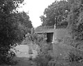
 Arthur's Bridge, Basingstoke Canal - geograph.org.uk - 582101.jpg 640 × 539; 148 KB
-
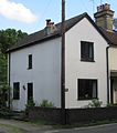
 Birch cottage.jpg 4,032 × 3,024; 5.57 MB
-
 Birch farm house.jpg 4,032 × 3,024; 6.45 MB
-
 Birch house.jpg 4,032 × 3,024; 5.89 MB
-
 Chertsey Road Bridge, Basingstoke Canal - geograph.org.uk - 582068.jpg 640 × 514; 141 KB
-
 Chobham Road Bridge, Basingstoke Canal - geograph.org.uk - 582080.jpg 640 × 499; 152 KB
-
 Danewell Pond on Horsell Common - geograph.org.uk - 168237.jpg 640 × 480; 222 KB
-
 Esgairs.jpg 4,032 × 3,024; 5.9 MB
-
 Former Anthonys Baptist Chapel, Chertsey Road, Horsell Common (June 2015).JPG 3,000 × 3,400; 1.48 MB
-
 Former Anthonys Baptist Church, Anthonys, Horsell Common (June 2015).JPG 2,800 × 2,800; 1.77 MB
-
 Horsell Birch - geograph.org.uk - 2487569.jpg 640 × 480; 342 KB
-
 Horsell Birch - geograph.org.uk - 2487575.jpg 640 × 480; 319 KB
-
 Horsell Birch - geograph.org.uk - 2487583.jpg 640 × 480; 278 KB
-
 Horsell Birch - geograph.org.uk - 3183494.jpg 2,048 × 1,536; 3.41 MB
-
 Horsell Evangelical Church, High Street, Horsell (June 2015) (1).JPG 4,000 × 2,200; 1.71 MB
-
 Horsell Evangelical Church, High Street, Horsell (June 2015) (2).JPG 4,600 × 3,000; 2.37 MB
-
 Horsell Grange.jpg 4,032 × 3,024; 4.51 MB
-
 Roundabout on Littlewick Road, Horsell Birch - geograph.org.uk - 3632053.jpg 2,048 × 1,536; 1.41 MB
-
 Sands at Bleak House pub, Chertsey Road, Anthonys, near Horsell (June 2015) (1).jpg 4,400 × 2,800; 2.57 MB
-
 Sands at Bleak House pub, Chertsey Road, Anthonys, near Horsell (June 2015) (2).jpg 4,200 × 2,600; 2.09 MB
-
 Sheerwater Bridge, Basingstoke Canal - geograph.org.uk - 581861.jpg 640 × 523; 175 KB
-
 Sheerwater Bridge, Basingstoke Canal - geograph.org.uk - 586051.jpg 640 × 427; 155 KB
-
 Step Bridge, Basingstoke Canal - geograph.org.uk - 582090.jpg 640 × 510; 133 KB
-
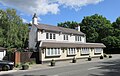
 The Cricketers, Horsell, Surrey.jpg 3,184 × 1,873; 1.96 MB
-
 Viggory Lane, Horsell Birch - geograph.org.uk - 3632039.jpg 1,536 × 2,048; 1.46 MB
-
 Whopshott farm.jpg 4,032 × 3,024; 4.58 MB
-
 Woking Golf Club - geograph.org.uk - 22965.jpg 640 × 480; 131 KB
-
 Woodend Bridge, Basingstoke Canal - geograph.org.uk - 582217.jpg 640 × 547; 190 KB
-
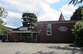
 Goldsworth Park Centre - geograph.org.uk - 45731.jpg 640 × 427; 92 KB
-
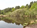
 Goldsworth Park lake - geograph.org.uk - 45623.jpg 640 × 427; 112 KB
-
 Lakeview Community Centre - geograph.org.uk - 45632.jpg 640 × 427; 98 KB
-
 Saunders Lane, Mayford - geograph.org.uk - 45759.jpg 640 × 427; 89 KB
-
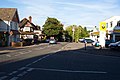
 Shops at Star Hill, Woking - geograph.org.uk - 45738.jpg 640 × 427; 93 KB
-
 Star Hill, Woking - geograph.org.uk - 45737.jpg 640 × 427; 78 KB
-
 The Bleak House PH near Sheerwater - geograph.org.uk - 533611.jpg 640 × 480; 78 KB


.JPG)
.JPG)


_(1).JPG)
_(2).JPG)


_(1).jpg)
_(2).jpg)


