Category:Hydrology
Jump to navigation
Jump to search
Français : Hydrologie
· 日本語: 水文学, 陸水学
· Português: Hidrologia
· 中文:水文学
· science that deals with the water above, on and below the land surface of the earth   | |||||
| Upload media | |||||
| Instance of |
| ||||
|---|---|---|---|---|---|
| Subclass of | |||||
| Part of | |||||
| Has part(s) |
| ||||
| Different from | |||||
| |||||
- For hydrological maps see Category:Hydrogeological maps, Category:Maps of geographical features including waterbodies
Subcategories
This category has the following 55 subcategories, out of 55 total.
#
*
+
- Hydrological journals (1 F)
B
C
- Climate dynamics (7 F)
D
- Darcy's Law (17 F)
E
F
H
I
K
L
M
N
P
Q
R
S
- Sapping (2 F)
T
- Turbidity currents (6 F)
V
W
Media in category "Hydrology"
The following 37 files are in this category, out of 37 total.
-
 20150114 1622 108 radzyn-stacja-hydrologiczna-imgw-mk-a.jpg 2,592 × 1,728; 1.86 MB
-

-
 Bioswale.jpg 2,048 × 1,201; 797 KB
-
 Cheesecake Brook, West Newton Village, Massachusetts.jpg 4,832 × 4,760; 14.22 MB
-
LL-Q1860 (eng)-I learned some phrases-endorheic.wav 1.4 s; 131 KB
-
 Hidrogramak.png 1,004 × 730; 31 KB
-
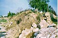
 High groundwater damage on the Veszprém Plateau 01.JPG 3,120 × 2,080; 3.47 MB
-
 IJsseloog.jpg 640 × 480; 52 KB
-
 Looking through the lake.jpg 3,468 × 4,624; 3.35 MB
-
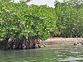
 Mangrove île du Saloum Sénégal.jpg 4,080 × 3,060; 2.12 MB
-
 Measuring flow near removed barrier (40965701694).jpg 5,472 × 3,416; 12.03 MB
-
Meeresrauschen.ogg 35 s; 435 KB
-
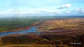
 Near Velarde, NM, View S., Middle Rio Grande, 2011 - panoramio.jpg 4,000 × 3,000; 3.34 MB
-
 Ostrogiwisla60lat.png 2,779 × 1,432; 4.65 MB
-
 Pirogue île du Saloum Sénégal 02.jpg 4,080 × 3,060; 2.57 MB
-
 Polder Krzesin - Bytomiec.jpg 2,560 × 1,440; 967 KB
-
 Polder Krzesin - Bytomiec2.jpg 2,560 × 1,440; 853 KB
-
 Przeplawka-iffezheim.jpg 2,272 × 1,704; 784 KB
-
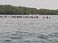 Pélicans île du Saloum Sénégal.jpg 4,080 × 3,060; 1.47 MB
-
 Risco-permissível.png 348 × 98; 3 KB
-

-
 Torrentera.jpg 2,224 × 1,443; 225 KB
-
 Uraren banaketa.png 800 × 300; 68 KB
-
 Urtegiaren zatiak.png 758 × 526; 19 KB
-
 Usa Uferbefestigung Schwalheimer Anfang 2019.jpg 2,592 × 1,944; 2.47 MB
-
 Vadose Zone.jpg 2,169 × 2,301; 2.99 MB
-
 Ves (Černousy), hydrologický objekt na řece Smědé.jpg 3,888 × 2,592; 5.43 MB
-
 Île du Saloum Sénégal 01.jpg 3,060 × 4,080; 2.58 MB
-
 Île du Saloum Sénégal 02.jpg 3,060 × 4,080; 2.93 MB
-
 Île du Saloum Sénégal 03.jpg 3,538 × 2,866; 1.29 MB
-
 Île du Saloum Sénégal 05.jpg 4,080 × 3,060; 2.75 MB
-
 Лёд ест берега.jpg 3,282 × 2,466; 4.17 MB
-
 Ледоход.jpg 3,282 × 2,466; 4.08 MB
-
 Наливной биопруд.jpg 1,280 × 960; 420 KB
-
 Платовская рябь.jpg 3,360 × 1,000; 1.09 MB
-
 Споменик природе Крупачко врело.JPG 3,648 × 2,736; 4.99 MB
-
 Эллипсоид со спичками.jpg 4,022 × 3,022; 4.98 MB


.jpg)


,_hydrologick%C3%BD_objekt_na_%C5%99ece_Sm%C4%9Bd%C3%A9.jpg)


