Category:Ightham
Jump to navigation
Jump to search
village and civil parish in Kent, England, UK  | |||||
| Upload media | |||||
| Instance of | |||||
|---|---|---|---|---|---|
| Location | Tonbridge and Malling, Kent, South East England, England | ||||
 | |||||
Subcategories
This category has the following 9 subcategories, out of 9 total.
I
- Ightham War Memorial (3 F)
O
- Oasts in Ightham (10 F)
- Old Forge House, Ightham (3 F)
- Oldbury hillfort (16 F)
T
- The George & Dragon, Ightham (7 F)
- The Harrow Inn, Ightham (6 F)
Media in category "Ightham"
The following 200 files are in this category, out of 375 total.
(previous page) (next page)-
 'Post Punk' Sex Pistols - geograph.org.uk - 3147143.jpg 1,024 × 680; 229 KB
-
 A protected crop - geograph.org.uk - 3829069.jpg 640 × 428; 93 KB
-
 A tree amongst the wheat - geograph.org.uk - 2042961.jpg 640 × 430; 140 KB
-
 A227, Tonbridge Rd - geograph.org.uk - 3494630.jpg 640 × 430; 93 KB
-
 A25 towards Ightham - geograph.org.uk - 4292364.jpg 3,424 × 2,268; 4.02 MB
-
 A25, Maidstone Rd - geograph.org.uk - 2902550.jpg 640 × 430; 80 KB
-
 Alder Shaw - geograph.org.uk - 2043052.jpg 640 × 430; 137 KB
-
 Alder Shaw - geograph.org.uk - 2043068.jpg 640 × 430; 120 KB
-
 Allotments - geograph.org.uk - 2919528.jpg 640 × 430; 109 KB
-
 Alongside Scathes Wood - geograph.org.uk - 5596759.jpg 4,000 × 3,000; 5.27 MB
-
 An apple orchard - geograph.org.uk - 2911933.jpg 640 × 430; 91 KB
-
 Ancient sweet chestnut at Ightham Mote in December - geograph.org.uk - 6347420.jpg 3,000 × 4,000; 3.95 MB
-
 Apple orchard - geograph.org.uk - 2907364.jpg 640 × 430; 76 KB
-
 Apple trees - geograph.org.uk - 3494661.jpg 640 × 430; 71 KB
-
 Approaching bend in Sevenoaks Road - geograph.org.uk - 4293000.jpg 4,662 × 3,084; 4.18 MB
-
 Approaching Coach Rd - geograph.org.uk - 3479722.jpg 640 × 430; 131 KB
-
 Back Lane - geograph.org.uk - 2916373.jpg 640 × 430; 136 KB
-
 Barn. Warren Farm - geograph.org.uk - 3494645.jpg 640 × 430; 93 KB
-
 Barnjet Cottage - geograph.org.uk - 1321687.jpg 640 × 480; 88 KB
-
 Benjamin Harrison. Photograph by Wallace Chisholm. Wellcome V0026516.jpg 2,244 × 3,231; 2.12 MB
-
 Bluebells north-east of Ightham Mote - geograph.org.uk - 2230040.jpg 768 × 1,024; 378 KB
-
 Bluebells north-east of Ightham Mote - geograph.org.uk - 2230045.jpg 768 × 1,024; 355 KB
-
 Borough Green Road, Ightham - geograph.org.uk - 4679151.jpg 2,272 × 1,704; 757 KB
-
 Borough Green Road, Ightham - geograph.org.uk - 4679160.jpg 2,272 × 1,704; 830 KB
-
 Borough Green Road, Ightham - geograph.org.uk - 5060409.jpg 2,448 × 2,448; 1.54 MB
-
 Bridleway east of Ightham Mote (2) - geograph.org.uk - 1362676.jpg 640 × 430; 149 KB
-
 Bridleway east of Ightham Mote (3) - geograph.org.uk - 1362694.jpg 640 × 430; 146 KB
-
 Bridleway east of Ightham Mote - geograph.org.uk - 1362674.jpg 640 × 430; 135 KB
-
 Bridleway heading north - geograph.org.uk - 1362687.jpg 640 × 430; 183 KB
-
 Bridleway heading north - geograph.org.uk - 2042944.jpg 640 × 430; 173 KB
-
 Bridleway in Oldbury Woods - geograph.org.uk - 1321155.jpg 640 × 480; 138 KB
-
 Bridleway in to Oldbury Hill - geograph.org.uk - 2898446.jpg 640 × 430; 135 KB
-
 Bridleway junction - geograph.org.uk - 2898063.jpg 640 × 430; 140 KB
-

-
 Bridleway off Common Rd - geograph.org.uk - 3487125.jpg 640 × 430; 137 KB
-
 Bridleway off Stone Street Rd - geograph.org.uk - 2925722.jpg 640 × 430; 138 KB
-
 Bridleway to Ightham Mote - geograph.org.uk - 2042970.jpg 640 × 430; 138 KB
-
 Bridleway, Oldbury Hill - geograph.org.uk - 2898580.jpg 640 × 430; 145 KB
-
 Bridleway, Oldbury Hill - geograph.org.uk - 2898590.jpg 640 × 430; 155 KB
-
 Bridleway, Oldbury Hill - geograph.org.uk - 2902539.jpg 640 × 430; 141 KB
-
 Bridleway, Oldbury Wood - geograph.org.uk - 2898607.jpg 640 × 430; 137 KB
-
 Bridleway, Oldbury Woods - geograph.org.uk - 856821.jpg 640 × 430; 154 KB
-
 Bridleway, Raspit Hill - geograph.org.uk - 3479623.jpg 640 × 430; 140 KB
-
 Bridleway, Raspit Hill - geograph.org.uk - 3479666.jpg 640 × 430; 145 KB
-
 Built in 1891 Grade 1 listed dog kennel Ightham Mote - geograph.org.uk - 4864028.jpg 4,000 × 3,000; 3.64 MB
-
 Bungalows on Maidstone Road, Borough Green - geograph.org.uk - 2868257.jpg 1,600 × 1,200; 634 KB
-
 Bus stop, end of Coach Rd - geograph.org.uk - 2902562.jpg 640 × 430; 95 KB
-
 Bus stop, Tonbridge Rd - geograph.org.uk - 2916370.jpg 640 × 430; 93 KB
-
 Busty Lane, Ightham - geograph.org.uk - 4664782.jpg 2,048 × 1,536; 1.04 MB
-
 Busty Lane, Ightham - geograph.org.uk - 5060372.jpg 3,264 × 2,448; 2.01 MB
-
 Busy bee - geograph.org.uk - 1596395.jpg 640 × 426; 59 KB
-
 Byway in Oldbury Woods - geograph.org.uk - 1321148.jpg 480 × 640; 132 KB
-
 Byway off Redwell Lane - geograph.org.uk - 2907222.jpg 640 × 430; 91 KB
-
 Cistern next to the path down to Ightham Mote - geograph.org.uk - 4664703.jpg 2,048 × 1,536; 1.03 MB
-
 Coach Rd - geograph.org.uk - 2902554.jpg 640 × 430; 98 KB
-
 Coach Rd - geograph.org.uk - 2919544.jpg 640 × 430; 114 KB
-
 Coach Rd - geograph.org.uk - 2919546.jpg 640 × 430; 124 KB
-
 Coach Road by the A25 junction - geograph.org.uk - 2868289.jpg 1,600 × 1,200; 520 KB
-
 Coach Road, Ightham Common - geograph.org.uk - 2868290.jpg 1,600 × 1,200; 498 KB
-
 Coach Road, Ightham Common - geograph.org.uk - 857433.jpg 640 × 430; 116 KB
-
 Common Rd - geograph.org.uk - 3487115.jpg 640 × 430; 111 KB
-
 Common Rd - geograph.org.uk - 3487118.jpg 640 × 430; 112 KB
-
 Common Rd - geograph.org.uk - 3487131.jpg 640 × 430; 96 KB
-
 Common Road, Ightham - geograph.org.uk - 4689189.jpg 2,272 × 1,704; 805 KB
-
 Common Road, Ightham - geograph.org.uk - 5063104.jpg 3,264 × 2,448; 2.44 MB
-
 Common Road, Ightham - geograph.org.uk - 5096262.jpg 3,264 × 2,448; 1.87 MB
-
 Converted Wesleyan Chapel - geograph.org.uk - 1321162.jpg 640 × 480; 95 KB
-
 Coppiced fence, Copt Hall Rd - geograph.org.uk - 2902577.jpg 640 × 430; 118 KB
-
 Coppiced trees by Stone Street Rd - geograph.org.uk - 2925719.jpg 640 × 430; 155 KB
-
 Coppicing East Bank Wood - geograph.org.uk - 1321668.jpg 640 × 480; 142 KB
-
 Copt Hall Rd - geograph.org.uk - 2902564.jpg 640 × 430; 137 KB
-
 Copt Hall Rd - geograph.org.uk - 2902568.jpg 640 × 430; 134 KB
-
 Copt Hall Rd - geograph.org.uk - 2902570.jpg 640 × 430; 124 KB
-
 Copt Hall Rd, Ightham Common - geograph.org.uk - 2902573.jpg 640 × 430; 101 KB
-
 Copt Hall Road, Ightham - geograph.org.uk - 4689205.jpg 2,272 × 1,704; 967 KB
-
 Cottage, Pine Tree Lane - geograph.org.uk - 3479709.jpg 640 × 430; 103 KB
-
 Cottage, Redwell Lane - geograph.org.uk - 3487158.jpg 640 × 430; 99 KB
-
 Court Road, Ightham - geograph.org.uk - 4689208.jpg 2,272 × 1,704; 1.22 MB
-
 Crossroads, Ightham Common - geograph.org.uk - 2753587.jpg 640 × 428; 95 KB
-
 Crossroads, Ightham Common - geograph.org.uk - 857420.jpg 640 × 430; 97 KB
-
 Crown Point, Seal Chart - geograph.org.uk - 4689217.jpg 2,272 × 1,704; 1,013 KB
-
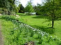 Daffodils in The Wilderness at Ightham Mote - geograph.org.uk - 4466563.jpg 4,000 × 3,000; 4.31 MB
-
 Davidia involucrata at Ightham Mote. - geograph.org.uk - 2382994.jpg 478 × 640; 151 KB
-
 Dead Bent Tree - geograph.org.uk - 5112750.jpg 2,244 × 3,641; 842 KB
-
 Dressage ring - geograph.org.uk - 2919415.jpg 640 × 430; 91 KB
-
 Dusk on the A25, Ightham Bypass - geograph.org.uk - 2868280.jpg 1,600 × 1,200; 595 KB
-
 Electricity Pylon - geograph.org.uk - 4336389.jpg 640 × 480; 47 KB
-
 Entering Stone Street - geograph.org.uk - 2925720.jpg 640 × 430; 120 KB
-
 Entrance to Hub PR ^ Marketing, Chapel Farm, A25 - geograph.org.uk - 2868278.jpg 1,600 × 1,200; 521 KB
-
 Eroded bridleway - geograph.org.uk - 2902528.jpg 640 × 430; 134 KB
-
 Farm building, Mote Farm - geograph.org.uk - 1362658.jpg 640 × 430; 150 KB
-
 Farm building, Warren Farm - geograph.org.uk - 3494647.jpg 640 × 430; 113 KB
-
 Fen Pond Road (A227), Ightham - geograph.org.uk - 5920220.jpg 1,024 × 768; 256 KB
-
 Fen Pond Road, Ightham - geograph.org.uk - 5060363.jpg 3,264 × 2,448; 2.08 MB
-
 Fen Pond Road, Ightham - geograph.org.uk - 5060365.jpg 3,264 × 2,448; 1.83 MB
-
 Field next to Fen Pond Road - geograph.org.uk - 3541832.jpg 4,000 × 3,000; 4.03 MB
-
 Field of Red Campion near Ightham Mote - geograph.org.uk - 2389737.jpg 640 × 426; 119 KB
-
 Field of Red Campion near Ightham Mote - geograph.org.uk - 2397048.jpg 1,024 × 681; 334 KB
-
 Fishing in Fishponds Wood at Ightham - geograph.org.uk - 107079.jpg 640 × 442; 93 KB
-

-
 Footpath across Ightham Common - geograph.org.uk - 857423.jpg 640 × 430; 139 KB
-
 Footpath across Ightham Common - geograph.org.uk - 857426.jpg 640 × 430; 127 KB
-
 Footpath across Ightham Common - geograph.org.uk - 857430.jpg 640 × 430; 142 KB
-
 Footpath approaching Ightham Mote - geograph.org.uk - 5596763.jpg 4,000 × 3,000; 4.89 MB
-
 Footpath by woodland and orchard - geograph.org.uk - 3494663.jpg 640 × 430; 147 KB
-
 Footpath in Ightham Common - geograph.org.uk - 1321746.jpg 640 × 480; 95 KB
-
 Footpath junction near Ightham - geograph.org.uk - 1321180.jpg 640 × 480; 130 KB
-
 Footpath near Ightham Mote - geograph.org.uk - 3505704.jpg 4,000 × 3,000; 4.25 MB
-
 Footpath off A227 - geograph.org.uk - 3494634.jpg 640 × 430; 115 KB
-
 Footpath off Coach Rd - geograph.org.uk - 2919550.jpg 640 × 430; 138 KB
-
 Footpath off Ismay Rd - geograph.org.uk - 2919518.jpg 640 × 430; 127 KB
-
 Footpath off Mote Rd - geograph.org.uk - 2043021.jpg 640 × 430; 137 KB
-
 Footpath off Sandy Lane - geograph.org.uk - 3479740.jpg 640 × 430; 125 KB
-
 Footpath off Stone Street Rd - geograph.org.uk - 2925705.jpg 640 × 430; 151 KB
-
 Footpath signpost - geograph.org.uk - 2919476.jpg 640 × 430; 85 KB
-
 Footpath to Coach Rd - geograph.org.uk - 3487122.jpg 640 × 430; 120 KB
-
 Footpath to Ightham - geograph.org.uk - 4902674.jpg 4,608 × 3,456; 3.38 MB
-
 Footpath to Stone Street Rd - geograph.org.uk - 2925701.jpg 640 × 430; 150 KB
-
 Footpath to Tonbridge Rd - geograph.org.uk - 2907250.jpg 640 × 430; 125 KB
-
 Footpath to Warren Farm - geograph.org.uk - 3494639.jpg 640 × 430; 147 KB
-
 Forest track junction, Oldbury Woods - geograph.org.uk - 856810.jpg 640 × 430; 140 KB
-
 Forest track, Oldbury Woods - geograph.org.uk - 856805.jpg 640 × 430; 137 KB
-
 Formerly the Cob Tree, Ightham - geograph.org.uk - 3829024.jpg 640 × 428; 98 KB
-
 Garden view - geograph.org.uk - 1595645.jpg 426 × 640; 62 KB
-
 Gated track off Stone Street Rd - geograph.org.uk - 2925707.jpg 640 × 430; 137 KB
-
 Gates on driveway to Ightham Court - geograph.org.uk - 4664786.jpg 2,048 × 1,536; 1.12 MB
-
 George V letter box at Ightham Mote Farm - geograph.org.uk - 4661673.jpg 1,536 × 2,048; 736 KB
-
 Glasshouse - geograph.org.uk - 2919463.jpg 640 × 430; 66 KB
-
 Glasshouses - geograph.org.uk - 2919460.jpg 640 × 430; 83 KB
-
 Grazing horse - geograph.org.uk - 2919422.jpg 640 × 430; 84 KB
-
 Greensand Way approaching Fatting Pen - geograph.org.uk - 3482643.jpg 4,320 × 3,240; 4.07 MB
-
 Greensand Way at Mote Farm - geograph.org.uk - 3482654.jpg 4,320 × 3,240; 3.56 MB
-

-
 Greensand Way east of Wilmot Hill - geograph.org.uk - 1362600.jpg 640 × 430; 98 KB
-

-
 Grubbed up orchard - geograph.org.uk - 2907360.jpg 640 × 430; 82 KB
-
 Guided Walk Of Gardens At Ightham Mote - geograph.org.uk - 2055547.jpg 1,496 × 1,122; 1.11 MB
-
 H - H, Borough Green - geograph.org.uk - 2154978.jpg 640 × 430; 99 KB
-
 Half-timbered house, Ightham Mote - geograph.org.uk - 3145616.jpg 1,024 × 680; 220 KB
-
 Hoppers' huts on the Ightham Mote 'Green Walk' - geograph.org.uk - 4661666.jpg 2,048 × 1,536; 1,013 KB
-
 Horses - geograph.org.uk - 2919426.jpg 640 × 430; 94 KB
-
 Horses off Fen Pond Road - geograph.org.uk - 1397030.jpg 640 × 480; 100 KB
-
 House off Redwall Lane - geograph.org.uk - 3487174.jpg 640 × 287; 56 KB
-
 House on Stone Street Rd - geograph.org.uk - 2925712.jpg 640 × 430; 89 KB
-
 House on Tonbridge Rd - geograph.org.uk - 2907339.jpg 640 × 430; 85 KB
-
 House, Redwall Lane - geograph.org.uk - 3487172.jpg 640 × 430; 94 KB
-
 Houses on Maidstone Road, Borough Green - geograph.org.uk - 2868261.jpg 1,600 × 1,200; 534 KB
-
 Houses on Redwall Lane - geograph.org.uk - 857292.jpg 640 × 430; 102 KB
-
 Houses on Stone Street Road - geograph.org.uk - 5229077.jpg 2,268 × 1,678; 1.11 MB
-
 Ightham - geograph.org.uk - 2207299.jpg 1,156 × 776; 473 KB
-
 Ightham Court.jpg 2,656 × 2,155; 1.48 MB
-
 Ightham High St, Ightham - geograph.org.uk - 857281.jpg 640 × 430; 86 KB
-
 Ightham primary School - geograph.org.uk - 856849.jpg 640 × 430; 90 KB
-
 Ightham square - geograph.org.uk - 2871121.jpg 640 × 480; 105 KB
-
 Ightham village, Kent - geograph.org.uk - 41984.jpg 640 × 427; 106 KB
-
 Ightham3679.JPG 2,848 × 2,136; 1.4 MB
-
 Ightham3682.JPG 2,848 × 2,136; 1.51 MB
-
 Ightham3683.JPG 2,848 × 2,136; 1.38 MB
-
 Ightham3687.JPG 2,848 × 2,136; 1.39 MB
-
 In the woods - geograph.org.uk - 2898586.jpg 640 × 430; 153 KB
-

-
 Information board, Oldbury Hill - geograph.org.uk - 2902547.jpg 640 × 430; 147 KB
-
 Inside Oldbury Woods - geograph.org.uk - 1531658.jpg 640 × 480; 212 KB
-
 Is it still a pub^ - geograph.org.uk - 2753606.jpg 640 × 428; 108 KB
-
 Ismay Rd - geograph.org.uk - 2919508.jpg 640 × 430; 91 KB
-
 Ismays Rd - geograph.org.uk - 2907246.jpg 640 × 430; 112 KB
-
 Ismays Rd - geograph.org.uk - 2919496.jpg 640 × 430; 117 KB
-
 Ismays Rd - geograph.org.uk - 2919503.jpg 640 × 430; 91 KB
-
 Ismays Rd - geograph.org.uk - 3487180.jpg 640 × 430; 95 KB
-
 Ismays Rd - geograph.org.uk - 3494627.jpg 640 × 430; 106 KB
-
 Ismays Road, Ightham - geograph.org.uk - 5063090.jpg 3,264 × 2,448; 2.41 MB
-
 Lake At Ightham Mote - geograph.org.uk - 2055550.jpg 1,496 × 1,122; 676 KB
-
 Lake in the grounds of Ightham Mote - geograph.org.uk - 3147114.jpg 1,024 × 680; 255 KB
-
 Large cottage near Ightham - geograph.org.uk - 857288.jpg 640 × 430; 130 KB
-
-
 Large house on Redwall Lane - geograph.org.uk - 3487155.jpg 640 × 430; 93 KB
-
 Large house on Redwall Lane - geograph.org.uk - 3487176.jpg 640 × 430; 85 KB
-
 Large house, Oldbury Lane - geograph.org.uk - 856833.jpg 640 × 430; 100 KB
-
 Leaving Borough Green on Maidstone Road - geograph.org.uk - 2869935.jpg 1,600 × 1,200; 236 KB
-
 Level crossing to Ightham - geograph.org.uk - 1321203.jpg 640 × 480; 127 KB
-
 Leys Cottage - geograph.org.uk - 1321719.jpg 640 × 480; 68 KB
-
 Little Cobs Day Nursery - geograph.org.uk - 856865.jpg 640 × 430; 79 KB
-
 London Countryway in Kent (138) - geograph.org.uk - 5047223.jpg 800 × 600; 181 KB
-
 London Countryway in Kent (139) - geograph.org.uk - 5047225.jpg 800 × 600; 161 KB
-
 London Countryway in Kent (140) - geograph.org.uk - 5047228.jpg 800 × 600; 197 KB
-
 London Countryway in Kent (141) - geograph.org.uk - 5047230.jpg 800 × 600; 204 KB
-
 London Countryway in Kent (142) - geograph.org.uk - 5047275.jpg 800 × 600; 134 KB
-
 London Countryway in Kent (143) - geograph.org.uk - 5047283.jpg 800 × 600; 134 KB
-

-
 Looking towards Ightham Church - geograph.org.uk - 4903587.jpg 4,608 × 3,456; 3.36 MB
-
 Maidstone Rd - geograph.org.uk - 2902553.jpg 640 × 430; 75 KB
-
 Medieval dancers, Ightham Mote - geograph.org.uk - 3147088.jpg 680 × 1,024; 258 KB
-
 Michael Jackson sculpture - geograph.org.uk - 3147134.jpg 680 × 1,024; 227 KB
-
 Mill Lane, Ightham - geograph.org.uk - 857283.jpg 640 × 430; 82 KB
-
 Mod Rock, The Who - geograph.org.uk - 3147127.jpg 1,024 × 680; 216 KB
-
 Mote Farm - geograph.org.uk - 5644992.jpg 640 × 480; 52 KB
-
 Mote Road - Steep Hill 1-8 - geograph.org.uk - 1428862.jpg 640 × 400; 121 KB
-
 New housing, Oldbury Lane - geograph.org.uk - 856857.jpg 640 × 430; 103 KB
-
 Old Church House - geograph.org.uk - 1321693.jpg 640 × 480; 62 KB
-
 Old Lane, Ightham - geograph.org.uk - 5096260.jpg 3,264 × 2,448; 2.65 MB


_-_geograph.org.uk_-_1362676.jpg)
_-_geograph.org.uk_-_1362694.jpg)


,_Ightham_-_geograph.org.uk_-_5920220.jpg)


_-_geograph.org.uk_-_5047223.jpg)
_-_geograph.org.uk_-_5047225.jpg)
_-_geograph.org.uk_-_5047228.jpg)
_-_geograph.org.uk_-_5047230.jpg)
_-_geograph.org.uk_-_5047275.jpg)
_-_geograph.org.uk_-_5047283.jpg)


