Category:Ilkley
Jump to navigation
Jump to search
town and civil parish in West Yorkshire, England  | |||||
| Upload media | |||||
| Instance of | |||||
|---|---|---|---|---|---|
| Location | Bradford, West Yorkshire, Yorkshire and the Humber, England | ||||
| Population |
| ||||
| Different from | |||||
| Said to be the same as | Ilkley (Wikimedia duplicated page, civil parish) | ||||
| official website | |||||
 | |||||
Ilkley is a spa town and civil parish in West Yorkshire, in the north of England. Ilkley civil parish includes the adjacent village of Ben Rhydding and is a ward within the City of Bradford. It has a population of 13,828.
Subcategories
This category has the following 21 subcategories, out of 21 total.
B
E
G
H
I
- Ilkley cemetery (8 F)
- Ilkley Tarn (20 F)
M
- Middleton Woods, Ilkley (3 F)
- Milestones in Ilkley (6 F)
P
- Panoramics of Ilkley (1 F)
- Post boxes in Ilkley (14 F)
R
S
- Guy Sigsworth (3 F)
T
V
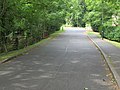
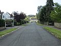
- Views of Ilkley (35 F)
W
Media in category "Ilkley"
The following 200 files are in this category, out of 872 total.
(previous page) (next page)-
 "Ghost sign", Leeds Road, Ilkley - geograph.org.uk - 4347728.jpg 1,129 × 1,600; 462 KB
-
 "Ghost sign", Station Road, Ilkley - geograph.org.uk - 4347755.jpg 1,076 × 1,600; 329 KB
-
 12 Wells Road Ilkley.jpg 3,786 × 2,600; 8.25 MB
-
 A break in the weather - geograph.org.uk - 5446443.jpg 4,032 × 3,024; 3.59 MB
-
 A shop for dogs in Ilkley - geograph.org.uk - 4663376.jpg 4,809 × 3,634; 4.12 MB
-
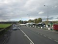
 A65 Coutances Way - geograph.org.uk - 5421450.jpg 640 × 481; 48 KB
-
 A65 Leeds Road - geograph.org.uk - 5421436.jpg 640 × 480; 59 KB
-
 A65 Leeds Road, Ilkley - geograph.org.uk - 6303766.jpg 1,600 × 1,033; 208 KB
-
 A65 Skipton Road entering Ilkley - geograph.org.uk - 5421418.jpg 640 × 481; 82 KB
-
 Above Ben Rhydding - geograph.org.uk - 6122763.jpg 1,024 × 683; 540 KB
-
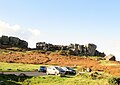
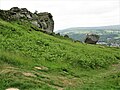
 Above Cow and Calf - geograph.org.uk - 6122816.jpg 1,024 × 683; 471 KB
-
 Above Cowpasture Road - geograph.org.uk - 6122733.jpg 1,024 × 683; 484 KB
-
 Above Ilkley - geograph.org.uk - 6122760.jpg 1,024 × 683; 572 KB
-
 Across the car park - geograph.org.uk - 6122874.jpg 1,024 × 683; 434 KB
-
 Across the moor - geograph.org.uk - 6122832.jpg 1,024 × 683; 534 KB
-
 Across the tarn - geograph.org.uk - 6122732.jpg 1,024 × 683; 514 KB
-

-
 Aisha's Rock (6100358459).jpg 3,000 × 4,000; 8.47 MB
-
 Alba Tyres Auto Centre, Little Lane, Ilkley - geograph.org.uk - 4199767.jpg 1,024 × 768; 110 KB
-

-
 All Saints Church, Ilkley - geograph.org.uk - 4080509.jpg 1,600 × 1,064; 624 KB
-
 All Saints Church, Ilkley - geograph.org.uk - 5266878.jpg 640 × 480; 89 KB
-
 All Saints Church, Ilkley - geograph.org.uk - 6303748.jpg 1,600 × 1,135; 295 KB
-
 All Saints Court - Bath Street - geograph.org.uk - 4422060.jpg 640 × 414; 71 KB
-
 All Saints Parish Church - geograph.org.uk - 4182211.jpg 1,600 × 1,093; 210 KB
-
 Allotments - off Dansk Way - geograph.org.uk - 4422161.jpg 640 × 480; 120 KB
-
 Along Blackstone Beck - geograph.org.uk - 6122756.jpg 683 × 1,024; 653 KB
-
 Along Brook Street - geograph.org.uk - 6122876.jpg 1,024 × 683; 532 KB
-
 Along Cowpasture Road - geograph.org.uk - 6122866.jpg 1,024 × 683; 691 KB
-

-

-
 Approaching Black Beck, Ilkley Moor - geograph.org.uk - 4084475.jpg 1,600 × 1,200; 582 KB
-
 Arch (2478934884).jpg 1,920 × 2,560; 2.52 MB
-
 Arriving into Ilkley railway station - geograph.org.uk - 5132101.jpg 1,024 × 768; 116 KB
-
 Art deco in Ilkley - geograph.org.uk - 4897833.jpg 1,600 × 1,200; 467 KB
-
 Ashlands Road - Leeds Road - geograph.org.uk - 4422068.jpg 640 × 480; 62 KB
-

-
-
 Ashlar Chair - geograph.org.uk - 3584652.jpg 4,320 × 3,240; 4.27 MB
-
 Audley Clevedon Retirement Village - geograph.org.uk - 2903982.jpg 2,592 × 1,944; 1,004 KB
-

-
 Back Parish Ghyll Road - Albany Walk - geograph.org.uk - 4096461.jpg 640 × 480; 93 KB
-
 Backstone Beck - geograph.org.uk - 2454835.jpg 4,320 × 3,240; 3.06 MB
-
 Backstone Lane - Wheatley Road - geograph.org.uk - 4231099.jpg 640 × 480; 136 KB
-
 Backstone Way - Little Lane - geograph.org.uk - 4231134.jpg 640 × 480; 76 KB
-
 Backstone Way - Little Lane - geograph.org.uk - 4231325.jpg 640 × 480; 82 KB
-
 Bandstand, The Grove, Ilkley - geograph.org.uk - 5755266.jpg 640 × 480; 100 KB
-
 Barmishaw Stone, Ilkley Moor - geograph.org.uk - 3081848.jpg 480 × 640; 132 KB
-
 Baths. (6107203312).jpg 2,628 × 1,763; 2.83 MB
-
 Beacon Rise - Beverley Rise - geograph.org.uk - 4240132.jpg 640 × 480; 77 KB
-
 Beamsley View - Beverley Rise - geograph.org.uk - 4240123.jpg 640 × 480; 82 KB
-
 Beck - Nesfield Road - geograph.org.uk - 4397299.jpg 480 × 640; 137 KB
-
 Beck Foot Farm - geograph.org.uk - 3135540.jpg 4,320 × 3,240; 5.38 MB
-
 Bedroom View - geograph.org.uk - 5446441.jpg 4,032 × 3,024; 4.18 MB
-
 Beetle - panoramio (1).jpg 4,592 × 2,576; 2.89 MB
-
 Belle Vue - Cowpasture Road - geograph.org.uk - 4230800.jpg 640 × 526; 82 KB
-
 Belmont Road - Valley Drive - geograph.org.uk - 4104602.jpg 640 × 480; 123 KB
-
 Below Cow and Calf - geograph.org.uk - 6122767.jpg 1,024 × 683; 495 KB
-
 Below Cow and Calf - geograph.org.uk - 6122787.jpg 683 × 1,024; 447 KB
-
 Ben Rhydding Cricket Ground - geograph.org.uk - 4080470.jpg 1,600 × 1,064; 701 KB
-
 Ben Rhydding Drive - geograph.org.uk - 4874606.jpg 1,024 × 768; 196 KB
-
 Ben Rhydding Drive - Wheatley Lane - geograph.org.uk - 4103570.jpg 640 × 480; 97 KB
-
 Ben Rhydding Methodist Church. Wheatley Road - geograph.org.uk - 5958487.jpg 4,608 × 3,456; 5.15 MB
-
-

-

-
-
 Benches on Wells Road, Ilkley - geograph.org.uk - 3383404.jpg 856 × 1,280; 220 KB
-
 Benchmark on Langbar Road - geograph.org.uk - 3004376.jpg 2,048 × 1,536; 505 KB
-
 Bend in Denton Road, Ilkley - geograph.org.uk - 5266888.jpg 640 × 480; 84 KB
-
 Bettys café and tea room Ilkley - geograph.org.uk - 5132105.jpg 1,024 × 768; 203 KB
-
 Bettys ilkley 3.jpg 2,448 × 3,264; 2.21 MB
-
 Bettys Tea Room, Ilkley - geograph.org.uk - 5266861.jpg 640 × 480; 97 KB
-
 Beverley Rise - Woodlands Rise - geograph.org.uk - 4240013.jpg 640 × 480; 59 KB
-
 Black Stone Beck - Leeds Road - geograph.org.uk - 4422191.jpg 640 × 480; 140 KB
-
 Blackstone Beck - geograph.org.uk - 6122755.jpg 683 × 1,024; 699 KB
-
 Blackthorn Road - Rombalds view - geograph.org.uk - 4422175.jpg 640 × 420; 54 KB
-
 Blackthorn Road - Valley Road - geograph.org.uk - 4231354.jpg 640 × 480; 79 KB
-
 Bluebells in Middleton Woods - geograph.org.uk - 4453868.jpg 1,600 × 1,200; 367 KB
-
 Bluebells in Middleton Woods - geograph.org.uk - 4453871.jpg 1,600 × 1,200; 364 KB
-
 Bluebells in Middleton Woods - geograph.org.uk - 4453872.jpg 1,600 × 1,200; 367 KB
-
 Boating lake on the moor - geograph.org.uk - 6088510.jpg 1,024 × 683; 502 KB
-
 Bolling Road (B6382), Ben Rhydding - geograph.org.uk - 5754491.jpg 640 × 480; 84 KB
-

-

-
 Bolton Abbey Mowers, Wharfe View Road, Ilkley - geograph.org.uk - 4180655.jpg 1,024 × 614; 105 KB
-
 Boundary Stone^ - geograph.org.uk - 5390449.jpg 2,112 × 2,816; 1 MB
-
 Boundary Stone^ - geograph.org.uk - 5390452.jpg 2,112 × 2,816; 1 MB
-
 Bowling Green - off Denton Road - geograph.org.uk - 4396572.jpg 640 × 386; 50 KB
-
 Bracken and Rowan - geograph.org.uk - 6122752.jpg 1,024 × 683; 520 KB
-
 Bracken on the moors - geograph.org.uk - 6122765.jpg 1,024 × 683; 552 KB
-
 Brackenwood Close - Valley Drive - geograph.org.uk - 4104604.jpg 640 × 480; 85 KB
-
 Brewery Road - Little Lane - geograph.org.uk - 1197798.jpg 640 × 480; 249 KB
-
 Briarfield Close - Clifton Road - geograph.org.uk - 4231028.jpg 640 × 425; 111 KB
-
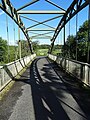
 Bridge over the River Wharfe - geograph.org.uk - 6303760.jpg 1,600 × 1,200; 470 KB
-
 Bridleway to Burley in Wharfedale, near Stead - geograph.org.uk - 4084499.jpg 1,600 × 1,200; 637 KB
-
 Bridleway to Tivoli - geograph.org.uk - 3009050.jpg 2,048 × 1,536; 525 KB
-
 Bridleway to Tivoli - geograph.org.uk - 3234935.jpg 3,768 × 2,340; 4.97 MB
-
 Briery Close - Beverley Rise - geograph.org.uk - 4240141.jpg 640 × 480; 53 KB
-
 Brighton Road - Ben Rhydding Drive - geograph.org.uk - 4103572.jpg 640 × 480; 85 KB
-
 Brighton Road - Wheatley Lane - geograph.org.uk - 4103604.jpg 640 × 480; 109 KB
-
 Brook Street - geograph.org.uk - 6122875.jpg 1,024 × 683; 547 KB
-
 Brook Street, Ilkley - geograph.org.uk - 5276781.jpg 1,024 × 768; 125 KB
-
 Buildings at Myddelton Grange - geograph.org.uk - 4080489.jpg 1,600 × 1,064; 600 KB
-
 Bus stop on Skipton Road (A65) - geograph.org.uk - 5266851.jpg 640 × 480; 59 KB
-
 Bus top on Skipton Road (A65) - geograph.org.uk - 5266832.jpg 640 × 480; 69 KB
-
 Can you see the face in the rock^ - geograph.org.uk - 3654939.jpg 4,608 × 3,456; 4.92 MB
-
 Car park, Ben Rhydding Sports Club - geograph.org.uk - 5266905.jpg 640 × 480; 44 KB
-
 Cardan Drive - off Wheatley Lane - geograph.org.uk - 4104596.jpg 640 × 480; 58 KB
-
 Cardan Drive - Valley Drive - geograph.org.uk - 4104597.jpg 640 × 480; 80 KB
-
 Castle Road Allotments - geograph.org.uk - 475513.jpg 640 × 309; 42 KB
-
 Cattle Grid - geograph.org.uk - 1981704.jpg 3,072 × 2,048; 434 KB
-
 Centre of Ilkley - geograph.org.uk - 6122872.jpg 1,024 × 683; 455 KB
-

-

-
 Cherry Grove - Dale View - geograph.org.uk - 4240008.jpg 640 × 480; 66 KB
-
 Chestnut Close - Wheatley Lane - geograph.org.uk - 4103613.jpg 640 × 480; 102 KB
-
 Christchurch, Ilkley - geograph.org.uk - 5266863.jpg 488 × 640; 62 KB
-
 Church Street, Ilkley - geograph.org.uk - 5100661.jpg 640 × 480; 68 KB
-
 Clifford Avenue - Clifford Road - geograph.org.uk - 4397318.jpg 640 × 480; 115 KB
-
 Clifford Road - Gill Bank Road - geograph.org.uk - 4396691.jpg 640 × 480; 61 KB
-
 Clifford Road - Rupert Road - geograph.org.uk - 4397313.jpg 640 × 480; 88 KB
-
 Clifford Road - Rupert Road - geograph.org.uk - 4397317.jpg 640 × 480; 79 KB
-
 Clifford Road, Ilkley - geograph.org.uk - 5764248.jpg 1,024 × 683; 225 KB
-
 Clifton Road - Ben Rhydding Road - geograph.org.uk - 4103692.jpg 640 × 480; 112 KB
-

-
-

-
 Clifton Road - Wheatley Road - geograph.org.uk - 4231034.jpg 640 × 480; 104 KB
-

-
 Climbing (16281535049).jpg 2,667 × 4,000; 8.46 MB
-
 Climbing (27761559882).jpg 1,293 × 2,299; 3.01 MB
-
 Close up, Elizabeth II postbox on Little Lane, Ilkley - geograph.org.uk - 5268067.jpg 1,304 × 2,475; 703 KB
-
 Cobbled Access behind Cowpasture Road - geograph.org.uk - 2454903.jpg 4,320 × 3,240; 3.86 MB
-
 Colbert Avenue - Leeds Road - geograph.org.uk - 4422167.jpg 640 × 480; 60 KB
-
 Colbert Avenue - Valley Drive - geograph.org.uk - 4104603.jpg 640 × 480; 86 KB
-
 Collects on Ilkley Moor - geograph.org.uk - 3436226.jpg 1,024 × 768; 210 KB
-
 College Drive - off Wells Road - geograph.org.uk - 4096288.jpg 640 × 480; 93 KB
-
 Come to the Fair (8708695620).jpg 3,803 × 2,162; 5.66 MB
-
 Connaught Road - Clifton Road - geograph.org.uk - 4103799.jpg 640 × 480; 82 KB
-
-
 Constable Road - Ben Rhydding Road - geograph.org.uk - 4230993.jpg 640 × 480; 112 KB
-
 Cote de Cow and Calf - geograph.org.uk - 4661496.jpg 1,600 × 1,200; 570 KB
-
 Coutances Way (A65) - geograph.org.uk - 5266907.jpg 640 × 480; 122 KB
-
 Coutances Way towards Ilkley - geograph.org.uk - 3202441.jpg 800 × 600; 75 KB
-
 Cow and Calf - geograph.org.uk - 5409985.jpg 640 × 427; 427 KB
-
 Cow and Calf - geograph.org.uk - 5446439.jpg 4,032 × 3,024; 3.97 MB
-

-
 Cow and Calf Hotel - geograph.org.uk - 4874587.jpg 1,024 × 768; 174 KB
-
 Cow and Calf Rocks - geograph.org.uk - 3718724.jpg 3,000 × 2,000; 2.37 MB
-
 Cow and Calf rocks - geograph.org.uk - 6122860.jpg 1,024 × 683; 496 KB
-
 Cow and Calf Rocks - geograph.org.uk - 6122863.jpg 1,024 × 683; 511 KB
-
 Cow and Calf rocks from behind cafe building - geograph.org.uk - 5958516.jpg 3,469 × 2,466; 3.06 MB
-
 Cow and Calf rocks on a sunny day - geograph.org.uk - 4874584.jpg 1,024 × 768; 194 KB
-
 Cow and Calf Rocks, Ilkley Moor - geograph.org.uk - 5801361.jpg 640 × 480; 94 KB
-
 Cowpasture Road - geograph.org.uk - 6122867.jpg 1,024 × 683; 685 KB
-

-
 Craiglands Park - Crossbeck Road - geograph.org.uk - 4230819.jpg 640 × 480; 99 KB
-
 Craigmore Drive - Valley Drive - geograph.org.uk - 4104600.jpg 640 × 480; 108 KB
-
 Cranford Gardens - Parish Ghyll Lane - geograph.org.uk - 4240316.jpg 640 × 480; 85 KB
-
 Crossbeck Close - Crossbeck Road - geograph.org.uk - 4230827.jpg 640 × 480; 113 KB
-
 Crossbeck Road - Cowpasture Road - geograph.org.uk - 4230813.jpg 640 × 480; 82 KB
-
 Crossbeck Road - Wells Road - geograph.org.uk - 4240999.jpg 640 × 480; 89 KB
-
-
 Crossing of paths on Rombalds Moor - geograph.org.uk - 4874589.jpg 1,024 × 768; 257 KB
-

-
 Cup and Ring stone - geograph.org.uk - 1560626.jpg 640 × 480; 147 KB
-
 Cup-marked stone - geograph.org.uk - 4637652.jpg 1,600 × 1,200; 617 KB
-
 Curlew Close - Beverley Rise - geograph.org.uk - 4240137.jpg 640 × 480; 68 KB
-
 Curly Hill - Gill Bank Road - geograph.org.uk - 4396680.jpg 640 × 480; 85 KB
-

-

-
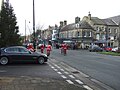 Cycling Santas, Ilkley - geograph.org.uk - 5266864.jpg 640 × 480; 77 KB
-
 Dale View - Victoria Avenue - geograph.org.uk - 4240004.jpg 640 × 480; 73 KB
-
 Dales Way footpath near Hadfield Farm - geograph.org.uk - 1475958.jpg 640 × 480; 177 KB
-
 Dales Way Link, Rombalds Moor - causeway - geograph.org.uk - 4874562.jpg 1,024 × 768; 236 KB
-
 Dales Way near Hadfield Farm - geograph.org.uk - 303945.jpg 640 × 480; 75 KB
-
 Dales Way near Hadfield Farm - geograph.org.uk - 6271469.jpg 5,184 × 3,456; 6.64 MB
-
 Dales Way on Ilkley Moor - geograph.org.uk - 3655013.jpg 4,608 × 3,456; 4.66 MB
-
 Dales Way opposite Ilkley Golf Course - geograph.org.uk - 2370980.jpg 4,320 × 3,240; 5.89 MB
-
 Darwin Gardens (3931785221).jpg 2,560 × 1,707; 4.95 MB
-

-

-
 Decorative roundel on a house in Bolton Bridge Road, Ilkley (8720418583).jpg 2,568 × 2,570; 5.3 MB
-
 Denton Bridge over River Wharfe - geograph.org.uk - 5958451.jpg 4,602 × 3,450; 6.74 MB
-
 Denton Bridge over The River Wharfe - geograph.org.uk - 4663414.jpg 3,674 × 4,898; 4.77 MB
-
 Denton Lane (4857608256).jpg 2,560 × 1,564; 3.19 MB
-
 Denton Road - Manley Road - geograph.org.uk - 4103853.jpg 640 × 480; 103 KB
-
 Denton Road - Margerison Road - geograph.org.uk - 4103847.jpg 640 × 480; 85 KB
-
 Derelict and disused sheepfold, Middleton - geograph.org.uk - 4180734.jpg 1,024 × 614; 127 KB
-
 Dillons, Railway Road, Ilkley - geograph.org.uk - 4199772.jpg 1,024 × 768; 107 KB
-
 Doggone it, start of The Dales Way - geograph.org.uk - 4170373.jpg 640 × 480; 107 KB
-
 Double Elizabeth II postbox, Ilkley Post Office - geograph.org.uk - 5268059.jpg 2,848 × 2,136; 1.4 MB
-

-
 Dukes Hill - Gill Bank Road - geograph.org.uk - 4397272.jpg 480 × 640; 78 KB
-
 Easby Close - Easby Drive - geograph.org.uk - 4239998.jpg 640 × 480; 71 KB
-
 East Buck Stones - geograph.org.uk - 3583440.jpg 4,320 × 3,240; 4.76 MB
-
 East Holmes Fields - geograph.org.uk - 4489268.jpg 1,200 × 808; 1.04 MB
-
 Eaton Road - Parish Ghyll Drive - geograph.org.uk - 4096571.jpg 640 × 480; 90 KB
-


_Squadron_-_Ashlands_Road_-_geograph.org.uk_-_4422076.jpg)
.jpg)


.jpg)


.jpg)


.jpg)


,_Ben_Rhydding_-_geograph.org.uk_-_5754491.jpg)


_-_geograph.org.uk_-_5266851.jpg)
_-_geograph.org.uk_-_5266832.jpg)


.jpg)
.jpg)


.jpg)


_-_geograph.org.uk_-_5266907.jpg)


.jpg)


.jpg)


.jpg)


