Category:Ince, Cheshire
Jump to navigation
Jump to search
village and civil parish in Cheshire, United Kingdom  | |||||
| Upload media | |||||
| Instance of | |||||
|---|---|---|---|---|---|
| Location | Cheshire West and Chester, Cheshire, North West England, England | ||||
| Population |
| ||||
| Said to be the same as | Ince (Wikimedia duplicated page, civil parish) | ||||
 | |||||
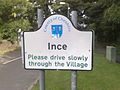
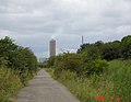
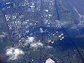
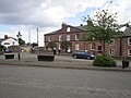
English: Ince is a village and civil parish in the unitary authority of Cheshire West and Chester and the ceremonial county of Cheshire, England. It is situated immediately to the east of the Stanlow Oil Refinery. It shares Ince and Elton railway station with the village of Elton, which it runs into. According to the 2001 Census, it was recorded as having a population of 209.
Subcategories
This category has the following 3 subcategories, out of 3 total.
Media in category "Ince, Cheshire"
The following 63 files are in this category, out of 63 total.
-
 1, 2,and 3 The Square, Ince.jpg 640 × 480; 61 KB
-
 1-3 The Square, Ince - geograph.org.uk - 6730079.jpg 1,024 × 752; 298 KB
-
 A long lens view of Runcorn's chemical plants - geograph.org.uk - 4794517.jpg 4,302 × 1,929; 4.52 MB
-
 An industrial road - private? - geograph.org.uk - 4794495.jpg 4,331 × 2,789; 6.54 MB
-
 Barns at Holme Farm - geograph.org.uk - 1442881.jpg 640 × 426; 289 KB
-

-
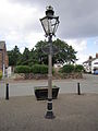 Commemorative street lamp, Ince, Cheshire.JPG 3,240 × 4,320; 3.11 MB
-
 Cut Mark, Lower Green Farm, Ince - geograph.org.uk - 2378115.jpg 3,648 × 2,736; 4.87 MB
-
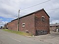 Farm buildings on Station Road, Ince.JPG 4,320 × 3,240; 3.23 MB
-

-
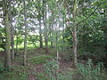
 Green space near Pool Lane, Ince, Cheshire (1).JPG 4,320 × 3,240; 5.24 MB
-
 Green space near Pool Lane, Ince, Cheshire (2).JPG 4,320 × 3,240; 4.26 MB
-
 Green space near Pool Lane, Ince, Cheshire (3).JPG 4,320 × 3,240; 5.89 MB
-
 Green space near Pool Lane, Ince, Cheshire (4).JPG 4,320 × 3,240; 3.93 MB
-
 Green space near Pool Lane, Ince, Cheshire (5).JPG 4,320 × 3,240; 4.83 MB
-
 Green space near Pool Lane, Ince, Cheshire (6).JPG 4,320 × 3,240; 4.1 MB
-
 Green space near Pool Lane, Ince, Cheshire (7).JPG 4,320 × 3,240; 4.17 MB
-
 Green space near Pool Lane, Ince, Cheshire (8).JPG 4,320 × 3,240; 4.65 MB
-
 Green space near Pool Lane, Ince, Cheshire (9).JPG 4,320 × 3,240; 4.99 MB
-
 GrowHow - geograph.org.uk - 6242255.jpg 1,024 × 576; 149 KB
-
 Holme Farm - geograph.org.uk - 4954484.jpg 640 × 481; 384 KB
-
 Holme Farm, Ince.jpg 640 × 480; 57 KB
-
 Ince - geograph.org.uk - 2743773.jpg 640 × 480; 66 KB
-
 Ince - geograph.org.uk - 39250.jpg 640 × 519; 65 KB
-
 Ince - geograph.org.uk - 39252.jpg 640 × 480; 95 KB
-
 Ince Village Hall - geograph.org.uk - 1442886.jpg 640 × 426; 351 KB
-
 Ince Village Hall - geograph.org.uk - 2743765.jpg 640 × 480; 94 KB
-
 Ince village sign (2).JPG 4,320 × 3,240; 3.29 MB
-
 Incevillagesign.jpg 2,592 × 1,944; 675 KB
-
 Kemira GrowHow factory access road, Ince, Cheshire (1).JPG 4,320 × 3,240; 3.73 MB
-
 Kemira GrowHow factory access road, Ince, Cheshire (2).JPG 4,320 × 3,240; 3.56 MB
-
 Kemira GrowHow fertiliser plant, Ince - geograph.org.uk - 198948.jpg 480 × 640; 53 KB
-
 Lordship Lane and Kemira GrowHow - geograph.org.uk - 198945.jpg 640 × 496; 52 KB
-
 Lower Green Farm, Ince - geograph.org.uk - 1610172.jpg 640 × 480; 86 KB
-
 Manchester Ship Canal, Ince Marshes - geograph.org.uk - 4954383.jpg 640 × 481; 312 KB
-
 Planter at Ince, Cheshire.JPG 4,320 × 3,240; 3.9 MB
-
 Planter at Station Road, Ince.JPG 4,320 × 3,240; 5.6 MB
-
 Pool Lane, Ince - geograph.org.uk - 4796043.jpg 640 × 480; 95 KB
-
 Pool Lane, Ince, Cheshire (1).JPG 4,320 × 3,240; 4.55 MB
-
 Pool Lane, Ince, Cheshire (2).JPG 4,320 × 3,240; 5.03 MB
-
 Pumping Station Wharf at Ince Marshes - geograph.org.uk - 4954475.jpg 640 × 481; 400 KB
-
 Pylon at Station Road, Ince.JPG 3,240 × 4,320; 2.95 MB
-
 Rose Cottage Kinseys Lane Ince - geograph.org.uk - 406148.jpg 640 × 480; 91 KB
-
 Stanlow Refinery - geograph.org.uk - 5612741.jpg 2,982 × 2,235; 3.85 MB
-
 Station Road, Ince, Cheshire.JPG 4,320 × 3,240; 5.42 MB
-
 Telephone box at The Square, Ince, Cheshire (1).JPG 4,320 × 3,240; 4.47 MB
-
 Telephone box at The Square, Ince, Cheshire (2).JPG 3,240 × 4,320; 4.43 MB
-
 The Duke of Wellington pub, Ince.JPG 4,320 × 3,240; 2.93 MB
-
 The field was actually full of Porkers. - geograph.org.uk - 1442878.jpg 640 × 426; 353 KB
-
 The Square, Ince (2).JPG 4,320 × 3,240; 3.29 MB
-
 The Square, Ince - geograph.org.uk - 4796038.jpg 640 × 480; 59 KB
-
 The Square, Ince, Cheshire.jpg 4,320 × 3,240; 3.54 MB
-
 View from Ince, Cheshire (1).JPG 4,000 × 3,000; 2.76 MB
-
 View from Ince, Cheshire (2).JPG 4,000 × 3,000; 2.78 MB
-
 View from Station Road, Ince.JPG 4,320 × 3,240; 3.15 MB
-
 Wastewater Treatment works, Ince - geograph.org.uk - 2743719.jpg 640 × 480; 63 KB
-
 Bridge Wall - geograph.org.uk - 679763.jpg 640 × 397; 90 KB
-
 Going South - geograph.org.uk - 679787.jpg 640 × 398; 111 KB
-
 Ince Marshes - geograph.org.uk - 350355.jpg 640 × 421; 68 KB
-
 Parallel Lines - geograph.org.uk - 680234.jpg 382 × 640; 49 KB
-
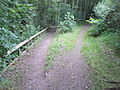
 Pool Lane Bridge - geograph.org.uk - 679775.jpg 640 × 398; 89 KB
-
 Railway Bridge - geograph.org.uk - 679751.jpg 640 × 398; 83 KB
-
 Road To Ince - geograph.org.uk - 679739.jpg 640 × 398; 78 KB


.JPG)
.JPG)
.JPG)
.JPG)
.JPG)
.JPG)
.JPG)
.JPG)
.JPG)


.JPG)

.JPG)
.JPG)


.JPG)
.JPG)


.JPG)
.JPG)


.JPG)


.JPG)
.JPG)


