Category:Inner Distribution Road
Jump to navigation
Jump to search
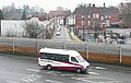
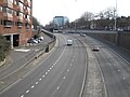
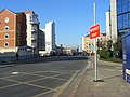
English: Inner Distribution Road or IDR is a dual carriageway ring road that encircles the town centre of Reading, Berkshire, England. It forms part of the A329 that runs from Wentworth in Surrey to Thame in Oxfordshire.
ring road in Reading, Berkshire, UK   | |||||
| Upload media | |||||
| Instance of | |||||
|---|---|---|---|---|---|
| Location | Reading, West Berkshire, Berkshire, South East England, England | ||||
| Has part(s) | |||||
| Inception |
| ||||
| Length |
| ||||
 | |||||
Subcategories
This category has the following 5 subcategories, out of 5 total.
Media in category "Inner Distribution Road"
The following 47 files are in this category, out of 47 total.
-
 Caversham Road - geograph.org.uk - 1163661.jpg 640 × 544; 75 KB
-
 Caversham Road, Reading - geograph.org.uk - 1075484.jpg 480 × 640; 111 KB
-
 Chatham Place - geograph.org.uk - 1329523.jpg 640 × 426; 194 KB
-
 Chatham Place from Oxford Road, Reading, November 2022.jpg 4,032 × 3,024; 4.71 MB
-
 Complex road crossings - geograph.org.uk - 780283.jpg 640 × 463; 69 KB
-
 Cut by the sliproad - geograph.org.uk - 1635510.jpg 640 × 480; 82 KB
-
 IDR flyover - geograph.org.uk - 1329279.jpg 640 × 425; 204 KB
-
 IDR junction - geograph.org.uk - 2227711.jpg 640 × 392; 182 KB
-
 IDR junction - geograph.org.uk - 2227714.jpg 640 × 427; 192 KB
-
 Inner Distribution Road - geograph.org.uk - 1631272.jpg 640 × 428; 206 KB
-
 Inner Distribution Road - geograph.org.uk - 1631274.jpg 424 × 640; 238 KB
-
 Inner Distribution Road - geograph.org.uk - 1631275.jpg 640 × 427; 194 KB
-
 Inner Distribution Road, Reading.jpg 4,032 × 2,268; 5.5 MB
-
 Inner Distribution Road.jpg 640 × 426; 163 KB
-

-
 King's Point, Reading - geograph.org.uk - 678889.jpg 640 × 480; 108 KB
-
 King's Point, Reading - geograph.org.uk - 919722.jpg 640 × 480; 346 KB
-
 Last house standing - geograph.org.uk - 1596497.jpg 640 × 480; 61 KB
-
 Looking towards the flyover - geograph.org.uk - 1635490.jpg 640 × 480; 65 KB
-
 Mill Lane South looking west towards the IDR flyover.jpg 800 × 603; 81 KB
-
 Mural on the corner - geograph.org.uk - 2198241.jpg 1,024 × 768; 162 KB
-
 O for Oracle, Reading - geograph.org.uk - 1032972.jpg 640 × 480; 110 KB
-
 Office block on the corner - geograph.org.uk - 1596532.jpg 480 × 640; 66 KB
-
 Offices and the Hexagon, Reading - geograph.org.uk - 671911.jpg 640 × 480; 123 KB
-
 Oracle Roundabout - geograph.org.uk - 1635940.jpg 640 × 480; 63 KB
-
 Part of Old Coley - geograph.org.uk - 2227716.jpg 640 × 404; 157 KB
-
 Premier Inn, Reading - geograph.org.uk - 1032974.jpg 640 × 480; 115 KB
-
-
 Subway beneath the IDR, Reading - geograph.org.uk - 664942.jpg 640 × 427; 100 KB
-
 The A33, Reading - geograph.org.uk - 604114.jpg 640 × 480; 137 KB
-
 The Civic Centre, Reading.jpg 640 × 480; 150 KB
-
 The Hexagon - geograph.org.uk - 1631277.jpg 640 × 640; 284 KB
-
 The IDR flyover and the Oracle, Reading - geograph.org.uk - 603759.jpg 640 × 480; 125 KB
-
 The IDR flyover and the Oracle, Reading - geograph.org.uk - 603806.jpg 640 × 480; 133 KB
-
 The Inner Distribution Road, Reading - geograph.org.uk - 1032969.jpg 640 × 480; 155 KB
-
 The Inner Distribution Road, Reading - geograph.org.uk - 597637.jpg 480 × 640; 143 KB
-
 The Inner Distribution Road, Reading - geograph.org.uk - 598185.jpg 640 × 480; 167 KB
-
 The Inner Distribution Road, Reading - geograph.org.uk - 996843.jpg 640 × 480; 128 KB
-
 The Oracle and flyover, Reading - geograph.org.uk - 1032973.jpg 640 × 480; 120 KB
-
 The Oracle, Reading - geograph.org.uk - 603814.jpg 480 × 640; 109 KB
-
 The Oracle, Reading - geograph.org.uk - 633869.jpg 640 × 480; 109 KB
-
 The Oracle, Reading, car park.jpg 4,288 × 2,848; 4.5 MB
-
 The police station, Reading - geograph.org.uk - 671919.jpg 640 × 480; 126 KB
-
 Watlington Street, Reading - geograph.org.uk - 695719.jpg 640 × 480; 126 KB
-
 Watlington Street, Reading - geograph.org.uk - 830136.jpg 640 × 480; 114 KB
-
 Watlington Street, Reading - geograph.org.uk - 996764.jpg 640 × 480; 115 KB
-
 Weir off the cut - geograph.org.uk - 1635514.jpg 640 × 480; 84 KB


