Category:Invergarry
Jump to navigation
Jump to search
human settlement in Highland, Scotland, UK  | |||||
| Upload media | |||||
| Instance of | |||||
|---|---|---|---|---|---|
| Location |
| ||||
 | |||||
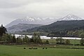
English: Invergarry is a village in the Highlands of Scotland. It is in the Great Glen, near where the River Garry flows into Loch Oich.
Subcategories
This category has the following 7 subcategories, out of 7 total.
A
- Ardochy Forest (6 F)
G
I
- Invergarry Castle (26 F)
- Invergarry Power Station (4 F)
- Invergarry railway station (18 F)
O
S
Media in category "Invergarry"
The following 139 files are in this category, out of 139 total.
-
 A nor'easterly view along Loch Oich - geograph.org.uk - 1455906.jpg 640 × 427; 47 KB
-

-
 A82 in Invergarry - geograph.org.uk - 2724612.jpg 1,024 × 768; 213 KB
-
 A87 entering Invergarry, in snow - geograph.org.uk - 2723959.jpg 1,024 × 740; 228 KB
-
 A87 through Invergarry in snow - geograph.org.uk - 2724610.jpg 1,024 × 768; 246 KB
-
 Allt Dail a' Chuirn - geograph.org.uk - 1175941.jpg 640 × 480; 96 KB
-

-
 Ardgarry farm log cabins, Invergarry - geograph.org.uk - 1594393.jpg 640 × 428; 48 KB
-
 Auchteraw Burial Ground - geograph.org.uk - 1497138.jpg 640 × 480; 109 KB
-
 Auchteraw Burial Ground - geograph.org.uk - 1497140.jpg 480 × 640; 83 KB
-
 Benchmark no 10760 - geograph.org.uk - 114082.jpg 462 × 640; 432 KB
-
 Bridge and estate building at Invergarry - geograph.org.uk - 3723730.jpg 1,600 × 1,200; 750 KB
-
 Bridge of Oich - geograph.org.uk - 402547.jpg 480 × 640; 94 KB
-
 Church of Scotland Invergarry - geograph.org.uk - 1409279.jpg 640 × 480; 100 KB
-
 Cottages in Invergarry.jpg 640 × 480; 72 KB
-
 Dam and water intake above Invergarry - geograph.org.uk - 3479379.jpg 1,024 × 678; 331 KB
-
 Dangerous - panoramio.jpg 1,280 × 960; 633 KB
-
 Early evening over Kinloch Hourn - panoramio.jpg 3,648 × 2,736; 2.43 MB
-
 Glen Albyn Lodge Invergarry - geograph.org.uk - 4277953.jpg 800 × 534; 98 KB
-
 Glen Barrisdale - panoramio.jpg 3,642 × 2,477; 4.23 MB
-
 Glen Garry (geograph 5445035).jpg 1,024 × 692; 341 KB
-
 Glengarry Community Hall - geograph.org.uk - 1352617.jpg 640 × 480; 109 KB
-
 Glengarry Community Hall - geograph.org.uk - 1528471.jpg 640 × 480; 123 KB
-
 Glengarry Community Hall, Invergarry - geograph.org.uk - 2408359.jpg 800 × 530; 171 KB
-
 Glengarry Lodge Gates and Drive - geograph.org.uk - 1056616.jpg 640 × 480; 86 KB
-
 Glengarry Lodges - geograph.org.uk - 3416990.jpg 2,592 × 1,952; 979 KB
-
 Glengarry Roll of Honour near Invergarry - geograph.org.uk - 3074416.jpg 640 × 420; 138 KB
-
 Glengarry Shinty Club - geograph.org.uk - 1528463.jpg 640 × 425; 84 KB
-
 Gone Fishing in Invergarry Hotel Garden - geograph.org.uk - 1146299.jpg 640 × 480; 107 KB
-
 Grazing land at Kilfinnan - geograph.org.uk - 2337337.jpg 640 × 480; 94 KB
-
 Houses at Invergarry - geograph.org.uk - 1640618.jpg 640 × 480; 80 KB
-
 Invergarry - Dail a' Chuirn track - geograph.org.uk - 1651683.jpg 640 × 359; 64 KB
-
 Invergarry - Dail a' Chuirn track - geograph.org.uk - 1652363.jpg 640 × 480; 121 KB
-
 Invergarry - Dail a' Chuirn track - geograph.org.uk - 1652374.jpg 640 × 480; 53 KB
-
 Invergarry Hotel - geograph.org.uk - 124308.jpg 490 × 640; 135 KB
-
 Invergarry in snow - geograph.org.uk - 2724608.jpg 1,024 × 768; 242 KB
-
 Invergarry Post Office - geograph.org.uk - 1640613.jpg 640 × 480; 117 KB
-
 Invergarry Post Office. - geograph.org.uk - 71070.jpg 640 × 413; 102 KB
-
 Invergarry Primary School - geograph.org.uk - 1912508.jpg 1,280 × 960; 373 KB
-
 Invergarry Primary School - geograph.org.uk - 1935742.jpg 3,648 × 2,736; 2.21 MB
-
 Invergarry War Memorial - geograph.org.uk - 4433180.jpg 2,592 × 1,944; 2.21 MB
-
 Invergarry's petite Post Office - geograph.org.uk - 1912506.jpg 1,264 × 910; 452 KB
-
 Loch Garry - panoramio.jpg 10,430 × 1,770; 10.89 MB
-
 Loch Lochy Hills - Invergarry, Scotland, UK - May 14, 1989.jpg 7,500 × 5,000; 21.84 MB
-
 Loch Loyne - panoramio (1).jpg 7,069 × 2,230; 10.86 MB
-
 Loch Loyne - panoramio (2).jpg 3,664 × 2,652; 6.32 MB
-
 Loch Loyne - panoramio (3).jpg 8,423 × 2,192; 12.61 MB
-
 Loch Loyne - panoramio (4).jpg 5,657 × 2,260; 7.02 MB
-
 Loch Loyne - panoramio.jpg 3,872 × 2,592; 3.87 MB
-
 Loch Oich - geograph.org.uk - 96500.jpg 640 × 358; 97 KB
-
 Loch Quoich from Gleouraich summit - panoramio.jpg 1,280 × 960; 654 KB
-
 Lodge house and entrance road to Invergarry Castle (geograph 3822570).jpg 1,600 × 1,200; 603 KB
-
 Old bridge at Invergarry - geograph.org.uk - 488531.jpg 640 × 425; 431 KB
-
 Ordnance Survey One-inch Sheet 36 Fort Augustus, Published 1956.jpg 8,606 × 10,682; 20.15 MB
-

-
 Quiet weather over Loch Garry - panoramio.jpg 3,460 × 2,607; 1.77 MB
-
 River Court - geograph.org.uk - 3232040.jpg 640 × 480; 364 KB
-
 River Court, Invergarry - geograph.org.uk - 2669253.jpg 640 × 480; 90 KB
-

-
 Seven Heads Store - geograph.org.uk - 1498419.jpg 640 × 480; 100 KB
-
 Sheltering boulders - geograph.org.uk - 650508.jpg 640 × 480; 68 KB
-
 Skócia (Scotland) - panoramio.jpg 1,600 × 1,200; 874 KB
-

-
 St Finnan's Roman Catholic Church, Invergarry - geograph.org.uk - 3500379.jpg 4,608 × 3,456; 3.22 MB
-
 St. Finnan's Catholic Church - geograph.org.uk - 1506343.jpg 640 × 480; 88 KB
-
 St. Finnan's Church - geograph.org.uk - 3635773.jpg 640 × 480; 76 KB
-
 Stone Cottage (geograph 4433173).jpg 1,944 × 2,592; 2.32 MB
-
 Telephone box and cycle path, Invergarry - geograph.org.uk - 1190983.jpg 640 × 359; 101 KB
-
 The A87 at Invergarry - geograph.org.uk - 1640620.jpg 640 × 480; 109 KB
-
 The Dude at Glenngarry.jpg 1,280 × 960; 229 KB
-
 View towards Bee Tee and Meall nan Rudhag - geograph.org.uk - 115460.jpg 480 × 640; 296 KB
-
 War memorial at Invergarry - geograph.org.uk - 3723823.jpg 1,600 × 1,200; 716 KB
-
 War memorial, Invergarry - geograph.org.uk - 3074408.jpg 480 × 640; 163 KB
-
 Warning sign, Invergarry - geograph.org.uk - 2408368.jpg 800 × 530; 156 KB
-
 Wild fires near Invergarry 2013-04-05 01-20.jpg 2,318 × 1,535; 562 KB
-
 Woodland, Invergarry - geograph.org.uk - 2155854.jpg 640 × 480; 126 KB
-

-
 A dry rib on a wet hill - geograph.org.uk - 1105018.jpg 640 × 480; 94 KB
-
 A mole's fountain - geograph.org.uk - 1117217.jpg 640 × 359; 116 KB
-

-
 Allt a' Charnaich Crossing Moor - geograph.org.uk - 1033836.jpg 480 × 640; 69 KB
-
 Allt a' Charnaich from Ford - geograph.org.uk - 1033933.jpg 640 × 480; 130 KB
-
 Allt a' Charnaich from Ford - geograph.org.uk - 1099959.jpg 640 × 480; 95 KB
-

-

-

-
 Allt Dail a' Chuirn - geograph.org.uk - 1104985.jpg 640 × 480; 106 KB
-
 Allt Dail a' Chuirn - geograph.org.uk - 1104993.jpg 640 × 480; 80 KB
-
 Allt na Glas Bheinne - geograph.org.uk - 1117321.jpg 640 × 480; 97 KB
-
 Allt na Larach watercourse going down to Glenbuck - geograph.org.uk - 1803006.jpg 3,264 × 2,448; 1.62 MB
-
 Approaching Meallan Odhar - Glas Charn Bealach - geograph.org.uk - 1803072.jpg 3,264 × 2,448; 2.53 MB
-

-

-
 Auchteraw Woods - geograph.org.uk - 100346.jpg 640 × 480; 76 KB
-
 Auchteraw Woods - geograph.org.uk - 315204.jpg 640 × 480; 90 KB
-
 Auchteraw Woods. - geograph.org.uk - 100193.jpg 640 × 480; 92 KB
-
 Auchteraw Woods. - geograph.org.uk - 100328.jpg 640 × 480; 134 KB
-
 Beech woods, Loch Oich - geograph.org.uk - 320724.jpg 640 × 480; 148 KB
-
 Boat on Loch Oich - geograph.org.uk - 330303.jpg 640 × 480; 71 KB
-
 Bog - geograph.org.uk - 650572.jpg 640 × 480; 104 KB
-
 Bog pool - geograph.org.uk - 650560.jpg 640 × 480; 52 KB
-
 Doire Darach - geograph.org.uk - 471175.jpg 640 × 438; 49 KB
-
 Doire Daraich - geograph.org.uk - 100201.jpg 640 × 480; 54 KB
-
 Doire Daraich - geograph.org.uk - 100326.jpg 640 × 480; 105 KB
-
 Doire na Duileag - geograph.org.uk - 650625.jpg 640 × 480; 103 KB
-
 Doire nan Duilleag - geograph.org.uk - 471184.jpg 640 × 415; 58 KB
-
 Drynachan, Loch Oich - geograph.org.uk - 386956.jpg 597 × 400; 106 KB
-

-
-
 Forest edge, Lochan na Curra - geograph.org.uk - 650567.jpg 640 × 480; 66 KB
-
 Forest edge, Lochan na Curra - geograph.org.uk - 650599.jpg 640 × 480; 60 KB
-
 Forested sides of the Great Glen - geograph.org.uk - 554910.jpg 640 × 480; 91 KB
-
 Former Crofthouse, Easter Mandally - geograph.org.uk - 95325.jpg 640 × 457; 167 KB
-
 Great Glen Water Park Loch Oich - geograph.org.uk - 463707.jpg 640 × 434; 65 KB
-
 Great Glen Water Park, Loch Oich - geograph.org.uk - 253396.jpg 500 × 375; 82 KB
-
 Hillside above Aberchalder - geograph.org.uk - 570330.jpg 640 × 480; 78 KB
-
 Leek farm buildings - geograph.org.uk - 369947.jpg 640 × 480; 144 KB
-
 Loch Lundie - geograph.org.uk - 161007.jpg 640 × 480; 63 KB
-
 Loch Lundie - geograph.org.uk - 471177.jpg 640 × 438; 59 KB
-
 Loch Oich - geograph.org.uk - 657793.jpg 640 × 426; 77 KB
-
 Lochan na Curra - geograph.org.uk - 650593.jpg 640 × 474; 88 KB
-
 Lochan na Curra - geograph.org.uk - 650605.jpg 640 × 480; 56 KB
-
 Lòn Mòr - geograph.org.uk - 650620.jpg 640 × 480; 61 KB
-
 Moorland above the Great Glen - geograph.org.uk - 650612.jpg 640 × 480; 61 KB
-
 Motto on Glengarry Castle Lodge - geograph.org.uk - 488528.jpg 549 × 640; 434 KB
-
 New turbines, Coire nan Gearran - geograph.org.uk - 650518.jpg 640 × 403; 33 KB
-
 Pylon, Auchteraw Woods. - geograph.org.uk - 100343.jpg 640 × 480; 55 KB
-
 Ride, Auchteraw Wood - geograph.org.uk - 315197.jpg 640 × 480; 87 KB
-
 River Garry - geograph.org.uk - 488557.jpg 640 × 425; 425 KB
-
 Ruined Farm Building at Wester Mandally - geograph.org.uk - 122586.jpg 640 × 480; 109 KB
-

-
 Shoreline on Loch Oich - geograph.org.uk - 284432.jpg 640 × 480; 90 KB
-
 Summit of Carn Dearg - geograph.org.uk - 471370.jpg 640 × 480; 83 KB
-
 The River Garry - geograph.org.uk - 90100.jpg 640 × 480; 188 KB
-
 The Road to Mandally - geograph.org.uk - 122594.jpg 640 × 480; 120 KB
-
 Track, Dail a' Chuirn - geograph.org.uk - 650495.jpg 640 × 480; 54 KB
-

-
 View towards Beinn Iaruinn - geograph.org.uk - 440078.jpg 640 × 427; 93 KB
-


.jpg)


.jpg)


.jpg)


_-_panoramio.jpg)


.jpg)


.jpg)
.jpg)
.jpg)