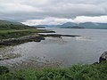
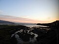
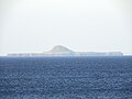
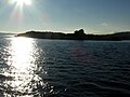
Category:Isle of Mull
Jump to navigation
Jump to search
second-largest Inner Hebrides island (after Skye) off the west coast of Scotland .jpg)  | |||||
| Upload media | |||||
| Instance of | |||||
|---|---|---|---|---|---|
| Part of | |||||
| Location | Argyll and Bute, Scotland | ||||
| Located in or next to body of water | |||||
| Capital | |||||
| Highest point |
| ||||
| Population |
| ||||
| Area |
| ||||
 | |||||
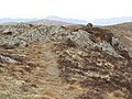
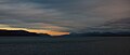
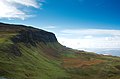
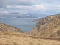
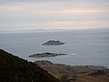
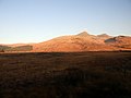
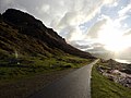
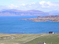
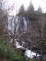
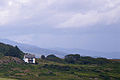
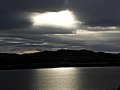
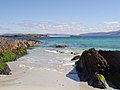
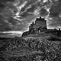
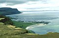
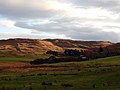
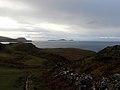
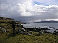
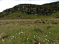
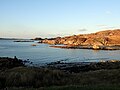
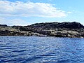
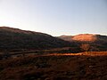
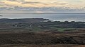
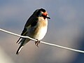
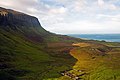
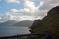
English: The Isle of Mull or simply Mull (Scottish Gaelic: Muile) is the second largest island of the Inner Hebrides, off the west coast of Scotland in the council area of Argyll and Bute. Its southern coast is a Site of SPecial Scientific Interest.
Subcategories
This category has the following 28 subcategories, out of 28 total.
- Maps of the Isle of Mull (37 F)
*
A
B
- Abhainn Bail' a' Mhuilinn (3 F)
- Beinn Bhuidhe, Ballygown (2 F)
- Beinn Bhuidhe, Ensay (3 F)
- Beinn Fhada, Scarisdale (35 F)
- Beinn Fhada, Strathcoil (2 F)
C
- Creag Mhòr, Isle of Mull (5 F)
- Allt na Criche, Killbeg (1 F)
E
- Eas Mor, Isle of Mull (4 F)
F
- Fishnish (22 F)
- Flora of the Isle of Mull (12 F)
G
- Glenforsa Airfield (9 F)
K
M
- Macquarie Mausoleum (12 F)
S
- Sunsets of the Isle of Mull (9 F)
T
Media in category "Isle of Mull"
The following 200 files are in this category, out of 515 total.
(previous page) (next page)-
 'S Airde Beinn - geograph.org.uk - 452535.jpg 640 × 480; 101 KB
-
 'S Airde Beinn - geograph.org.uk - 75135.jpg 640 × 480; 111 KB
-
 'S Airde Bheinn - geograph.org.uk - 452889.jpg 640 × 141; 29 KB
-
 2012 - Trip to Mull (8114201773).jpg 4,928 × 3,264; 2.04 MB
-
 2012 - Trip to Mull (8114201948).jpg 4,928 × 3,264; 1.6 MB
-
 2012 - Trip to Mull (8114202532).jpg 4,928 × 2,097; 538 KB
-
 2012 - Trip to Mull (8114203239).jpg 4,928 × 3,264; 1.98 MB
-
 2012 - Trip to Mull (8114212729).jpg 4,928 × 3,264; 2.18 MB
-
 2012 - Trip to Mull (8114213370).jpg 4,928 × 3,264; 1.73 MB
-
 2012 - Trip to Mull (8114213835).jpg 4,928 × 3,264; 1.74 MB
-
 2012 - Trip to Mull (8114217708).jpg 4,928 × 3,264; 2.04 MB
-
 2012 - Trip to Mull (8114236205).jpg 4,928 × 3,264; 2.98 MB
-
 A clear day in Argyll - geograph.org.uk - 6158682.jpg 1,024 × 768; 193 KB
-
 A good place to camp - geograph.org.uk - 410191.jpg 640 × 412; 63 KB
-
-
 Abandoned croft on Mull (31107981407).jpg 5,184 × 3,888; 8.26 MB
-
 Abandoned pier on Calgary Bay, Isle of Mull. - geograph.org.uk - 2379471.jpg 1,280 × 960; 500 KB
-
 Afternoon sun over Mull (8114230645).jpg 4,928 × 3,264; 2.61 MB
-
 Aird Mor - geograph.org.uk - 6147969.jpg 3,085 × 2,311; 1.76 MB
-
 Airigh Mhic Cribhain - geograph.org.uk - 1409779.jpg 640 × 479; 79 KB
-
 Allt an Dearc - geograph.org.uk - 993001.jpg 640 × 480; 87 KB
-
 Allt Bealach an Eilean - geograph.org.uk - 194472.jpg 480 × 640; 129 KB
-
 Allt Gualann na Gearra - geograph.org.uk - 183933.jpg 480 × 640; 98 KB
-
 Am Fraoch-eilean - geograph.org.uk - 4567308.jpg 640 × 480; 368 KB
-
 An Cruachen, Jura - geograph.org.uk - 46142.jpg 640 × 480; 56 KB
-
 An Leth Fhonn (44231166420).jpg 5,184 × 3,888; 8.05 MB
-
 An Leth Fhonn (44231219130).jpg 4,421 × 911; 1.03 MB
-
 An Leth Fhonn and Ben More (46047129871).jpg 5,184 × 3,888; 8.46 MB
-
 An Speireachan - geograph.org.uk - 176814.jpg 640 × 480; 103 KB
-
 Aoineadh Mor (32176128158).jpg 5,184 × 3,888; 7.4 MB
-
 Approaching Mull (45135360265).jpg 5,184 × 3,888; 8.72 MB
-
 Ardalanish.jpg 399 × 154; 11 KB
-
 Ardmeanach on Mull from Iona.JPG 2,816 × 2,112; 1.32 MB
-
 Ardmore - geograph.org.uk - 108466.jpg 640 × 420; 106 KB
-
 Arinasliseig - geograph.org.uk - 20341.jpg 640 × 480; 59 KB
-
 Aros (45135307715).jpg 5,184 × 3,888; 7.54 MB
-
 Aros bay, Isle of Mull.JPG 3,264 × 2,448; 2.59 MB
-
 Aros Falls near Tobermory.JPG 2,112 × 2,816; 1,023 KB
-
 Arosbaygeograph.jpg 640 × 426; 110 KB
-
 At Fionnphort, on the south-west of the Isle of Mull (9734052959).jpg 1,600 × 533; 1.06 MB
-
 Balnahard (31108139307).jpg 5,184 × 3,888; 8.66 MB
-
 Basalt columns, Eilean a' Bhuic - geograph.org.uk - 2456380.jpg 640 × 359; 180 KB
-
 Basalt Rock Formation - geograph.org.uk - 180882.jpg 640 × 480; 132 KB
-
 Bearraich (44231100380).jpg 5,184 × 3,888; 8.42 MB
-
 Bearraich (45997219332).jpg 5,184 × 3,888; 9.85 MB
-
 Beinn Bhuidhe-Geograph-3469906.jpg 2,560 × 1,920; 2.91 MB
-
 Beinn na Croise-Geograph-4447666.jpg 1,500 × 855; 1.17 MB
-
 Beinn na Duatharach-Geograph-2357817.jpg 640 × 480; 304 KB
-
 Beinn na Duatharach-Geograph-2427710.jpg 640 × 480; 285 KB
-
 Beinn na Srèine-Geograph-4388370.jpg 800 × 600; 429 KB
-
 Ben Hiant in Ardnamurchan in Scotland - 2012-08-18.jpg 4,581 × 3,054; 3.11 MB
-
 Ben More (46047048161).jpg 5,184 × 3,888; 7.75 MB
-
 Benderloch Ardmucknish Bay seen from A828 1.jpg 5,892 × 3,832; 11.52 MB
-
 Benderloch Ardmucknish Bay seen from A828 2.jpg 4,944 × 3,076; 7.75 MB
-
 Bike, letterbox and Ben More.jpg 1,024 × 768; 312 KB
-
 Black's Memorial Lighthouse (45322821954).jpg 5,184 × 3,888; 8.45 MB
-
 Blar Mor (32176013188).jpg 5,184 × 3,888; 7.58 MB
-
 Blar Mor (46047064441).jpg 5,184 × 3,888; 8.17 MB
-
 Boats On Isle Of Mull (228836447).jpeg 1,367 × 2,048; 1.45 MB
-
 Boats On Isle Of Mull Ii (228837347).jpeg 2,048 × 1,367; 1.16 MB
-
 Boulder Field, Balnahard - geograph.org.uk - 193855.jpg 640 × 480; 89 KB
-
 Bunessan (32176016548).jpg 5,184 × 3,888; 8.71 MB
-
 Bunessan (44231156520).jpg 5,184 × 3,888; 7.75 MB
-
 Bunessan (46047067311).jpg 5,184 × 3,888; 7.12 MB
-

-
 Bus stop, Mull, Scotland, Sept. 2010 - Flickr - PhillipC.jpg 3,825 × 2,384; 2.16 MB
-
 Cairn na Burgh Beg - Birds taking flight - geograph.org.uk - 5834080.jpg 1,500 × 1,000; 1.37 MB
-
 Calgary Bay (31108022907).jpg 5,184 × 3,888; 7.28 MB
-
 Calgary Bay (32175926218).jpg 5,184 × 3,888; 7.79 MB
-
 Calgary Bay (32175932298).jpg 5,184 × 3,888; 7.81 MB
-
 Calgary Bay (44231001420).jpg 5,184 × 3,888; 7.67 MB
-
 Calgary Bay (45135118015).jpg 5,184 × 3,888; 8.47 MB
-
 Calgary Bay (46046986501).jpg 4,074 × 911; 942 KB
-
 Calgary Bay Pier (45322540294).jpg 5,184 × 3,888; 7.96 MB
-
 CalMac Ferry in the Sound of Mull (44231259730).jpg 5,184 × 3,888; 8.5 MB
-
 CalMac Ferry in the Sound of Mull (44231261590).jpg 5,184 × 3,888; 7.77 MB
-
 Camas Ban (32176245688).jpg 5,184 × 3,888; 8.88 MB
-
 Canoeist and dog - geograph.org.uk - 877660.jpg 640 × 480; 55 KB
-
 Caolas Annraidh - geograph.org.uk - 1916764.jpg 2,560 × 1,920; 912 KB
-
 Caolas Annraidh - geograph.org.uk - 5849415.jpg 1,600 × 969; 205 KB
-
 Car park entrance at Dun Earba - geograph.org.uk - 5518615.jpg 1,024 × 768; 260 KB
-
 Carraig Ghilliondrais - geograph.org.uk - 5796322.jpg 3,840 × 2,160; 3.47 MB
-
 Castle (24139847).jpeg 1,600 × 1,600; 535 KB
-
 Clear Felling, Ardmore Forest - geograph.org.uk - 194491.jpg 640 × 480; 123 KB
-
 Cliffs above Gribun - geograph.org.uk - 828545.jpg 640 × 411; 54 KB
-
 Cnoc Fuar - geograph.org.uk - 183962.jpg 640 × 480; 63 KB
-
 Cnoc Odhar (46046996791).jpg 5,184 × 3,888; 7.32 MB
-
 Cnoc Udmail (31107982107).jpg 5,184 × 3,888; 7.78 MB
-
 Cnoc Udmail (31107983867).jpg 5,184 × 3,888; 7.98 MB
-
 Coastline at Sgeir Ruadh - geograph.org.uk - 4772941.jpg 640 × 480; 59 KB
-
-
 Coastline of Mull - geograph.org.uk - 4504238.jpg 2,560 × 1,920; 2.37 MB
-
 Coastline south of Quinish Point - geograph.org.uk - 1962804.jpg 640 × 374; 58 KB
-
 Coll seen from Mull (31107975947).jpg 5,184 × 3,888; 11.21 MB
-
 Columnar Basalt (9721854404).jpg 1,280 × 1,134; 1.75 MB
-
 Columnar Basalt (9732274820).jpg 2,048 × 1,662; 4.07 MB
-
 Columnar Basalt (9735614291).jpg 2,048 × 1,382; 4.29 MB
-
 Corr-Sgeir - geograph.org.uk - 6147220.jpg 3,984 × 2,988; 3.52 MB
-
 Crab carapace and attachments (13928929235).jpg 4,928 × 3,264; 1.68 MB
-
 Crags, Cairn na Burgh Beg - geograph.org.uk - 2455434.jpg 640 × 359; 204 KB
-
 Crags, Mishnish - geograph.org.uk - 183967.jpg 640 × 480; 99 KB
-
 Crannog in Loch Sguabain - geograph.org.uk - 408497.jpg 431 × 640; 112 KB
-
 Creach Bheinn-Geograph-4502329.jpg 2,526 × 1,874; 2.38 MB
-
 Creag Mhor (32176124258).jpg 5,184 × 3,888; 8.22 MB
-
 Creag Mhor, Mull - geograph.org.uk - 828510.jpg 640 × 422; 43 KB
-
 Creagg a Ghaill (45997283352).jpg 5,184 × 3,888; 8.74 MB
-
 Cruach Torr an Lochain-Geograph-4506397.jpg 2,560 × 1,920; 2.19 MB
-
 Cruachan Mìn - geograph.org.uk - 457908.jpg 640 × 480; 100 KB
-
 Cùl a' Gheata - geograph.org.uk - 3045516.jpg 600 × 450; 74 KB
-
 Dearg Sgeir and Eileanan Glasa - geograph.org.uk - 2069700.jpg 3,236 × 1,632; 817 KB
-
 Dearg Sgeir and Eileanan Glasa - geograph.org.uk - 3991527.jpg 1,600 × 1,064; 231 KB
-
 Deep gorge cutting into Erraid - geograph.org.uk - 6144201.jpg 3,366 × 1,840; 1.42 MB
-
 Deer, Cruach na Seilcheig - geograph.org.uk - 992410.jpg 640 × 480; 86 KB
-
 Derelict Boats Beached on the Isle of Mull - panoramio.jpg 4,320 × 3,240; 2.35 MB
-
 Derelict Boats on the Isle of Mull - panoramio.jpg 4,320 × 3,240; 2.82 MB
-

-

-
 Disappearing Square - geograph.org.uk - 2979186.jpg 640 × 413; 320 KB
-
 DSCN6050 (44231192310).jpg 5,184 × 3,888; 7.31 MB
-
 DSCN6052 (45997038602).jpg 5,184 × 3,888; 7.82 MB
-
 DSCN6055 (31108118147).jpg 5,184 × 3,888; 8 MB
-
 DSCN6114 (45997190072).jpg 5,184 × 3,888; 9.95 MB
-
 DSCN6259 (45135041125).jpg 5,184 × 3,888; 9.17 MB
-
 DSCN6260 (45135082325).jpg 5,184 × 3,888; 9.04 MB
-
 Duart Point (45997039772).jpg 5,184 × 3,888; 9.03 MB
-
 Duart Point (45997062172).jpg 5,184 × 3,888; 8.86 MB
-
 Duart Point (46046974611).jpg 5,184 × 3,888; 9.19 MB
-
 Dubh Sgeir with Mull beyond - geograph.org.uk - 2393525.jpg 1,024 × 569; 501 KB
-
 Dun I (45997192472).jpg 5,184 × 3,888; 8.09 MB
-
 Dyke Mull ss 2007.JPG 1,600 × 1,200; 971 KB
-
 Easter 2013 (8619884829).jpg 4,928 × 3,264; 1.93 MB
-
 Easter 2013 (8619910759).jpg 4,227 × 2,818; 1.53 MB
-
 Easter 2013 (8619912959).jpg 4,928 × 3,264; 1.56 MB
-
 Easter 2013 (8620989738).jpg 4,928 × 3,264; 3.93 MB
-
 Easter 2013 (8620990678).jpg 3,264 × 4,928; 1.99 MB
-
 Edge of Eilean na Seamair - geograph.org.uk - 6147966.jpg 2,625 × 1,969; 1.12 MB
-
 Eilean Mor - geograph.org.uk - 570765.jpg 640 × 480; 80 KB
-
 Eilean Musdile (31108228677).jpg 5,184 × 3,888; 9.1 MB
-
 End of the Rocks - geograph.org.uk - 2979178.jpg 640 × 417; 298 KB
-
 End of the track - geograph.org.uk - 175752.jpg 640 × 480; 80 KB
-
 Entering Oban Harbour (46046962791).jpg 5,184 × 3,888; 7.98 MB
-
 Entering the Sound of Mull at Duart point (45322815854).jpg 5,184 × 3,888; 8.35 MB
-
 Entrance to Loch Feochan, Mull beyond - geograph.org.uk - 101179.jpg 640 × 388; 68 KB
-
 Eorsa - geograph.org.uk - 596785.jpg 600 × 402; 154 KB
-
 Eos Fors (Isle of Mull) 1.jpg 4,000 × 6,016; 6.42 MB
-
 Eos Fors (Isle of Mull) 2.jpg 6,016 × 4,000; 6.42 MB
-
 Eos Fors (Isle of Mull) 3.jpg 6,016 × 4,000; 6.37 MB
-
 Eos Fors (Isle of Mull) 4.jpg 6,016 × 4,000; 6.47 MB
-
 Fence, Ardmore Forest - geograph.org.uk - 181516.jpg 480 × 640; 129 KB
-
 Fields Off the Glengorm Road - geograph.org.uk - 183930.jpg 640 × 480; 56 KB
-
 Fionnphort (32176019998).jpg 5,184 × 3,888; 9.22 MB
-
 Fionnphort (32176021448).jpg 5,184 × 3,888; 8.82 MB
-
 Fionnphort (32176084648).jpg 5,184 × 3,888; 7.83 MB
-
 Fisherman's Pier Fish and Chips (45322494894).jpg 5,184 × 3,888; 8.2 MB
-
 Footpath From Burg, Ladder - geograph.org.uk - 185216.jpg 640 × 480; 137 KB
-
 Ford on the River Bà - geograph.org.uk - 877663.jpg 640 × 480; 96 KB
-
 Foreshore near Kellan - geograph.org.uk - 6179325.jpg 2,448 × 3,264; 3.28 MB
-
 Forest Gate, Ardmore - geograph.org.uk - 184123.jpg 640 × 480; 83 KB
-
 Forestry Dept office and depot - geograph.org.uk - 175486.jpg 640 × 480; 97 KB
-
 Forestry pier at Rubha na Leitreach - geograph.org.uk - 5518314.jpg 1,024 × 768; 116 KB
-
 From St Oran's to Mull - geograph.org.uk - 743176.jpg 1,744 × 1,307; 1.42 MB
-
 From the ferry to Oban (46046967661).jpg 5,184 × 3,888; 9.82 MB
-
 Full Moon over Mull (45997245052).jpg 5,184 × 3,888; 3 MB
-
 Gamhnach Mhòr - geograph.org.uk - 6147212.jpg 4,000 × 3,000; 5.7 MB
-
 Gamhnach Mhòr - geograph.org.uk - 6147215.jpg 4,000 × 3,000; 5.62 MB
-
 Gaodhail - geograph.org.uk - 175234.jpg 640 × 480; 122 KB
-
 Geograph-5976374-by-Andrew-Wood-Andrea Geile.jpg 4,930 × 3,698; 4.05 MB
-
 Glas Eileanan - geograph.org.uk - 166820.jpg 640 × 480; 96 KB
-
 Glas Eileanan, Sound of Mull - geograph.org.uk - 1899011.jpg 1,600 × 1,067; 259 KB
-
 Glen More (31107936587).jpg 5,184 × 3,888; 7.18 MB
-
 Glen More (31108116667).jpg 5,184 × 3,888; 9.94 MB
-
 Glen More (31108161957).jpg 5,184 × 3,888; 8.84 MB
-
 Glen More (32176144648).jpg 5,184 × 3,888; 8 MB
-
 Glen More (32176146258).jpg 5,184 × 3,888; 8.53 MB
-
 Glen More (44231168370).jpg 5,184 × 3,888; 8.46 MB
-
 Glen More (44231176690).jpg 5,184 × 3,888; 7.08 MB
-
 Glen More (45997235852).jpg 5,184 × 3,888; 7.74 MB
-
 Glengorm from Cnoc Fuar.jpg 1,438 × 806; 453 KB
-
 Glimpse of Na Maoil Mhòra - geograph.org.uk - 6147986.jpg 2,264 × 1,697; 909 KB
-
 Goldfinch on Iona (32176030788).jpg 5,184 × 3,888; 5.37 MB
-
 Goldfinch on Iona (45135202065).jpg 5,184 × 3,888; 6.2 MB
-
 Grave of an Unknown Merchant Seaman (45322647954).jpg 3,888 × 5,184; 8.33 MB
-
 Grave of John Smith on Iona (46047106111).jpg 3,888 × 5,184; 8.31 MB
-
 Gribun (45135274185).jpg 5,184 × 3,888; 9.89 MB
-
 Gribun, Mull, Scotland, 15 Sept. 2010 - Flickr - PhillipC (1).jpg 4,288 × 2,848; 2.84 MB
-
 Gribun, Mull, Scotland, 15 Sept. 2010 - Flickr - PhillipC.jpg 4,288 × 2,848; 2.11 MB
-
 Gribun, Mull, Scotland, Sept. 2010 - Flickr - PhillipC (1).jpg 3,825 × 2,384; 1.86 MB
-
 Gribun, Mull, Scotland, Sept. 2010 - Flickr - PhillipC.jpg 4,288 × 2,848; 3.2 MB
-
GT Isle of Mull.ogg 1.7 s; 20 KB
-
GT Muile.ogg 0.8 s; 11 KB
-
 Guirdil Bay - geograph.org.uk - 6454402.jpg 2,660 × 1,486; 780 KB
-
 Harbour Seal near Grasspoint Mull - geograph.org.uk - 1806662.jpg 2,784 × 1,856; 509 KB
-
 Helicopter filling water bucket in Tobermory Bay (44231269030).jpg 5,184 × 3,888; 9.21 MB
-
 Helicopter filling water bucket in Tobermory Bay (46047210791).jpg 5,184 × 3,888; 8.58 MB
-
 Heron at Calgary Bay (45135134585).jpg 5,184 × 3,888; 8.17 MB
-
 Heron at Calgary Bay (45135135885).jpg 5,184 × 3,888; 8.16 MB
-
 Heron on Loch na Keal. - geograph.org.uk - 877673.jpg 640 × 480; 96 KB
-

-
 Hispania Wreck NLB Buoy.JPG 3,072 × 2,304; 3.03 MB
-
 Hooded Crow on Iona (45997183232).jpg 5,184 × 3,888; 7.82 MB


.jpg)
.jpg)
.jpg)
.jpg)
.jpg)
.jpg)
.jpg)
.jpg)
.jpg)

_title_page.png)
.jpg)

.jpg)


.jpg)
.jpg)

.jpg)
.jpg)


.jpg)


.jpg)


.jpg)
.jpg)


.jpg)


.jpg)
.jpg)
.jpg)
.jpeg)
.jpeg)

.jpg)
.jpg)
.jpg)
_-_geograph.org.uk_-_811170.jpg)


.jpg)
.jpg)
.jpg)
.jpg)
.jpg)
.jpg)
.jpg)
.jpg)
.jpg)


.jpeg)


.jpg)
.jpg)
.jpg)


.jpg)
.jpg)
.jpg)
.jpg)

.jpg)


.jpg)

.jpg)


.jpg)

.jpg)
.jpg)
.jpg)
.jpg)
.jpg)
.jpg)
.jpg)
.jpg)
.jpg)

.jpg)

.jpg)
.jpg)
.jpg)
.jpg)
.jpg)


.jpg)


.jpg)
.jpg)


_1.jpg)
_2.jpg)
_3.jpg)
_4.jpg)


.jpg)
.jpg)
.jpg)
.jpg)


.jpg)
.jpg)


.jpg)
.jpg)
.jpg)
.jpg)
.jpg)
.jpg)
.jpg)
.jpg)


.jpg)
.jpg)
.jpg)
.jpg)
.jpg)
.jpg)

.jpg)


.jpg)
.jpg)
.jpg)
.jpg)


.jpg)
.jpg)
.jpg)
.jpg)