Category:Isles of Scilly
Jump to navigation
Jump to search
Brezhoneg: Inizi Sillan eo anv un enezeg eus Kernev-Veur lec'hiet da 28 milmor e Su-mervent Land's End.
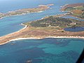
English: The Isles of Scilly are a group of islands 28 miles SSW of Land's End in Cornwall.
Français : Les îles Scilly, anciennement Sorlingues, (Angleterre: Isles of Scilly), forment un archipel situé à l'extrèmité ouest de la Manche, au point de rencontre de celle-ci avec l'océan Atlantique et au sud-ouest de la péninsule de Cornouailles. Elles s'étendent sur une superficie de 16,33 km².
Slovenščina: Otoki Scilly so otoška skupina 45 kilometrov severoseverozahodno od rta Land's End v Cornwallu.
archipelago and local government district off the south-westernmost point of mainland Britain    | |||||
| Upload media | |||||
| Instance of |
| ||||
|---|---|---|---|---|---|
| Part of | |||||
| Location | Cornwall, South West England, England | ||||
| Located in or next to body of water | |||||
| Capital | |||||
| Legislative body |
| ||||
| Has part(s) | |||||
| Heritage designation | |||||
| Population |
| ||||
| Area |
| ||||
| Elevation above sea level |
| ||||
| Different from | |||||
| official website | |||||
 | |||||
Subcategories
This category has the following 14 subcategories, out of 14 total.
Media in category "Isles of Scilly"
The following 133 files are in this category, out of 133 total.
-
 Baner ynysek Syllan.svg 1,000 × 600; 1 KB
-
-
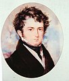 Augustus Smith c. 1826.jpg 740 × 866; 295 KB
-
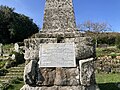 Augustus Smith Memorial, Old Town Churchyard (Closeup).jpg 4,032 × 3,024; 6.52 MB
-
 Augustus Smith Memorial, Old Town Churchyard.jpg 3,024 × 4,032; 3.13 MB
-
 Bar Point St Mary's Scilly - geograph.org.uk - 6203750.jpg 640 × 409; 41 KB
-
 Biggal rock - geograph.org.uk - 5397634.jpg 3,264 × 2,448; 2.01 MB
-
 Biggal rock - geograph.org.uk - 5777312.jpg 5,472 × 3,648; 4.76 MB
-
 Bishop Rock Lighthouse - geograph.org.uk - 2733399.jpg 768 × 1,024; 117 KB
-
 Bishop Rock Lighthouse - geograph.org.uk - 5326520.jpg 2,048 × 1,360; 1.41 MB
-
 Black Rock in the distance - geograph.org.uk - 5142267.jpg 3,648 × 2,432; 2.95 MB
-
 Broad Ledge and Yellow Ledge - geograph.org.uk - 2372663.jpg 640 × 480; 72 KB
-
 Camber Rock - geograph.org.uk - 3446249.jpg 2,592 × 1,944; 1.09 MB
-
 Camber Rocks - geograph.org.uk - 5142277.jpg 2,793 × 1,862; 1.02 MB
-
 Camber Rocks - geograph.org.uk - 5142284.jpg 3,648 × 2,432; 3.13 MB
-
 Chimney Rocks from the South - geograph.org.uk - 3665773.jpg 640 × 290; 46 KB
-
 Cliff on Hanjague - geograph.org.uk - 2366233.jpg 480 × 640; 74 KB
-

-
 Council of the Isles of Scilly composition.svg 360 × 185; 1 KB
-

-

-

-
 Creeb - geograph.org.uk - 2365706.jpg 640 × 480; 70 KB
-
 Creeb and Halangy Down - geograph.org.uk - 2368141.jpg 640 × 480; 59 KB
-
 Crow Rock - geograph.org.uk - 1968569.jpg 640 × 426; 70 KB
-

-
 Crow Rock marker - geograph.org.uk - 3451503.jpg 1,478 × 1,103; 573 KB
-
 Crow Rock Marker, Isles of Scilly - geograph.org.uk - 3400208.jpg 4,000 × 1,666; 5.61 MB
-
 Didley's Point - geograph.org.uk - 5142272.jpg 3,648 × 2,432; 3.03 MB
-
 Dive boat - geograph.org.uk - 2379753.jpg 640 × 480; 71 KB
-
 East Withan off White Island, Scilly - geograph.org.uk - 2601321.jpg 640 × 401; 105 KB
-
 Eastern gap in Men-a-Vaur - geograph.org.uk - 5142323.jpg 3,648 × 2,432; 2.84 MB
-
 England Isles of Scilly Council 2021.svg 360 × 185; 2 KB
-
 Five Islands Academy.jpg 4,032 × 3,024; 2.74 MB
-
 Flag of the Isles of Scilly Steamship Company.svg 900 × 600; 3 KB
-
 Ganilly Bar, Scilly - geograph.org.uk - 2603901.jpg 640 × 180; 44 KB
-
 Golden Ball from the north - geograph.org.uk - 5142331.jpg 3,648 × 2,432; 2.81 MB
-
 Gorregan - geograph.org.uk - 3139912.jpg 640 × 427; 59 KB
-
 Great Cheese Rock - geograph.org.uk - 1968804.jpg 640 × 426; 62 KB
-

-
 Great Rag Ledge - geograph.org.uk - 2366395.jpg 640 × 480; 46 KB
-
 Great Rag Ledge - geograph.org.uk - 3095480.jpg 2,592 × 1,936; 895 KB
-
 Great Smith Rock from the North - geograph.org.uk - 3668594.jpg 640 × 328; 92 KB
-
 Great Smith Rock, north west of St Agnes - geograph.org.uk - 2733402.jpg 1,024 × 768; 164 KB
-
 Great Wingletang - geograph.org.uk - 3145523.jpg 640 × 417; 70 KB
-
 Green Island - geograph.org.uk - 6142788.jpg 3,648 × 2,432; 1.88 MB
-
 Hanjague - geograph.org.uk - 2366224.jpg 640 × 480; 63 KB
-
 Hanjague from the East - geograph.org.uk - 3665790.jpg 640 × 407; 89 KB
-
 Hanjague from the South - geograph.org.uk - 3665784.jpg 640 × 384; 100 KB
-
 Hanjague, Scilly, from the East - geograph.org.uk - 2603807.jpg 640 × 418; 87 KB
-
 Hanjague, Scilly, from the north - geograph.org.uk - 2603802.jpg 640 × 393; 72 KB
-
 Hulman Rock - geograph.org.uk - 3095477.jpg 2,592 × 1,936; 1.24 MB
-
 Isles of Scilly Health and Wellbeing Centre.jpg 4,032 × 3,024; 2.27 MB
-
 Isles of Scilly, UK (ASTER).jpg 852 × 868; 93 KB
-
 ISS065-E-93698 - View of England.jpg 5,568 × 3,712; 8.63 MB
-
 Iss065e093698.jpg 720 × 480; 159 KB
-
 Jacky's Rock - geograph.org.uk - 3145456.jpg 1,024 × 683; 138 KB
-
Jer-Seurlîngue.ogg 1.4 s; 16 KB
-
 Postcard - Wreck of S.S. Lady Charlotte - C. J. King.jpg 1,600 × 964; 230 KB
-

-

-
 Little cheese rock - geograph.org.uk - 3450340.jpg 2,592 × 1,936; 2.01 MB
-
 Little Cheese Rock - geograph.org.uk - 3450349.jpg 1,882 × 1,406; 1.84 MB
-
 Little Cheese Rock at low tide - geograph.org.uk - 3450355.jpg 2,592 × 1,936; 2.02 MB
-
 Little Maiden Bower - geograph.org.uk - 5397628.jpg 3,264 × 2,448; 2.35 MB
-
-
 Melledgan - geograph.org.uk - 3135104.jpg 640 × 427; 46 KB
-
 Men-a-vaur - geograph.org.uk - 3446264.jpg 2,438 × 1,815; 777 KB
-
 Men-a-Vaur - geograph.org.uk - 5142328.jpg 3,648 × 2,432; 2.87 MB
-
 Men-a-Vaur from the north-west - geograph.org.uk - 3650434.jpg 640 × 480; 132 KB
-
 Mincarlo - geograph.org.uk - 1963463.jpg 640 × 426; 74 KB
-
 Mincarlo from the east - geograph.org.uk - 3650441.jpg 640 × 303; 63 KB
-
 Minmanueth Rocks off Annet - geograph.org.uk - 3668599.jpg 1,280 × 328; 150 KB
-
 Mouls - geograph.org.uk - 2366212.jpg 640 × 480; 56 KB
-
 Mouls - geograph.org.uk - 2379769.jpg 640 × 480; 57 KB
-
 Mouls, from the East - geograph.org.uk - 3665794.jpg 640 × 306; 69 KB
-
 Mouls, in the Eastern Isles, Scilly - geograph.org.uk - 1949574.jpg 640 × 285; 54 KB
-
 Nautical chaos - geograph.org.uk - 3446778.jpg 2,592 × 1,936; 1.49 MB
-
 Near Spanish Ledges - Scillies - geograph.org.uk - 34757.jpg 640 × 425; 87 KB
-
 Nut Rock - geograph.org.uk - 1965333.jpg 640 × 426; 75 KB
-
 Nut Rock - geograph.org.uk - 2174963.jpg 640 × 480; 44 KB
-
 Nut Rock - geograph.org.uk - 3446772.jpg 2,592 × 1,936; 1.97 MB
-
 Nut Rock in St Mary's Sound, Scilly - geograph.org.uk - 2607290.jpg 640 × 294; 52 KB
-
 Old Woman's House - geograph.org.uk - 2366247.jpg 640 × 480; 57 KB
-
 Outer Colvel Rock - geograph.org.uk - 2172445.jpg 640 × 480; 82 KB
-
 Passing Stoney Island, Isles of Scilly - geograph.org.uk - 3396621.jpg 4,000 × 1,925; 6.11 MB
-
 Porth Arlo beach, St Marys, Scilly.jpg 4,000 × 2,805; 2.24 MB
-
 Proposed flags of the Isles of Scilly 2rd place.svg 938 × 469; 4 KB
-
 Proposed flags of the Isles of Scilly 3rd place.svg 938 × 469; 5 KB
-
 Proposed flags of the Isles of Scilly 4th place.svg 938 × 469; 7 KB
-
 Proposed flags of the Isles of Scilly 5th place.svg 938 × 469; 9 KB
-
 Proposed flags of the Isles of Scilly 6th place.svg 938 × 469; 10 KB
-
 Proposed flags of the Isles of Scilly 7th place.svg 938 × 469; 11 KB
-
 Proposed flags of the Isles of Scilly 8th place.svg 938 × 469; 11 KB
-
 Proposed flags of the Isles of Scilly 9th place.svg 938 × 469; 11 KB
-
 Radio Times - 1928-03-11 - page 22 (lower).jpg 516 × 316; 34 KB
-

-

-

-
 Ruined Cottage on Rosevear - geograph.org.uk - 3145399.jpg 640 × 427; 79 KB
-
 ScillonianCross.svg 1,000 × 500; 695 bytes
-
 Scillonian Cross.png 599 × 301; 3 KB
-
 Scilly Rock - geograph.org.uk - 1960925.jpg 640 × 426; 67 KB
-
 Scilly Rock - geograph.org.uk - 2315950.jpg 640 × 480; 68 KB
-
 Scilly Rock - geograph.org.uk - 5395946.jpg 3,264 × 2,448; 2.55 MB
-
 Scilly Rock from the south-west - geograph.org.uk - 3653559.jpg 640 × 327; 70 KB
-
 Seals on Scilly Rock - geograph.org.uk - 1960927.jpg 640 × 426; 153 KB
-
 Shag Rocks from the South - geograph.org.uk - 3665782.jpg 640 × 328; 65 KB
-
 Shags on Great Wingletang - geograph.org.uk - 3145531.jpg 640 × 427; 64 KB
-
 Shags on Mincarlo - geograph.org.uk - 1963466.jpg 640 × 426; 144 KB
-
 Shipman Head - geograph.org.uk - 2315538.jpg 640 × 480; 63 KB
-
 Soldier Beetles on Wild Carrot (2969661170).jpg 2,593 × 1,608; 1.05 MB
-
 Southward Well Point and Samson - geograph.org.uk - 3446763.jpg 2,592 × 1,936; 1.88 MB
-
 St Marys Scilly 2021.jpg 3,840 × 2,160; 1.63 MB
-
 Swimming with seals - geograph.org.uk - 2379751.jpg 640 × 480; 80 KB
-
 Swimming with seals - geograph.org.uk - 2379755.jpg 640 × 480; 83 KB
-
 The Cow - geograph.org.uk - 1947310.jpg 640 × 426; 54 KB
-
 The end of South Cuckoo - geograph.org.uk - 5395950.jpg 4,631 × 3,087; 3.1 MB
-
 The gap between Scilly Rock and South Cuckoo - geograph.org.uk - 5395954.jpg 4,871 × 3,002; 3.9 MB
-
 The Gilstone, Western Rocks - geograph.org.uk - 2733397.jpg 1,024 × 768; 135 KB
-
 The Haycocks - geograph.org.uk - 2315561.jpg 640 × 480; 53 KB
-
 The Mare - geograph.org.uk - 2366421.jpg 640 × 480; 51 KB
-
 The marker on Crow Rock - geograph.org.uk - 5142256.jpg 2,441 × 1,627; 989 KB
-
 The north end of St Helen's - geograph.org.uk - 5142321.jpg 3,648 × 2,432; 2.79 MB
-
 The Northern end of Mincarlo - geograph.org.uk - 2923329.jpg 3,072 × 2,304; 2.87 MB
-
 The remains of Ennor Castle (Isles of Scilly).jpg 4,032 × 3,024; 1.6 MB
-
 The Southern tip of Mincarlo - geograph.org.uk - 2923324.jpg 3,072 × 2,304; 2.54 MB
-
 The Southernmost point of Southward Well Point - geograph.org.uk - 2923340.jpg 3,072 × 2,304; 2.92 MB
-
 Trenemene - geograph.org.uk - 3141058.jpg 640 × 427; 67 KB
-
 Wally the Walrus in St Mary’s Harbour.jpg 3,024 × 4,032; 1.19 MB
-
 A week in the Isles of Scilly (IA weekinislesofsci00nortiala).pdf 839 × 1,258, 228 pages; 19.25 MB
-

-
 Yellow Ledge - geograph.org.uk - 6142785.jpg 3,648 × 2,432; 2.09 MB


.jpg)


.jpg)


.jpg)


.jpg)


.jpg)


