Category:Jagdschloss Forst
Jump to navigation
Jump to search
| Object location | | View all coordinates using: OpenStreetMap |
|---|
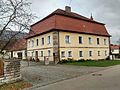
This is the category of the Bavarian Baudenkmal (cultural heritage monument) with the ID D-5-71-217-16 (Wikidata)
|
| NO WIKIDATA ID FOUND! Search for Jagdschloss Forst on Wikidata | |
| Upload media |
Media in category "Jagdschloss Forst"
The following 2 files are in this category, out of 2 total.
-
 Schloss Forst 1.jpg 2,592 × 1,944; 1.41 MB
-
 Schloss Forst 2.jpg 2,592 × 1,944; 1.81 MB

