Category:Johnson County, Arkansas
Vai alla navigazione
Vai alla ricerca
Counties of Arkansas: Arkansas · Ashley · Baxter · Benton · Boone · Bradley · Calhoun · Carroll · Chicot · Clark · Clay · Cleburne · Cleveland · Columbia · Conway · Craighead · Crawford · Crittenden · Cross · Dallas · Desha · Drew · Faulkner · Franklin · Fulton · Garland · Grant · Greene · Hempstead · Hot Spring · Howard · Independence · Izard · Jackson · Jefferson · Johnson · Lafayette · Lawrence · Lee · Lincoln · Little River · Logan · Lonoke · Madison · Marion · Miller · Mississippi · Monroe · Montgomery · Nevada · Newton · Ouachita · Perry · Phillips · Pike · Poinsett · Polk · Pope · Prairie · Pulaski · Randolph · Saline · Scott · Searcy · Sebastian · Sevier · Sharp · St. Francis · Stone · Union · Van Buren · Washington · White · Woodruff · Yell
contea dello stato dell'Arkansas   | |||||
| Carica un file multimediale | |||||
| Istanza di | |||||
|---|---|---|---|---|---|
| Prende il nome da |
| ||||
| Luogo | Arkansas, Stati Uniti d'America | ||||
| Capitale | |||||
| Data di fondazione o creazione |
| ||||
| Popolazione |
| ||||
| Superficie |
| ||||
| Distinto da | |||||
| sito web ufficiale | |||||
 | |||||
Sottocategorie
Questa categoria contiene le 10 sottocategorie indicate di seguito, su un totale di 10.
File nella categoria "Johnson County, Arkansas"
Questa categoria contiene 23 file, indicati di seguito, su un totale di 23.
-
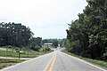
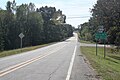 AR 164 south of I-40.jpg 3 888 × 2 592; 2,84 MB
-
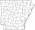
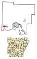
 ARMap-doton-Clarksville.png 300 × 262; 13 KB
-
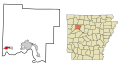
 ARMap-doton-Coal Hill.png 300 × 262; 13 KB
-
 ARMap-doton-Hartman.png 300 × 262; 13 KB
-
 ARMap-doton-Knoxville.png 300 × 262; 13 KB
-
 ARMap-doton-Lamar.png 300 × 262; 13 KB
-
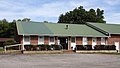 Coal Hill, AR City Hall.jpg 3 887 × 2 187; 2,19 MB
-
 Hartman, AR City Hall.jpg 3 542 × 2 361; 1,29 MB
-
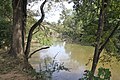
 Horsehead Creek Hartman, AR 1.jpg 3 888 × 2 592; 3,69 MB
-
 Horsehead Creek Hartman, AR 2.jpg 3 888 × 2 592; 3,44 MB
-

-
-
-

-

-

-
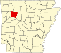 Map of Arkansas highlighting Johnson County.svg 1 278 × 1 113; 90 KB
-
 Ozark Highlands Scenic Byway.gif 400 × 400; 40 KB
-
 Parker Ridge Overlook - panoramio.jpg 5 726 × 1 000; 3,23 MB
-
 Pilot's Knob Road - panoramio.jpg 6 000 × 950; 2,74 MB
-
 Southern terminus of AR 164 in Coal Hill.jpg 2 829 × 1 887; 1,2 MB
-
 USA Johnson County, Arkansas age pyramid.svg 520 × 600; 7 KB
-
 Westside HS, Johnson Co, AR.jpg 3 851 × 2 166; 1,41 MB


