Category:June 2005 in North Yorkshire
Jump to navigation
Jump to search
Deutsch: Bilder, die im Juni 2005 in North Yorkshire aufgenommen worden sind. Bitte beachten Sie, dass dies weder das Datum des Uploads noch das Datum des Scannens eines Fotos ist.
English: Images/pictures taken in North Yorkshire during June 2005. Note this is not the date of the upload, nor the date a photo was scanned.
Español: Fotografías o imágenes tomadas en North Yorkshire durante junio 2005. No es la fecha de subida ni escaneo, sino la fecha en que las fotografías o imágenes se crearon.
Esperanto: Bildoj faritaj en North Yorkshire en junio 2005. Tio ne estas la dato, kiam la bildoj estis alŝutitaj aŭ skanitaj.
Français : Photographies ou images prises en North Yorkshire durant juin 2005. Ce n'est pas la date du téléchargement ou du scan.
Galego: Fotografías ou imaxes tomadas en North Yorkshire durante xuño 2005. Non é a data de subida nin escaneamento, senón a data na que se crearon as fotografías ou imaxes.
Italiano: Fotografie o immagini scattate a North Yorkshire nel giugno 2005. Nota bene: la data non si riferisce né a quella di upload né a quella in cui la foto è stata digitalizzata.
Norsk bokmål: Bilder tatt i North Yorkshire i løpet av juni 2005. Merk at dette ikke er datoen for opplasting, eller når et bilde har blitt skannet.
Norsk nynorsk: Bilete teke i North Yorkshire i løpet av juni 2005. Merk at dette ikkje er datoen for opplasting, eller når eit bilete har vorte skanna.
Русский: Изображения, сделанные в North Yorkshire в течение июнь 2005 (не дата загрузки изображения).
Українська: Зображення, зроблені в North Yorkshire протягом червень 2005. Зауважте, що це не дата завантаження чи дата сканування фотографії.
| June 2004 | ← | June 2005 | → | June 2006 | |||||||
| Jan | Feb | Mar | Apr | May | Jun | Jul | Aug | Sep | Oct | Nov | Dec |
| 7 | 15 | 23 | 48 | 49 | 93 | 86 | 121 | 72 | 74 | 62 | 71 |
|---|---|---|---|---|---|---|---|---|---|---|---|
Subcategories
This category has only the following subcategory.
Y
Media in category "June 2005 in North Yorkshire"
The following 92 files are in this category, out of 92 total.
-
 St. Botolph's Church, Carlton-in-Cleveland - geograph.org.uk - 16245.jpg 480 × 640; 106 KB
-
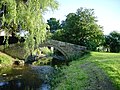
 Barden Bridge, Wharfedale - geograph.org.uk - 21384.jpg 640 × 480; 126 KB
-
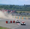
 Croft Circuit MMB 01.jpg 1,600 × 1,200; 790 KB
-
 Croft Circuit MMB 02.jpg 1,600 × 1,200; 771 KB
-
 Croft Circuit MMB 03.jpg 1,600 × 1,200; 774 KB
-
 Croft Circuit MMB 04.jpg 1,600 × 1,200; 775 KB
-
 Croft Circuit MMB 05.jpg 1,600 × 1,200; 785 KB
-
 Croft Circuit MMB 06.jpg 1,600 × 1,200; 809 KB
-
 Croft Circuit MMB 07.jpg 1,600 × 1,200; 790 KB
-
 Croft Circuit MMB 08.jpg 1,600 × 1,200; 795 KB
-
 Croft Circuit MMB 09.jpg 1,600 × 1,200; 784 KB
-
 Croft Circuit MMB 10.jpg 1,600 × 1,200; 798 KB
-
 Croft Circuit MMB 11.jpg 1,600 × 1,200; 794 KB
-
 Croft Circuit MMB 12.jpg 1,600 × 1,200; 795 KB
-
 Croft Circuit MMB 13.jpg 1,600 × 1,200; 780 KB
-
 Croft Circuit MMB 14.jpg 1,600 × 1,200; 786 KB
-
 Croft Circuit MMB 15.jpg 966 × 1,200; 656 KB
-
 Croft Circuit MMB 16.jpg 1,600 × 1,200; 761 KB
-
 Croft Circuit MMB 17.jpg 1,600 × 1,200; 785 KB
-
 Croft Circuit MMB 18.jpg 1,600 × 1,200; 785 KB
-
 Croft Circuit MMB 19.jpg 1,600 × 1,200; 770 KB
-
 Croft Circuit MMB 20.jpg 1,600 × 1,200; 785 KB
-
 Croft Circuit MMB 21.jpg 1,600 × 1,200; 772 KB
-
 Croft Circuit MMB 22.jpg 1,600 × 1,200; 786 KB
-
 Croft Circuit MMB 23.jpg 1,600 × 1,200; 765 KB
-
 Croft Circuit MMB 24.jpg 1,600 × 1,200; 780 KB
-
 Croft Circuit MMB 25.jpg 1,600 × 1,200; 809 KB
-
 Croft Circuit MMB 26.jpg 1,600 × 1,200; 790 KB
-
 Croft Circuit MMB 27.jpg 1,600 × 1,200; 791 KB
-
 Croft Circuit MMB 28.jpg 1,140 × 1,200; 930 KB
-
 Croft Circuit MMB 29.jpg 1,600 × 1,200; 757 KB
-
 Croft Circuit MMB 30.jpg 1,600 × 1,200; 780 KB
-
 Croft Circuit MMB 31.jpg 1,600 × 1,200; 784 KB
-
 Croft Circuit MMB 32.jpg 1,600 × 1,200; 795 KB
-
 Croft Circuit MMB 33.jpg 1,600 × 1,200; 803 KB
-
 Croft Circuit MMB 34.jpg 1,600 × 1,200; 767 KB
-
 Croft Circuit MMB 35.jpg 1,600 × 1,200; 781 KB
-
 Croft Circuit MMB 36.jpg 1,600 × 1,200; 781 KB
-
 Croft Circuit MMB 37.jpg 1,600 × 1,200; 762 KB
-
 Croft Circuit MMB 38.jpg 1,600 × 1,200; 761 KB
-
 Croft Circuit MMB 39.jpg 1,600 × 1,200; 771 KB
-
 Croft Circuit MMB 40.jpg 1,600 × 1,200; 771 KB
-
 Croft Circuit MMB 41.jpg 1,600 × 1,200; 786 KB
-
 Croft Circuit MMB 42.jpg 1,600 × 1,200; 791 KB
-
 Croft Circuit MMB 43.jpg 1,600 × 1,200; 796 KB
-
 Croft Circuit MMB 44.jpg 1,600 × 1,200; 798 KB
-
 Croft Circuit MMB 45.jpg 1,600 × 1,200; 791 KB
-
 Croft Circuit MMB 46.jpg 1,100 × 1,054; 824 KB
-
 Croft Circuit MMB 47.jpg 1,600 × 1,200; 787 KB
-
 Cornforth Hill from Castle Walk Richmond - geograph.org.uk - 728779.jpg 640 × 480; 100 KB
-
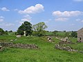
 Boundary stone - geograph.org.uk - 37194.jpg 640 × 480; 81 KB
-
 City of Troy. - geograph.org.uk - 134454.jpg 640 × 481; 147 KB
-
 CodBeckReservoir.jpg 640 × 480; 118 KB
-
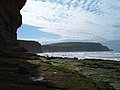 Cowbar Nab - geograph.org.uk - 17818.jpg 640 × 480; 94 KB
-
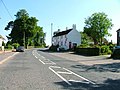 Crathorne Village Shop and Post Office - geograph.org.uk - 21960.jpg 640 × 480; 71 KB
-
 Croft Circuit 1.JPG 2,400 × 1,600; 1.61 MB
-
 Disused Filling Station, Thirsk - geograph.org.uk - 95074.jpg 640 × 427; 53 KB
-
 Dodd Fell - geograph.org.uk - 30336.jpg 640 × 480; 83 KB
-
 Duck Bridge between Danby and Houlsyke - geograph.org.uk - 19331.jpg 640 × 405; 63 KB
-
 Eavestone Lake - geograph.org.uk - 20288.jpg 640 × 480; 153 KB
-
 Farm Track, Eston Moor - geograph.org.uk - 17454.jpg 640 × 480; 48 KB
-
 Fen Bog, North Yorks Moors - geograph.org.uk - 19842.jpg 640 × 480; 79 KB
-
 Flash flood aftermath - geograph.org.uk - 276461.jpg 640 × 427; 83 KB
-
 Forest Moor Road, Calcutt - geograph.org.uk - 69924.jpg 640 × 480; 76 KB
-
 Harrogate Library.jpg 640 × 478; 179 KB
-
 Hawes - geograph.org.uk - 30148.jpg 640 × 480; 125 KB
-
 Haymaking - geograph.org.uk - 38831.jpg 640 × 427; 159 KB
-
 Hilltop Eavestone - geograph.org.uk - 20284.jpg 640 × 480; 168 KB
-
 James Cook University Hospital - geograph.org.uk - 17945.jpg 640 × 480; 71 KB
-
 John O' Gaunt's Castle - geograph.org.uk - 16486.jpg 640 × 480; 88 KB
-
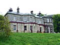 Malham tarn house.jpg 640 × 481; 90 KB
-
 Malton Bacon Factory - geograph.org.uk - 16435.jpg 640 × 334; 45 KB
-
 Most of North Yorkshire - geograph.org.uk - 116721.jpg 620 × 640; 112 KB
-
 Norwood Social Hall Bland Hill - geograph.org.uk - 17597.jpg 640 × 480; 103 KB
-
 Pack Horse Bridge, Romanby - geograph.org.uk - 21611.jpg 640 × 480; 139 KB
-
 Paddys Hole - geograph.org.uk - 52455.jpg 640 × 480; 92 KB
-

-
 RedmireStation(CarlBendelow)Jun2005.jpg 640 × 480; 76 KB
-
 Rural postbox - geograph.org.uk - 174511.jpg 640 × 481; 162 KB
-
 SheriffHuttonCastle(AlisonStamp)Jun2005.jpg 640 × 480; 113 KB
-
 Skell Gill - geograph.org.uk - 116717.jpg 427 × 640; 136 KB
-
-
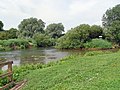
 The River Ure - geograph.org.uk - 116750.jpg 427 × 640; 130 KB
-
 Thornthwaite - geograph.org.uk - 147342.jpg 640 × 427; 103 KB
-
 Tramlines in wheat near Kildale - geograph.org.uk - 22842.jpg 640 × 357; 53 KB
-
 Village Green, Newby - geograph.org.uk - 21151.jpg 640 × 480; 57 KB
-
 York Road Industrial Park, Malton - geograph.org.uk - 16390.jpg 640 × 307; 54 KB
-

-
 East Coast Mainline - geograph.org.uk - 16400.jpg 640 × 346; 100 KB
-
 Huthwaite Green, Scugdale - geograph.org.uk - 18912.jpg 640 × 480; 50 KB
-

-
 Standing Stone on Wheeldale Moor - geograph.org.uk - 19847.jpg 480 × 640; 87 KB


Jun2005.jpg)

Jun2005.jpg)


