Category:October 2005 in North Yorkshire
Jump to navigation
Jump to search
Ok
Deutsch: Bilder, die im Oktober 2005 in North Yorkshire aufgenommen worden sind. Bitte beachten Sie, dass dies weder das Datum des Uploads noch das Datum des Scannens eines Fotos ist.
English: Images/pictures taken in North Yorkshire during October 2005. Note this is not the date of the upload, nor the date a photo was scanned.
Español: Fotografías o imágenes tomadas en North Yorkshire durante octubre 2005. No es la fecha de subida ni escaneo, sino la fecha en que las fotografías o imágenes se crearon.
Esperanto: Bildoj faritaj en North Yorkshire en oktobro 2005. Tio ne estas la dato, kiam la bildoj estis alŝutitaj aŭ skanitaj.
Français : Photographies ou images prises en North Yorkshire durant octobre 2005. Ce n'est pas la date du téléchargement ou du scan.
Galego: Fotografías ou imaxes tomadas en North Yorkshire durante outubro 2005. Non é a data de subida nin escaneamento, senón a data na que se crearon as fotografías ou imaxes.
Italiano: Fotografie o immagini scattate a North Yorkshire nel ottobre 2005. Nota bene: la data non si riferisce né a quella di upload né a quella in cui la foto è stata digitalizzata.
Norsk bokmål: Bilder tatt i North Yorkshire i løpet av oktober 2005. Merk at dette ikke er datoen for opplasting, eller når et bilde har blitt skannet.
Norsk nynorsk: Bilete teke i North Yorkshire i løpet av oktober 2005. Merk at dette ikkje er datoen for opplasting, eller når eit bilete har vorte skanna.
Русский: Изображения, сделанные в North Yorkshire в течение октябрь 2005 (не дата загрузки изображения).
Українська: Зображення, зроблені в North Yorkshire протягом жовтень 2005. Зауважте, що це не дата завантаження чи дата сканування фотографії.
| October 2004 | ← | October 2005 | → | October 2006 | |||||||
| Jan | Feb | Mar | Apr | May | Jun | Jul | Aug | Sep | Oct | Nov | Dec |
| 7 | 15 | 23 | 48 | 48 | 93 | 86 | 121 | 72 | 74 | 62 | 71 |
|---|---|---|---|---|---|---|---|---|---|---|---|
Subcategories
This category has only the following subcategory.
Y
Media in category "October 2005 in North Yorkshire"
The following 73 files are in this category, out of 73 total.
-
 Hampsthwaite Bridge - geograph.org.uk - 68167.jpg 640 × 480; 91 KB
-
 Hawes Station 2006 - panoramio.jpg 2,592 × 1,952; 1.33 MB
-
 The Devonshire Arms, Bolton Bridge - geograph.org.uk - 71350.jpg 640 × 480; 136 KB
-
 A quiet road to Kettlesing - geograph.org.uk - 68154.jpg 640 × 480; 99 KB
-
 A section of Waterdale - geograph.org.uk - 94014.jpg 640 × 427; 59 KB
-
 A6068 at Hey, west of Cowling - geograph.org.uk - 68755.jpg 640 × 480; 67 KB
-
 Arable Fields, Haggitt Hill Lane - geograph.org.uk - 65776.jpg 640 × 480; 65 KB
-
 ArkleBeck.jpg 640 × 480; 180 KB
-
 Birstwith Post Office and General Store - geograph.org.uk - 68165.jpg 640 × 480; 116 KB
-
 Blue Barn Lane - geograph.org.uk - 66763.jpg 640 × 480; 86 KB
-
 Boggle Hole Youth Hostel - geograph.org.uk - 71687.jpg 640 × 480; 143 KB
-

-
 Cottages at Robin Hood's Bay - geograph.org.uk - 71694.jpg 483 × 640; 93 KB
-
 Council Offices, Northallerton - geograph.org.uk - 470982.jpg 640 × 480; 62 KB
-
 Dacre Banks Sports Club - geograph.org.uk - 64963.jpg 640 × 480; 94 KB
-
-
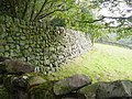 Enormous and wonderful stone wall - geograph.org.uk - 101680.jpg 640 × 480; 147 KB
-
 Farmland - geograph.org.uk - 71343.jpg 640 × 480; 93 KB
-
 Fearby.jpg 640 × 480; 79 KB
-
 Field Adjacent to New Dales Plantation - geograph.org.uk - 66753.jpg 640 × 480; 54 KB
-
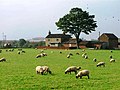 Field in Front of Halfway House - geograph.org.uk - 470984.jpg 640 × 480; 55 KB
-
 Fields near Middleton - geograph.org.uk - 60805.jpg 640 × 480; 130 KB
-
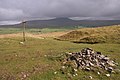 Fingerpost, Moughton - geograph.org.uk - 60023.jpg 640 × 427; 109 KB
-
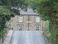 Flying Dutchman, Summerbridge - geograph.org.uk - 64965.jpg 640 × 480; 121 KB
-
 Ford at Fore Gill Gate - geograph.org.uk - 69154.jpg 640 × 480; 120 KB
-
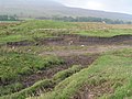 Ford, Winterscales Beck - geograph.org.uk - 66543.jpg 640 × 480; 163 KB
-
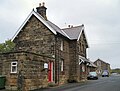
-
 Gatekirk Cave - geograph.org.uk - 66546.jpg 640 × 480; 192 KB
-
 Haws Gill Wheel - geograph.org.uk - 66550.jpg 640 × 480; 208 KB
-
 Haws Gill Wheel 1 - geograph.org.uk - 66548.jpg 640 × 480; 203 KB
-
 Ivescar - geograph.org.uk - 66542.jpg 640 × 480; 129 KB
-
 Looking out over Bransdale - geograph.org.uk - 76764.jpg 640 × 480; 89 KB
-

-
 Low Snowden and Washburn Farm - geograph.org.uk - 61661.jpg 640 × 480; 146 KB
-
 Majestic and Conference Centre - geograph.org.uk - 60081.jpg 640 × 479; 130 KB
-
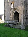 Middleham Castle.JPG 960 × 1,280; 552 KB
-
 October "War Weekend" in Pickering - geograph.org.uk - 171570.jpg 640 × 480; 112 KB
-
 Papes - geograph.org.uk - 238555.jpg 640 × 114; 48 KB
-
 Postman - geograph.org.uk - 72303.jpg 640 × 480; 100 KB
-
 Public Convenience, Redcar Stray - geograph.org.uk - 65291.jpg 640 × 480; 51 KB
-
 RAF Menwith Hill - geograph.org.uk - 64954.jpg 640 × 480; 93 KB
-
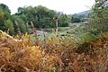 Railway Signal, Kirkham - geograph.org.uk - 74847.jpg 640 × 427; 196 KB
-
 Ripon Canal Basin - geograph.org.uk - 680468.jpg 640 × 480; 95 KB
-
 Scar House, Arkengarthdale - geograph.org.uk - 69121.jpg 640 × 483; 119 KB
-
 Shakeholes above Kingsdale - geograph.org.uk - 66161.jpg 640 × 480; 131 KB
-
 Sheep in an awkward gridsquare - geograph.org.uk - 61677.jpg 640 × 480; 160 KB
-
 Sheep near East Moor House Farm - geograph.org.uk - 60871.jpg 640 × 480; 156 KB
-
 Sidings at Ribblehead station (geograph 6504077).jpg 1,024 × 768; 535 KB
-
 Signal Box, M'boro to Redcar Railway - geograph.org.uk - 80660.jpg 640 × 480; 49 KB
-
 Silver Hill Farm - geograph.org.uk - 94002.jpg 640 × 413; 68 KB
-
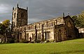 Skipton Church - geograph.org.uk - 603212.jpg 640 × 413; 75 KB
-
 St. Luke's Hospital - geograph.org.uk - 67660.jpg 640 × 480; 56 KB
-
 Stainburn from Almscliffe - geograph.org.uk - 82008.jpg 640 × 480; 83 KB
-
 Swaledale North of Muker - geograph.org.uk - 97879.jpg 640 × 480; 107 KB
-
 Telephone kiosk and postbox - geograph.org.uk - 73706.jpg 640 × 529; 77 KB
-
 The A19 - geograph.org.uk - 72046.jpg 640 × 480; 95 KB
-
 The Fields of Bilsdale - geograph.org.uk - 196046.jpg 640 × 447; 182 KB
-
 Thornton-le-Dale Post Office - geograph.org.uk - 70268.jpg 485 × 640; 72 KB
-
 Trees in Aldro Plantation - geograph.org.uk - 94308.jpg 640 × 427; 79 KB
-
 Upper Nidderdale.JPG 1,280 × 960; 612 KB
-

-
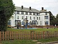 Westville House School - geograph.org.uk - 60868.jpg 640 × 480; 162 KB
-
 Yordas Cave - geograph.org.uk - 66192.jpg 640 × 480; 197 KB
-
 York Street - geograph.org.uk - 65759.jpg 640 × 480; 51 KB
-
 Boroughbridge Service Station - geograph.org.uk - 71934.jpg 640 × 488; 89 KB
-
 Bridleway near Austwick - geograph.org.uk - 59997.jpg 640 × 427; 129 KB
-
 Cattle near Stoupe Brow - geograph.org.uk - 71671.jpg 640 × 480; 90 KB
-
 Cycleway, Pinchinthorpe - geograph.org.uk - 76815.jpg 640 × 480; 144 KB
-
 Pipebridge - geograph.org.uk - 61502.jpg 640 × 480; 62 KB
-
 Springcote and Twistleton Scars - geograph.org.uk - 66146.jpg 640 × 480; 137 KB
-
 The noisy cow - geograph.org.uk - 68176.jpg 640 × 480; 125 KB
-
 Waterfall at Skelton Beck - geograph.org.uk - 356036.jpg 426 × 640; 145 KB
-
 Wine Haven - geograph.org.uk - 71559.jpg 640 × 480; 56 KB


.jpg)


