Category:Kaiserhammer
Jump to navigation
Jump to search
human settlement  | |||||
| Upload media | |||||
| Instance of |
| ||||
|---|---|---|---|---|---|
| Location |
| ||||
| Elevation above sea level |
| ||||
 | |||||
Subcategories
This category has the following 2 subcategories, out of 2 total.
J
- Jagdschloss Kaiserhammer (1 F)
K
Media in category "Kaiserhammer"
The following 2 files are in this category, out of 2 total.
-
 AK - Egerbrücke - Kaiserhammer mit Tierstein - 1906.jpg 1,600 × 2,080; 2.17 MB
-
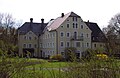 Kaiserhammer Hammergut 2004.jpg 2,330 × 1,515; 665 KB
