Category:Kidderminster
Jump to navigation
Jump to search
town and civil parish in Worcestershire, England, UK  | |||||
| Upload media | |||||
| Instance of | |||||
|---|---|---|---|---|---|
| Location | Wyre Forest, Worcestershire, West Midlands, England | ||||
| Population |
| ||||
 | |||||
Subcategories
This category has the following 20 subcategories, out of 20 total.
B
- Bewdley Tunnel (3 F)
- Broadwaters (15 F)
F
- Falling Sands Lock (9 F)
H
- Hoobrook War Memorial (2 F)
K
- Kidderminster Lock (14 F)
- Kidderminster railway station (72 F)
M
N
S
- Spennells Valley (7 F)
W
- Whittle (bus company) (23 F)
Y
- John Francis Young (4 F)
Media in category "Kidderminster"
The following 200 files are in this category, out of 1,692 total.
(previous page) (next page)-
 "Tee with four bunkers" Kidderminster Golf Course - geograph.org.uk - 4543650.jpg 3,648 × 2,736; 2.92 MB
-
 21-23 Coventry Street, Kidderminster - geograph.org.uk - 4301943.jpg 1,024 × 681; 189 KB
-
 5410 Roundabout in the centre of Kidderminster - geograph.org.uk - 2105301.jpg 3,072 × 2,304; 3.34 MB
-
 A Barge At The Watermill - geograph.org.uk - 5610167.jpg 640 × 445; 116 KB
-
 A bend in the canal, Kidderminster - geograph.org.uk - 3371134.jpg 640 × 480; 85 KB
-
 A bend on the Staffs and Worcs canal - geograph.org.uk - 3160939.jpg 1,024 × 768; 169 KB
-
-
 A canal cycle route, Kidderminster - geograph.org.uk - 3335969.jpg 640 × 480; 99 KB
-
 A few shops at Franche - geograph.org.uk - 2122613.jpg 640 × 480; 74 KB
-

-

-

-

-

-

-

-

-

-

-
 A True Relation of the Terrible Earthquake at West Brommidge, in Staffordshire - 1675.pdf 966 × 1,220, 8 pages; 182 KB
-
 A very necessary underpass - geograph.org.uk - 2122604.jpg 640 × 480; 89 KB
-

-
 A442 Kidderminster Mill Street Exit - geograph.org.uk - 3866833.jpg 640 × 422; 60 KB
-
 A442 southbound in Franche - geograph.org.uk - 3554016.jpg 640 × 480; 56 KB
-

-

-
 A449 Chester Road North - geograph.org.uk - 4635260.jpg 640 × 481; 62 KB
-

-
 A449 Island - geograph.org.uk - 3536097.jpg 640 × 480; 45 KB
-

-
 A449 north of Summerfield - geograph.org.uk - 2665634.jpg 2,048 × 1,536; 1.33 MB
-
 A456 at Coventry Street roundabout - geograph.org.uk - 3554023.jpg 640 × 481; 68 KB
-
 A456 Bewdley Road - geograph.org.uk - 1876972.jpg 640 × 480; 76 KB
-
 A456 junction at Carpet Trades Way, Kidderminster - DSCF0968.JPG 4,000 × 3,000; 2.89 MB
-
 A456 leaving Kidderminster - geograph.org.uk - 2665825.jpg 640 × 480; 85 KB
-
 A456 Park Butts Ringway - geograph.org.uk - 3554019.jpg 640 × 480; 56 KB
-
 A456 Westbound Near Bewdley Hill - geograph.org.uk - 5129075.jpg 640 × 480; 104 KB
-

-
 A456 Westbound Near Turn for A4549 - geograph.org.uk - 5129080.jpg 640 × 480; 84 KB
-

-

-
 Access to Walter Nash Road - geograph.org.uk - 2665782.jpg 640 × 480; 79 KB
-
 Advertising panels, Kidderminster station - geograph.org.uk - 6039281.jpg 4,361 × 2,326; 1.21 MB
-

-
-

-
 Albert Road, Kidderminster - geograph.org.uk - 4550793.jpg 2,272 × 1,704; 759 KB
-
 Aldi, Silverwoods Way, Kidderminster - geograph.org.uk - 5598320.jpg 1,024 × 666; 165 KB
-
 Alley to Bewdley Hill Wood, Kidderminster, Worcs - geograph.org.uk - 6225642.jpg 725 × 1,024; 165 KB
-
 Alley to Birchfield Road, Kidderminster, Worcs - geograph.org.uk - 6225637.jpg 706 × 1,024; 278 KB
-
 Am I seeing straight^ - geograph.org.uk - 1064536.jpg 480 × 640; 79 KB
-

-

-
 Another Kidderminster pub bites the dust - geograph.org.uk - 2067392.jpg 1,024 × 771; 234 KB
-

-

-

-
 Approaching Kidderminster Station - geograph.org.uk - 2608150.jpg 800 × 600; 248 KB
-

-

-
 Aqueduct on the Staffs and Worcs Canal - geograph.org.uk - 809349.jpg 640 × 480; 266 KB
-
 Aqueduct over River Stour - geograph.org.uk - 5635585.jpg 607 × 800; 171 KB
-
 Aqueduct over the River Stour - geograph.org.uk - 809335.jpg 640 × 480; 322 KB
-
 Arch Hill, Kidderminster - geograph.org.uk - 4146093.jpg 741 × 1,024; 242 KB
-
 Arched entrance to Springfield Park - geograph.org.uk - 5729038.jpg 680 × 1,024; 342 KB
-

-
 Ark Royal open for inspection, Kidderminster - geograph.org.uk - 5463467.jpg 3,248 × 2,160; 1.3 MB
-

-

-

-
 Asda sign in car park, New Road, Kidderminster - geograph.org.uk - 2502671.jpg 1,024 × 758; 189 KB
-
 Ashlane, Kidderminster - geograph.org.uk - 3333161.jpg 640 × 410; 73 KB
-
 Avill Grove, Kidderminster - geograph.org.uk - 3789100.jpg 3,488 × 2,616; 2.18 MB
-
 Avocet Drive, Spennells, Kidderminster - geograph.org.uk - 3694545.jpg 1,024 × 669; 154 KB
-

-
 Baldwin Road, Kidderminster - geograph.org.uk - 4550839.jpg 2,272 × 1,704; 768 KB
-
 Barnetts Lane Kidderminster - geograph.org.uk - 3147598.jpg 640 × 480; 120 KB
-
 Barnetts Lane, Kidderminster - geograph.org.uk - 3575365.jpg 1,024 × 672; 274 KB
-
 Barnetts Lane, Kidderminster - geograph.org.uk - 3575373.jpg 1,024 × 680; 222 KB
-
 Barnetts Lane, Kidderminster - geograph.org.uk - 6176923.jpg 640 × 480; 128 KB
-

-
 Batham Road, Greenhill - geograph.org.uk - 4550856.jpg 2,272 × 1,704; 682 KB
-
 Baxter Avenue, Kidderminster - geograph.org.uk - 4551276.jpg 2,272 × 1,704; 709 KB
-
 Baxter College in Kidderminster - geograph.org.uk - 3932900.jpg 4,752 × 3,168; 2.08 MB
-
 Baxter Terrace house, Kidderminster - geograph.org.uk - 3147460.jpg 640 × 489; 65 KB
-
 Beeches Road, Franche - geograph.org.uk - 3789068.jpg 3,488 × 2,616; 2.15 MB
-

-
 Bewdley Hill (A456), Kidderminster, Worcs - geograph.org.uk - 6229184.jpg 1,024 × 672; 227 KB
-

-

-

-

-
 Birchen Coppice estate scene - geograph.org.uk - 2665787.jpg 640 × 480; 63 KB
-
 Birchen Coppice,Farm Close. - panoramio.jpg 2,560 × 1,920; 825 KB
-
 Birchfield Road, Kidderminster, Worcs - geograph.org.uk - 6225650.jpg 1,024 × 681; 139 KB
-

-
 Birmingham Road, Kidderminster - geograph.org.uk - 1104714.jpg 640 × 480; 94 KB
-
 Bittern Wood Road, Spennells, Kidderminster - geograph.org.uk - 3396629.jpg 1,024 × 653; 180 KB
-
 Black Horse Lane, Kidderminster - geograph.org.uk - 3789112.jpg 3,488 × 2,616; 2.19 MB
-
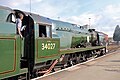
 Black smoke from Pannier tank 1501 - geograph.org.uk - 5445928.jpg 640 × 480; 56 KB
-
 Blake Brook in Springfield Park, Kidderminster - geograph.org.uk - 3303920.jpg 675 × 1,024; 332 KB
-

-

-
 Blake Brook, Springfield Park, Kidderminster - geograph.org.uk - 3369765.jpg 1,024 × 675; 288 KB
-
 Blake Brook, Springfield Park, Kidderminster - geograph.org.uk - 5625303.jpg 1,024 × 768; 337 KB
-
 Blakebrook Green - geograph.org.uk - 5929358.jpg 6,000 × 4,000; 5.9 MB
-

-
 Boarded-up The Crown, Kidderminster - geograph.org.uk - 3333066.jpg 640 × 385; 50 KB
-

-

-
 Boars Head, Kidderminster - geograph.org.uk - 1985636.jpg 2,646 × 2,414; 2.22 MB
-
 Borrington Road, Kidderminster - geograph.org.uk - 6176934.jpg 800 × 600; 80 KB
-
 Boundary stone on Kidderminster Road - geograph.org.uk - 5928312.jpg 6,000 × 4,000; 5.35 MB
-

-
 Brewers Decorator Centre - geograph.org.uk - 4923068.jpg 1,187 × 596; 292 KB
-
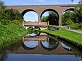 Bridge and viaduct across the canal near Kidderminster (geograph 5516842).jpg 1,280 × 960; 1.32 MB
-

-

-

-

-

-
 Bridge over the Stour, Kidderminster - geograph.org.uk - 1914054.jpg 640 × 480; 90 KB
-
 Bridgnorth Road in Kidderminster - geograph.org.uk - 5298305.jpg 800 × 567; 111 KB
-

-
 Brinton Park - Kidderminster - geograph.org.uk - 5440689.jpg 640 × 480; 79 KB
-
 Brinton Park, Kidderminster - geograph.org.uk - 5505163.jpg 640 × 480; 100 KB
-

-
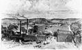 Brintons factory, Kidderminster.jpg 5,352 × 3,305; 2.13 MB
-
-

-
 Broadwaters Bridge - geograph.org.uk - 1630938.jpg 640 × 480; 160 KB
-
 Broadwaters Bridge - geograph.org.uk - 1660327.jpg 640 × 477; 90 KB
-
 Broadwaters Bridge plaque - geograph.org.uk - 1630951.jpg 640 × 434; 123 KB
-

-

-

-
 Broadwaters Mill, Kidderminster, Worcs - geograph.org.uk - 1726878.jpg 3,072 × 2,304; 3.98 MB
-
 Broadwaters Park - geograph.org.uk - 5729055.jpg 1,024 × 680; 396 KB
-
 Broadwaters Park car park - geograph.org.uk - 1108261.jpg 640 × 479; 93 KB
-
 Broadwaters Park in Kidderminster - geograph.org.uk - 5486835.jpg 800 × 428; 103 KB
-
 Broadwaters Park in Kidderminster - geograph.org.uk - 5486862.jpg 800 × 450; 143 KB
-

-
 Broomfield Road, Kidderminster - geograph.org.uk - 3788895.jpg 3,488 × 2,616; 2.15 MB
-
 Bruce Road, Kidderminster - geograph.org.uk - 4550825.jpg 2,272 × 1,704; 637 KB
-

-

-
 Bull Ring, Kidderminster - geograph.org.uk - 5691440.jpg 6,000 × 4,000; 7.07 MB
-

-

-
 Bus shelter, Exchange Street - geograph.org.uk - 2212877.jpg 1,024 × 764; 198 KB
-

-

-
 Bus, Kidderminster - DSCF0916.JPG 4,000 × 3,000; 2.86 MB
-
 Bus, Kidderminster - DSCF0928.JPG 4,000 × 3,000; 2.79 MB
-
 Businesses in Comberton Place, Kidderminster - geograph.org.uk - 3525768.jpg 1,024 × 656; 152 KB
-
 Cairndhu Drive, Kidderminster - geograph.org.uk - 4550812.jpg 2,272 × 1,704; 759 KB
-

-

-
 Caldwall Lock near Kidderminster in Worcestershire - geograph.org.uk - 5687003.jpg 960 × 1,280; 1.74 MB
-
 Caldwall Lock near Kidderminster in Worcestershire - geograph.org.uk - 5687013.jpg 960 × 1,280; 1.55 MB
-

-
 Caldwall Lock south of Kidderminster, Worcestershire - geograph.org.uk - 5516135.jpg 1,280 × 960; 1.42 MB
-
 Caldwall Lock south of Kidderminster, Worcestershire - geograph.org.uk - 5516142.jpg 960 × 1,280; 1.12 MB
-

-

-
 Caldwall Mill Bridge - geograph.org.uk - 499256.jpg 640 × 499; 153 KB
-

-

-

-
 Caldwall Tower - Castle Road, Kidderminster (29218612940).jpg 3,456 × 4,608; 6.18 MB
-
 Caldwall Tower, Kidderminster - geograph.org.uk - 5368003.jpg 1,200 × 1,600; 365 KB
-
 Caldwell Lock on the Staffs and Worcs Canal - geograph.org.uk - 2058677.jpg 3,072 × 2,304; 4.5 MB
-
 Canada Geese in Kidderminster, Worcestershire - geograph.org.uk - 4714757.jpg 1,280 × 853; 996 KB
-

-

-

-
-

-

-
 Canal approaching Kidderminster in Worcestershire - geograph.org.uk - 5686813.jpg 1,280 × 825; 1.42 MB
-

-

-

-

-
 Canal approaching Pratt's Wharf near Stourport - geograph.org.uk - 5684421.jpg 1,600 × 961; 2.11 MB
-
 Canal arm, Springfield Park - geograph.org.uk - 1630892.jpg 640 × 471; 131 KB
-

-

-
 Canal bridge 15, Kidderminster - geograph.org.uk - 3370899.jpg 640 × 452; 69 KB
-

-

-

-

-

-

-

-
 Canal in Kidderminster centre, Worcestershire - geograph.org.uk - 5687963.jpg 1,440 × 960; 1.46 MB
-
 Canal in Kidderminster, Staffordshire - geograph.org.uk - 5151586.jpg 1,280 × 960; 713 KB
-
 Canal in Kidderminster, Worcestershire - geograph.org.uk - 5150826.jpg 1,280 × 937; 940 KB
-
 Canal in Kidderminster, Worcestershire - geograph.org.uk - 5151599.jpg 960 × 1,280; 966 KB


_-_geograph.org.uk_-_2212203.jpg)
_-_geograph.org.uk_-_2212213.jpg)


,_Hoo_Road,_Kidderminster_-_geograph.org.uk_-_2681534.jpg)
_Stand,_Hoo_Road,_Kidderminster_-_geograph.org.uk_-_2681514.jpg)
,_Hoo_Road,_Kidderminster_-_geograph.org.uk_-_2681488.jpg)


,_Kidderminster,_Worcs_-_geograph.org.uk_-_5302932.jpg)
,_Kidderminster,_Worcs_-_geograph.org.uk_-_5302942.jpg)


,_New_Road,_Kidderminster_-_geograph.org.uk_-_2502638.jpg)


,_Kidderminster,_Worcs_-_geograph.org.uk_-_6229184.jpg)


.jpg)


,_Chapel_Hill,_Broadwaters,_Kidderminster_-_geograph.org.uk_-_4765926.jpg)
_-_sign,_Chapel_Hill,_Broadwaters,_Kidderminster_-_geograph.org.uk_-_4765936.jpg)
_-_foundation_stone,_Chapel_Hill,_Broadwaters,_Kidderminster_-_geograph.org.uk_-_4765946.jpg)


_Tower_-_east_side,_Castle_Road,_Kidderminster_-_geograph.org.uk_-_2724020.jpg)


_-_name_plaque,_Staffs_%5E_Worcs_Canal,_Kidderminster_-_geograph.org.uk_-_2288360.jpg)
,_Staffs_%5E_Worcs_Canal,_Kidderminster_-_geograph.org.uk_-_2288304.jpg)


.jpg)


