Category:Kildare
Jump to navigation
Jump to search
Български: Килдеър (на английски Kildare, на ирландски Cill Dara) е град в централната източна част на Ирландия. Намира се в графство Килдеър на провинция Ленстър на около 60 km западно от столицата Дъблин и на 19 km също западно от административния център на графството Нейс. Има жп гара. Населението му е 7 538 жители от преброяването през 2006 г. [1]
Brezhoneg: Cill Dara (Kildare e saozneg) a zo ur gêr eus reter Iwerzhon, un 50 kilometr bennak er mervent da Zulenn. Gevellet eo gant Kornuz.
Dansk: Kildare (by) ( Irsk: Cill Dara) er en irsk by i County Kildare i provinsen Leinster, i den centrale del af Republikken Irland med en befolkning (inkl. opland) på 7.538 indb i 2006 (5.694 i 2002)
Deutsch: Kildare ( irisch: Cill Dara) liegt im Westen der gleichnamigen irischen Grafschaft. Die Stadt wurde im 5. Jahrhundert gegründet und hat 7.538 Einwohner (Stand 2006).
English: Kildare (Cill Dara in modern Irish, originally derived from Cell Dara in Old Irish, meaning "Church of the Oak") is a town in County Kildare, Ireland. Its population of 7,538 (2006 Census) makes it the seventh largest town in Kildare and the 55th largest in the Republic of Ireland, with a growth rate of 32.4pc since the 2002 census. Although Kildare gives its name to the county, Naas is the county town. The town lies on the R445, some 50 km west of Dublin – near enough for it to have become, despite being a regional centre in its own right, a commuter town for the capital.
Euskara: Kildare (gaur egungo irlanderaz Cill Dara, jatorriz aintzineko irlanderaren Cell Dara izendapenetik eratorria; euskaraz Haritzaren Eliza esan nahi du) Irlandako Errepublikako Kildare konderrian kokatzen den udalerria da. Udalerri honek 7.538 biztanle ditu (2006ko erroldaren arabera). Kildare konderriko 7. udalerririk handiena da eta Irlandako Errepublikaren 55. udalerria. Nahiz eta Kildare udalerriak konderriari bere izena eman, Naas da Kildare konderriko hiriburua. Udalerri hau R445 errepidean kokatzen da, Dublindik 50 km mendebalderantz.
Français : Kildare (Cill Dara en gaélique irlandais, c'est-à-dire « Église des chênes ») est une ville du comté de Kildare en République d'Irlande. Bien qu'elle donne son nom au comté, Kildare n'en est pas le chef-lieu, ce privilège revenant à Naas. La ville se situe à environ à l'ouest de Dublin, suffisamment près pour être devenue une ville-dortoir de la capitale.
Gaeilge: Baile is ea Cill Dara (Kildare as Béarla) i g Contae Chill Dara. De réir an béaloideas bhunaigh Bríd Naofa an baile. Bhronn taoiseach an méid talún is a chlúdaigh a brat uirthi. Leag sí a brat síos ar an talamh agus thosaigh sé ag méadú. Thóg Bríd eaglais nó cill in aice le dair. Is de bharr sin a ghlaotar Cill Dara (.i. an chill in aice leis an dair) air.
Gaelg: Ta Keeill Darey ( Baarle: Kildare, Yernish: Cill Dara) ny valley ayns Coontae Cheeill Darey, Pobblaght Nerin. Rere coontey-sleih ny bleeaney 2006 va 7,538 cummaltee ayns y valley, as myr shen t'eh yn sheyoo balley smoo ayns y chountee as y 55-oo balley smoo ayns y çheer lesh leahys bishagh 32.4% veih coontey-sleih ny bleeaney 2002. Faagail magh dy vel ennym y chountee çheet magh ass ennym y valley, she Naas y balley countee. Ta'n balley soit er yn R445 50 km sheear veih Divlyn, as lesh shen t'eh ny valley troailtagh da'n phreeu-valley.
Bahasa Indonesia: Kildare ( bahasa Irlandia: Cill Dara) ialah sebuah kota di County Kildare, Republik Irlandia. Meskipun nama kota ini sama dengan nama county, namun pusat administrasi county ada di Naas.
Italiano: Kildare (Cill Dara in irlandese, che significa "chiesa della quercia") è una città della contea di Kildare nella Repubblica d'Irlanda. Sebbene dia il suo nome alla contea, Kildare non è il capoluogo della contea, che è invece Naas. La città si trova a circa 50 km da Dublino, abbastanza vicino per essere diventata una città dormitorio della capitale.
Lietuvių: Kilderas – miestas rytinėje Airijoje, 50 km į vakarus nuo sostinės Dublino. Yra katedra. Garsėja parkais.
Nederlands: Kildare (Cill Dara) is een plaats in het Ierse graafschap County Kildare. De plaats telt 5694 inwoners.
Norsk bokmål: Kildare er en by i grevskapet Kildare i Republikken Irland. Selv om den har gitt navn til grevskapet, er det Naas og ikke Kildare som er administrasjonsby.
Polski: W Kildare znajdują się słynne Ogrody Japońskie, katedra świętej Brygidy, okrągła wieża i Irlandzka Narodowa Stadnina.
Português: Kildare (Cill Dara em irlandês) é uma cidade da Irlanda e é situada no condado de Kildare. Possui 5.694 habitantes (censo de 2002).
Slovenčina: Kildare ( ír. Cill Dara) je mesto vo východnej časti Írska, v grófstve Kildare. Žije tu 7 538 obyvateľov (2006).
Svenska: Kildare ( iriska: Cill Dara) är en ort i grevskapet Kildare i Republiken Irland. Även om grevskapet fått samma namn som orten är det Naas som är grevskapets administrationscentrum.
town in County Kildare, Ireland  | |||||
| Upload media | |||||
| Instance of |
| ||||
|---|---|---|---|---|---|
| Part of | |||||
| Location | County Kildare, Leinster, Ireland | ||||
| Population |
| ||||
| Elevation above sea level |
| ||||
| Different from | |||||
| official website | |||||
 | |||||
Subcategories
This category has the following 10 subcategories, out of 10 total.
A
- August 2007 in Kildare (265 F)
C
G
- Kildare Grey Friary (6 F)
I
K
- Kildare Courthouse (1 F)
- Kildare Post Office (1 F)
N
S
- Saint Fiachra's Garden (5 F)
W
Media in category "Kildare"
The following 151 files are in this category, out of 151 total.
-
 1922 Civil War memorial Kildare.jpg 3,240 × 4,320; 5.48 MB
-
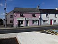
 Ace Casino - Wee Kee Chinese Takeaway - geograph.org.uk - 4183735.jpg 640 × 480; 166 KB
-
 Alpacas in Kildare - panoramio.jpg 4,000 × 3,000; 2.83 MB
-
 Athy Railway Station, Co. Kildare, Ireland.jpg 5,312 × 2,988; 4.21 MB
-
 Ballyboggan monastery - panoramio.jpg 2,592 × 1,944; 1.22 MB
-
 Black Church (8412718703).jpg 2,000 × 1,913; 983 KB
-
 Black saint, Kildare.jpg 2,934 × 3,155; 1.23 MB
-
 Boardwalk, Kildare - geograph.org.uk - 4183686.jpg 640 × 480; 163 KB
-
 Bog of Allen Nature Centre - panoramio.jpg 4,000 × 3,000; 4.3 MB
-
 Brallistown Little, Co. Kildare, Ireland - panoramio - vilino100 (1).jpg 5,184 × 3,456; 7.41 MB
-
 Brallistown Little, Co. Kildare, Ireland - panoramio - vilino100 (2).jpg 5,184 × 3,456; 10.66 MB
-
 Brallistown Little, Co. Kildare, Ireland - panoramio - vilino100 (3).jpg 5,184 × 3,456; 9.66 MB
-
 Brallistown Little, Co. Kildare, Ireland - panoramio - vilino100.jpg 5,184 × 3,456; 9.35 MB
-
 Brallistown Little, Co. Kildare, Ireland - panoramio.jpg 5,184 × 3,456; 9.45 MB
-
 Bran and Sceolan - geograph.org.uk - 633660.jpg 640 × 480; 87 KB
-
 Brochure Cover.jpg 3,600 × 2,700; 2.62 MB
-
 Built-in steps, Graveyard Wall - geograph.org.uk - 4183757.jpg 640 × 480; 186 KB
-
 Carrick Castle - panoramio.jpg 1,944 × 2,592; 1.65 MB
-
 Carrick Hill (View to the east) - panoramio.jpg 2,592 × 1,944; 1.46 MB
-
 Castles of Leinster, Kildare, Co. Kildare (1) - geograph.org.uk - 5029020.jpg 1,024 × 688; 617 KB
-
 Castles of Leinster, Kildare, Co. Kildare (2) - geograph.org.uk - 5029023.jpg 1,024 × 673; 666 KB
-
 Cill Dara Golf Club - geograph.org.uk - 4104234.jpg 1,814 × 1,093; 375 KB
-
 Claregate Street, Kildare, 2021-07-03.jpg 4,032 × 3,024; 3.97 MB
-
 Clonespoe (6363429223).jpg 827 × 618; 266 KB
-
 Clonmeen Hill (View south from Carrick Hill) - panoramio.jpg 2,592 × 1,944; 1.37 MB
-
 Clootie tree, Kildare.jpg 4,320 × 3,240; 3.22 MB
-
 Clothes Market, but where? Kildare Town! (9014457386).jpg 2,000 × 1,341; 2.35 MB
-
 Co Kildare - geograph.org.uk - 4662326.jpg 4,000 × 2,664; 5.28 MB
-
 Co Kildare - geograph.org.uk - 4662328.jpg 4,000 × 2,460; 4.44 MB
-
 Convent building, Kildare - geograph.org.uk - 4183717.jpg 640 × 480; 176 KB
-
 Convent buildings, Kildare - geograph.org.uk - 4183744.jpg 640 × 480; 171 KB
-
 Cookes Pub Caragh - panoramio.jpg 4,000 × 3,000; 2.88 MB
-
 County Kildare - St Brigid's Church - 20180928195929.jpg 640 × 480; 59 KB
-
 CWMS Hall, Kildare - geograph.org.uk - 4183750.jpg 640 × 480; 155 KB
-
 Derby House Hotel, Kildare - geograph.org.uk - 4183738.jpg 640 × 480; 164 KB
-

-

-
 Ducks in the canal - panoramio.jpg 1,936 × 2,592; 2.29 MB
-
 Edenderry Golf Club - panoramio.jpg 4,000 × 3,000; 2.92 MB
-
 Express train at Kildare station - geograph.org.uk - 5349238.jpg 3,732 × 2,799; 3.68 MB
-
 Fields at Loughminane - geograph.org.uk - 4104266.jpg 1,581 × 1,186; 369 KB
-
 First Pupil James McLornan Plaque.JPG 3,264 × 2,448; 2.63 MB
-
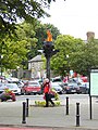 Flame sculpture in Kildare Square - geograph.org.uk - 5524615.jpg 480 × 640; 325 KB
-
 Flyover of the M4 - panoramio.jpg 2,048 × 1,536; 646 KB
-
 French Furze Grove, Kildare - geograph.org.uk - 4183725.jpg 640 × 480; 159 KB
-
 Gobán Saor.jpg 3,063 × 3,023; 2.56 MB
-
 Graveyard wall, Kildare - geograph.org.uk - 4183754.jpg 640 × 480; 158 KB
-
 Grey Abbey, Kildare.jpg 3,240 × 4,320; 2.35 MB
-
 Heaven -) - panoramio.jpg 1,600 × 1,200; 996 KB
-

-
 Irish Countryside (Unsplash).jpg 3,992 × 2,992; 9.07 MB
-
 James Nolan pub - geograph.org.uk - 5524622.jpg 640 × 480; 219 KB
-
-
 Kildare - St Brigid's Cathedral from Round Tower - geograph.org.uk - 4638026.jpg 1,024 × 768; 201 KB
-
-
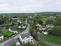
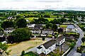
 Kildare - View E from top of Round Tower - geograph.org.uk - 4638037.jpg 1,024 × 768; 159 KB
-

-
 Kildare Castle.jpg 3,240 × 4,320; 2.66 MB
-
 Kildare Cathedral (St Brigid's) - geograph.org.uk - 6243281.jpg 640 × 800; 645 KB
-
 Kildare Cathedral Church of St. Brigid View from the Round Tower 1.jpg 4,592 × 3,447; 8 MB
-
 Kildare Cathedral Church of St. Brigid View from the Round Tower 2.jpg 4,542 × 3,163; 7.68 MB
-
 Kildare Cathedral Church of St. Brigid View from the Round Tower 3.jpg 4,514 × 2,877; 6.31 MB
-
 Kildare Cathedral Church of St. Brigid View from the Round Tower 4.jpg 4,546 × 3,386; 5.76 MB
-
 Kildare Cathedral Church of St. Brigid View from the Round Tower 5.jpg 4,533 × 2,733; 5.88 MB
-
 Kildare Cathedral Church of St. Brigid View from the Round Tower 6.jpg 4,573 × 3,137; 7.35 MB
-
 Kildare Cathedral Church of St. Brigid View from the Round Tower 7.jpg 4,544 × 2,977; 6.72 MB
-
 Kildare Cathedral Church of St. Brigid View from the Round Tower 8.jpg 4,579 × 3,073; 8.34 MB
-
 Kildare Cathedral Church of St. Brigid View from the Round Tower 9.jpg 4,576 × 3,428; 8.71 MB
-

-
 Kildare Cathedral Market Square, 2021-07-03.jpg 4,032 × 3,024; 5.26 MB
-
 Kildare Cathedral, 2021-07-03.jpg 3,212 × 2,409; 1.77 MB
-
 Kildare Credit Union.jpg 4,032 × 3,024; 4.46 MB
-
 Kildare Heritage Centre, 2021-07-03, 01.jpg 3,024 × 4,032; 3.99 MB
-
 Kildare Heritage Centre, 2021-07-03, 02.jpg 4,032 × 3,024; 3.91 MB
-
 Kildare Heritage Centre, 2021-07-03, 03.jpg 4,032 × 3,024; 4.47 MB
-
 Kildare Market House (geograph 4565009).jpg 1,024 × 768; 181 KB
-
 Kildare Market Square Statue of St Brigid 2013 09 04.jpg 2,336 × 3,504; 4.8 MB
-

-
 Kildare Round Tower - geograph.org.uk - 2833939.jpg 1,536 × 2,048; 575 KB
-
 Kildare Shopping Village - geograph.org.uk - 3397700.jpg 640 × 360; 54 KB
-
 Kildare station footbridges - geograph.org.uk - 5349221.jpg 4,000 × 3,000; 3.31 MB
-
 Kildare station platform - geograph.org.uk - 5349216.jpg 3,150 × 2,362; 2.68 MB
-
 Kildare Town - The Sweet Shop (3763208499).jpg 5,616 × 3,744; 14.83 MB
-
 Kildare Town - The Sweet Shop (3763764262).jpg 3,744 × 5,616; 12.11 MB
-
 Kildare Town and Surrounds.jpg 3,744 × 5,616; 16.62 MB
-
 Kildare Village banner Irish National Stud.jpg 4,690 × 670; 1.14 MB
-
 Kildare Village Shopping Outlet - geograph.org.uk - 4183688.jpg 640 × 480; 171 KB
-
 Kildare Village Shopping Outlet - geograph.org.uk - 4183700.jpg 640 × 480; 162 KB
-
 Kildare, Cleanmore Road - geograph.org.uk - 6243284.jpg 800 × 533; 507 KB
-
 Kildare-The Grey Abbey Ruins - geograph.org.uk - 3397678.jpg 1,024 × 575; 134 KB
-
 KILEEN CORMAC02 - panoramio.jpg 2,816 × 2,120; 2.05 MB
-
 Kinnefad castle - panoramio.jpg 3,264 × 2,448; 1.86 MB
-
 Main Street in Ballitore.jpg 4,032 × 3,024; 3.14 MB
-
 Meadow Road, Kildare - geograph.org.uk - 4183716.jpg 640 × 480; 159 KB
-
 Memorial Inscription on Mary Leadbeater House in Ballitore.jpg 4,032 × 3,024; 5.57 MB
-
 Murtaghs Corner Naas - panoramio.jpg 4,000 × 3,000; 2.89 MB
-
 Old convent building, Kildare - geograph.org.uk - 4183739.jpg 640 × 480; 173 KB
-
 Old forge in Kildare - panoramio.jpg 4,000 × 3,000; 2.83 MB
-
 Old style Saoirse Eireann post box - panoramio.jpg 3,000 × 4,000; 2.83 MB
-
 One way traffic - geograph.org.uk - 902911.jpg 640 × 492; 74 KB
-
 Owen Finn 1798 Memorial Inscription in Ballitore.jpg 4,032 × 3,024; 3.99 MB
-
 Paddy Dempsey 1798 Memorial Inscription in Ballitore.jpg 4,032 × 3,024; 3.74 MB
-
 Plaque in graveyard wall, Kildare - geograph.org.uk - 4183760.jpg 640 × 480; 180 KB
-
 Plaque, Bran ^ Sceloan - geograph.org.uk - 4183696.jpg 640 × 481; 175 KB
-
 Punchestown racing - panoramio.jpg 2,048 × 1,536; 608 KB
-
 R445, Kildare - geograph.org.uk - 4183720.jpg 640 × 480; 161 KB
-
 R445, Kildare - geograph.org.uk - 4183723.jpg 640 × 480; 164 KB
-
 R445, Kildare - geograph.org.uk - 4183731.jpg 640 × 480; 168 KB
-
 Rahin wood - panoramio.jpg 1,944 × 2,592; 1.59 MB
-
 Rahin Wood near Ballyboggan - panoramio.jpg 2,592 × 1,944; 1.76 MB
-
 River Boyne (view to the east from Ballyboggan Bridge) - panoramio.jpg 2,592 × 1,944; 1.34 MB
-
 Road at Kildare - geograph.org.uk - 4183702.jpg 640 × 480; 165 KB
-
 Round Tower, Kildare (agost 2011) - panoramio.jpg 1,536 × 2,048; 1.23 MB
-
 Ruined abbey, Kildare - geograph.org.uk - 4183679.jpg 640 × 480; 156 KB
-

-
 Silken Thomas Chapter 16 - geograph.org.uk - 4565047.jpg 1,024 × 768; 146 KB
-
 Squire Gannon's Kildare.jpg 3,240 × 4,320; 6.63 MB
-
 St Brigid's Cathedral, Kildare - geograph.org.uk - 5524534.jpg 640 × 480; 233 KB
-
 St Brigid's Cathedral, Kildare - geograph.org.uk - 6243279.jpg 640 × 800; 749 KB
-
 St Brigid's Parish Church, Kildare - geograph.org.uk - 4183706.jpg 640 × 480; 149 KB
-
 St. Brigid's Parish Catholic Church, Kildare, 2021-07-03.jpg 3,024 × 4,032; 3.08 MB
-
 St. Brigid’s Church in Clogherinkoe - panoramio.jpg 4,000 × 3,000; 2.92 MB
-
 St.Brigid's Cathedral, Kildare - geograph.org.uk - 4612343.jpg 1,024 × 768; 179 KB
-
 Statue in Kildare, 1798.jpg 2,907 × 3,877; 1.89 MB
-
 Stepping Stones - geograph.org.uk - 1770335.jpg 387 × 581; 60 KB
-
 Stone cottage, Kildare - geograph.org.uk - 4183745.jpg 640 × 480; 177 KB
-
 Stopping train to Dublin, Kildare station - geograph.org.uk - 5237537.jpg 1,024 × 747; 133 KB
-
 Stores, Kildare - geograph.org.uk - 4183728.jpg 640 × 480; 159 KB
-
 Sunset - panoramio (40).jpg 2,592 × 1,936; 2.13 MB
-

-
 The Boyne near Edenderry - panoramio.jpg 4,000 × 3,000; 2.85 MB
-
 The Curragh of Kildare, looking towards the Grandstand - panoramio.jpg 2,592 × 1,944; 1.22 MB
-
 The Curragh of Kildare, towards the Army camp in the distance - panoramio.jpg 2,592 × 1,944; 1.33 MB
-
 The Curragh Wrens.jpg 750 × 1,000; 459 KB
-
 The Curragh, towards Kildare Town - panoramio.jpg 2,592 × 1,944; 1.27 MB
-
 The golf course - geograph.org.uk - 4662332.jpg 4,000 × 2,136; 3.93 MB
-
 The Ivy Inn Naas - panoramio.jpg 4,000 × 3,000; 2.84 MB
-
 The M7 - E20 towards junction 12 - geograph.org.uk - 4150922.jpg 1,600 × 1,057; 1.03 MB
-
 The M7 - E20 towards junction 13 - geograph.org.uk - 4150874.jpg 1,600 × 899; 817 KB
-
 The Market Square, Kildare - geograph.org.uk - 4612375.jpg 1,024 × 768; 219 KB
-
 The Mary Leadbeater House.jpg 4,032 × 3,024; 3.96 MB
-
 The Old Bog Road - panoramio (1).jpg 3,000 × 4,000; 2.72 MB
-
 The Old Bog Road - panoramio.jpg 4,000 × 3,000; 2.84 MB
-
 The river Boyne near Edenderry - panoramio.jpg 4,000 × 3,000; 2.88 MB
-
 The Turn Inn Derrinturn - panoramio.jpg 4,000 × 3,000; 2.87 MB
-
 The Verger's House Kildare - geograph.org.uk - 4612367.jpg 1,024 × 768; 183 KB
-
There was an Old Man of Kildare.ogg 9.8 s; 111 KB
-
 Town square, Kildare - geograph.org.uk - 5524618.jpg 640 × 480; 246 KB
-
 Unusual cross - geograph.org.uk - 5524524.jpg 480 × 640; 271 KB
-
 Wall, roofs and water tower, Kildare - geograph.org.uk - 4612266.jpg 1,024 × 768; 200 KB
-
 Kildare Village, Nurney Road Kildare - geograph.org.uk - 633644.jpg 640 × 477; 56 KB


.jpg)


.jpg)
.jpg)
.jpg)


_-_panoramio.jpg)
_-_geograph.org.uk_-_5029020.jpg)
_-_geograph.org.uk_-_5029023.jpg)


.jpg)
_-_panoramio.jpg)

.jpg)


_-_panoramio.jpg)

.jpg)


_-_geograph.org.uk_-_6243281.jpg)


.jpg)


.jpg)
.jpg)


_-_panoramio.jpg)

_-_panoramio.jpg)


.jpg)


.jpg)


