Category:Kingswood, South Gloucestershire
Jump to navigation
Jump to search
Deutsch: Kingswood ist eine Stadt in South Gloucestershire im Südwesten Englands. Es handelt sich um eine östliche Vorstadt von Bristol an der A 420 von Bristol nach Oxford. Kingswood hat 62.679 Einwohner (2001).
English: Media related to the town of Kingswood, South Gloucestershire, England
Nederlands: Kingswood is een plaats in het bestuurlijke gebied South Gloucestershire, in het Engelse graafschap Gloucestershire. De plaats telt 62.679 inwoners, en ligt ten oosten van Bristol
Polski: Kingswood - miasto w Wielkiej Brytanii, w Anglii w hrabstwie Gloucestershire. Połozone jest na obrzeżach Bristolu przy drodze krajowej A 420. Miasto jest spójne z Bristolem, choć nie leży w granicach miasta. Jest 131 miastem Wielkiej Brytanii pod względem liczby ludności.

suburban area in South Gloucestershire, UK  | |||||
| Upload media | |||||
| Instance of |
| ||||
|---|---|---|---|---|---|
| Location | South Gloucestershire, Gloucestershire, South West England, England | ||||
| Different from | |||||
 | |||||
Subcategories
This category has only the following subcategory.
R
Media in category "Kingswood, South Gloucestershire"
The following 88 files are in this category, out of 88 total.
-
 2011 , Cock Road, Hanham, Bristol - geograph.org.uk - 2278182.jpg 3,910 × 2,871; 3.84 MB
-
 2011 , Hollyguest Road, Mount Hill, Hanham - geograph.org.uk - 2270680.jpg 3,676 × 2,777; 4.34 MB
-
 2011 , West on Mount Hill Road, Hanham - geograph.org.uk - 2278213.jpg 1,600 × 1,155; 365 KB
-
 Anchor Made for Ever, New Cheltenham - geograph.org.uk - 1550521.jpg 640 × 466; 168 KB
-

-
 ASDA, Longwell Green - geograph.org.uk - 245887.jpg 640 × 480; 74 KB
-

-
 Bank, Regent Street, Kingswood. - panoramio.jpg 2,525 × 2,033; 1.18 MB
-
 Bright Street, Kingswood - geograph.org.uk - 1556663.jpg 640 × 458; 168 KB
-
 Cheltenham Road looking west - geograph.org.uk - 1550679.jpg 640 × 519; 177 KB
-
 Cheltenham Road, New Cheltenham (2) - geograph.org.uk - 1550401.jpg 640 × 518; 240 KB
-
 Cheltenham Road, New Cheltenham - geograph.org.uk - 1532656.jpg 640 × 517; 166 KB
-
 Church path, Kingswood - geograph.org.uk - 1775233.jpg 480 × 640; 124 KB
-
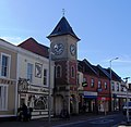
 Clock Tower, Kingswood - geograph.org.uk - 1775719.jpg 530 × 640; 72 KB
-
 Communication Masts, High Street. - panoramio.jpg 2,501 × 1,561; 703 KB
-
 Communications Mast, High Street, Kingswood. - panoramio.jpg 2,031 × 2,562; 804 KB
-
 Communications Mast, Lansdown View. - panoramio.jpg 1,931 × 2,706; 1,022 KB
-
 Con Trails over Bristol. September 2014 - panoramio.jpg 3,648 × 2,736; 1.72 MB
-
 Congregational church, Kingswood - geograph.org.uk - 1775536.jpg 640 × 480; 67 KB
-
 Do you think they do part exchange^ - geograph.org.uk - 1532784.jpg 640 × 469; 118 KB
-

-
 Electricity Sub Station, Gilbert Road, Kingswood. - panoramio.jpg 2,364 × 1,649; 1.1 MB
-
 Former Boot Factories, Orchard Road, (1896) - panoramio.jpg 2,661 × 2,009; 1,006 KB
-
 Former Engine House, Smiths Pit. - panoramio.jpg 1,961 × 2,013; 1.15 MB
-
 Former Offices of Douglas Motorcycle Factory. (Built 1902). - panoramio.jpg 2,816 × 2,112; 2.72 MB
-
 Gladstone Street, Soundwell - geograph.org.uk - 1776262.jpg 640 × 480; 104 KB
-
 Hanham Hospital and Hanham Hall Farm - geograph.org.uk - 534105.jpg 640 × 480; 95 KB
-
 Hanham Mount. 2008. - panoramio.jpg 2,055 × 2,329; 1.11 MB
-
 Hanham Road, Kingswood - geograph.org.uk - 1775490.jpg 640 × 427; 64 KB
-

-
 Kingsgate House, Kingswood - geograph.org.uk - 1776366.jpg 480 × 640; 94 KB
-
 Kingswood Fire Station - geograph.org.uk - 166675.jpg 640 × 427; 186 KB
-
 Kingswood Leisure Centre - geograph.org.uk - 1776248.jpg 640 × 352; 55 KB
-
 Kingswood Museum.jpg 500 × 365; 128 KB
-
 Kingswood, Derrick Road - geograph.org.uk - 2535586.jpg 1,024 × 768; 131 KB
-
 Kingswoodclocktower.JPG 1,718 × 1,682; 691 KB
-

-
 Moravian Road, Kingswood - geograph.org.uk - 1532794.jpg 640 × 515; 116 KB
-
 Mount Hill Road, Mount Hill - geograph.org.uk - 3385256.jpg 1,024 × 768; 112 KB
-
 New houses, Hanham Road, Kingswood - geograph.org.uk - 2475126.jpg 640 × 480; 77 KB
-
 New Mills, Kingswood (geograph 6141035).jpg 640 × 420; 99 KB
-
 Nursery, Soundwell - geograph.org.uk - 1776283.jpg 640 × 363; 65 KB
-
 Orchard Corner, Kingswood - geograph.org.uk - 3115456.jpg 640 × 480; 144 KB
-
 Post box BS15 2458 & 2459 (8004498552).jpg 3,000 × 4,000; 5.13 MB
-
-
 Public Toilet, Moravian Road, Kingswood. - panoramio.jpg 2,426 × 1,676; 1 MB
-
 Ramp, Kings Chase Shopping Centre - geograph.org.uk - 1775566.jpg 480 × 640; 93 KB
-
 River Avon passing St Annes Park, Bristol - geograph.org.uk - 33996.jpg 640 × 426; 115 KB
-
 River Avon west of Hanham Green - geograph.org.uk - 181438.jpg 640 × 424; 82 KB
-
 River Avon, Conham Ferry - geograph.org.uk - 181455.jpg 640 × 422; 98 KB
-
 Roundabout at the end of Cheltenham Road - geograph.org.uk - 1550468.jpg 640 × 494; 175 KB
-
 Shop Fronts (1892) Regent Street, Kingswood. - panoramio.jpg 1,952 × 2,592; 1.04 MB
-

-
 Shops, Cheltenham Road - geograph.org.uk - 1550411.jpg 640 × 488; 191 KB
-
 Single crisps - geograph.org.uk - 1775587.jpg 640 × 480; 53 KB
-
 Soundwell Road - geograph.org.uk - 1776237.jpg 640 × 418; 65 KB
-
 South Gloucestershire , Bristol Scenery - geograph.org.uk - 4155544.jpg 4,288 × 2,848; 7.41 MB
-
 Spring Hill - geograph.org.uk - 1776305.jpg 640 × 382; 67 KB
-
 Staple Hill Citadel Songsters - geograph.org.uk - 1614190.jpg 640 × 438; 79 KB
-

-
 Summit Close, Kingswood - geograph.org.uk - 1775464.jpg 640 × 480; 50 KB
-

-
 Syston Way, Hopewell Hill - geograph.org.uk - 1549356.jpg 640 × 493; 191 KB
-
 Tenniscourt Road, New Cheltenham - geograph.org.uk - 1550505.jpg 640 × 459; 154 KB
-
 The River Avon at Hanham, in the snow - geograph.org.uk - 5691.jpg 640 × 480; 151 KB
-
 The River Avon below Conham - geograph.org.uk - 565998.jpg 640 × 426; 122 KB
-
 The Shant - geograph.org.uk - 1776222.jpg 640 × 395; 47 KB
-
 The Warmley Giant - geograph.org.uk - 953625.jpg 480 × 640; 105 KB
-

-
 Urban graffiti beside the River Avon. - geograph.org.uk - 33997.jpg 640 × 426; 136 KB
-

-
 Waterside housing, St Anne's Park - geograph.org.uk - 182044.jpg 640 × 424; 113 KB
-
 B and Q Superstore - geograph.org.uk - 245875.jpg 640 × 480; 73 KB
-
 Hanham Green - geograph.org.uk - 534111.jpg 640 × 480; 122 KB
-
 Hanham Hospital - geograph.org.uk - 245893.jpg 640 × 480; 77 KB
-

-
 Milestone by Summerhill Road - geograph.org.uk - 491001.jpg 480 × 640; 142 KB
-

-
 Pipeline below Conham - geograph.org.uk - 565994.jpg 640 × 426; 142 KB
-

-

-
 River Avon above Conham - geograph.org.uk - 181442.jpg 640 × 418; 86 KB
-
 River Avon above St Anne's Park - geograph.org.uk - 182018.jpg 640 × 424; 104 KB
-
 River Avon, above St Anne's Park - geograph.org.uk - 182014.jpg 640 × 424; 103 KB
-
 River Avon, Conham - geograph.org.uk - 181445.jpg 640 × 418; 101 KB
-
 River Avon, Conham Ferry - geograph.org.uk - 181449.jpg 640 × 410; 111 KB
-
 Speedwell Fire Station - geograph.org.uk - 166672.jpg 640 × 427; 195 KB
-
 Watsons Road - geograph.org.uk - 245879.jpg 640 × 480; 92 KB


_-_geograph.org.uk_-_1550401.jpg)


_-_panoramio.jpg)

._-_panoramio.jpg)


.jpg)


.jpg)


_Regent_Street,_Kingswood._-_panoramio.jpg)


