Category:Kloosterplein, Breda
Jump to navigation
Jump to search
| Camera location | | View all coordinates using: OpenStreetMap |
|---|
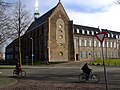
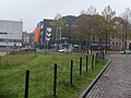
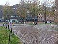
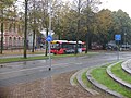
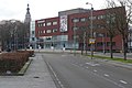
Nederlands: Afbeeldingen van de straat het Kloosterplein, Breda in het centrum van Breda in de provincie Noord-Brabant in het zuiden van Nederland. Het Kloosterplein is het verlengde van de straat de Oude Vest en gaat dan vervolgens over in de straat de Claudius Prinsenlaan.
street in Breda, the Netherlands | |||||
| Upload media | |||||
| Instance of | |||||
|---|---|---|---|---|---|
| Location | Breda, North Brabant, Netherlands | ||||
| Street address |
| ||||
 | |||||
Subcategories
This category has the following 3 subcategories, out of 3 total.
B
H
S
Media in category "Kloosterplein, Breda"
The following 17 files are in this category, out of 17 total.
-
 Bibliotheek Breda DSCF3614.jpg 2,048 × 1,536; 1.53 MB
-
 Catharina van Alexandrië WIP 1.png 2,759 × 4,340; 13.42 MB
-
 Catharina van Alexandrië.png 2,592 × 4,707; 16.03 MB
-
 Chasse Promenade DSCF2788.jpg 2,048 × 1,536; 1.6 MB
-
 Chasse Promenade DSCF2789.jpg 2,048 × 1,536; 1.55 MB
-
 Kloosterkazerne DSCF2424.JPG 2,816 × 2,112; 2.87 MB
-
 Kloosterplein, Breda DSCF3606.jpg 2,048 × 1,536; 1.56 MB
-
 Kloosterplein, Breda DSCF3607.jpg 2,048 × 1,536; 1.57 MB
-
 Kloosterplein, Breda DSCF3608.jpg 2,048 × 1,536; 1.54 MB
-
 Kloosterplein, Breda DSCF3609.jpg 2,048 × 1,536; 1.56 MB
-
 Kloosterplein, Breda DSCF3610.jpg 2,048 × 1,536; 1.56 MB
-
 Kloosterplein, Breda DSCF3611.jpg 2,048 × 1,536; 1.57 MB
-
 Kloosterplein, Breda DSCF3615.jpg 2,048 × 1,536; 1.53 MB
-
 Kloosterplein, Breda P1340765.jpg 4,000 × 2,672; 5.84 MB
-
 Kloosterplein, Breda P1340767.jpg 4,000 × 2,672; 5.96 MB
-
 Kloosterplein, Breda P1340769.jpg 4,000 × 2,672; 5.81 MB
-
 Kloosterplein, Breda P1340785.jpg 4,000 × 2,672; 6.11 MB


