Category:Oude Vest, Breda
Jump to navigation
Jump to search
| Object location | | View all coordinates using: OpenStreetMap |
|---|
street in Breda, the Netherlands | |||||
| Upload media | |||||
| Instance of | |||||
|---|---|---|---|---|---|
| Location | Breda Centrum, Breda, North Brabant, Netherlands | ||||
| Street address |
| ||||
 | |||||
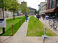
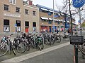
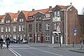
Nederlands: Afbeeldingen van de straat de Oude Vest gelegen in het centrum van de stad Breda in de provincie Noord-Brabant in het zuiden van Nederland. De Oude Vest is een verlengde van de straat de Houtmarkt, Breda en gaat dan vervolgens over in de straat het Kloosterplein, Breda.
Subcategories
This category has the following 5 subcategories, out of 5 total.
Media in category "Oude Vest, Breda"
The following 12 files are in this category, out of 12 total.
-
 Albert Heijn Oude Vest Breda DSCF1973.jpg 2,048 × 1,536; 1.54 MB
-
 Chasse, Breda, Netherlands - panoramio (2).jpg 2,048 × 1,375; 540 KB
-
 Fietsenstalling DSCF1966.jpg 2,048 × 1,536; 1.53 MB
-
 Oude Vest Breda DSCF1965.jpg 1,536 × 2,048; 1.41 MB
-
 Oude Vest Breda DSCF1967.jpg 2,048 × 1,536; 1.58 MB
-
 Oude Vest Breda DSCF1968.jpg 1,536 × 2,048; 1.58 MB
-
 Oude Vest Breda DSCF1969.jpg 2,048 × 1,536; 1.59 MB
-
 Oude Vest, Breda DSCF1974.jpg 2,048 × 1,536; 1.57 MB
-
 Oude Vest, Breda DSCF3234.jpg 2,816 × 2,112; 2.89 MB
-
 Oude Vest, Breda P1340790.jpg 4,000 × 2,672; 5.89 MB
-
 Oude Vest, Breda P1340792.jpg 4,000 × 2,672; 5.84 MB
-
 What Lifts You.png 3,366 × 2,376; 12.35 MB

.jpg)


