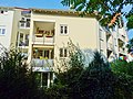
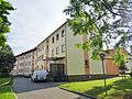
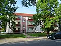
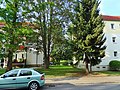
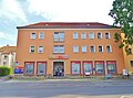
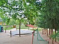
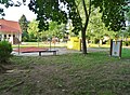
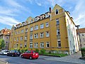
Category:Kohlbergstraße (Pirna)
Jump to navigation
Jump to search


| Object location | | View all coordinates using: OpenStreetMap |
|---|

street in Pirna, Saxony, Germany | |||||
| Upload media | |||||
| Instance of | |||||
|---|---|---|---|---|---|
| Location | Pirna, Sächsische Schweiz-Osterzgebirge, Saxony, Germany | ||||
 | |||||
Subcategories
This category has the following 21 subcategories, out of 21 total.
0
- Kohlbergstraße 4 (Pirna) (23 F)
- Kohlbergstraße 5 (Pirna) (7 F)
2
- Kohlbergstraße 27A (Pirna) (26 F)
- Kohlbergstraße 27B (Pirna) (25 F)
- Kohlbergstraße 27C (Pirna) (30 F)
- Kohlbergstraße 29 (Pirna) (9 F)
3
- Kohlbergstraße 30 (Pirna) (2 F)
- Kohlbergstraße 31 (Pirna) (8 F)
- Kohlbergstraße 32 (Pirna) (2 F)
- Kohlbergstraße 34 (Pirna) (4 F)
- Kohlbergstraße 36 (Pirna) (4 F)
A
B
- Bus stop Kohlbergstraße (1 F)
G
K
- Kohlbergstraße 1; 3 (Pirna) (14 F)
- Kohlbergstraße 5; 7 (Pirna) (1 F)
- Kohlbergstraße 9; 11 (Pirna) (9 F)
Media in category "Kohlbergstraße (Pirna)"
The following 200 files are in this category, out of 229 total.
(previous page) (next page)-
 20191020 Saniertes Haus Kohlbergstrasse 11 2019.jpg 6,016 × 4,000; 8.36 MB
-
 Abrissreifes Haus Zehistaer-Strasse 16 Ecke Kohlbergstrasse-15-11-2009.jpg 4,672 × 3,104; 6.45 MB
-
 Betonplatten neben Seidewitz nach Hochwasser Schwarzweiss 2002.jpg 1,703 × 1,111; 1.37 MB
-
 Ecke Kohlberg- und Zehistaer Strasse 16 ehemaliger Hausstandort 2010.jpg 4,680 × 3,120; 6.9 MB
-
 Fritz Ehrlich Straße, Pirna 123016979.jpg 5,184 × 3,888; 10.62 MB
-
 Fritz-Ehrlich-Straße Pirna 1979.jpg 3,504 × 2,481; 3.89 MB
-
 Fritz-Ehrlich-Straße Pirna Richtung Kohlbergstraße 1979.jpg 5,166 × 3,336; 2.46 MB
-
 Kohlberg (Hill), Pirna 121947081.jpg 5,184 × 3,888; 10.45 MB
-
 Kohlbergstrasse Zehistaer Strasse 16 Ecke Kohlbergstrasse 2018.jpg 6,016 × 4,000; 10.72 MB
-
 Kohlbergstraße 10 und Kohlbergstraße 20 1978.jpg 9,194 × 5,802; 9.09 MB
-
 Kohlbergstraße Pirna - panoramio (1).jpg 5,184 × 3,888; 13.95 MB
-
 Kohlbergstraße Pirna - panoramio (10).jpg 5,184 × 3,888; 13.44 MB
-
 Kohlbergstraße Pirna - panoramio (11).jpg 5,184 × 3,888; 12.36 MB
-
 Kohlbergstraße Pirna - panoramio (12).jpg 5,184 × 3,888; 13.27 MB
-
 Kohlbergstraße Pirna - panoramio (13).jpg 5,184 × 3,888; 12.57 MB
-
 Kohlbergstraße Pirna - panoramio (14).jpg 5,184 × 3,888; 14.35 MB
-
 Kohlbergstraße Pirna - panoramio (15).jpg 5,184 × 3,888; 15.11 MB
-
 Kohlbergstraße Pirna - panoramio (2).jpg 5,184 × 3,888; 12.31 MB
-
 Kohlbergstraße Pirna - panoramio (3).jpg 5,184 × 3,888; 13.63 MB
-
 Kohlbergstraße Pirna - panoramio (4).jpg 5,184 × 3,888; 14.14 MB
-
 Kohlbergstraße Pirna - panoramio (5).jpg 5,184 × 3,888; 13.8 MB
-
 Kohlbergstraße Pirna - panoramio (6).jpg 5,184 × 3,888; 13.62 MB
-
 Kohlbergstraße Pirna - panoramio (7).jpg 5,184 × 3,888; 12.44 MB
-
 Kohlbergstraße Pirna - panoramio (8).jpg 5,184 × 3,888; 12.97 MB
-
 Kohlbergstraße Pirna - panoramio (9).jpg 5,184 × 3,888; 12.9 MB
-
 Kohlbergstraße Pirna - panoramio.jpg 5,184 × 3,888; 13.05 MB
-
 Kohlbergstraße Pirna Winter 1982.jpg 3,000 × 2,000; 1.22 MB
-
 Kohlbergstraße, Pirna 121949196.jpg 5,184 × 3,888; 13.58 MB
-
 Kohlbergstraße, Pirna 121949199.jpg 5,184 × 3,888; 14.67 MB
-
 Kohlbergstraße, Pirna 121949200.jpg 5,184 × 3,888; 15.27 MB
-
 Kohlbergstraße, Pirna 121949201.jpg 5,184 × 3,888; 12.49 MB
-
 Kohlbergstraße, Pirna 121949203.jpg 5,184 × 3,888; 9.44 MB
-
 Kohlbergstraße, Pirna 121949206.jpg 5,184 × 3,888; 14.55 MB
-
 Kohlbergstraße, Pirna 121949208.jpg 5,184 × 3,888; 13.72 MB
-
 Kohlbergstraße, Pirna 121949211.jpg 5,184 × 3,888; 14.75 MB
-
 Kohlbergstraße, Pirna 121949213.jpg 5,184 × 3,888; 15.21 MB
-
 Kohlbergstraße, Pirna 121949216.jpg 5,184 × 3,888; 12.84 MB
-
 Kohlbergstraße, Pirna 121949217.jpg 3,888 × 5,184; 13.84 MB
-
 Kohlbergstraße, Pirna 121949218.jpg 5,184 × 3,888; 13.58 MB
-
 Kohlbergstraße, Pirna 121949220.jpg 3,888 × 5,184; 11.63 MB
-
 Kohlbergstraße, Pirna 121949223.jpg 5,184 × 3,888; 14.45 MB
-
 Kohlbergstraße, Pirna 121949227.jpg 5,184 × 3,888; 15.11 MB
-
 Kohlbergstraße, Pirna 121949230.jpg 5,184 × 3,888; 3.24 MB
-
 Kohlbergstraße, Pirna 121949233.jpg 5,184 × 3,888; 3.65 MB
-
 Kohlbergstraße, Pirna 121949234.jpg 5,184 × 3,888; 14.87 MB
-
 Kohlbergstraße, Pirna 121949236.jpg 5,184 × 3,888; 13.34 MB
-
 Kohlbergstraße, Pirna 121949239.jpg 5,184 × 3,888; 14.9 MB
-
 Kohlbergstraße, Pirna 121949243.jpg 5,184 × 3,888; 15.12 MB
-
 Kohlbergstraße, Pirna 121949246.jpg 5,184 × 3,888; 15.73 MB
-
 Kohlbergstraße, Pirna 121949248.jpg 4,970 × 3,584; 2.55 MB
-
 Kohlbergstraße, Pirna 121949251.jpg 5,184 × 3,888; 14.19 MB
-
 Kohlbergstraße, Pirna 121949255.jpg 3,888 × 5,184; 11.85 MB
-
 Kohlbergstraße, Pirna 121949260.jpg 5,184 × 3,888; 14.13 MB
-
 Kohlbergstraße, Pirna 121949262.jpg 5,184 × 3,888; 2.6 MB
-
 Kohlbergstraße, Pirna 121949264.jpg 5,184 × 3,888; 13.83 MB
-
 Kohlbergstraße, Pirna 121949269.jpg 5,184 × 3,888; 13.79 MB
-
 Kohlbergstraße, Pirna 121949271.jpg 5,184 × 3,888; 14.27 MB
-
 Kohlbergstraße, Pirna 121949273.jpg 5,184 × 3,888; 12.4 MB
-
 Kohlbergstraße, Pirna 121949277.jpg 5,184 × 3,888; 3.57 MB
-
 Kohlbergstraße, Pirna 121949282.jpg 5,184 × 3,888; 12.85 MB
-
 Kohlbergstraße, Pirna 121949285.jpg 5,184 × 3,888; 14.31 MB
-
 Kohlbergstraße, Pirna 121949287.jpg 5,184 × 3,888; 11.51 MB
-
 Kohlbergstraße, Pirna 121949292.jpg 4,954 × 3,562; 11.07 MB
-
 Kohlbergstraße, Pirna 121949296.jpg 5,184 × 3,888; 14.59 MB
-
 Kohlbergstraße, Pirna 121949299.jpg 5,184 × 3,888; 12.45 MB
-
 Kohlbergstraße, Pirna 121949300.jpg 5,184 × 3,888; 10.87 MB
-
 Kohlbergstraße, Pirna 121949302.jpg 5,184 × 3,888; 13.1 MB
-
 Kohlbergstraße, Pirna 121949304.jpg 3,888 × 5,184; 11.03 MB
-
 Kohlbergstraße, Pirna 121949306.jpg 5,184 × 3,888; 14.32 MB
-
 Kohlbergstraße, Pirna 121949308.jpg 5,184 × 3,888; 11.89 MB
-
 Kohlbergstraße, Pirna 121949311.jpg 5,184 × 3,888; 15.6 MB
-
 Kohlbergstraße, Pirna 121949314.jpg 5,184 × 3,888; 13.23 MB
-
 Kohlbergstraße, Pirna 121949315.jpg 5,184 × 3,888; 12.4 MB
-
 Kohlbergstraße, Pirna 121949319.jpg 5,184 × 3,888; 12.25 MB
-
 Kohlbergstraße, Pirna 121949321.jpg 5,184 × 3,888; 10.6 MB
-
 Kohlbergstraße, Pirna 121949322.jpg 5,184 × 3,888; 11.85 MB
-
 Kohlbergstraße, Pirna 121949325.jpg 5,184 × 3,888; 12.53 MB
-
 Kohlbergstraße, Pirna 121949326.jpg 3,640 × 5,008; 12.98 MB
-
 Kohlbergstraße, Pirna 121949329.jpg 5,184 × 3,888; 15.11 MB
-
 Kohlbergstraße, Pirna 121949332.jpg 5,184 × 3,888; 12.18 MB
-
 Kohlbergstraße, Pirna 121949335.jpg 5,184 × 3,888; 14.77 MB
-
 Kohlbergstraße, Pirna 121949336.jpg 5,184 × 3,888; 12.52 MB
-
 Kohlbergstraße, Pirna 121949337.jpg 5,184 × 3,888; 7.9 MB
-
 Kohlbergstraße, Pirna 121949339.jpg 3,888 × 5,184; 12.46 MB
-
 Kohlbergstraße, Pirna 121949340.jpg 3,888 × 5,184; 10.87 MB
-
 Kohlbergstraße, Pirna 121949344.jpg 5,184 × 3,888; 13.89 MB
-
 Kohlbergstraße, Pirna 121949347.jpg 5,184 × 3,888; 2.9 MB
-
 Kohlbergstraße, Pirna 121949348.jpg 3,798 × 5,118; 10.05 MB
-
 Kohlbergstraße, Pirna 121949351.jpg 5,184 × 3,888; 12.55 MB
-
 Kohlbergstraße, Pirna 121949352.jpg 5,184 × 3,888; 11.58 MB
-
 Kohlbergstraße, Pirna 121949354.jpg 5,184 × 3,888; 12.57 MB
-
 Kohlbergstraße, Pirna 121949356.jpg 5,184 × 3,888; 10.52 MB
-
 Kohlbergstraße, Pirna 121949361.jpg 5,184 × 3,888; 12.25 MB
-
 Kohlbergstraße, Pirna 121949363.jpg 5,184 × 3,888; 2.68 MB
-
 Kohlbergstraße, Pirna 121949364.jpg 5,184 × 3,888; 12.79 MB
-
 Kohlbergstraße, Pirna 121949366.jpg 5,184 × 3,888; 16.16 MB
-
 Kohlbergstraße, Pirna 121949368.jpg 5,184 × 3,888; 10.37 MB
-
 Kohlbergstraße, Pirna 121949370.jpg 5,184 × 3,888; 12.97 MB
-
 Kohlbergstraße, Pirna 121949371.jpg 5,184 × 3,888; 13.61 MB
-
 Kohlbergstraße, Pirna 121949372.jpg 5,184 × 3,888; 9.49 MB
-
 Kohlbergstraße, Pirna 121949374.jpg 3,888 × 5,184; 11.77 MB
-
 Kohlbergstraße, Pirna 121949377.jpg 5,184 × 3,888; 12.65 MB
-
 Kohlbergstraße, Pirna 121949378.jpg 5,184 × 3,888; 12.86 MB
-
 Kohlbergstraße, Pirna 121949379.jpg 5,184 × 3,888; 13.61 MB
-
 Kohlbergstraße, Pirna 121949381.jpg 3,888 × 5,184; 3.15 MB
-
 Kohlbergstraße, Pirna 121949382.jpg 5,184 × 3,888; 14.01 MB
-
 Kohlbergstraße, Pirna 121949384.jpg 5,184 × 3,888; 13.92 MB
-
 Kohlbergstraße, Pirna 121949386.jpg 5,184 × 3,888; 3.42 MB
-
 Kohlbergstraße, Pirna 121949387.jpg 3,888 × 5,184; 11.62 MB
-
 Kohlbergstraße, Pirna 121949388.jpg 3,888 × 5,184; 12.08 MB
-
 Kohlbergstraße, Pirna 121949390.jpg 5,184 × 3,888; 14.46 MB
-
 Kohlbergstraße, Pirna 121949392.jpg 5,184 × 3,888; 13.24 MB
-
 Kohlbergstraße, Pirna 121949393.jpg 5,184 × 3,888; 3.4 MB
-
 Kohlbergstraße, Pirna 121949395.jpg 5,184 × 3,888; 11.37 MB
-
 Kohlbergstraße, Pirna 121949399.jpg 5,184 × 3,888; 15.94 MB
-
 Kohlbergstraße, Pirna 121949405.jpg 5,184 × 3,888; 13.62 MB
-
 Kohlbergstraße, Pirna 121949407.jpg 5,184 × 3,888; 14.04 MB
-
 Kohlbergstraße, Pirna 121949408.jpg 5,184 × 3,888; 14.42 MB
-
 Kohlbergstraße, Pirna 121949411.jpg 5,184 × 3,888; 12.25 MB
-
 Kohlbergstraße, Pirna 121949412.jpg 5,184 × 3,888; 12.49 MB
-
 Kohlbergstraße, Pirna 121949413.jpg 5,184 × 3,888; 14.55 MB
-
 Kohlbergstraße, Pirna 121949415.jpg 5,184 × 3,888; 14.57 MB
-
 Kohlbergstraße, Pirna 121949418.jpg 5,184 × 3,888; 14.71 MB
-
 Kohlbergstraße, Pirna 121949419.jpg 5,184 × 3,888; 14.53 MB
-
 Kohlbergstraße, Pirna 121949421.jpg 5,184 × 3,888; 12.99 MB
-
 Kohlbergstraße, Pirna 121949422.jpg 5,184 × 3,888; 15.02 MB
-
 Kohlbergstraße, Pirna 121949424.jpg 5,184 × 3,888; 10.95 MB
-
 Kohlbergstraße, Pirna 121949425.jpg 5,184 × 3,888; 11.98 MB
-
 Kohlbergstraße, Pirna 121949427.jpg 4,978 × 3,596; 2.26 MB
-
 Kohlbergstraße, Pirna 121949429.jpg 5,184 × 3,888; 14.05 MB
-
 Kohlbergstraße, Pirna 121949430.jpg 3,888 × 5,184; 10.54 MB
-
 Kohlbergstraße, Pirna 121949432.jpg 5,184 × 3,888; 12.2 MB
-
 Kohlbergstraße, Pirna 121949435.jpg 3,888 × 5,184; 11.51 MB
-
 Kohlbergstraße, Pirna 121949438.jpg 5,184 × 3,888; 9.42 MB
-
 Kohlbergstraße, Pirna 121949443.jpg 5,184 × 3,888; 11.65 MB
-
 Kohlbergstraße, Pirna 121949444.jpg 5,184 × 3,888; 9.5 MB
-
 Kohlbergstraße, Pirna 121949447.jpg 5,184 × 3,888; 13.05 MB
-
 Kohlbergstraße, Pirna 121949452.jpg 5,184 × 3,888; 15.05 MB
-
 Kohlbergstraße, Pirna 121949454.jpg 5,184 × 3,888; 10.35 MB
-
 Kohlbergstraße, Pirna 121949457.jpg 3,888 × 5,184; 13.15 MB
-
 Kohlbergstraße, Pirna 121949459.jpg 5,184 × 3,888; 11.82 MB
-
 Kohlbergstraße, Pirna 121949462.jpg 5,184 × 3,888; 13.47 MB
-
 Kohlbergstraße, Pirna 121949465.jpg 5,184 × 3,888; 15.44 MB
-
 Kohlbergstraße, Pirna 121949469.jpg 5,184 × 3,888; 13.41 MB
-
 Kohlbergstraße, Pirna 121949470.jpg 5,184 × 3,888; 11.68 MB
-
 Kohlbergstraße, Pirna 121949472.jpg 5,184 × 3,888; 14.68 MB
-
 Kohlbergstraße, Pirna 121949476.jpg 5,184 × 3,888; 12.21 MB
-
 Kohlbergstraße, Pirna 121949479.jpg 5,184 × 3,888; 14.42 MB
-
 Kohlbergstraße, Pirna 121949481.jpg 3,888 × 5,184; 11.9 MB
-
 Kohlbergstraße, Pirna 121949484.jpg 5,184 × 3,888; 13.95 MB
-
 Kohlbergstraße, Pirna 121949486.jpg 5,184 × 3,888; 10.26 MB
-
 Kohlbergstraße, Pirna 121949489.jpg 5,184 × 3,888; 11.13 MB
-
 Kohlbergstraße, Pirna 121949491.jpg 5,184 × 3,888; 10.9 MB
-
 Kohlbergstraße, Pirna 121949495.jpg 5,122 × 3,806; 9.77 MB
-
 Kohlbergstraße, Pirna 121949498.jpg 5,184 × 3,888; 10.83 MB
-
 Kohlbergstraße, Pirna 121950165.jpg 5,184 × 3,888; 12.78 MB
-
 Kohlbergstraße, Pirna 121950168.jpg 5,184 × 3,888; 9.41 MB
-
 Kohlbergstraße, Pirna 121950171.jpg 5,184 × 3,888; 13.44 MB
-
 Kohlbergstraße, Pirna 121950173.jpg 5,184 × 3,888; 14.61 MB
-
 Kohlbergstraße, Pirna 121950177.jpg 5,184 × 3,888; 13.44 MB
-
 Kohlbergstraße, Pirna 121950181.jpg 3,888 × 5,184; 14.04 MB
-
 Kohlbergstraße, Pirna 121950183.jpg 3,888 × 5,184; 10.55 MB
-
 Kohlbergstraße, Pirna 121950185.jpg 5,184 × 3,888; 3.8 MB
-
 Kohlbergstraße, Pirna 121950189.jpg 5,184 × 3,888; 13.95 MB
-
 Kohlbergstraße, Pirna 121950191.jpg 5,184 × 3,888; 15 MB
-
 Kohlbergstraße, Pirna 121950193.jpg 5,184 × 3,888; 13.61 MB
-
 Kohlbergstraße, Pirna 121950196.jpg 5,048 × 3,702; 12.1 MB
-
 Kohlbergstraße, Pirna 121950200.jpg 5,184 × 3,888; 12.43 MB
-
 Kohlbergstraße, Pirna 121950201.jpg 3,888 × 5,184; 13.05 MB
-
 Kohlbergstraße, Pirna 121950204.jpg 5,184 × 3,888; 11.87 MB
-
 Kohlbergstraße, Pirna 121950207.jpg 3,888 × 5,184; 8.75 MB
-
 Kohlbergstraße, Pirna 121950209.jpg 5,184 × 3,888; 15 MB
-
 Kohlbergstraße, Pirna 121950210.jpg 5,062 × 3,720; 9.28 MB
-
 Kohlbergstraße, Pirna 121950212.jpg 3,754 × 5,086; 9.76 MB
-
 Kohlbergstraße, Pirna 121950213.jpg 5,184 × 3,888; 10.18 MB
-
 Kohlbergstraße, Pirna 121950216.jpg 5,184 × 3,888; 11.22 MB
-
 Kohlbergstraße, Pirna 121950217.jpg 5,184 × 3,888; 10.95 MB
-
 Kohlbergstraße, Pirna 121950219.jpg 3,888 × 5,184; 8.89 MB
-
 Kohlbergstraße, Pirna 121950221.jpg 5,184 × 3,888; 12.46 MB
-
 Kohlbergstraße, Pirna 121950223.jpg 5,062 × 3,720; 7.97 MB
-
 Kohlbergstraße, Pirna 121950226.jpg 3,888 × 5,184; 11.69 MB
-
 Kohlbergstraße, Pirna 121950230.jpg 5,184 × 3,888; 11.78 MB
-
 Kohlbergstraße, Pirna 121950231.jpg 5,184 × 3,888; 11.58 MB
-
 Kohlbergstraße, Pirna 121950233.jpg 3,888 × 5,184; 11.33 MB
-
 Kohlbergstraße, Pirna 121950235.jpg 5,184 × 3,888; 10.33 MB
-
 Kohlbergstraße, Pirna 121950236.jpg 5,184 × 3,888; 10.28 MB
-
 Kohlbergstraße, Pirna 121950244.jpg 5,184 × 3,888; 2.27 MB
-
 Kohlbergstraße, Pirna 121950248.jpg 5,184 × 3,888; 13.7 MB
-
 Kohlbergstraße, Pirna 121950260.jpg 5,184 × 3,888; 12.24 MB
-
 Kohlbergstraße, Pirna 121950262.jpg 5,184 × 3,888; 11.14 MB
-
 Kohlbergstraße, Pirna 121950263.jpg 5,184 × 3,888; 11.73 MB
-
 Kohlbergstraße, Pirna 121950268.jpg 5,184 × 3,888; 14.3 MB
-
 Kohlbergstraße, Pirna 121950270.jpg 5,184 × 3,888; 11.36 MB
-
 Kohlbergstraße, Pirna 121950272.jpg 3,888 × 5,184; 12.88 MB
-
 Kohlbergstraße, Pirna 121950275.jpg 5,184 × 3,888; 13.81 MB
-
 Kohlbergstraße, Pirna 121950276.jpg 5,184 × 3,888; 8.37 MB
-
 Kohlbergstraße, Pirna 121950277.jpg 5,184 × 3,888; 10.18 MB
-
 Kohlbergstraße, Pirna 121950278.jpg 3,888 × 5,184; 10.26 MB
-
 Kohlbergstraße, Pirna 121950279.jpg 3,888 × 5,184; 10.36 MB
-
 Kohlbergstraße, Pirna 121950281.jpg 3,778 × 5,102; 11.14 MB


,_Pirna_121947081.jpg)


.jpg)
.jpg)
.jpg)
.jpg)
.jpg)
.jpg)
.jpg)
.jpg)
.jpg)
.jpg)
.jpg)
.jpg)
.jpg)
.jpg)
.jpg)


&filefrom=Kohlbergstra%C3%9Fe%2C+Pirna+121950285.jpg#mw-category-media)