Category:Lötschberg
Jump to navigation
Jump to search
| Object location | | View all coordinates using: OpenStreetMap |
|---|
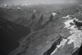
mountainous region in the canton of Valais, Switzerland  Vue aérienne de septembre 1934 du Lötschberg vu depuis le nord-est ; le glacier au premier plan est le Tellingletscher. | |||||
| Upload media | |||||
| Instance of | |||||
|---|---|---|---|---|---|
| Location | Ferden, Westlich Raron District, Valais, Switzerland | ||||
| Mountain range |
| ||||
| Elevation above sea level |
| ||||
| Different from | |||||
 | |||||
Subcategories
This category has the following 6 subcategories, out of 6 total.
Media in category "Lötschberg"
The following 35 files are in this category, out of 35 total.
-
 027 24A Campion Jean-Claude.jpg 1,536 × 1,024; 1.21 MB
-
 Bietschhorn from Lötschen Pass.jpg 4,000 × 2,856; 8.03 MB
-
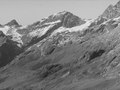
 Bietschhorn W.jpg 3,209 × 2,632; 4.28 MB
-
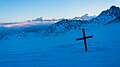 Dusk at Lötschenpass.jpg 6,000 × 3,375; 13.31 MB
-
 ETH-BIB-Bietschhorn vom Lötschenpass-Dia 247-00964.tif 3,590 × 2,551; 26.27 MB
-
 ETH-BIB-Lawinenkegel, Balmhorn, Lötschenpass-Dia 247-02052.tif 3,596 × 2,730; 9.44 MB
-
 ETH-BIB-Lötschental-Inlandflüge-LBS MH05-21-32 (cropped).tif 1,891 × 1,418; 7.69 MB
-
 ETH-BIB-Lötschental-Inlandflüge-LBS MH05-21-32.tif 3,508 × 2,363; 23.83 MB
-
 ETH-BIB-Lötschental-LBS H1-018899 (cropped).tif 2,783 × 2,086; 5.57 MB
-
 ETH-BIB-Lötschental-LBS H1-018899.tif 6,777 × 4,757; 92.37 MB
-
 Ferdenrothorn (3.180 m ü.d.M.) mit Lötschenpass - panoramio.jpg 3,872 × 2,592; 3.69 MB
-
 Ferdenrothorn NE.jpg 4,000 × 3,000; 8.26 MB
-
 Ferdenrothorn.jpg 4,000 × 3,000; 9.53 MB
-
 Loetschepasshuette.JPG 3,072 × 2,304; 1.92 MB
-
 Lötschegletscher.jpg 1,544 × 1,024; 754 KB
-
 Lötschegletscher01.jpg 1,600 × 1,200; 676 KB
-
 Lötschegletscher02.jpg 1,600 × 1,200; 678 KB
-
 Lötschegletscher03.jpg 1,600 × 1,200; 660 KB
-
 Lötschengletscher.jpg 3,200 × 2,400; 5.19 MB
-
 Lötschenpass LBS L1-880097.jpg 6,757 × 5,340; 4.74 MB
-
 Lötschenpass Süd.jpg 1,600 × 1,200; 653 KB
-
 Lötschenpass Wanderweg.jpg 1,544 × 1,024; 985 KB
-
 Lötschenpass.jpg 1,000 × 700; 107 KB
-
 Lötschenpasshütte 1988 LBS L1-880097.jpg 6,757 × 5,340; 25.32 MB
-
 Lötschepass01.jpg 1,600 × 1,200; 669 KB
-
 Lötschepass02.jpg 1,600 × 1,200; 618 KB
-
 Lötschepass03.jpg 1,600 × 1,200; 629 KB
-
 Militärseilbahn Lötschenpass BAR.jpg 1,669 × 2,362; 1.18 MB
-
 Night sky at Lötschenpass.jpg 6,000 × 4,000; 35.06 MB
-
 Panoramic view between Lötschepass and Kleinhockenhorn (16613754528).jpg 29,280 × 3,669; 90.26 MB
-
 Panoramic view between Lötschepass and Kleinhockenhorn - panoramio (1).jpg 18,325 × 2,182; 8.46 MB
-
 Panoramic view between Lötschepass and Kleinhockenhorn - panoramio.jpg 17,866 × 2,238; 7.22 MB
-
 Rising clouds above Lötschenpass.jpg 6,000 × 3,375; 8.2 MB
-
 Suone Lötschenpass Süd.jpg 1,200 × 1,600; 631 KB
-
 Wanderwergweiser Lötschenpass.jpg 450 × 394; 62 KB


_mit_L%C3%B6tschenpass_-_panoramio.jpg)


.jpg)
.jpg)