Category:Larabanga
Jump to navigation
Jump to search
| Object location | | View all coordinates using: OpenStreetMap |
|---|
human settlement in Ghana  | |||||
| Upload media | |||||
| Instance of | |||||
|---|---|---|---|---|---|
| Location | |||||
 | |||||
Larabanga (also Laribanga) is a village in the West Gonja Municipal District of the Savannah Region of Ghana.
Subcategories
This category has the following 2 subcategories, out of 2 total.
L
- Larabanga Mystic Stone (6 F)
Media in category "Larabanga"
The following 8 files are in this category, out of 8 total.
-
 Babouin (120916011).jpeg 2,048 × 1,536; 1.09 MB
-
 Larabanga Mosque 0.jpg 6,016 × 4,016; 597 KB
-
 Larabanga Mosque 1.jpg 6,016 × 4,016; 474 KB
-
 Larabanga Mosque 2.jpg 6,016 × 4,016; 465 KB
-
 Larabanga Shea Nut.jpg 2,048 × 1,536; 1.07 MB
-
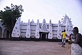
 Larbanga Mosque in the Savannah Region of Ghana.jpg 960 × 540; 84 KB
-
 Mistry Stone in Larabanja.jpg 6,016 × 4,016; 10.45 MB
-
 Wood in a dam at Larabanga.jpg 6,016 × 4,016; 9.29 MB
.jpeg)


