Category:Lemybrien
Jump to navigation
Jump to search
village in Munster, Ireland  | |||||
| Upload media | |||||
| Instance of | |||||
|---|---|---|---|---|---|
| Location | County Waterford, Munster, Ireland | ||||
 | |||||
English: Lemybrien (Léim Uí Bhriain, meaning "O'Brien's leap", in Irish) is a small Irish village on the N25 road – part of European route E30, linking Cork to Omsk in Russia – between Dungarvan and Waterford. It lies in the foothills of the scenic Monavullagh Mountains in an area of County Waterford known as "The Déise". Stage 2 of the 1998 Tour de France passed through Lemybrien.
Media in category "Lemybrien"
The following 9 files are in this category, out of 9 total.
-
 Eastbound N25 at Lemybrien - geograph.org.uk - 6093080.jpg 800 × 533; 451 KB
-
 Field near Lemybrien, north view - geograph.org.uk - 3725405.jpg 2,592 × 1,936; 1.81 MB
-
 Field near Lemybrien, northwest view - geograph.org.uk - 3725399.jpg 2,592 × 1,936; 1.71 MB
-
 N25 at Lemybrien (geograph 6093056).jpg 800 × 600; 853 KB
-
 N25-E30 east of Lemybrien - geograph.org.uk - 6093082.jpg 800 × 533; 560 KB
-
-
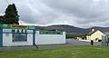
 Texaco garage (geograph 4790746).jpg 1,200 × 848; 350 KB
-
 Texaco Garage at Lemybrien - geograph.org.uk - 6093061.jpg 800 × 533; 520 KB
-
 The R676 at Lemybrien (geograph 4790723).jpg 1,200 × 741; 398 KB


.jpg)

.jpg)

.jpg)