Category:Leominster
Jump to navigation
Jump to search
town in Herefordshire, England, UK  | |||||
| Upload media | |||||
| Pronunciation audio | |||||
|---|---|---|---|---|---|
| Instance of | |||||
| Location | Herefordshire, West Midlands, England | ||||
| Different from | |||||
| official website | |||||
 | |||||
 | |||||


Cymraeg: Mae Llanllieni ( Saesneg: Leominster) yn dref hanesyddol yn Swydd Henffordd. Fe'i lleolir hanner ffordd rhwng Henffordd i'r de a Llwydlo i'r gogledd, ar groesffordd ffyrdd yr A49 a'r A44. Mae ganddi boblogaeth o tua 11,000. (→Llanllieni)
Deutsch: Leominster [) ist eine englische Kleinstadt mit Marktrecht in den West Midlands. Sie liegt am Fluss Lugg in der Grafschaft Herefordshire und hat ungefähr 11.000 Einwohner. Leominster war seit dem Spätmittelalter besonders für sein Lemster Ore, eine besonders feine kurzfaserige Schafwolle, bekannt. (→Leominster)
English: Leominster ( north of the city of Hereford and approx 7 miles south of the Shropshire border, 11 miles from Ludlow in Shropshire. With a population of approximately 11,700 people, Leominster is the largest of the five towns (Leominster, Ross-on-Wye, Ledbury, Bromyard & Kington) in the county surrounding the City of Hereford. (→Leominster)
Frysk: Leominster is in plak yn it bestjoerlike gebiet Herefordshire, yn it Ingelske greefskip Herefordshire. It leit op it plak dêr't de rivieren Lugg en Kenwater byelkoar komme, sa'n 19 km benoarden de stêd Hereford en 18 km besuden Ludlow. (→Leominster)
Magyar: Leominster egy 11 000 lakosú vásárváros az angliai Herefordshire grófságban. A Lugg folyó partján fekszik. (→Leominster)
Italiano: Leominster è un paese di 11.000 abitanti della contea dell' Herefordshire, in Inghilterra. (→Leominster (Regno Unito))
Nederlands: Leominster is een plaats in het bestuurlijke gebied Herefordshire, in het gelijknamige Engelse graafschap. De plaats telt ongeveer 11.000 inwoners en ligt op zo'n 19 km van Hereford. Archeologisch onderzoek duidt op stichting van de nederzetting in het midden van de 7e eeuw. Rond de wisseling van het eerste naar het tweede millennium was het dorp de verblijfplaats van Leofric, Earl (graaf) van Murcia en zijn vrouw Lady Godiva. Tegenwoordig is het een market town, een Engelse term met wettelijke grondslag, waarmee onderscheid wordt gemaakt naar het grotere stad en het kleinere dorp. (→Leominster (Herefordshire))
Norsk nynorsk: Leominster er ein marknadsby i grevskapet Herefordshire i England. Han har kring 11 000 innbyggjarar og ligg om lag 19 km nord for byen Hereford og 18 km sør for Ludlow. Han er den største av fem byar kring Hereford i grevskapet, og ligg der elva Lugg møter Kenwater. (→Leominster)
Polski: Leominster (wym. ) – miasto w Wielkiej Brytanii, w Anglii, w regionie West Midlands, w hrabstwie Herefordshire. W 2001 roku miasto to zamieszkiwało 11 000 osób. (→Leominster)
Română: Leominster (pronunțat ) este un oraș în comitatul Herefordshire, regiunea West Midlands, Anglia. (→Leominster)
Simple English: Leominster is a small town in the English county of Herefordshire. The name is said as "Lemster". Leominster is about 12 miles north of Hereford and 11 miles south of Ludlow. There are about 11,000 people living in Leominster. It is a historic market town going back to the seventh century. Markets are still held every Friday in Corn Square. The Leominster Priory, originally a monastery, began in 663 AD. (→Leominster)
Svenska: Leominster är en stad i Herefordshire i England, med ungefär 11 000 invånare. Staden, som på kymriska heter Llanllieni, drabbades under medeltiden av sitt läge nära gränsen till Wales, bland annat genom slaget vid Llanllieni mellan Gruffydd ap Llywelyns walesare och en normandisk/saxisk styrka från England, och plundringen av Leominsters kloster av Owain Glyndŵr 1402. Staden är också hemort för den gamla fårrasen Ryeland, och drev tidigt yllehandel. Mellan 1748 och 1754 fanns ett tidigt bomullsspinneri i staden. (→Leominster)
Volapük: Leominster (pron: ) binon zif in grafän: Herefordshire, in Linglän. (→Leominster (Herefordshire))

Subcategories
This category has the following 8 subcategories, out of 8 total.
A
C
E
G
H
N
P
T
Media in category "Leominster"
The following 200 files are in this category, out of 1,146 total.
(previous page) (next page)-
 15 and 17 The Priory, Leominster - geograph.org.uk - 3806204.jpg 800 × 666; 132 KB
-
 16 16A 17 Corn Square leominster.jpg 4,928 × 3,264; 6.31 MB
-
 19th century post box, Cholstrey - geograph.org.uk - 4423835.jpg 533 × 800; 153 KB
-
 2000 Leominster MM - geograph.org.uk - 5053493.jpg 800 × 531; 108 KB
-
 40 sign, Southern Avenue, Leominster - geograph.org.uk - 6312210.jpg 1,600 × 1,407; 534 KB
-

-
 A corner of Paradise - geograph.org.uk - 2947100.jpg 640 × 480; 85 KB
-
 A jettied timber building - geograph.org.uk - 5218278.jpg 768 × 1,024; 186 KB
-
 A Manchester-Cardiff service passes Leominster - geograph.org.uk - 6216132.jpg 3,547 × 2,069; 1.76 MB
-
 A muddy field - geograph.org.uk - 5207840.jpg 1,024 × 768; 350 KB
-

-

-

-
 A remarkable roof (geograph 5633171).jpg 1,024 × 768; 229 KB
-
 A small riverside field - geograph.org.uk - 1611359.jpg 640 × 480; 116 KB
-
 A swollen River Lugg - geograph.org.uk - 5208475.jpg 800 × 600; 170 KB
-
 A ^ B Memorials, Leominster - geograph.org.uk - 6301120.jpg 1,600 × 1,249; 650 KB
-
 A44 approaching a tight right-hander - geograph.org.uk - 2670971.jpg 640 × 480; 45 KB
-
 A44 at Stagbatch - geograph.org.uk - 5677695.jpg 1,600 × 901; 677 KB
-
 A44 becomes Bargates - geograph.org.uk - 3822950.jpg 3,648 × 2,736; 2.23 MB
-
 A44 crosses the railway - geograph.org.uk - 3822956.jpg 3,648 × 2,736; 2.04 MB
-
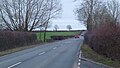 A44 east of Monkland - geograph.org.uk - 5677703.jpg 1,600 × 901; 557 KB
-
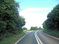 A44 junction with Tick Bridge Lane - geograph.org.uk - 3824649.jpg 3,648 × 2,736; 1.57 MB
-
 A44 level crossing - geograph.org.uk - 2956750.jpg 640 × 480; 54 KB
-

-
 A44 towards Leominster - geograph.org.uk - 5677683.jpg 1,600 × 899; 656 KB
-
 A49 and Hereford to Shrewsbury railway - geograph.org.uk - 5574783.jpg 1,024 × 576; 288 KB
-
 A49 approaches junction with A44 - geograph.org.uk - 3824646.jpg 3,648 × 2,736; 1.52 MB
-
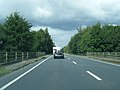 A49 at bridge over the River Lugg - geograph.org.uk - 4141007.jpg 640 × 481; 63 KB
-

-

-
 A49 looking north from lay-by near Wharton - geograph.org.uk - 4455345.jpg 1,600 × 1,200; 1.76 MB
-
 A49, Leominster Bypass - geograph.org.uk - 2284823.jpg 800 × 394; 49 KB
-
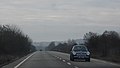 A49, Leominster Bypass - geograph.org.uk - 2284833.jpg 640 × 365; 23 KB
-
 Access road to Leominster Primary School - geograph.org.uk - 6300305.jpg 1,600 × 1,050; 406 KB
-
 Access road to Leominster railway station - geograph.org.uk - 6304795.jpg 1,600 × 1,130; 529 KB
-
 Access to Gateway Lane, Leominster - geograph.org.uk - 3816984.jpg 800 × 702; 113 KB
-
 Access to Wharton Court - geograph.org.uk - 866055.jpg 640 × 480; 74 KB
-
 Acorn court mews - geograph.org.uk - 958016.jpg 640 × 480; 57 KB
-
 Across a railway bridge, Leominster - geograph.org.uk - 6302298.jpg 1,600 × 951; 323 KB
-
-
 Across the A49 Leominster Bypass - geograph.org.uk - 6302385.jpg 1,600 × 1,482; 596 KB
-
 Adjacent opticians in Leominster - geograph.org.uk - 3024304.jpg 640 × 480; 89 KB
-
 Advance sign for A44 Worcester Road roundabout - geograph.org.uk - 4455365.jpg 1,600 × 1,200; 1.26 MB
-
 Alexander and Duncan, Leominster - geograph.org.uk - 3819436.jpg 800 × 513; 94 KB
-
 Along the Kenwater in Leominster - geograph.org.uk - 3806156.jpg 800 × 565; 156 KB
-
 Ancient and modern, Leominster - geograph.org.uk - 2912990.jpg 640 × 609; 84 KB
-
 Andrew Jones Upholsterer in Leominster - geograph.org.uk - 6298280.jpg 1,600 × 1,223; 364 KB
-

-
 Angling Trust office in Leominster - geograph.org.uk - 3683462.jpg 626 × 640; 87 KB
-
 Approaching Leominster - geograph.org.uk - 866047.jpg 640 × 480; 67 KB
-
 Arable field beside the A44 - geograph.org.uk - 5208552.jpg 800 × 600; 145 KB
-
 Arable land below Brierley Hill - geograph.org.uk - 4785432.jpg 1,600 × 901; 738 KB
-
 Arable land near Leominster - geograph.org.uk - 3852643.jpg 640 × 480; 272 KB
-
 Arable land, Elms Green - geograph.org.uk - 3273890.jpg 640 × 480; 256 KB
-
 Armorial Bearings of the BRABAZON family of Eaton Hall, Leominster, Herefordshire.png 1,200 × 1,200; 787 KB
-
 Arriva Trains Wales train - geograph.org.uk - 5617825.jpg 1,024 × 768; 192 KB
-
 Arrow flood plain - geograph.org.uk - 4423855.jpg 800 × 533; 317 KB
-
 Arrow flood plain - geograph.org.uk - 5574770.jpg 1,024 × 576; 261 KB
-
 Arrow Plant ^ Tool Hire ^ Sales, Leominster - geograph.org.uk - 6298875.jpg 1,600 × 1,055; 268 KB
-
 Arrow Valley Pastures - geograph.org.uk - 1200611.jpg 640 × 480; 193 KB
-
 Asia Village in Leominster - geograph.org.uk - 3682368.jpg 791 × 800; 130 KB
-
 Attempted path closure - geograph.org.uk - 4634459.jpg 800 × 533; 436 KB
-
 Autumn colours, Caswell Crescent, Leominster - geograph.org.uk - 6298401.jpg 1,561 × 1,600; 747 KB
-
 Autumn colours, Southern Avenue, Leominster - geograph.org.uk - 6302976.jpg 1,600 × 1,459; 542 KB
-
 B4360 junction with A44 - geograph.org.uk - 3822946.jpg 3,648 × 2,736; 1.1 MB
-
 B4360 junction with B4529 - geograph.org.uk - 3812608.jpg 3,382 × 2,490; 1.14 MB
-
 B4360 passes Westfield Farm - geograph.org.uk - 3812604.jpg 3,648 × 2,736; 1.6 MB
-
 B4361 bridge over the river Lugg - geograph.org.uk - 641572.jpg 640 × 480; 100 KB
-
 B4361, Marlbook - geograph.org.uk - 6313877.jpg 640 × 480; 62 KB
-
 B4361, The Broad - geograph.org.uk - 2381078.jpg 640 × 359; 224 KB
-
 B4529 approaching Leominster - geograph.org.uk - 2587913.jpg 640 × 480; 78 KB
-
 B4529 south of Westfield Farm - geograph.org.uk - 3738040.jpg 3,427 × 2,355; 1.03 MB
-

-
 Barclays Bank (Leominster) - geograph.org.uk - 5682540.jpg 1,024 × 768; 114 KB
-
 Barclays Bank (Leominster) - geograph.org.uk - 5696061.jpg 3,264 × 2,448; 1.65 MB
-
 Barclays Bank (Leominster) - geograph.org.uk - 5833152.jpg 3,648 × 2,736; 3.47 MB
-
 Barclays Bank Leominster - geograph.org.uk - 3682441.jpg 800 × 669; 103 KB
-
 Bargates at Westfield Walk - geograph.org.uk - 2672738.jpg 640 × 480; 72 KB
-
 Bargates from Westfield Walk - geograph.org.uk - 2671038.jpg 640 × 480; 85 KB
-
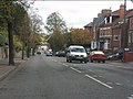
 Bargates north of Westfield Walk - geograph.org.uk - 2671043.jpg 640 × 480; 88 KB
-
-
 Barn at Brierley Court - geograph.org.uk - 4640881.jpg 4,000 × 3,000; 3.98 MB
-
 Barons Cross junction, Leominster - geograph.org.uk - 2587916.jpg 640 × 480; 71 KB
-
 Barons Cross Road, looking east - geograph.org.uk - 2672730.jpg 640 × 480; 60 KB
-

-
 Battle of the Somme Centenary Bench (Leominster) - geograph.org.uk - 6382980.jpg 3,648 × 2,736; 3.5 MB
-
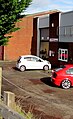 BC Valeting, Leominster - geograph.org.uk - 6302191.jpg 978 × 1,600; 392 KB
-
 BCW Transport articulated lorry in Leominster - geograph.org.uk - 6298866.jpg 1,600 × 1,122; 414 KB
-
 BedStyles of Leominster van - geograph.org.uk - 6304778.jpg 1,389 × 1,600; 486 KB
-

-

-

-
 Bend in Worcester Road, Leominster - geograph.org.uk - 6304787.jpg 1,600 × 1,441; 446 KB
-

-
 Bengry Motors, Leominster - geograph.org.uk - 3817046.jpg 800 × 525; 102 KB
-
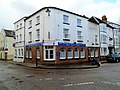
-
 Between the ramparts, Ivington Camp - geograph.org.uk - 5573592.jpg 1,024 × 683; 597 KB
-
 Bill Davies Honda, Southern Avenue, Leominster - geograph.org.uk - 6312237.jpg 1,600 × 1,224; 465 KB
-
 Bird in Hand (Leominster) - geograph.org.uk - 5833176.jpg 3,648 × 2,736; 4.21 MB
-
 Black Swan - geograph.org.uk - 2005851.jpg 800 × 600; 176 KB
-
 Black Swan inn sign - geograph.org.uk - 5633090.jpg 600 × 800; 112 KB
-
 Black swan sign - geograph.org.uk - 4640870.jpg 2,118 × 2,824; 1.81 MB
-
 Black Swan, Leominster - geograph.org.uk - 5633087.jpg 1,024 × 768; 179 KB
-
 Blue plaque, Leominster - geograph.org.uk - 1612443.jpg 640 × 480; 57 KB
-
 Bluebells Florists, Leominster - geograph.org.uk - 2041529.jpg 640 × 480; 81 KB
-

-
 Boundless crops - geograph.org.uk - 866051.jpg 640 × 480; 102 KB
-
 Bow Plant Sales in Leominster - geograph.org.uk - 6304790.jpg 1,600 × 1,317; 402 KB
-
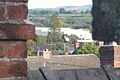 BPI (Leominster) - geograph.org.uk - 5921072.jpg 4,096 × 2,730; 3.08 MB
-
 BPI Leominster - geograph.org.uk - 3757228.jpg 800 × 549; 138 KB
-
 Bramble Cottage, Leominster - geograph.org.uk - 6297830.jpg 1,546 × 1,600; 454 KB
-

-

-
 Brick houses on a corner in the south of Leominster - geograph.org.uk - 6297844.jpg 1,600 × 1,331; 394 KB
-
 Bridge Inn (Leominster) - geograph.org.uk - 5696445.jpg 3,264 × 2,448; 1.64 MB
-
 Bridge over A49 carrying track to Wharton Court - geograph.org.uk - 4455349.jpg 1,600 × 1,200; 1.42 MB
-

-
 Bridge over the Arrow, Ivington Court - geograph.org.uk - 2641494.jpg 3,421 × 2,381; 7.77 MB
-
 Bridge Street Leisure Centre (Leominster) - geograph.org.uk - 5921171.jpg 1,920 × 1,080; 972 KB
-
 Bridge Street Leisure Centre (Leominster) - geograph.org.uk - 6168290.jpg 3,648 × 2,056; 2.51 MB
-
 Bridge Street Leisure Centre (Leominster) - geograph.org.uk - 6168294.jpg 3,648 × 2,056; 3.32 MB
-
 Bridge Street Leisure Centre (Leominster) - geograph.org.uk - 6168295.jpg 3,648 × 2,056; 3.61 MB
-
 Bridge Street, (B4361), Leominster - geograph.org.uk - 6313916.jpg 640 × 480; 58 KB
-
 Bridge Street, Leominster - geograph.org.uk - 6155051.jpg 1,864 × 1,188; 997 KB
-
 Bridge Street-Mill Street junction - geograph.org.uk - 2956744.jpg 640 × 480; 49 KB
-
 Bridleway and field near Oakwood Farm - geograph.org.uk - 5207776.jpg 1,024 × 768; 228 KB
-
 Bridleway to the Fort - geograph.org.uk - 151296.jpg 640 × 480; 100 KB
-
 Brierley - geograph.org.uk - 5574765.jpg 1,024 × 683; 452 KB
-
 Brierley Cottages - geograph.org.uk - 4640894.jpg 4,000 × 3,000; 4.59 MB
-
 Brierley Lane - geograph.org.uk - 4785440.jpg 1,600 × 901; 526 KB
-
 Brierley near Leominster - geograph.org.uk - 4634464.jpg 800 × 533; 371 KB
-
 Brierley village entrance - geograph.org.uk - 2139491.jpg 640 × 480; 74 KB
-
 Brierley Way, Leominster - geograph.org.uk - 6308488.jpg 1,600 × 1,331; 514 KB
-
 Brierley Wood - geograph.org.uk - 5573596.jpg 1,024 × 683; 521 KB
-
 Brightwells - Easters Court - geograph.org.uk - 1611367.jpg 640 × 480; 93 KB
-
 Broad Street (Leominster) - geograph.org.uk - 6370735.jpg 1,795 × 1,342; 700 KB
-
 Broad Street Bridge - geograph.org.uk - 641566.jpg 640 × 480; 83 KB
-
 Broad Street car park - geograph.org.uk - 1421640.jpg 640 × 480; 69 KB
-
 Broad Street Car Park - geograph.org.uk - 4387235.jpg 800 × 600; 84 KB
-
 Broad Street, east side - geograph.org.uk - 1957424.jpg 3,322 × 2,466; 5.67 MB
-
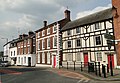 Broad Street, east side. - geograph.org.uk - 1957476.jpg 3,411 × 2,367; 4.47 MB
-
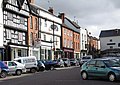 Broad Street, Leominster - geograph.org.uk - 1221471.jpg 640 × 455; 106 KB
-
 Broad Street, west side - geograph.org.uk - 1957326.jpg 3,427 × 2,362; 4.62 MB
-
 Broadward - geograph.org.uk - 4634473.jpg 800 × 533; 373 KB
-
 Broadward Bridge - geograph.org.uk - 4414846.jpg 800 × 533; 424 KB
-
 Broadward Hall (geograph 7155315).jpg 1,600 × 1,069; 481 KB
-
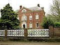 Broadward Hall - geograph.org.uk - 1884958.jpg 3,456 × 2,592; 7.07 MB
-
 Brook Hall and Pinsley House - geograph.org.uk - 1842905.jpg 3,286 × 2,189; 4.11 MB
-
 Brook House ^ Pinsley House (Leominster) - geograph.org.uk - 6386367.jpg 3,648 × 2,736; 4.66 MB
-
 Brown Clee Hill (Viewed from Leominster) - geograph.org.uk - 5921152.jpg 1,920 × 1,080; 960 KB
-
 Browns Carpentry ^ Joinery Ltd in Leominster - geograph.org.uk - 6308496.jpg 1,600 × 1,176; 534 KB
-
-
 Building detail, Broad Street - geograph.org.uk - 1424495.jpg 640 × 480; 43 KB
-
 Bupa Dental Care (Leominster) - geograph.org.uk - 6382954.jpg 2,048 × 1,536; 593 KB
-
 Burchetts Row - geograph.org.uk - 4640862.jpg 3,000 × 4,000; 3.44 MB
-
 Burgess Street (Leominster) - geograph.org.uk - 5682573.jpg 1,024 × 768; 121 KB
-
 Burgess Street (Leominster) - geograph.org.uk - 5696047.jpg 3,264 × 2,448; 1.67 MB
-
 Burgess street - geograph.org.uk - 958022.jpg 640 × 480; 52 KB
-
 Bury Cottages - geograph.org.uk - 4640879.jpg 4,000 × 3,000; 4.45 MB
-
 Bus stop - maybe - geograph.org.uk - 955291.jpg 640 × 480; 58 KB
-

-
 Butchers row - geograph.org.uk - 958029.jpg 640 × 480; 68 KB
-
 Butchers Row, Leominster - geograph.org.uk - 206259.jpg 480 × 640; 98 KB
-
 Butchers Row, Leominster - geograph.org.uk - 5318677.jpg 768 × 1,024; 223 KB
-
 Butchers Row, Leominster - geograph.org.uk - 5318678.jpg 768 × 1,024; 233 KB
-
 B^Q (Leominster) - geograph.org.uk - 5696340.jpg 3,264 × 2,448; 2.03 MB
-
 C. Townsend Ltd, 19 Etnam Street, Leominster - geograph.org.uk - 6298278.jpg 1,375 × 1,600; 376 KB
-
 C. Townsend Ltd, Leominster - geograph.org.uk - 2912674.jpg 640 × 463; 65 KB
-
 Canopy on the east side of South Street, Leominster - geograph.org.uk - 6311894.jpg 1,600 × 1,200; 425 KB
-
 Car dealership, Leominster - geograph.org.uk - 6313887.jpg 800 × 493; 67 KB
-
 Car Graveyard (Leominster) - geograph.org.uk - 5738043.jpg 3,264 × 2,448; 2.8 MB
-
 Car Graveyard (Leominster) - geograph.org.uk - 5738046.jpg 3,264 × 2,448; 2.23 MB
-
 Car Graveyard (Leominster) - geograph.org.uk - 5959139.jpg 3,648 × 2,736; 4.76 MB
-
 Cars for sale, Southern Avenue, Leominster - geograph.org.uk - 6312332.jpg 1,600 × 1,094; 369 KB
-
 Cat by the River Kenwater (Leominster) - geograph.org.uk - 6382915.jpg 2,048 × 1,237; 1.22 MB
-
 Cennick Court plaque, Leominster - geograph.org.uk - 6311902.jpg 971 × 1,269; 258 KB
-
 Cennick Court, Leominster - geograph.org.uk - 3815805.jpg 800 × 557; 97 KB
-
 Cereal field near Ivington - geograph.org.uk - 5051321.jpg 800 × 531; 154 KB
-
 Chapel in Leominster Cemetery - geograph.org.uk - 6312429.jpg 1,187 × 1,600; 529 KB
-
 Chapel Walk - geograph.org.uk - 2954875.jpg 480 × 640; 83 KB
-
 Charlies Auto Repair Services in Leominster - geograph.org.uk - 6303002.jpg 1,600 × 1,037; 296 KB
-
 Chequers Inn, Leominster - geograph.org.uk - 5218262.jpg 1,024 × 768; 178 KB
-
 Cholstrey Road, Leominster - geograph.org.uk - 4413383.jpg 800 × 533; 373 KB
-
 Christmas lights in Drapers Lane (Leominster) (geograph 6695616).jpg 3,230 × 2,859; 2.25 MB
-
 Church Street to West - panoramio.jpg 780 × 520; 59 KB
-
 Church Street, Leominster - geograph.org.uk - 6416234.jpg 1,024 × 1,024; 432 KB
-
 Cider to the left - geograph.org.uk - 866067.jpg 640 × 480; 80 KB
-
 Clarks Hospital (geograph 6004944).jpg 1,024 × 683; 198 KB
-
 Clash of the Titans in Leominster - geograph.org.uk - 3819507.jpg 800 × 756; 113 KB
-
 Clifton Bingo hall, 30 South Street, Leominster - geograph.org.uk - 6298246.jpg 1,600 × 1,254; 312 KB
-
 Clifton Cinema (Leominster) - geograph.org.uk - 5742884.jpg 3,648 × 2,432; 3.25 MB
-
 Clifton, Leominster - geograph.org.uk - 4638573.jpg 800 × 533; 332 KB
-
 Clock on Frank H. Dale (Leominster) - geograph.org.uk - 5696376.jpg 3,264 × 2,448; 1.13 MB
-
 Clocks - geograph.org.uk - 5827861.jpg 1,024 × 768; 180 KB
-
 Clocks in a shop window - geograph.org.uk - 5827857.jpg 1,024 × 768; 229 KB
-
 Co-op (Close-Up ^ Leominster) - geograph.org.uk - 5686206.jpg 3,264 × 2,448; 1.41 MB
-
 Co-op (Leominster) - geograph.org.uk - 5686197.jpg 3,264 × 2,448; 2.1 MB
-
 Co-op (Leominster) - geograph.org.uk - 5686199.jpg 3,264 × 2,448; 2.01 MB
-


.jpg)


_-_geograph.org.uk_-_5682540.jpg)
_-_geograph.org.uk_-_5696061.jpg)
_-_geograph.org.uk_-_5833152.jpg)


_-_geograph.org.uk_-_6382980.jpg)


_-_geograph.org.uk_-_5833176.jpg)


_-_geograph.org.uk_-_5921072.jpg)


_-_geograph.org.uk_-_5696445.jpg)


_-_geograph.org.uk_-_5921171.jpg)
_-_geograph.org.uk_-_6168290.jpg)
_-_geograph.org.uk_-_6168294.jpg)
_-_geograph.org.uk_-_6168295.jpg)
,_Leominster_-_geograph.org.uk_-_6313916.jpg)


_-_geograph.org.uk_-_6370735.jpg)


.jpg)


_-_geograph.org.uk_-_6386367.jpg)
_-_geograph.org.uk_-_5921152.jpg)


_-_geograph.org.uk_-_6382954.jpg)

_-_geograph.org.uk_-_5682573.jpg)
_-_geograph.org.uk_-_5696047.jpg)


_-_geograph.org.uk_-_5696340.jpg)


_-_geograph.org.uk_-_5738043.jpg)
_-_geograph.org.uk_-_5738046.jpg)
_-_geograph.org.uk_-_5959139.jpg)

_-_geograph.org.uk_-_6382915.jpg)


_(geograph_6695616).jpg)


.jpg)


_-_geograph.org.uk_-_5742884.jpg)

_-_geograph.org.uk_-_5696376.jpg)


_-_geograph.org.uk_-_5686206.jpg)
_-_geograph.org.uk_-_5686197.jpg)
_-_geograph.org.uk_-_5686199.jpg)

