Category:Lintrathen, Angus
Jump to navigation
Jump to search
Scottish parish in Angus, Scotland, UK | |||||
| Upload media | |||||
| Instance of | |||||
|---|---|---|---|---|---|
| Named after | |||||
| Location |
| ||||
| Population |
| ||||
| Area |
| ||||
 | |||||
Subcategories
This category has the following 5 subcategories, out of 5 total.
B
K
L
Media in category "Lintrathen, Angus"
The following 200 files are in this category, out of 435 total.
(previous page) (next page)-
 A farm track - geograph.org.uk - 3249460.jpg 640 × 360; 204 KB
-

-
 Almost clear fell - geograph.org.uk - 1953452.jpg 1,500 × 1,125; 954 KB
-
 Alpacas at Clintlaw Farm - geograph.org.uk - 2852888.jpg 640 × 480; 84 KB
-
 Alpacas, Clintlaw, Lintrathen - geograph.org.uk - 1999436.jpg 800 × 533; 112 KB
-
 Approaching Drumshade - geograph.org.uk - 3064180.jpg 2,048 × 1,536; 1.64 MB
-
 Arable field on Gallow Knowe - geograph.org.uk - 4898866.jpg 1,600 × 1,107; 213 KB
-

-
 B951 - geograph.org.uk - 4823344.jpg 800 × 600; 195 KB
-
 B951 - geograph.org.uk - 4824222.jpg 800 × 600; 170 KB
-
 B951 at Purgavie - geograph.org.uk - 5480547.jpg 5,184 × 3,888; 6.84 MB
-
 B951 passes Roadside Cottage - geograph.org.uk - 4824219.jpg 800 × 600; 202 KB
-
 B954 Bridge of Craigisla - geograph.org.uk - 5370239.jpg 5,184 × 3,888; 6.95 MB
-
 B954 near Pitewan - geograph.org.uk - 2861624.jpg 640 × 480; 92 KB
-
 B954, Formal - geograph.org.uk - 4823071.jpg 800 × 600; 190 KB
-
 Backwater Dam (north end) - geograph.org.uk - 2119617.jpg 3,648 × 2,736; 2.22 MB
-
 Backwater Dam - geograph.org.uk - 5478264.jpg 5,184 × 3,888; 5.33 MB
-
 Backwater Dam - geograph.org.uk - 6364261.jpg 1,024 × 683; 177 KB
-
 Backwater Dam - geograph.org.uk - 6707696.jpg 1,600 × 451; 372 KB
-
 Backwater Dam at dusk (north end) - geograph.org.uk - 2119622.jpg 3,648 × 2,736; 2.05 MB
-
 Backwater Dam through van - geograph.org.uk - 2119639.jpg 3,648 × 2,736; 2.07 MB
-
 Backwater Reservoir - geograph.org.uk - 2862327.jpg 640 × 480; 86 KB
-
 Backwater Reservoir - geograph.org.uk - 4627320.jpg 640 × 480; 60 KB
-
 Backwater Reservoir - geograph.org.uk - 4628355.jpg 640 × 428; 34 KB
-
 Backwater Reservoir - geograph.org.uk - 4628366.jpg 640 × 480; 69 KB
-
 Backwater Reservoir - geograph.org.uk - 5478256.jpg 5,184 × 3,888; 5.28 MB
-
 Backwater Reservoir - geograph.org.uk - 6295928.jpg 1,600 × 900; 430 KB
-
 Backwater Reservoir - geograph.org.uk - 6364258.jpg 1,024 × 683; 86 KB
-
 Backwater Reservoir - geograph.org.uk - 6375060.jpg 1,600 × 1,035; 351 KB
-
 Backwater Reservoir dam wall - geograph.org.uk - 3063694.jpg 2,816 × 2,112; 1.73 MB
-
 Backwater Reservoir filling up - geograph.org.uk - 3974277.jpg 640 × 427; 43 KB
-
 Backwater Reservoir, western road - geograph.org.uk - 5478212.jpg 5,184 × 3,888; 6.69 MB
-
 Backwater spillway - geograph.org.uk - 3063669.jpg 2,816 × 2,112; 1.69 MB
-
 Balintore - geograph.org.uk - 2125603.jpg 3,648 × 2,736; 2.44 MB
-
 Balintore - geograph.org.uk - 2895023.jpg 640 × 480; 88 KB
-
 Balintore Castle - geograph.org.uk - 2895050.jpg 640 × 480; 80 KB
-
 Balintore Castle - geograph.org.uk - 3967617.jpg 640 × 427; 75 KB
-
 Balintore Castle - geograph.org.uk - 4337449.jpg 1,500 × 1,125; 253 KB
-
 Barley beneath Brankam Hill - geograph.org.uk - 4824364.jpg 800 × 600; 139 KB
-
 Barn at Auldallan - geograph.org.uk - 1778310.jpg 640 × 427; 46 KB
-
-
 Bend in the road - geograph.org.uk - 5478235.jpg 5,184 × 3,888; 6.79 MB
-
 Big Brown Bull by Balintore - geograph.org.uk - 2125586.jpg 3,648 × 2,736; 2.35 MB
-
 Bird hide on the Loch of Lintrathen - geograph.org.uk - 2863173.jpg 640 × 480; 135 KB
-
 Blackdyke Farm, Glen Isla - geograph.org.uk - 2861604.jpg 640 × 480; 79 KB
-
 Boulder wall - geograph.org.uk - 1123296.jpg 427 × 640; 191 KB
-
 Boundary stone on Cat Law - geograph.org.uk - 3929667.jpg 1,024 × 681; 352 KB
-
 Brankam Hill - geograph.org.uk - 2863179.jpg 640 × 480; 104 KB
-
 Brankam Hill - geograph.org.uk - 4824332.jpg 800 × 600; 146 KB
-
 Bridge of Craigisla - geograph.org.uk - 5370225.jpg 5,184 × 3,888; 5.65 MB
-
 Bridge of Craigisla, Glen Isla - geograph.org.uk - 5817012.jpg 640 × 480; 142 KB
-
 Bridge of Lundies - geograph.org.uk - 1102813.jpg 640 × 427; 87 KB
-
 Bridge of Lundies - geograph.org.uk - 2853097.jpg 640 × 480; 138 KB
-

-
 Bridge over the Burn of Dalry - geograph.org.uk - 2895064.jpg 640 × 480; 110 KB
-
 Bridge over the Inzion Burn - geograph.org.uk - 5480559.jpg 5,184 × 3,888; 6.57 MB
-

-

-
 Bridgend of Lintrathen - geograph.org.uk - 2863168.jpg 640 × 480; 125 KB
-
 Bridgend of Lintrathen - geograph.org.uk - 5480509.jpg 5,184 × 3,888; 4.34 MB
-

-
 Bridgend of Lintrathen from the Bridge - geograph.org.uk - 158309.jpg 640 × 475; 109 KB
-

-
 Burn of Dairy - geograph.org.uk - 2324150.jpg 1,500 × 1,125; 974 KB
-
 Burn of Dairy - geograph.org.uk - 2324175.jpg 1,125 × 1,500; 1,004 KB
-
 Burnt heather beside the track up Cat Law - geograph.org.uk - 3929683.jpg 1,024 × 681; 401 KB
-
 Buses stop here occasionally - geograph.org.uk - 2862612.jpg 640 × 480; 86 KB
-
 Cairn Corse - geograph.org.uk - 910282.jpg 640 × 360; 50 KB
-
 Cat Law (trig point) - geograph.org.uk - 4834463.jpg 2,017 × 1,510; 356 KB
-
 Cat Law from the track from Balintore - geograph.org.uk - 3929403.jpg 1,024 × 682; 243 KB
-
 Cat Law trig pillar - geograph.org.uk - 6031321.jpg 5,184 × 3,888; 6.08 MB
-
 Cat Law with Balintore Castle - geograph.org.uk - 2355842.jpg 4,288 × 2,250; 2.08 MB
-
 Clump of trees near Inzion - geograph.org.uk - 2863162.jpg 640 × 480; 91 KB
-
 Control tower, Backwater Reservoir - geograph.org.uk - 2861638.jpg 640 × 480; 70 KB
-
 Corner of a field, Middleton. Kilry - geograph.org.uk - 1103113.jpg 640 × 426; 91 KB
-
 Corwharn cairn - geograph.org.uk - 3064336.jpg 2,048 × 1,536; 738 KB
-
 Craig of Balintore - geograph.org.uk - 3929442.jpg 1,024 × 681; 213 KB
-
 Craig of Balintore - geograph.org.uk - 6031312.jpg 5,184 × 3,888; 5.85 MB
-
 Craig of Balintore from the track up Cat Law - geograph.org.uk - 3929358.jpg 1,024 × 682; 145 KB
-
 Craig of Balloch - geograph.org.uk - 2590218.jpg 1,500 × 984; 168 KB
-
 Craig of Balloch - geograph.org.uk - 911682.jpg 640 × 360; 91 KB
-
 Craig of Balloch Crag - geograph.org.uk - 911683.jpg 360 × 640; 86 KB
-
 Craigisla bridge - geograph.org.uk - 3063651.jpg 2,816 × 2,112; 2.78 MB
-
 Craiglea Hill - geograph.org.uk - 4824348.jpg 800 × 600; 166 KB
-
 Crossing the Glendamff Burn^ - geograph.org.uk - 1144416.jpg 640 × 491; 100 KB
-
 Crossroads near Loch of Lintrathen - geograph.org.uk - 5056117.jpg 4,375 × 3,062; 2.45 MB
-
 Crossroads, Dykend - geograph.org.uk - 4823353.jpg 800 × 600; 202 KB
-
 Dam control tower - geograph.org.uk - 3063679.jpg 2,816 × 2,112; 1.88 MB
-
 Dam of Backwater Reservoir - geograph.org.uk - 6694488.jpg 2,000 × 1,333; 1.96 MB
-
 Dam on a hillside - geograph.org.uk - 2324138.jpg 1,500 × 1,125; 952 KB
-
 Dam on the Loch of Lintrathen - geograph.org.uk - 2863169.jpg 640 × 480; 128 KB
-
 Dam on the Loch of Lintrathen - geograph.org.uk - 2863170.jpg 640 × 480; 82 KB
-
 Decorative fence post, Backwater Dam - geograph.org.uk - 2119674.jpg 2,736 × 3,648; 2.15 MB
-
 Derelict barn, West Campsie - geograph.org.uk - 1083531.jpg 640 × 427; 70 KB
-

-

-

-
 Ducks on a frozen Loch of Lintrathen - geograph.org.uk - 2209596.jpg 800 × 534; 65 KB
-
 Ducks on a frozen Loch of Lintrathen - geograph.org.uk - 2209597.jpg 800 × 535; 81 KB
-
 Dykend - geograph.org.uk - 1123393.jpg 427 × 640; 169 KB
-
 East Campsie, Airlie - geograph.org.uk - 1999441.jpg 800 × 534; 203 KB
-
 East Campsie, Airlie - geograph.org.uk - 1999444.jpg 800 × 534; 188 KB
-
 Easter Coul from the track up Cat Law - geograph.org.uk - 3929349.jpg 1,024 × 682; 170 KB
-
 Eastern slope of Craiglea Hill - geograph.org.uk - 3063554.jpg 2,381 × 1,537; 722 KB
-
 End of the road - geograph.org.uk - 1499428.jpg 640 × 480; 83 KB
-
 Entrance and driveway to Balintore Castle - geograph.org.uk - 4702448.jpg 1,800 × 1,013; 2.41 MB
-
 Entrance to Balintore Castle - geograph.org.uk - 3603579.jpg 1,024 × 681; 210 KB
-
 Entrance to Lintrathen sawmill - geograph.org.uk - 5056177.jpg 4,119 × 3,089; 3.16 MB
-
 Ewe and Lambs near Blackdykes, Formal - geograph.org.uk - 1326342.jpg 640 × 427; 118 KB
-
 Farm road to Middle Coul - geograph.org.uk - 2895004.jpg 640 × 480; 77 KB
-
 Farm track near Loch of Lintrathen - geograph.org.uk - 1123302.jpg 426 × 640; 240 KB
-
 Farmland near East Campsie - geograph.org.uk - 1083537.jpg 640 × 427; 62 KB
-
 Felled woodland near Pitmudie - geograph.org.uk - 2862359.jpg 640 × 480; 107 KB
-
 Fence gate with tall post - geograph.org.uk - 3063810.jpg 2,048 × 1,536; 832 KB
-
 Fence line - geograph.org.uk - 3064303.jpg 2,048 × 1,536; 1.65 MB
-
 Fence near Balintore - geograph.org.uk - 1779848.jpg 600 × 450; 91 KB
-
 Fence near Cat Law summit - geograph.org.uk - 6265877.jpg 5,148 × 3,677; 4.7 MB
-
 Fenceline on Craiglea Hill - geograph.org.uk - 1123184.jpg 427 × 640; 189 KB
-
 Fenceline, Milldewan Hill - geograph.org.uk - 910373.jpg 640 × 360; 96 KB
-
 Field above Loch of Lintrathen - geograph.org.uk - 4823309.jpg 800 × 600; 170 KB
-
 Field at Brankam - geograph.org.uk - 2863183.jpg 640 × 480; 81 KB
-
 Field at the Loups of Kenny, Airlie - geograph.org.uk - 1999451.jpg 800 × 534; 196 KB
-
 Field elevation near Hilton Farm - geograph.org.uk - 1123318.jpg 640 × 427; 200 KB
-
 Field near Dykend - geograph.org.uk - 4824371.jpg 800 × 600; 234 KB
-
 Field near Peel Farm - geograph.org.uk - 2862336.jpg 640 × 480; 79 KB
-
 Field, north of the Isla - geograph.org.uk - 5480482.jpg 5,184 × 3,888; 5.01 MB
-
 Fields and trees at Lintrathen - geograph.org.uk - 1105192.jpg 640 × 426; 89 KB
-
 Fields at Dykend - geograph.org.uk - 1105171.jpg 640 × 426; 69 KB
-
 Fields at Knowehead of Auldallan - geograph.org.uk - 3603567.jpg 1,024 × 681; 132 KB
-
 Fields at Middle Coul, near Balintore - geograph.org.uk - 3603597.jpg 1,024 × 681; 130 KB
-
 Flock among the forests - geograph.org.uk - 3063804.jpg 2,048 × 1,536; 1.63 MB
-
 Footbridge over burn - geograph.org.uk - 4076447.jpg 2,048 × 1,536; 834 KB
-
 Footpath around Hare Cairn - geograph.org.uk - 2619282.jpg 640 × 480; 68 KB
-
 Footpath east into Craig of Balloch - geograph.org.uk - 2619302.jpg 640 × 480; 70 KB
-

-
 Ford through Burn of Dairy - geograph.org.uk - 2324190.jpg 1,500 × 1,122; 835 KB
-
 Fording a burn - geograph.org.uk - 3064290.jpg 1,536 × 2,048; 1.1 MB
-
 Forest edge - geograph.org.uk - 1951779.jpg 1,500 × 1,125; 793 KB
-
 Forest edge - geograph.org.uk - 3063637.jpg 2,816 × 2,112; 694 KB
-
 Forest gate - geograph.org.uk - 1144394.jpg 640 × 483; 101 KB
-
 Fornethy woods - geograph.org.uk - 3063633.jpg 2,816 × 2,112; 1.24 MB
-
 Fornethy Woods - geograph.org.uk - 4824319.jpg 800 × 600; 253 KB
-
 Frozen Backwater Reservoir - geograph.org.uk - 2209621.jpg 640 × 427; 49 KB
-
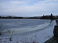
 Frozen Loch of Lintrathen - geograph.org.uk - 2209595.jpg 800 × 535; 170 KB
-
-
 Gate and Knock of Formal - geograph.org.uk - 4824379.jpg 800 × 600; 180 KB
-
 Gate in the fence - geograph.org.uk - 3064259.jpg 2,048 × 1,536; 1.53 MB
-
 Gate on Milldewan Hill - geograph.org.uk - 910324.jpg 640 × 360; 51 KB
-
-
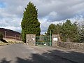
 Gateway to Balintore Castle - geograph.org.uk - 2895079.jpg 640 × 480; 128 KB
-
 Glen Dye - geograph.org.uk - 911699.jpg 640 × 360; 53 KB
-
 Glendamff Farm - geograph.org.uk - 4076434.jpg 2,048 × 1,536; 706 KB
-
 Glenhead farm - geograph.org.uk - 3063709.jpg 2,048 × 1,536; 1.53 MB
-
 Glenhead Farm - geograph.org.uk - 3561389.jpg 1,024 × 683; 242 KB
-
 Glenhead farm road - geograph.org.uk - 3063728.jpg 2,048 × 1,536; 1.05 MB
-
 Gorse on Craiglea Hill - geograph.org.uk - 1123237.jpg 427 × 640; 176 KB
-
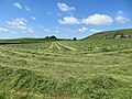
 Grass cutting in Glen Isla - geograph.org.uk - 1953487.jpg 1,500 × 1,125; 852 KB
-
 Gravel pit - geograph.org.uk - 4824384.jpg 800 × 600; 204 KB
-
 Grazing sheep - geograph.org.uk - 3063794.jpg 2,048 × 1,536; 695 KB
-
 Grouse butt along the track up Cat Law - geograph.org.uk - 3929465.jpg 1,024 × 682; 211 KB
-

-
-

-
 Hare - geograph.org.uk - 6365907.jpg 1,024 × 718; 173 KB
-
 Hay making time near Wardend - drying after cutting - geograph.org.uk - 6201689.jpg 4,000 × 3,000; 4.19 MB
-
 Heather on Craiglea Hill - geograph.org.uk - 6694324.jpg 2,000 × 1,345; 2.09 MB
-
 Heather, Craiglea Hill - geograph.org.uk - 1123192.jpg 427 × 640; 194 KB
-
 Hill near Reekie Linn falls - geograph.org.uk - 1731341.jpg 1,600 × 1,200; 326 KB
-
 Hill ridge track - geograph.org.uk - 3064278.jpg 2,048 × 1,536; 1.54 MB
-
 Hill track on Monthrey - geograph.org.uk - 6265878.jpg 5,152 × 3,864; 5.01 MB
-
 Hillside above the reservoir - geograph.org.uk - 5478199.jpg 5,184 × 3,888; 5.82 MB
-
 Hilton Farm - geograph.org.uk - 1123267.jpg 640 × 427; 208 KB
-
 Hole at Hole - geograph.org.uk - 1144384.jpg 640 × 481; 98 KB
-
 Hole Burn - geograph.org.uk - 1149367.jpg 640 × 427; 86 KB
-
 Hole Burn at Glenhead Farm - geograph.org.uk - 3561392.jpg 1,024 × 681; 205 KB
-
 House at Dykend - geograph.org.uk - 3063586.jpg 2,816 × 2,112; 1.3 MB
-
 In need of some TLC - geograph.org.uk - 3063799.jpg 2,048 × 1,536; 1.64 MB
-
 Isla Primary School - geograph.org.uk - 4898770.jpg 1,600 × 1,057; 200 KB
-
 Isla Primary School, Lintrathen - geograph.org.uk - 1999435.jpg 800 × 534; 143 KB
-
 Isla Primary School, Lintrathen - geograph.org.uk - 2862349.jpg 640 × 480; 103 KB
-
 Isla Primary School, Lintrathen - geograph.org.uk - 3019844.jpg 640 × 463; 76 KB
-

-
 Knock of Formal - geograph.org.uk - 1103165.jpg 640 × 426; 78 KB
-
 Knock of Formal - geograph.org.uk - 1951787.jpg 1,500 × 941; 717 KB
-
 Knock of Formal - geograph.org.uk - 3063661.jpg 2,816 × 2,112; 2.21 MB
-
 Knock of Formal from the west - geograph.org.uk - 5480623.jpg 5,184 × 3,888; 5.02 MB
-
 Knockside Cottage, Formal - geograph.org.uk - 1103123.jpg 640 × 426; 97 KB
-
 Line of sheep - geograph.org.uk - 2324306.jpg 1,125 × 1,500; 916 KB
-

-
 Lintrathen loch frozen over. - geograph.org.uk - 2136854.jpg 640 × 480; 52 KB
-
 Lintrathen School - geograph.org.uk - 1102790.jpg 640 × 427; 34 KB
-
 Loch of Lintrathen (Reservoir) - geograph.org.uk - 6201672.jpg 4,000 × 3,000; 3.22 MB
-
 Loch of Lintrathen - geograph.org.uk - 2863160.jpg 640 × 480; 76 KB
-
 Loch of Lintrathen - geograph.org.uk - 3968606.jpg 640 × 480; 119 KB
-
 Loch of Lintrathen - geograph.org.uk - 3968611.jpg 640 × 480; 118 KB
-
 Loch of Lintrathen - geograph.org.uk - 4824347.jpg 800 × 600; 200 KB
-
 Loch of Lintrathen - geograph.org.uk - 5817040.jpg 640 × 480; 107 KB
-
 Looking across the Backwater Reservoir - geograph.org.uk - 2861914.jpg 640 × 480; 100 KB
-
 Looking out from the trees - geograph.org.uk - 1144390.jpg 640 × 480; 99 KB
-


_-_geograph.org.uk_-_2119617.jpg)


_-_geograph.org.uk_-_2119622.jpg)


_-_geograph.org.uk_-_4834463.jpg)


_-_geograph.org.uk_-_6201672.jpg)


