Category:Little Malvern
Jump to navigation
Jump to search
village in United Kingdom  | |||||
| Upload media | |||||
| Instance of | |||||
|---|---|---|---|---|---|
| Location | Malvern Hills, Worcestershire, West Midlands, England | ||||
 | |||||
Subcategories
This category has the following 5 subcategories, out of 5 total.
Media in category "Little Malvern"
The following 200 files are in this category, out of 976 total.
(previous page) (next page)-

-
 A carpet of daisies in Berrington Quarry - geograph.org.uk - 3982723.jpg 1,024 × 683; 930 KB
-
 A Christmas Eve walk - geograph.org.uk - 6007497.jpg 1,024 × 683; 203 KB
-

-

-
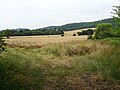
 A Fair Field Full of Bales - geograph.org.uk - 184699.jpg 640 × 479; 110 KB
-
 A field of winter cereal near Little Malvern - geograph.org.uk - 6003092.jpg 1,024 × 768; 231 KB
-
 A hop hornbeam tree - geograph.org.uk - 5842412.jpg 768 × 1,024; 368 KB
-
 A muddy path on the side of British Camp - geograph.org.uk - 3823433.jpg 1,536 × 1,152; 1.28 MB
-
 A nice day for a walk - geograph.org.uk - 4650079.jpg 1,600 × 1,200; 443 KB
-
 A reminder of a wet winter - geograph.org.uk - 6425402.jpg 1,024 × 768; 319 KB
-
 A touch of Monet in Little Malvern - geograph.org.uk - 6144137.jpg 1,024 × 768; 261 KB
-
 A449 at Malvern Wells boundary - geograph.org.uk - 3059397.jpg 640 × 480; 88 KB
-
 A449 climbing the Malvern Hills - geograph.org.uk - 5302693.jpg 4,720 × 3,120; 5.34 MB
-
 Aldous Memorial Seat - geograph.org.uk - 650569.jpg 640 × 427; 280 KB
-
 Along the Shire Ditch to Broad Down - geograph.org.uk - 1417378.jpg 640 × 427; 259 KB
-
 Amorous Entanglement - geograph.org.uk - 724636.jpg 427 × 640; 338 KB
-
 And There They Were - Gone ^ - geograph.org.uk - 185147.jpg 640 × 479; 89 KB
-
 Anemone Nemorosa - geograph.org.uk - 733348.jpg 640 × 596; 241 KB
-
 Anon-K07745 - Little Malvern.jpg 2,250 × 1,624; 955 KB
-
 Ant hills in the snow - geograph.org.uk - 1719788.jpg 640 × 427; 254 KB
-
 Ant hills on Castlemorton Common - geograph.org.uk - 2208779.jpg 4,110 × 2,227; 6.85 MB
-
 Apples near Black Hill - geograph.org.uk - 2602075.jpg 3,951 × 3,439; 6.46 MB
-
 Approaching St. Wulstan's R.C. Church - geograph.org.uk - 461746.jpg 640 × 427; 291 KB
-
 Ascent of British Camp - geograph.org.uk - 2282181.jpg 4,272 × 2,848; 5.37 MB
-
 Assarts Playing Ffield - geograph.org.uk - 425491.jpg 640 × 407; 256 KB
-
 Autumn colours on the Malvern Hills - geograph.org.uk - 2426840.jpg 1,024 × 768; 243 KB
-
 Autumn colours on Tinkers Hill - geograph.org.uk - 6326225.jpg 1,024 × 768; 246 KB
-
 Autumn in the Malvern Hills - geograph.org.uk - 5978366.jpg 1,024 × 683; 223 KB
-
 Autumn in the Malvern Hills - geograph.org.uk - 5978367.jpg 1,024 × 683; 226 KB
-
 Autumn in the Malvern Hills - geograph.org.uk - 6326227.jpg 1,024 × 768; 241 KB
-
 Baling Hay near Mayall's Coppice - geograph.org.uk - 184481.jpg 640 × 479; 111 KB
-
 Bare trees - geograph.org.uk - 6425431.jpg 1,024 × 768; 305 KB
-
 Barry Jackson Commemorative Plaque - geograph.org.uk - 501045.jpg 640 × 526; 365 KB
-
 Barry Jackson Commemorative Plaque - geograph.org.uk - 501075.jpg 640 × 437; 284 KB
-
 Barry Jackson Commemorative Seats - geograph.org.uk - 501033.jpg 640 × 427; 285 KB
-

-
 Behind the Woods - geograph.org.uk - 852099.jpg 640 × 480; 98 KB
-
 Below Millennium Hill - geograph.org.uk - 5691470.jpg 1,024 × 680; 214 KB
-
 Bend and hill on Hancocks Lane - geograph.org.uk - 1724658.jpg 640 × 427; 284 KB
-
 Berrington's Quarry - geograph.org.uk - 3208489.jpg 2,723 × 1,635; 3.12 MB
-
 Berrington's Quarry - geograph.org.uk - 683574.jpg 640 × 427; 307 KB
-
 Berrington's Quarry, Black Hill, Malvern - geograph.org.uk - 2820743.jpg 4,000 × 2,667; 6.42 MB
-
 Berrington's Quarry, Black Hill, The Malvern Hills - geograph.org.uk - 3982736.jpg 1,600 × 1,067; 1.89 MB
-
 Berrow Down now demolished^ May 2007 - geograph.org.uk - 443087.jpg 640 × 480; 388 KB
-
 Black Hill - geograph.org.uk - 2741252.jpg 680 × 1,024; 227 KB
-
 Black Hill - geograph.org.uk - 428733.jpg 640 × 424; 103 KB
-
 Black Hill at noon on the longest day - geograph.org.uk - 1925740.jpg 4,272 × 2,848; 6.83 MB
-
 Black Hill in the mist - geograph.org.uk - 2783008.jpg 3,495 × 1,756; 2.47 MB
-
 Black Hill, The Malvern Hills - geograph.org.uk - 3179232.jpg 4,358 × 2,662; 6.74 MB
-
 Black Poplar - Male Flower - geograph.org.uk - 742986.jpg 640 × 389; 180 KB
-
 Black Poplar tree, off Hancocks Lane - geograph.org.uk - 1726383.jpg 640 × 462; 256 KB
-
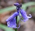
 Bluebells on the Malvern Hills - geograph.org.uk - 417264.jpg 640 × 427; 339 KB
-
 Bluebells on the Malvern Hills - geograph.org.uk - 467466.jpg 640 × 480; 147 KB
-
 Bluebells on the Malvern Hills - geograph.org.uk - 467470.jpg 640 × 480; 152 KB
-
 Boundary Stone in the Red Earl's Dyke - geograph.org.uk - 650388.jpg 640 × 374; 216 KB
-
 Boundary stone in the Red Earls Ditch - geograph.org.uk - 2290653.jpg 4,272 × 2,848; 4.76 MB
-

-
 Bracket fungi - geograph.org.uk - 6311919.jpg 768 × 1,024; 336 KB
-

-
 Bredon Hill - geograph.org.uk - 6343760.jpg 1,024 × 683; 259 KB
-
 Bridleway and track - geograph.org.uk - 5670065.jpg 1,024 × 768; 394 KB
-
 Bridleway approaching Underhill Farm - geograph.org.uk - 6144076.jpg 1,024 × 768; 291 KB
-
-
 Bridleway below Broad Down - geograph.org.uk - 6030183.jpg 1,024 × 768; 391 KB
-
 Bridleway below Hangman's Hill - geograph.org.uk - 5670071.jpg 1,024 × 768; 379 KB
-

-
 Bridleway passing British Camp Reservoir - geograph.org.uk - 5625974.jpg 800 × 600; 160 KB
-
 British Camp and the Malvern Hills - geograph.org.uk - 5521370.jpg 1,024 × 683; 200 KB
-
 British Camp from Broad Down, Malvern Hills - geograph.org.uk - 4650094.jpg 1,600 × 1,200; 575 KB
-
 British Camp from the saddle - geograph.org.uk - 2010652.jpg 800 × 600; 48 KB
-
 British camp from Welland Hill - geograph.org.uk - 4910758.jpg 1,600 × 1,199; 289 KB
-
 British Camp hillside - geograph.org.uk - 2286582.jpg 4,272 × 2,848; 6.46 MB
-
 British Camp Reservoir, Malverns - geograph.org.uk - 6408946.jpg 5,184 × 2,920; 5.1 MB
-
 British Camp, Malvern - geograph.org.uk - 2539934.jpg 4,235 × 2,170; 4.74 MB
-
 Broad Down - geograph.org.uk - 1135939.jpg 640 × 427; 249 KB
-
 Broad Down - geograph.org.uk - 1387218.jpg 640 × 427; 258 KB
-
 Broad Down - geograph.org.uk - 5854246.jpg 1,024 × 683; 220 KB
-
 Broad Down, Malvern Hills - geograph.org.uk - 4207888.jpg 800 × 531; 112 KB
-
 Broad Down, The Malvern Hills - geograph.org.uk - 3179213.jpg 2,746 × 1,873; 3.39 MB
-
 Broken gate - geograph.org.uk - 6257044.jpg 1,024 × 768; 309 KB
-
 Broom in flower - geograph.org.uk - 3988098.jpg 2,919 × 3,315; 7.03 MB
-
 Camp Reservoir - geograph.org.uk - 5979684.jpg 1,024 × 683; 229 KB
-
 Camp Reservoir and the Malvern Hills - geograph.org.uk - 6030188.jpg 1,024 × 768; 195 KB
-
 Car Park at British Camp - geograph.org.uk - 1922032.jpg 640 × 480; 55 KB
-
 Car Park, Castlemorton Common - geograph.org.uk - 650708.jpg 640 × 427; 292 KB
-
 Carving on monks' stalls, Little Malvern Priory - geograph.org.uk - 2516296.jpg 3,000 × 3,478; 6.77 MB
-
 Carving on monks' stalls, Little Malvern Priory - geograph.org.uk - 2516314.jpg 3,000 × 3,402; 6.68 MB
-
 Carving on monks' stalls, Little Malvern Priory - geograph.org.uk - 2516601.jpg 3,124 × 3,465; 6.66 MB
-
 Carving on monks' stalls, Little Malvern Priory - geograph.org.uk - 2516619.jpg 2,188 × 2,876; 4.05 MB
-
 Castlemorton and the Severn Valley - geograph.org.uk - 5825726.jpg 1,600 × 1,200; 461 KB
-
 Cattle in the Stream - geograph.org.uk - 468282.jpg 640 × 427; 316 KB
-
 Chief outside De Lys - geograph.org.uk - 3296128.jpg 446 × 640; 290 KB
-
 Christmas in Watery Lane - geograph.org.uk - 639983.jpg 640 × 435; 223 KB
-
 Clearance on the Welland Hills - geograph.org.uk - 2628503.jpg 4,609 × 2,594; 7.58 MB
-
 Clearing the A4104 - geograph.org.uk - 334453.jpg 640 × 443; 249 KB
-
 Cleavers (Galium Aparine) - geograph.org.uk - 434313.jpg 640 × 455; 223 KB
-
 Cleavers (Galium Aparine) - geograph.org.uk - 434473.jpg 640 × 467; 239 KB
-
 Close up of the feet - geograph.org.uk - 906954.jpg 480 × 640; 103 KB
-
 Cock Pheasant - geograph.org.uk - 3978803.jpg 1,600 × 1,067; 1.26 MB
-
 Cock pheasant in mid crow - geograph.org.uk - 4484530.jpg 1,600 × 1,360; 2 MB
-
 Collecting a Swarm of Bees - geograph.org.uk - 442496.jpg 640 × 428; 325 KB
-
 Comma butterfly - geograph.org.uk - 6427152.jpg 1,024 × 768; 313 KB
-
 Crop spraying in Little Malvern - geograph.org.uk - 4007700.jpg 640 × 423; 293 KB
-
 Crop Spraying near Mayall's Coppice - geograph.org.uk - 103688.jpg 640 × 480; 113 KB
-
 Curious artefact on Hangman's Hill - geograph.org.uk - 3854773.jpg 640 × 427; 281 KB
-
 Cyclist descend - geograph.org.uk - 4910772.jpg 1,600 × 1,200; 369 KB
-
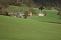
 Dales Hall - geograph.org.uk - 2186859.jpg 3,655 × 2,106; 5.27 MB
-
 Danger Quarry - geograph.org.uk - 6088955.jpg 1,024 × 768; 324 KB
-
 De Lys Antiques Warehouse, Wells Road - geograph.org.uk - 3296137.jpg 640 × 385; 300 KB
-
 Dead tree - geograph.org.uk - 6425476.jpg 768 × 1,024; 302 KB
-
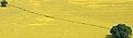 Diagonal in yellow - geograph.org.uk - 798486.jpg 640 × 189; 124 KB
-
 Direction sign to Hangman's Hill - geograph.org.uk - 2290695.jpg 4,272 × 2,848; 7.57 MB
-

-

-
 Drainage improvements in Watery Lane - geograph.org.uk - 1726397.jpg 640 × 427; 298 KB
-
 Driveway to Little Malvern Court - geograph.org.uk - 2212376.jpg 4,272 × 2,848; 6.46 MB
-
 Early morning on the Welland Hills - geograph.org.uk - 3255419.jpg 5,184 × 3,456; 6.59 MB
-
 Earthworks on the British Camp - geograph.org.uk - 6265378.jpg 1,024 × 768; 257 KB
-
 Earthworks on the Herefordshire Beacon - geograph.org.uk - 4207955.jpg 1,024 × 680; 235 KB
-
 Earthworks on the Herefordshire Beacon - geograph.org.uk - 4208413.jpg 800 × 531; 104 KB
-
 Earthworks on the Malvern Hills - geograph.org.uk - 4207965.jpg 800 × 531; 110 KB
-
 Earthworks on the Malvern Hills - geograph.org.uk - 4208412.jpg 800 × 531; 91 KB
-
 Eastern flank of Broad Down - geograph.org.uk - 1169176.jpg 640 × 437; 106 KB
-
 Eastern Path around British Camp - geograph.org.uk - 650370.jpg 640 × 565; 372 KB
-

-
 Eastern slopes of the Herefordshire Beacon - geograph.org.uk - 6343717.jpg 1,024 × 683; 236 KB
-
 Eastern slopes of the Herefordshire Beacon - geograph.org.uk - 6343723.jpg 1,024 × 683; 271 KB
-
 Easy access path, Malvern Hills - geograph.org.uk - 825409.jpg 640 × 480; 146 KB
-
 Elderflowers just opening - geograph.org.uk - 4487420.jpg 1,600 × 1,183; 1.37 MB
-
 Emerging Bluebell - geograph.org.uk - 724630.jpg 640 × 564; 234 KB
-
 Entrance to Grounds Farm - geograph.org.uk - 1719908.jpg 640 × 421; 305 KB
-

-
 Entrance to North Farm, Little Malvern - geograph.org.uk - 1654345.jpg 640 × 427; 289 KB
-
 Entrapment, Oak and Wire and Mist - geograph.org.uk - 691113.jpg 640 × 427; 222 KB
-
 Evergreen tree in an increasingly brown world - geograph.org.uk - 5842348.jpg 1,024 × 768; 297 KB
-
 Farm track at Underhill Farm - geograph.org.uk - 754200.jpg 640 × 480; 86 KB
-
 Farmland and Underhills Farm - geograph.org.uk - 5887221.jpg 1,024 × 768; 228 KB
-
 Farmland and Underhills Farm - geograph.org.uk - 6237536.jpg 1,024 × 768; 294 KB
-
 Farmland at Little Malvern - geograph.org.uk - 5887234.jpg 1,024 × 768; 254 KB
-
 Farmland at Little Malvern - geograph.org.uk - 6209030.jpg 1,024 × 768; 191 KB
-
 Farmland at Underhills Farm - geograph.org.uk - 664369.jpg 640 × 426; 61 KB
-
 Farmland near Little Malvern - geograph.org.uk - 5849046.jpg 1,024 × 768; 279 KB
-
 Farmland near Underhills Farm - geograph.org.uk - 6003093.jpg 1,024 × 768; 239 KB
-
 Farmland near Underhills Farm - geograph.org.uk - 6237525.jpg 1,024 × 768; 358 KB
-
 Farmland near Underhills Farm - geograph.org.uk - 6237531.jpg 1,024 × 768; 260 KB
-

-
 Field gateway - geograph.org.uk - 6425420.jpg 1,024 × 768; 273 KB
-
 Field headland and Little Malvern Priory - geograph.org.uk - 5355591.jpg 1,024 × 768; 293 KB
-
 Fields near Mayall's Farm - geograph.org.uk - 2213496.jpg 4,272 × 2,848; 4.72 MB
-
 Fields of Little Malvern - geograph.org.uk - 2201717.jpg 4,272 × 2,848; 5.18 MB
-
 Fields of Little Malvern - geograph.org.uk - 2208712.jpg 4,272 × 2,848; 6.29 MB
-
 Fields of Little Malvern - geograph.org.uk - 2208724.jpg 4,272 × 2,848; 5.66 MB
-
 Fields of Little Malvern - geograph.org.uk - 2208744.jpg 2,938 × 1,742; 2.98 MB
-
 Fields of Little Malvern - geograph.org.uk - 2208750.jpg 2,544 × 1,495; 2.18 MB
-
 Fields of Little Malvern - geograph.org.uk - 2208830.jpg 4,272 × 2,848; 4.22 MB
-
 First Bluebell - geograph.org.uk - 724625.jpg 640 × 545; 366 KB
-
 Footpath - Once the Road to Welland - geograph.org.uk - 445982.jpg 640 × 427; 320 KB
-

-
 Footpath near Underhills Farm - geograph.org.uk - 5808072.jpg 1,024 × 768; 302 KB
-

-
 Footpath through a field of oilseed rape - geograph.org.uk - 6122240.jpg 1,024 × 768; 365 KB
-

-

-
 Footpath through an oilseed rape field - geograph.org.uk - 6144122.jpg 1,024 × 768; 297 KB
-
 Footpath through the rape, Little Malvern - geograph.org.uk - 3432262.jpg 5,184 × 3,456; 7.28 MB
-
 Footpath to Little Malvern Priory - geograph.org.uk - 5849026.jpg 1,024 × 768; 314 KB
-
 Footpath to Little Malvern Priory - geograph.org.uk - 5888052.jpg 768 × 1,024; 275 KB
-
 Footpath to Little Malvern Priory - geograph.org.uk - 6003086.jpg 768 × 1,024; 314 KB
-
 Footpath to Little Malvern Priory - geograph.org.uk - 6122249.jpg 768 × 1,024; 355 KB
-
 Footpath to Little Malvern Priory - geograph.org.uk - 6144107.jpg 768 × 1,024; 323 KB
-
 Footpath to Little Malvern Priory - geograph.org.uk - 6144116.jpg 1,024 × 768; 288 KB
-
 Footpath to Upper Welland - geograph.org.uk - 2356982.jpg 4,272 × 2,600; 5.83 MB
-
 Footpath to Upper Welland - geograph.org.uk - 6104181.jpg 1,024 × 768; 295 KB
-
 Footpath to Upper Welland - geograph.org.uk - 6209051.jpg 1,024 × 768; 288 KB
-
 Footpath to Upper Welland - geograph.org.uk - 6257027.jpg 1,024 × 768; 263 KB
-
 Footpath to Upper Wellend - geograph.org.uk - 6144071.jpg 1,024 × 768; 257 KB
-
 Foxglove flowers - geograph.org.uk - 6186204.jpg 768 × 1,024; 195 KB
-
 Foxglove on the Malvern Hills - geograph.org.uk - 4064204.jpg 2,208 × 3,153; 2.67 MB
-
 Foxgloves on the hillside - geograph.org.uk - 5821893.jpg 1,024 × 768; 497 KB
-

-
 Frosted hawthorn on Pinnacle Hill - geograph.org.uk - 1344138.jpg 640 × 480; 113 KB
-
 Frozen British Camp Reservoir - geograph.org.uk - 5701283.jpg 1,024 × 680; 288 KB
-
 Frozen British Camp Reservoir - geograph.org.uk - 5701294.jpg 800 × 531; 67 KB
-
 Funnel web spider's web, British Camp, Malvern - geograph.org.uk - 2538486.jpg 3,612 × 2,172; 3.24 MB
-
 Garden with a view - geograph.org.uk - 907474.jpg 640 × 480; 125 KB
-
 Gas Excavations in Upper Welland Road - geograph.org.uk - 629872.jpg 640 × 420; 265 KB
-
 Gas Work in Upper Welland Road - geograph.org.uk - 629887.jpg 640 × 427; 289 KB
-
 Gate on Pinnacle Hill - geograph.org.uk - 3047931.jpg 640 × 451; 237 KB
-
 Gathering in the hay. - geograph.org.uk - 1925782.jpg 2,819 × 1,844; 3.73 MB
-

-
 Golden October dawn on Mayall's Coppice - geograph.org.uk - 2119802.jpg 3,853 × 2,187; 5.21 MB
-

-
 Grounds Farm - geograph.org.uk - 2874947.jpg 640 × 427; 229 KB
-
 Grounds Farm - geograph.org.uk - 2874959.jpg 640 × 427; 259 KB
-
 Hancock's Lane - geograph.org.uk - 4777844.jpg 1,600 × 901; 715 KB
-
 Hancocks Lane - geograph.org.uk - 1019219.jpg 640 × 480; 99 KB
-
 Hancocks Lane - geograph.org.uk - 1724650.jpg 640 × 427; 299 KB
-
 Hancocks Lane, near Grounds Farm - geograph.org.uk - 823146.jpg 640 × 480; 88 KB
-
 Hangmans hill. - geograph.org.uk - 3527307.jpg 640 × 480; 47 KB


_-_geograph.org.uk_-_434313.jpg)
_-_geograph.org.uk_-_434473.jpg)


_-_geograph.org.uk_-_434488.jpg)


