Category:Llanrhidian
Jump to navigation
Jump to search
village in City and County of Swansea, United Kingdom  | |||||
| Upload media | |||||
| Instance of | |||||
|---|---|---|---|---|---|
| Location | Swansea, Wales | ||||
 | |||||
Cymraeg: Mae Llanrhidian yn bentref ar benrhyn Gŵyr, yn sir Abertawe, de Cymru. Enwir y llan a'r pentref ar ôl y sant cynnar Rhidian (5ed-6ed ganrif).
English: Llanrhidian is a village in the Gower peninsula, Wales falling in the Gower ward of Swansea.
Subcategories
This category has the following 4 subcategories, out of 4 total.
Media in category "Llanrhidian"
The following 14 files are in this category, out of 14 total.
-
 Arthur's stone - Maen Ceti.JPG 2,955 × 2,219; 2.76 MB
-
 Arthur's Stone, Cefn Bryn - geograph.org.uk - 301420.jpg 418 × 281; 22 KB
-

-
 Crowds of people with donkeys are gathering cockles on the b Wellcome V0039692.jpg 3,044 × 2,379; 2.8 MB
-
Llanrhidian.ogg 0.8 s; 24 KB
-
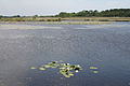
 Broad Pool - geograph.org.uk - 265921.jpg 640 × 480; 101 KB
-
 Cilibion, Broad Pool - geograph.org.uk - 185202.jpg 640 × 427; 145 KB
-
 Cilibion, Broad Pool - geograph.org.uk - 185204.jpg 640 × 427; 150 KB
-
 Llanrhidian Marsh road - geograph.org.uk - 262916.jpg 640 × 478; 103 KB
-
 Near Reynoldston, at Holywell - geograph.org.uk - 185210.jpg 640 × 427; 139 KB
-
 Permissive path onto Cilifor Top - geograph.org.uk - 257497.jpg 640 × 480; 77 KB
-
 Petrol station and shop, Llanrhidian - geograph.org.uk - 262909.jpg 640 × 478; 84 KB
-
 The Greyhound Inn, Oldwalls - geograph.org.uk - 262908.jpg 640 × 455; 88 KB
-
 Trig pillar on Cilifor Top - geograph.org.uk - 257486.jpg 640 × 480; 54 KB


