Category:Llanthony
Jump to navigation
Jump to search
village in Monmouthshire, Wales, United Kingdom  Llanddewi Nant Hodni o'r bryniau | |||||
| Upload media | |||||
| Instance of | |||||
|---|---|---|---|---|---|
| Location | Crucorney, Monmouthshire, Wales, UK | ||||
 | |||||
Subcategories
This category has the following 2 subcategories, out of 2 total.
C
- Court Farmhouse, Llanthony (1 F)
P
Media in category "Llanthony"
The following 73 files are in this category, out of 73 total.
-
 20140818 19 Beacons Way - LLanthony (14934094340).jpg 3,648 × 2,736; 5.88 MB
-
 20140818 48 Llanthony - Half Moon Hotel (14934025098).jpg 3,648 × 2,736; 6.28 MB
-
 20140819 I02 Llanthony (14979083510).jpg 5,184 × 3,888; 9.63 MB
-
 Above Black Darren - geograph.org.uk - 438352.jpg 640 × 480; 68 KB
-
 Below Bal-Mawr - geograph.org.uk - 704159.jpg 639 × 479; 195 KB
-
 Black Mountains near Bal-Bach - geograph.org.uk - 133117.jpg 640 × 426; 104 KB
-
 Bridge over Afon Honddu - geograph.org.uk - 2840623.jpg 1,600 × 1,200; 1.18 MB
-
 Bwlch Bach - geograph.org.uk - 704211.jpg 639 × 479; 210 KB
-
 Bwlch Isaf Ridge - geograph.org.uk - 476728.jpg 640 × 480; 40 KB
-
 Bwlch Isaf ridge - geograph.org.uk - 704188.jpg 639 × 479; 225 KB
-
 Footpath above Loxidge Tump - geograph.org.uk - 438340.jpg 640 × 480; 69 KB
-
 Footpath to Llanthony - geograph.org.uk - 133093.jpg 640 × 426; 130 KB
-
 Footpath to Maes-y-Beran - geograph.org.uk - 133099.jpg 640 × 426; 121 KB
-
 Footpath up from Llanthony - geograph.org.uk - 71728.jpg 640 × 480; 99 KB
-
 Frozen track in the Vale of Ewyas - geograph.org.uk - 133088.jpg 426 × 640; 115 KB
-
 Good Grass in the Black Mountains - geograph.org.uk - 18521.jpg 640 × 480; 107 KB
-
 Graig Ddu, Black Mountains - geograph.org.uk - 132717.jpg 640 × 426; 124 KB
-
 Half Moon Hotel - geograph.org.uk - 312937.jpg 640 × 440; 65 KB
-
 Hatterall Ridge and the Vale of Eywas - geograph.org.uk - 274322.jpg 640 × 480; 121 KB
-
 Hatterral Ridge near Llanthony.jpg 7,801 × 1,840; 6.67 MB
-
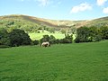
 Horses at Llanthony Priory - geograph.org.uk - 3122165.jpg 640 × 480; 108 KB
-
 Llanthony from Cwm Bwchel - geograph.org.uk - 3373036.jpg 640 × 480; 56 KB
-
 Llanthony Priory and the Vale of Ewyas - geograph.org.uk - 2118452.jpg 1,024 × 681; 202 KB
-
 Llanthony Priory from Cwm-bwchel - geograph.org.uk - 3660475.jpg 640 × 480; 107 KB
-
 Llanthony viewed from the west - geograph.org.uk - 133111.jpg 640 × 426; 112 KB
-
 Llanthony, Monmouthshire.jpeg 750 × 602; 193 KB
-
 Metal footbridge near Llanthony - geograph.org.uk - 2576489.jpg 640 × 480; 137 KB
-
 Near Llanthony Priory. - panoramio (1).jpg 3,648 × 2,736; 3.29 MB
-
 Near Llanthony Priory. - panoramio.jpg 3,648 × 2,736; 3.04 MB
-
 Offa's Dyke footpath, Hatterall Ridge - geograph.org.uk - 195680.jpg 1,024 × 683; 196 KB
-
 Offa's Dyke Path, Hatterall Ridge - geograph.org.uk - 274309.jpg 640 × 480; 128 KB
-
 Ordnance Survey Cut Mark - geograph.org.uk - 3810653.jpg 640 × 480; 95 KB
-

-
 Pile of Stones, Hatterall Ridge - geograph.org.uk - 195690.jpg 1,024 × 683; 182 KB
-
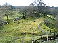
 Ruins near Llanthony Priory - geograph.org.uk - 2971750.jpg 1,024 × 680; 230 KB
-
 Sunnybank cottage near Llanthony - geograph.org.uk - 3122245.jpg 640 × 480; 124 KB
-
 The Half Moon Inn, Llanthony - geograph.org.uk - 274807.jpg 640 × 480; 94 KB
-
 The welcoming committee - geograph.org.uk - 312951.jpg 640 × 431; 85 KB
-

-
 Tower ruins of Llanthony Priory - geograph.org.uk - 3818325.jpg 3,040 × 4,048; 3.66 MB
-
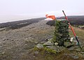
 Trig point, Hatterall Ridge - geograph.org.uk - 195671.jpg 1,024 × 683; 169 KB
-
 Wooden footbridge above Llanthony - geograph.org.uk - 3373060.jpg 640 × 480; 131 KB
-
 Across Cwm Grwyne Fawr - geograph.org.uk - 703786.jpg 479 × 639; 232 KB
-
 Bal-Mawr - geograph.org.uk - 704180.jpg 638 × 458; 210 KB
-
 Black Mountains path - geograph.org.uk - 413503.jpg 640 × 480; 157 KB
-
 Campsite Maes-y-Beran - geograph.org.uk - 629297.jpg 640 × 425; 92 KB
-
 Descent from Bal-Mawr - geograph.org.uk - 704170.jpg 639 × 479; 204 KB
-
 Farm at Cwm-bwchel, Llanthony - geograph.org.uk - 133115.jpg 640 × 426; 137 KB
-
 Farm at Maes-y-Baren, Vale of Ewyas - geograph.org.uk - 133082.jpg 640 × 426; 133 KB
-
 Farmland meets forest - geograph.org.uk - 660030.jpg 640 × 480; 98 KB
-
 Footpath below Bal-Mawr - geograph.org.uk - 704146.jpg 639 × 479; 182 KB
-
 Footpath sign on Offa's Dyke path - geograph.org.uk - 273591.jpg 640 × 480; 142 KB
-
 Into the woods - geograph.org.uk - 704117.jpg 639 × 479; 263 KB
-
 Land near Ffawydden - geograph.org.uk - 705500.jpg 639 × 479; 217 KB
-
 Line of dying trees - geograph.org.uk - 436532.jpg 640 × 480; 77 KB
-
 Looking down from Bwlch Bach - geograph.org.uk - 704223.jpg 639 × 479; 232 KB
-
 Loxidge Wood - geograph.org.uk - 133103.jpg 640 × 426; 117 KB
-
 Mynydd Du Forest - geograph.org.uk - 413526.jpg 640 × 480; 98 KB
-
 Nantgwyddel Farm - geograph.org.uk - 132733.jpg 640 × 426; 121 KB
-
 Nantybedd - geograph.org.uk - 705491.jpg 639 × 479; 245 KB
-
 Offa's Dyke Long Distance Path - geograph.org.uk - 273589.jpg 480 × 640; 123 KB
-
 On Bwlch Bach - geograph.org.uk - 703811.jpg 639 × 479; 178 KB
-
 Pasture below Loxidge Tump - geograph.org.uk - 438330.jpg 640 × 480; 64 KB
-
 Path around Bal-Mawr - geograph.org.uk - 704153.jpg 639 × 479; 196 KB
-
 Path towards Loxidge Tump - geograph.org.uk - 438321.jpg 640 × 480; 102 KB
-
 Ruined farmstead - geograph.org.uk - 704110.jpg 639 × 479; 285 KB
-
 Ruined farmstead - geograph.org.uk - 704125.jpg 479 × 639; 240 KB
-
 Ruined farmstead - geograph.org.uk - 704137.jpg 638 × 467; 198 KB
-
 South from the flank of Bal-Mawr - geograph.org.uk - 703798.jpg 639 × 479; 219 KB
-
 The Vale of Ewyas - geograph.org.uk - 312865.jpg 640 × 428; 49 KB
-

-
 Trig point on Hatterall Ridge - geograph.org.uk - 274305.jpg 640 × 480; 132 KB
-
 View up the Vale of Ewyas - geograph.org.uk - 133108.jpg 640 × 426; 136 KB
.jpg)
.jpg)


.jpg)


.jpg)