Category:Locator maps of Venezuela
Jump to navigation
Jump to search
| NO WIKIDATA ID FOUND! Search for Locator maps of Venezuela on Wikidata | |
| Upload media |

Federal territory: Capital District · Federal Dependencies · Territorial claim: Guayana Esequiba
Subcategories
This category has the following 7 subcategories, out of 7 total.
!
*
~
Media in category "Locator maps of Venezuela"
The following 41 files are in this category, out of 41 total.
-
 AIFAmapadestinos.png 1,472 × 715; 49 KB
-
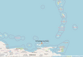
 Archipiélago de Las Aves.png 934 × 662; 217 KB
-
 Archipiélago de Los Monjes.png 954 × 660; 252 KB
-
 Archipiélago Los Frailes.png 952 × 662; 166 KB
-
 Archipiélago Los Hermanos.png 958 × 660; 209 KB
-
 Archipiélago Los Roques.png 955 × 657; 167 KB
-
 Archipiélago Los Testigos.png 883 × 657; 141 KB
-
 Capitanía General de Venezuela proyección ortográfica.svg 550 × 550; 325 KB
-
 Caribbean - Isla Margarita.PNG 929 × 606; 48 KB
-
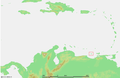 Caribbean - Tortuga.PNG 929 × 606; 48 KB
-
 Elito.jpg 368 × 283; 8 KB
-
 Fourth Republic of Venezuela (orthographic projection).svg 550 × 550; 443 KB
-
 Isla Blanquilla.png 955 × 665; 142 KB
-
 Isla Cubagua.png 950 × 658; 166 KB
-
 Isla de Coche.png 949 × 657; 161 KB
-
 Isla de Margarita.png 952 × 657; 124 KB
-
 Isla La Orchila.png 954 × 661; 176 KB
-
 Isla La Sola.png 951 × 660; 151 KB
-
 Isla La Tortuga.png 948 × 658; 170 KB
-
 Locationklein-venedig.png 250 × 115; 5 KB
-
 LocationVenezuela.png 250 × 115; 6 KB
-
 Maco langue.png 1,086 × 1,304; 2.21 MB
-
 Mapa de venezuela. Concesiones por regiones en telefonia rural.jpg 400 × 280; 23 KB
-
 Mapaanzoategui.jpg 1,651 × 1,276; 433 KB
-
 Mocoties Merida.png 490 × 555; 60 KB
-
 ParroquiasDelMunicipioAlbertoAdriani.png 711 × 454; 107 KB
-
 ParroquiasMeridaMunicipioLibertador.png 792 × 535; 119 KB
-
 Países Bolivarianos.jpg 535 × 750; 144 KB
-
 Países de Bolivar.jpg 360 × 360; 19 KB
-
 South America location VEN.png 762 × 1,091; 381 KB
-
 Ubicacion Temblador Venezuela.png 778 × 599; 81 KB
-
 Ubicaciones IUPSM.png 920 × 766; 183 KB
-
 Ubicación de Guanape en Venezuela.png 1,502 × 1,127; 527 KB
-
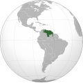
 Ubicación de Venezuela en el Globo.jpg 541 × 541; 41 KB
-
 Ubicaón de Capitanejo en Zamora.jpg 1,134 × 1,089; 144 KB
-
 Venezuela in South America.png 1,100 × 1,432; 37 KB
-
 Venezuela-locator.png 329 × 353; 6 KB
-
 Venezuela-locatorV2.png 329 × 353; 19 KB
-
 Venezuela-Pos.png 330 × 399; 19 KB
-
 Venezuela01.png 541 × 541; 83 KB
-
 World Factbook (1982) Venezuela.jpg 587 × 587; 76 KB


.svg)


_Venezuela.jpg)